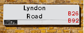
Lyndon Road Solihull is a street located in the town of Solihull
About Lyndon Road
Lyndon Road is a street located in the town of Solihull. The street has a length of approximately 1,835 metres.
The street is located within the Solihull District (B) and Birmingham District (B) Council's jurisdiction. They provide various services, like refuse collection, and manage council tax collection. It's situated in the West Midlands region of the UK.
The road has been assigned the Unique Street Reference Numbers of 35000385, 35080133 and 2709451 in the National Street Gazetteer.
The street has the postcodes of B92 7RQ, B92 7RG, B92 7RF, B92 7RE, B92 7RD, B92 7QX, B92 7QW, B92 7QU, B92 7QT, B92 7QS, B92 7QR, B92 7QQ, B92 7QP, B92 7QN, B92 7QJ, B92 7QG, B92 7QF and B92 7QE.
It is located within the county of West Midlands, situated in the West Midlands region of the UK. It's 97.32 miles North West from central London., 4.99 miles South East from Birmingham, 12.41 miles West from Coventry and 25.12 miles North East from Worcester.

Do you know why this road is called Lyndon Road?
What's it like to live here?
Ask the community a question.
Do you have any questions, memories to share or know any facts? We'd love to know more.
Map of Lyndon Road
| Postcodes | ||
|---|---|---|
| Icon | Postcodes for Lyndon Road | |
| Walking Distances | ||
| Distance Info | Green Circle = 10 Minutes Walk (800 metres) | |
Street Crime Data accessed from data.police.uk on 06/10/2024.
Budget Friendly Hotels near Lyndon Road
| Budget Hotel Name | Distance (miles) |
|---|---|
|
1: Name:Travelodge Birmingham Sheldon Address: 2225 Coventry Rd, Birmingham, B26 3EH Telephone: 0871 559 1806 Visit Hotel Page |
0.63 |
|
2: Name:Travelodge Birmingham Yardley Address: 1741 Coventry Rd, Birmingham, B26 1DS Telephone: 0871 984 6065 Visit Hotel Page |
1.00 |
|
3: Name:Holiday Inn Express Birmingham�South A45 Address: 1270 Coventry Road, Yardley Telephone: Visit Hotel Page |
1.68 |
|
4: Name:Travelodge Birmingham Airport Address: Terminal Rd, Birmingham, B26 3QW Telephone: 0871 984 6483 Visit Hotel Page |
1.92 |
|
5: Name:Premier Inn Solihull Town Centre Address: Station Road Telephone: Visit Hotel Page |
2.27 |
Your support helps keep this site running!
If you enjoy using this website, consider buying me a coffee to help cover hosting costs.
Nearby Estate Agents
| Name | Address | Website |
|---|---|---|
| Solihull Sales and Lettings | 46B Castle Lane, Solihull, B92 8DD | Visit Website |
| Sydney Mitchell Estate Agents | 2233 Coventry Road, Sheldon, Solihull, B26 3NL | Visit Website |
| Encasa | 57 Warwick Road, Olton Hollow, Solihull, B92 7HS | Visit Website |
| Burchell Edwards | 2208 Coventry Road, Sheldon, Birmingham, B26 3JH | Visit Website |
| Melvyn Danes | 2214 Coventry Road, Sheldon, Birmingham, B26 3JH | Visit Website |
We have found 18 postcodes
Neighbourhood Policing |
| Police Force: West Midlands |
 View Neighbourhood Crime and Policing View Neighbourhood Crime and Policing |
| Find a Local Neighbourhood Watch Scheme |
Location Details
| Lyndon Road | |
|---|---|

| |
| Latitude | 52.446677 |
| Longitude | -1.795814 |
| OS Easting (X): | 413876 |
| OS Northing (Y): | 283251 |
| OS Grid Reference: | SP139833 |
Roads that have a Junction with Lyndon Road
| Street | Junction Type |
|---|---|
| Richmond Road | junction |
| Bartley Close | junction |
| Barrington Road | junction |
| Chapel Fields Road | junction |
| Ulleries Road | junction |
| Kent's Close | junction |
| Butler Road | junction |
| Barn Lane | junction |
| Coverdale Road | junction |
| Daylesford Road | junction |
| Beamans Close | junction |
| Melton Avenue | junction |
| Coverdale Road | junction |
| Coventry Road (A45) | pseudo node |
Sunset and Sunrise times
| Sunrise | 07:39 |
|---|---|
| Sunset | 16:07 |
Latest Weather Conditions
| Observed at Weather Station: | Coleshill 21 November 2024 at 23:00 (5.05 miles away) |
|---|---|
| Current Weather: | Clear night |
| Temperature and Humidity: | 0.5°C (84.4%) |
| Wind Direction and Speed: | SW (5 mph) |
Population Statistics
| ONS Area Code | E00051352, E00051382, E00051369, E00051370, E00051359, E00051355 & E00051361 |
|---|---|
| ONS Area Name | Self-Sufficient Retirement, Multi-Ethnic Professionals with Families, Multi-Ethnic Suburbia & Industrious Transitions |
| Average Age | 42.67, 39.44 & 38.83 |
| Area Population | 1525.00, 1465.00 & 1413.00 |
| Male Population | 764.00, 716.00 & 673.00 (49%) |
| Female Population | 761.00, 749.00 & 740.00 (51%) |
| Benefit Claimants | 13, 10 & 12 (1%) |
| LSOA Code: | E01010161, E01010163 &E01010159 |
|---|---|
| LSOA Name: | Solihull 012E, Solihull 010D &Solihull 010B |
| SOA Code: | 8c &3b |
| SOA Name: | |
| MSOA Code: | E02002092 &E02002090 |
| MSOA Name: | Solihull 012 &Solihull 010 |
Nearest Supermarkets
| Tesco Sheldon Superstore |
|---|
| Coventry Rd, Sheldon, Birmingham, B26 3DY |
| 0345 677 9845 |
| Distance: 0.52 Miles |
| Directions to Tesco Sheldon Superstore |
| Tesco Hobs Moat Express |
|---|
| 47-49 Hobs Moat Rd, Sheldon, Solihull, B92 8JJ |
| 0345 026 9030 |
| Distance: 0.53 Miles |
| Directions to Tesco Hobs Moat Express |
| Iceland Sheldon |
|---|
| 2154 Coventry Road, Sheldon, Birmingham, B26 3JB |
| 01217423939 |
| Distance: 0.65 Miles |
| Directions to Iceland Sheldon |
| Tesco Solihull Esso Express |
|---|
| 11 Warwick Rd, Olton, Solihull, B92 7HS |
| 0345 677 9809 |
| Distance: 0.71 Miles |
| Directions to Tesco Solihull Esso Express |
Telephone Information
| Area Code |
|---|
| Area Code: 0121 - Birmingham |
| Area Code: 01675 - Coleshill |
| Area Code: 01676 - Meriden |
| Area Code: 01564 - Lapworth |
Broadband Information
| Speed | Average Speed | Median Speed | Maximum Speed | Next-generation access (NGA) | Number of Connections |
|---|---|---|---|---|---|
| Less than 2 Mbps | 23.2 | 20 | >=30 | Y | 29 |
Local Government
| Local Council Details |
|---|
| Within the area of Solihull |
| Visit the Council's Website |
| PO Box 18, Council House, Solihull, West Midlands &B91 3QS |
| Send email |
| Telephone Number: 0121 704 6000 |
| Local Member of Parliament |
|---|
| Within the Westminster Parliamentary Constituency of Solihull |
| The Member of Parliament is Neil Shastri-Hurst |
| Details for the MP Neil Shastri-Hurst on parliament.uk |
| Details for the MP Neil Shastri-Hurst on theyworkforyou.com |
| In the 2024 General Election Neil Shastri-Hurst won with a majority of 4,620 the result was Con hold. The total electorate was 71,816 |
| Wards, Parish Councils and County Councils |
|---|
| Ward: Lyndon Ward |
| Ceremonial County: West Midlands |
Nearest Schools
England Primary Schools
Lyndon Green Junior School
Address: Lyndon Green Junior School, Wensley Road, Sheldon, Birmingham, West Midlands, B26 1LU
Distance: 1.04 miles
Contact: 01216752983
Lyndon Green Infant School
Address: Lyndon Green Infant School, Wychwood Cresent, Sheldon, Birmingham, West Midlands, B26 1LZ
Distance: 0.94 miles
Contact: 01216753543
Gilbertstone Primary School
Address: Gilbertstone Primary School, Clay Lane, Birmingham, West Midlands, B26 1EH
Distance: 0.78 miles
Contact: 01214644664
Holy Souls Catholic Primary School
Address: Holy Souls Catholic Primary School, Mallard Close, Acocks Green, Birmingham, West Midlands, B27 6BN
Distance: 1.02 miles
Contact:
Stanville Primary School
Address: Stanville Primary School, Stanville Road, Birmingham, West Midlands, B26 3YN
Distance: 1.29 miles
Contact: 01214642322
St Thomas More Catholic Primary School
Address: St Thomas More Catholic Primary School, Horse Shoes Lane, Sheldon, Birmingham, West Midlands, B26 3HU
Distance: 0.80 miles
Contact:
Cottesbrooke Infant and Nursery School
Address: Cottesbrooke Infant and Nursery School, Yardley Road, Acocks Green, Birmingham, West Midlands, B27 6LG
Distance: 1.00 miles
Contact: 01217062742
Mapledene Primary School
Address: Mapledene Primary School, Mapledene Road, Mapledene Road, Birmingham, Uk, Birmingham, West Midlands, B26 3XE
Distance: 1.47 miles
Contact: 01214642881
Ulverley School
Address: Ulverley School, Rodney Road, Solihull, West Midlands, B92 8RZ
Distance: 0.87 miles
Contact:
St Andrew's Catholic Primary School
Address: St Andrew's Catholic Primary School, Windrush Close, Solihull, West Midlands, B92 8QL
Distance: 0.38 miles
Contact:
Valley Primary
Address: Valley Primary, Old Lode Lane, Solihull, West Midlands, B92 8LW
Distance: 0.80 miles
Contact: 01217434691
Olton Primary School
Address: Olton Primary School, Lyndon Road, Olton, Solihull, West Midlands, B92 7QF
Distance: 0.10 miles
Contact: 01217062644
Oak Cottage Primary School
Address: Oak Cottage Primary School, Greswolde Road, Solihull, West Midlands, B91 1DY
Distance: 1.48 miles
Contact: 01217049123
St Margaret's Church of England Voluntary Aided Primary School
Address: St Margaret's Church of England Voluntary Aided Primary School, Richmond Road, Olton, Solihull, West Midlands, B92 7RR
Distance: 0.38 miles
Contact:
Langley Primary School
Address: Langley Primary School, St Bernard's Road, Olton, Solihull, West Midlands, B92 7DJ
Distance: 1.66 miles
Contact:
Kineton Green Primary School
Address: Kineton Green Primary School, Kineton Green Road, Olton, Solihull, West Midlands, B92 7EB
Distance: 1.03 miles
Contact: 01217063873
Our Lady of Compassion Catholic Primary School
Address: Our Lady of Compassion Catholic Primary School, Kineton Green Road, Solihull, West Midlands, B92 7EG
Distance: 1.28 miles
Contact:
The Oaklands Primary School
Address: The Oaklands Primary School, Dolphin Lane, Acocks Green, Birmingham, West Midlands, B27 7BT
Distance: 1.11 miles
Contact: 01217062168
Acocks Green Primary School
Address: Acocks Green Primary School, Westley Road, Acocks Green, Birmingham, West Midlands, B27 7UQ
Distance: 1.27 miles
Contact:
England Secondary Schools
Archbishop Ilsley Catholic School
Address: Archbishop Ilsley Catholic School, Victoria Road, Acocks Green, Birmingham, West Midlands, B27 7XY
Distance: 1.10 miles
Contact:
Lode Heath School
Address: Lode Heath School, Lode Lane, Solihull, West Midlands, B91 2HW
Distance: 1.66 miles
Contact: 01217041421
Lyndon School
Address: Lyndon School, Daylesford Road, Solihull, West Midlands, B92 8EJ
Distance: 0.28 miles
Contact: 01217433402
Langley School
Address: Langley School, Kineton Green Road, Olton, Solihull, West Midlands, B92 7ER
Distance: 1.42 miles
Contact: 01217069771
Nearest Hospitals
| Name | Address | Postcode | Distance | Map |
|---|
Nearest Dentists
Dentists
| Name | Address | Postcode | Distance | Map |
|---|
Nearest GP Surgeries
Doctors
RICHMOND MEDICAL CENTRE
Address: 179 RICHMOND ROAD, SOLIHULL, WEST MIDLANDS, B92 7SA
Distance: 0.15 miles
Contact: tel: 0121 7432159
RICHMOND MEDICAL CENTRE - COVID LOCAL VACCINATION SERVICE 2
Address: 179 RICHMOND ROAD, SOLIHULL, B92 7SA
Distance: 0.15 miles
Contact: :
HOBS MOAT MEDICAL CENTRE
Address: ULLERIES ROAD, SOLIHULL, WEST MIDLANDS, B92 8ED
Distance: 0.34 miles
Contact: tel: 0121 7425211
MEADOWSIDE FAMILY HEALTH CENTRE
Address: 30 WINCHCOMBE ROAD, SOLIHULL, B92 8PJ
Distance: 0.45 miles
Contact: :
ST. MARGARETS MEDICAL PRACTICE
Address: 8 ST. MARGARETS ROAD, SOLIHULL, WEST MIDLANDS, B92 7JS
Distance: 0.76 miles
Contact: tel: 0121 7060307
COVENTRY ROAD PRACTICE
Address: 2314 COVENTRY ROAD, SHELDON, BIRMINGHAM, WEST MIDLANDS, B26 3JS
Distance: 0.91 miles
Contact: tel: 0121 7432154
Nearest Dispensing Chemists
Pharmacies
| Name | Address | Postcode | Telephone | Map | Distance in Km |
|---|
Nearest Opticians
Opticians
Transport
Nearest Rail Stations
Olton Station is 0.67 miles away.
Address: Olton station, Warwick Road, Solihull, West Midlands, B92 7AR
Olton is situated on the Chiltern Main Line.
Olton Station is staffed on a part time basis.
Acocks Green Station is 0.99 miles away.
Address: Acocks Green station, Yardley Road, Acocks Green, West Midlands, B27 6EB
Acocks Green is situated on the Chiltern Main Line.
Acocks Green Station is staffed on a part time basis.