Damson Parkway is a street located in the town of Solihull and near the town of Solihull. The street has a length of approximately 3,556 metres.
The street is located within the Solihull District (B) Council's jurisdiction. They provide various services, like refuse collection, and manage council tax collection. It's situated in the West Midlands region of the UK.
The road has been assigned the Unique Street Reference Number of 35005530 and 35081124 in the National Street Gazetteer.
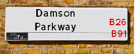
The street has the postcodes of B92 8PS and B91 2PP.
It is located within the county of West Midlands, situated in the West Midlands region of the UK. It's 95.44 miles North West from central London., 6.91 miles South East from Birmingham, 10.58 miles West from Coventry and 25.74 miles North East from Worcester.
Moving to Damson Parkway?
I can help you uncover potential pitfalls and provide key questions to ask about your new property. With decades of experience as a Local Land Charges Manager, I offer confidential insights to make your move informed and stress-free.
This service is free, but you may wish to make an optional donation to support it. Please include the property name and address in your request as well as anything you wish to focus on.
Contact Me
Do you know why this road is called Damson Parkway?
What's it like to live here?
Ask the community a question.
Do you have any questions, memories to share or know any facts? We'd love to know more.
Map of Damson Parkway
| Postcodes | ||
|---|---|---|
| Icon | Postcodes for Damson Parkway | |
| Walking Distances | ||
| Distance Info | Green Circle = 10 Minutes Walk (800 metres) | |
Street Crime Data accessed from data.police.uk on 06/10/2024.
Budget Friendly Hotels near Damson Parkway
| Budget Hotel Name | Distance (miles) |
|---|---|
|
1: Name:Travelodge Birmingham Airport Address: Terminal Rd, Birmingham, B26 3QW Telephone: 0871 984 6483 Visit Hotel Page |
0.98 |
|
2: Name:Premier Inn Solihull Town Centre Address: Station Road Telephone: Visit Hotel Page |
1.68 |
|
3: Name:Travelodge Birmingham Sheldon Address: 2225 Coventry Rd, Birmingham, B26 3EH Telephone: 0871 559 1806 Visit Hotel Page |
1.71 |
|
4: Name:ibis budget Birmingham International Airport � NEC Address: Ambassador Road Telephone: Visit Hotel Page |
1.71 |
|
5: Name:Premier Inn Birmingham NEC/Airport Address: Bickenhill Parkway Telephone: Visit Hotel Page |
2.35 |
Hotel Options
Your support helps keep this site running!
If you enjoy using this website, consider buying me a coffee to help cover hosting costs.
Nearby Estate Agents
| Name | Address | Website |
|---|---|---|
| Simon Burt Privilege | Malvern House New Road, Solihull, B91 3DL | Visit Website |
| Simon Burt The Estate Agent | Malvern House New Road, Solihull, B91 3DL | Visit Website |
| Burchell Edwards | 2208 Coventry Road, Sheldon, Birmingham, B26 3JH | Visit Website |
| Melvyn Danes | 2214 Coventry Road, Sheldon, Birmingham, B26 3JH | Visit Website |
| Dixons | 70 Poplar Road, Solihull, West Midlands, B91 3AB |
Neighbourhood Policing |
| Police Force: West Midlands |
 View Neighbourhood Crime and Policing View Neighbourhood Crime and Policing |
| Find a Local Neighbourhood Watch Scheme |
Location Details
| Damson Parkway | |
|---|---|

| |
| Latitude | 52.433244 |
| Longitude | -1.755885 |
| OS Easting (X): | 416594 |
| OS Northing (Y): | 281765 |
| OS Grid Reference: | SP166818 |
Roads that have a Junction with Damson Parkway
| Street | Junction Type |
|---|---|
| Coventry Road (A45) | junction |
| Terminal Road (B4105) | junction |
| Old Damson Lane | junction |
| Damson Lane | roundabout |
| Huxbey Drive | junction |
| Lansdale Avenue | junction |
| Merstal Drive | junction |
| Cloudbridge Drive | junction |
| Barnfield Drive | junction |
| Lugtrout Lane | junction |
| Hainfield Drive | junction |
| Yew Tree Lane (B4105) | pseudo node |
Sunset and Sunrise times
| Sunrise | 08:13 |
|---|---|
| Sunset | 15:58 |
Latest Weather Conditions
| Observed at Weather Station: | Coleshill 22 December 2024 at 09:00 (4.29 miles away) |
|---|---|
| Current Weather: | Sunny day |
| Temperature and Humidity: | 3.2°C (79.5%) |
| Wind Direction and Speed: | W (11 mph) |
Population Statistics
| ONS Area Code | E00051702 & E00051111 |
|---|---|
| ONS Area Name | Self-Sufficient Retirement & Ageing in Suburbia |
| Average Age | 47.26 & 42.67 |
| Area Population | 1891.00 & 1498.00 |
| Male Population | 906.00 & 730.00 (48%) |
| Female Population | 985.00 & 768.00 (52%) |
| Benefit Claimants | 10 & 13 (1%) |
| LSOA Code: | E01010227 &E01010115 |
|---|---|
| LSOA Name: | Solihull 015C &Solihull 015A |
| SOA Code: | 3b &3a |
| SOA Name: | |
| MSOA Code: | E02002095 |
| MSOA Name: | Solihull 015 |
Nearest Supermarkets
| Tesco Lode Heath Express |
|---|
| 8-10 Hermitage Rd, Lode Heath, Solihull, B91 2LJ |
| 0345 026 9240 |
| Distance: 1.16 Miles |
| Directions to Tesco Lode Heath Express |
| Tesco Hobs Moat Express |
|---|
| 47-49 Hobs Moat Rd, Sheldon, Solihull, B92 8JJ |
| 0345 026 9030 |
| Distance: 1.39 Miles |
| Directions to Tesco Hobs Moat Express |
| Morrisons Sheldon |
|---|
| 2259-2297 Coventry Road, Sheldon B26 3PD |
| 0121 742 6584 |
| Distance: 1.55 Miles |
| Directions to Morrisons Sheldon |
| Morrisons Solihull |
|---|
| George Road, Solihull B91 3BQ |
| 0121 7090680 |
| Distance: 1.59 Miles |
| Directions to Morrisons Solihull |
Telephone Information
| Area Code |
|---|
| Area Code: 01676 - Meriden |
| Area Code: 01675 - Coleshill |
| Area Code: 01564 - Lapworth |
| Area Code: 0121 - Birmingham |
Local Government
| Local Council Details |
|---|
| Within the area of Solihull |
| Visit the Council's Website |
| PO Box 18, Council House, Solihull, West Midlands &B91 3QS |
| Send email |
| Telephone Number: 0121 704 6000 |
| Local Member of Parliament |
|---|
| Within the Westminster Parliamentary Constituency of Solihull |
| The Member of Parliament is Saqib Bhatti |
| Details for the MP Saqib Bhatti on parliament.uk |
| Details for the MP Saqib Bhatti on theyworkforyou.com |
| In the 2024 General Election Saqib Bhatti won with a majority of 4,584 the result was Con hold. The total electorate was 73,659 |
| Wards, Parish Councils and County Councils |
|---|
| Ward: Silhill &Elmdon Ward |
| Ceremonial County: West Midlands |
Nearest Schools
England Primary Schools
Coppice Junior School
Address: Coppice Junior School, Coppice Road, Solihull, West Midlands, B92 9JY
Distance: 0.37 miles
Contact:
Damson Wood Nursery and Infant School
Address: Damson Wood Nursery and Infant School, Stockwell Rise, Solihull, West Midlands, B92 9LX
Distance: 0.46 miles
Contact: 01217058652
Damson Wood Nursery and Infant School
Address: Damson Wood Nursery and Infant School, Stockwell Rise, Solihull, West Midlands, B92 9LX
Distance: 0.46 miles
Contact:
Yew Tree Primary School
Address: Yew Tree Primary School, Wherretts Well Lane, Solihull, West Midlands, B91 2SD
Distance: 0.81 miles
Contact:
St Alphege Church of England Infant and Nursery School
Address: St Alphege Church of England Infant and Nursery School, New Road, Solihull, West Midlands, B91 3DW
Distance: 1.73 miles
Contact: 01217050443
England Secondary Schools
Lode Heath School
Address: Lode Heath School, Lode Lane, Solihull, West Midlands, B91 2HW
Distance: 1.05 miles
Contact: 01217041421
Nearest Hospitals
| Name | Address | Postcode | Distance | Map |
|---|
Nearest Dentists
Dentists
| Name | Address | Postcode | Distance | Map |
|---|
Nearest GP Surgeries
Doctors
YEW TREE MEDICAL CENTRE
Address: 100 YEW TREE LANE, SOLIHULL, WEST MIDLANDS, B91 2RA
Distance: 0.93 miles
Contact: :
SOLIHULL HEALTHCARE PARTNERSHIP
Address: GROVE SURGERY, 3 GROVE ROAD, SOLIHULL, WEST MIDLANDS, B91 2AG
Distance: 1.24 miles
Contact: tel: 0121 7051105
MEADOWSIDE FAMILY HEALTH CENTRE
Address: 30 WINCHCOMBE ROAD, SOLIHULL, B92 8PJ
Distance: 1.47 miles
Contact: :
COVENTRY ROAD PRACTICE
Address: 2314 COVENTRY ROAD, SHELDON, BIRMINGHAM, WEST MIDLANDS, B26 3JS
Distance: 1.54 miles
Contact: tel: 0121 7432154
HOBS MOAT MEDICAL CENTRE
Address: ULLERIES ROAD, SOLIHULL, WEST MIDLANDS, B92 8ED
Distance: 1.58 miles
Contact: tel: 0121 7425211
CRANES PARK ROAD SURGERY
Address: 25 CRANES PARK ROAD, SHELDON, BIRMINGHAM, WEST MIDLANDS, B26 3SE
Distance: 1.88 miles
Contact: tel: 0121 7432018
Nearest Dispensing Chemists
Pharmacies
| Name | Address | Postcode | Telephone | Map | Distance in Km |
|---|
Nearest Opticians
Opticians
MIDLAND EYE
Address: 50 LODE LANE, SOLIHULL, B91 2AW
Distance: 1.25 miles
Contact: :
EYE SPECIALISTS OPTICIANS (SOLIHULL)
Address: 83 HOBS MOAT ROAD, SOLIHULL, WEST MIDLANDS, B92 8JL
Distance: 1.43 miles
Contact: :
A B OPTICS LIMITED (WARWICK ROAD)
Address: 681A WARWICK ROAD, SOLIHULL, WEST MIDLANDS, B91 3DA
Distance: 1.53 miles
Contact: :
PERSPECTIVE OPTICIANS LTD
Address: 56 DRURY LANE, MELL SQUARE, SOLIHULL, WEST MIDLANDS, B91 3BH
Distance: 1.56 miles
Contact: :
BOOTS OPTICIANS (SOLIHULL)
Address: 57 MILL LANE, SOLIHULL, WEST MIDLANDS, B91 3AT
Distance: 1.57 miles
Contact: :
BOOTS OPTICIANS (SHELDON)
Address: 2236 COVENTRY ROAD, SHELDON, BIRMINGHAM, WEST MIDLANDS, B26 3JH
Distance: 1.65 miles
Contact: :
Transport
Nearest Rail Stations
Birmingham International Station is 1.75 miles away.
Address: Birmingham International station, Stationlink Road, National Exhibition Centre, Birmingham, B40 1PA
Birmingham International is situated on the Rugby�Birmingham�Stafford line|West Coast Main Line and is managed by Avanti West Coast.
Birmingham International Station is staffed on a full time basis.
Solihull Station is 1.89 miles away.
Address: Solihull station, Station Approach, Solihull, West Midlands, B91 1LE
Solihull is situated on the Chiltern Main Line and is managed by Chiltern Railway.
Solihull Station is an unstaffed station.