Sheldon Heath Road is a street located in the city of Birmingham. The street has a length of approximately 1,734 metres.
The street is publicly maintained which means that the road is adopted and Birmingham is responsible for the repair and upkeep of the highway.
The street is located within the Birmingham District (B) Council's jurisdiction. They provide various services, like refuse collection, and manage council tax collection. It's situated in the West Midlands region of the UK.
The road has been assigned the Unique Street Reference Numbers of 2705721, 2759178 and 2735868 in the National Street Gazetteer.
The street has the postcodes of B26 2UB, B26 2UA, B26 2TY, B26 2RZ, B26 2RY, B26 2RU, B26 2DS, B26 2DR, B26 2DQ, B26 2DP, B26 2DJ and B26 2DH.
It is located within the county of West Midlands, situated in the West Midlands region of the UK. It's 98.11 miles North West from central London., 4.95 miles East from Birmingham, 12.45 miles West from Coventry and 26.64 miles North East from Worcester.
SHELDON HEATH ROAD is within the Post Town of BIRMINGHAM
Map of Sheldon Heath Road
| Street Crime (updated 03/12/2024) | ||
|---|---|---|
| Location Note | Central Point of Street - Not Actual Location | |
| MSOA Info | For MSOAs E02001888, E02001895 (Statistical Neighbourhood) | |
| Click Hint | Click on a Circle for a detailed breakdown below map. | |
| Crime Levels |
Green = Very Low Yellow = Low Orange = High Red = Very High |
|
| Postcodes | ||
| Icon | Postcodes for Sheldon Heath Road | |
| Walking Distances | ||
| Distance Info | Green Circle = 10 Minutes Walk (800 metres) | |
Street Crime Data accessed from data.police.uk on 06/10/2024.
Moving to Sheldon Heath Road?
I can help you uncover potential pitfalls and provide key questions to ask about your new property. With decades of experience as a Local Land Charges Manager, I offer confidential insights to make your move informed and stress-free.
This service is free, but you may wish to make an optional donation to support it. Please include the property name and address in your request as well as anything you wish to focus on.
Contact Me
Do you know why this road is called Sheldon Heath Road?
What's it like to live here?
Share a Photo of Sheldon Heath Road
Ask the community a question.
Do you have any questions, memories to share, have any photos or know any facts? We'd love to know more.
Submit Your Comment
Budget Friendly Hotels near Sheldon Heath Road
| Budget Hotel Name | Distance (miles) |
|---|---|
|
1: Name:Travelodge Birmingham Yardley Address: 1741 Coventry Rd, Birmingham, B26 1DS Telephone: 0871 984 6065 Visit Hotel Page |
1.12 |
|
2: Name:Travelodge Birmingham Sheldon Address: 2225 Coventry Rd, Birmingham, B26 3EH Telephone: 0871 559 1806 Visit Hotel Page |
1.35 |
|
3: Name:Holiday Inn Express Birmingham�South A45 Address: 1270 Coventry Road, Yardley Telephone: Visit Hotel Page |
1.81 |
|
4: Name:Travelodge Birmingham Castle Bromwich Address: Chester Rd, Birmingham, B36 0AG Telephone: 0871 559 1813 Visit Hotel Page |
2.21 |
|
5: Name:Travelodge Birmingham Airport Address: Terminal Rd, Birmingham, B26 3QW Telephone: 0871 984 6483 Visit Hotel Page |
2.22 |
Hotel Options
Your support helps keep this site running!
If you enjoy using this website, consider making a donation to help me cover hosting costs.
Flats and Apartments in Sheldon Heath Road
FLAT
FLAT
FLAT
FLAT
FLAT
FLAT
FLAT
FLAT
FLAT 2
FLAT 2
FLAT 3
FLAT 3
FLAT 4
FLAT 4
FLAT 5
FLAT 5
FLAT 7
FLAT 7
FLAT 8
FLAT 8
FLAT 9
FLAT 9
FLAT 20
FLAT 20
FLAT 23
FLAT 23
FLAT 25
FLAT 25
FLAT 26
FLAT 26
FLAT 27
FLAT 27
FLAT 28
FLAT 28
FLAT 30
FLAT 30
FLAT 35
FLAT 35
FLAT 42
FLAT 42
FLAT 43
FLAT 43
FLAT 47
FLAT 47
FLAT 50
FLAT 50
FLAT 52
FLAT 52
FLAT 57
FLAT 57
FLAT 58
FLAT 58
FLAT 60
FLAT 60
FLAT 62
FLAT 62
FLAT 65
FLAT 65
FLAT 67
FLAT 67
FLAT 70
FLAT 70
FLAT 73
FLAT 73
FLAT 79
FLAT 79
FLAT 85
FLAT 85
FLAT 87
FLAT 87
FLAT 1
FLAT 1
FLAT 2
FLAT 2
FLAT 3
FLAT 3
FLAT 4
FLAT 4
FLAT 5
FLAT 5
FLAT 6
FLAT 6
FLAT 1
FLAT 1
FLAT 3
FLAT 3
FLAT 4
FLAT 4
FLAT 5
FLAT 5
FLAT 6
FLAT 6
FLAT 8
FLAT 8
FLAT 10
FLAT 10
FLAT 11
FLAT 11
FLAT 12
FLAT 12
FLAT 14
FLAT 14
FLAT 15
FLAT 15
FLAT 16
FLAT 16
FLAT 17
FLAT 17
FLAT 18
FLAT 18
FLAT 19
FLAT 19
FLAT 20
FLAT 20
FLAT 21
FLAT 21
FLAT 22
FLAT 22
FLAT 23
FLAT 23
FLAT 24
FLAT 24
FLAT 25
FLAT 25
FLAT 26
FLAT 26
FLAT 27
FLAT 27
FLAT 28
FLAT 28
FLAT 29
FLAT 29
FLAT 30
FLAT 30
FLAT 31
FLAT 31
FLAT 32
FLAT 32
FLAT 33
FLAT 33
FLAT 34
FLAT 34
FLAT 35
FLAT 35
FLAT 36
FLAT 36
FLAT 37
FLAT 37
FLAT 38
FLAT 38
FLAT 39
FLAT 39
FLAT 40
FLAT 40
FLAT 3
FLAT 3
FLAT 6
FLAT 6
FLAT 7
FLAT 7
FLAT 10
FLAT 10
FLAT 11
FLAT 11
FLAT 16
FLAT 16
FLAT 17
FLAT 17
FLAT 18
FLAT 18
FLAT 19
FLAT 19
FLAT 21
FLAT 21
FLAT 22
FLAT 22
FLAT 24
FLAT 24
FLAT 29
FLAT 29
FLAT 32
FLAT 32
FLAT 33
FLAT 33
FLAT 34
FLAT 34
FLAT 36
FLAT 36
FLAT 37
FLAT 37
FLAT 38
FLAT 38
FLAT 39
FLAT 39
FLAT 40
FLAT 40
FLAT 41
FLAT 41
FLAT 44
FLAT 44
FLAT 45
FLAT 45
FLAT 46
FLAT 46
FLAT 48
FLAT 48
FLAT 49
FLAT 49
FLAT 51
FLAT 51
FLAT 53
FLAT 53
FLAT 55
FLAT 55
FLAT 56
FLAT 56
FLAT 59
FLAT 59
FLAT 61
FLAT 61
FLAT 63
FLAT 63
FLAT 64
FLAT 64
FLAT 66
FLAT 66
FLAT 68
FLAT 68
FLAT 69
FLAT 69
FLAT 72
FLAT 72
FLAT 74
FLAT 74
FLAT 75
FLAT 75
FLAT 76
FLAT 76
FLAT 77
FLAT 77
FLAT 78
FLAT 78
FLAT 80
FLAT 80
FLAT 81
FLAT 81
FLAT 82
FLAT 82
FLAT 83
FLAT 83
FLAT 84
FLAT 84
FLAT 86
FLAT 86
FLAT 88
FLAT 88
APARTMENT 1
APARTMENT 1
APARTMENT 2
APARTMENT 2
APARTMENT 3
APARTMENT 3
APARTMENT 4
APARTMENT 4
APARTMENT 5
APARTMENT 5
APARTMENT 6
APARTMENT 6
APARTMENT 7
APARTMENT 7
APARTMENT 8
APARTMENT 8
APARTMENT 9
APARTMENT 9
APARTMENT 10
APARTMENT 10
APARTMENT 11
APARTMENT 11
APARTMENT 12
APARTMENT 12
APARTMENT 14
APARTMENT 14
FLAT 1
FLAT 1
FLAT 2
FLAT 2
FLAT 3
FLAT 3
FLAT 4
FLAT 4
FLAT 5
FLAT 5
FLAT 6
FLAT 6
EPC (Energy Performance Certificate) Information for Sheldon Heath Road
UPRN: 10033392718
EPC Current: C
EPC Potential: C
Habitable Rooms: 2
Property Type: Flat
Tenure: Rented (social)
Built Form: Mid-Terrace
Age Band: 1996-2002
Mains Gas: Yes
UPRN: 10033392718
EPC Current: C
EPC Potential: C
Habitable Rooms: 2
Property Type: Flat
Tenure: Rented (social)
Built Form: Mid-Terrace
Age Band: 1996-2002
Mains Gas: Yes
UPRN: 10033392723
EPC Current: C
EPC Potential: C
Habitable Rooms: 2
Property Type: Flat
Tenure: Rented (social)
Built Form: Semi-Detached
Age Band: 1991-1995
Mains Gas: Yes
UPRN: 10033392723
EPC Current: C
EPC Potential: C
Habitable Rooms: 2
Property Type: Flat
Tenure: Rented (social)
Built Form: Semi-Detached
Age Band: 1991-1995
Mains Gas: Yes
UPRN: 10033392725
EPC Current: C
EPC Potential: C
Habitable Rooms: 2
Property Type: Flat
Tenure: Rented (social)
Built Form: Enclosed End-Terrace
Age Band: 1991-1995
Mains Gas: Yes
UPRN: 10033392725
EPC Current: C
EPC Potential: C
Habitable Rooms: 2
Property Type: Flat
Tenure: Rented (social)
Built Form: Enclosed End-Terrace
Age Band: 1991-1995
Mains Gas: Yes
UPRN: 100070509105
EPC Current: D
EPC Potential: C
Habitable Rooms: 6
Property Type: House
Tenure: rental (private)
Built Form: Semi-Detached
Age Band: 1950-1966
Mains Gas: Yes
UPRN: 100070509105
EPC Current: D
EPC Potential: C
Habitable Rooms: 6
Property Type: House
Tenure: rental (private)
Built Form: Semi-Detached
Age Band: 1950-1966
Mains Gas: Yes
UPRN: 100070509111
EPC Current: D
EPC Potential: C
Habitable Rooms: 7
Property Type: House
Tenure: Rented (social)
Built Form: Semi-Detached
Age Band: 1950-1966
Mains Gas: Yes
UPRN: 100070509111
EPC Current: D
EPC Potential: C
Habitable Rooms: 7
Property Type: House
Tenure: Rented (social)
Built Form: Semi-Detached
Age Band: 1950-1966
Mains Gas: Yes
UPRN: 100070509113
EPC Current: D
EPC Potential: C
Habitable Rooms: 7
Property Type: House
Tenure: rental (social)
Built Form: Semi-Detached
Age Band: 1950-1966
Mains Gas: Yes
UPRN: 100070509113
EPC Current: D
EPC Potential: C
Habitable Rooms: 7
Property Type: House
Tenure: rental (social)
Built Form: Semi-Detached
Age Band: 1950-1966
Mains Gas: Yes
UPRN: 100070509114
EPC Current: C
EPC Potential: B
Habitable Rooms: 6
Property Type: House
Tenure: rental (private)
Built Form: Semi-Detached
Age Band: 1950-1966
Mains Gas: Yes
UPRN: 100070509114
EPC Current: C
EPC Potential: B
Habitable Rooms: 6
Property Type: House
Tenure: rental (private)
Built Form: Semi-Detached
Age Band: 1950-1966
Mains Gas: Yes
UPRN: 100070509116
EPC Current: D
EPC Potential: B
Habitable Rooms: 5
Property Type: House
Tenure: rental (private)
Built Form: Semi-Detached
Age Band: 1950-1966
Mains Gas: Yes
UPRN: 100070509116
EPC Current: D
EPC Potential: B
Habitable Rooms: 5
Property Type: House
Tenure: rental (private)
Built Form: Semi-Detached
Age Band: 1950-1966
Mains Gas: Yes
UPRN: 100070509117
EPC Current: D
EPC Potential: C
Habitable Rooms: 5
Property Type: House
Tenure: Owner-occupied
Built Form: Semi-Detached
Age Band: 1930-1949
Mains Gas: Yes
UPRN: 100070509117
EPC Current: D
EPC Potential: C
Habitable Rooms: 5
Property Type: House
Tenure: Owner-occupied
Built Form: Semi-Detached
Age Band: 1930-1949
Mains Gas: Yes
UPRN: 10033392755
EPC Current: C
EPC Potential: C
Habitable Rooms: 2
Property Type: Flat
Tenure: Rented (social)
Built Form: End-Terrace
Age Band: 1996-2002
Mains Gas: Yes
UPRN: 10033392755
EPC Current: C
EPC Potential: C
Habitable Rooms: 2
Property Type: Flat
Tenure: Rented (social)
Built Form: End-Terrace
Age Band: 1996-2002
Mains Gas: Yes
UPRN: 100070509118
EPC Current: C
EPC Potential: C
Habitable Rooms: 6
Property Type: House
Tenure: Owner-occupied
Built Form: Semi-Detached
Age Band: 1930-1949
Mains Gas: Yes
UPRN: 100070509118
EPC Current: C
EPC Potential: C
Habitable Rooms: 6
Property Type: House
Tenure: Owner-occupied
Built Form: Semi-Detached
Age Band: 1930-1949
Mains Gas: Yes
UPRN: 100070509119
EPC Current: D
EPC Potential: B
Habitable Rooms: 6
Property Type: House
Tenure: Owner-occupied
Built Form: Semi-Detached
Age Band: 1950-1966
Mains Gas: Yes
UPRN: 100070509119
EPC Current: D
EPC Potential: B
Habitable Rooms: 6
Property Type: House
Tenure: Owner-occupied
Built Form: Semi-Detached
Age Band: 1950-1966
Mains Gas: Yes
UPRN: 100070509122
EPC Current: D
EPC Potential: B
Habitable Rooms: 4
Property Type: House
Tenure: Rented (private)
Built Form: Semi-Detached
Age Band: 1950-1966
Mains Gas: Yes
UPRN: 100070509122
EPC Current: D
EPC Potential: B
Habitable Rooms: 4
Property Type: House
Tenure: Rented (private)
Built Form: Semi-Detached
Age Band: 1950-1966
Mains Gas: Yes
UPRN: 100070509126
EPC Current: D
EPC Potential: B
Habitable Rooms: 4
Property Type: House
Tenure: Rented (social)
Built Form: Semi-Detached
Age Band: 1930-1949
Mains Gas: Yes
UPRN: 100070509126
EPC Current: D
EPC Potential: B
Habitable Rooms: 4
Property Type: House
Tenure: Rented (social)
Built Form: Semi-Detached
Age Band: 1930-1949
Mains Gas: Yes
UPRN: 100070509128
EPC Current: D
EPC Potential: C
Habitable Rooms: 4
Property Type: House
Tenure: Owner-occupied
Built Form: Semi-Detached
Age Band: 1950-1966
Mains Gas: Yes
UPRN: 100070509128
EPC Current: D
EPC Potential: C
Habitable Rooms: 4
Property Type: House
Tenure: Owner-occupied
Built Form: Semi-Detached
Age Band: 1950-1966
Mains Gas: Yes
UPRN: 100070509129
EPC Current: D
EPC Potential: C
Habitable Rooms: 4
Property Type: House
Tenure: Owner-occupied
Built Form: Semi-Detached
Age Band: 1950-1966
Mains Gas: Yes
UPRN: 100070509129
EPC Current: D
EPC Potential: C
Habitable Rooms: 4
Property Type: House
Tenure: Owner-occupied
Built Form: Semi-Detached
Age Band: 1950-1966
Mains Gas: Yes
UPRN: 100070509130
EPC Current: C
EPC Potential: C
Habitable Rooms: 4
Property Type: House
Tenure: rental (social)
Built Form: Semi-Detached
Age Band: 1930-1949
Mains Gas: Yes
UPRN: 100070509130
EPC Current: C
EPC Potential: C
Habitable Rooms: 4
Property Type: House
Tenure: rental (social)
Built Form: Semi-Detached
Age Band: 1930-1949
Mains Gas: Yes
UPRN: 100070509132
EPC Current: C
EPC Potential: B
Habitable Rooms: 6
Property Type: House
Tenure: Rented (private)
Built Form: Mid-Terrace
Age Band: 1950-1966
Mains Gas: Yes
UPRN: 100070509132
EPC Current: C
EPC Potential: B
Habitable Rooms: 6
Property Type: House
Tenure: Rented (private)
Built Form: Mid-Terrace
Age Band: 1950-1966
Mains Gas: Yes
UPRN: 100070509134
EPC Current: C
EPC Potential: B
Habitable Rooms: 4
Property Type: House
Tenure: Owner-occupied
Built Form: End-Terrace
Age Band: 1950-1966
Mains Gas: Yes
UPRN: 100070509134
EPC Current: C
EPC Potential: B
Habitable Rooms: 4
Property Type: House
Tenure: Owner-occupied
Built Form: End-Terrace
Age Band: 1950-1966
Mains Gas: Yes
UPRN: 100070509135
EPC Current: E
EPC Potential: C
Habitable Rooms: 5
Property Type: House
Tenure: Owner-occupied
Built Form: End-Terrace
Age Band: 1950-1966
Mains Gas: Yes
UPRN: 100070509135
EPC Current: E
EPC Potential: C
Habitable Rooms: 5
Property Type: House
Tenure: Owner-occupied
Built Form: End-Terrace
Age Band: 1950-1966
Mains Gas: Yes
UPRN: 100070509136
EPC Current: C
EPC Potential: B
Habitable Rooms: 4
Property Type: House
Tenure: rental (private)
Built Form: Mid-Terrace
Age Band: 1950-1966
Mains Gas: Yes
UPRN: 100070509136
EPC Current: C
EPC Potential: B
Habitable Rooms: 4
Property Type: House
Tenure: rental (private)
Built Form: Mid-Terrace
Age Band: 1950-1966
Mains Gas: Yes
UPRN: 100070509138
EPC Current: E
EPC Potential: D
Habitable Rooms: 5
Property Type: House
Tenure: rental (private)
Built Form: Semi-Detached
Age Band: 1950-1966
Mains Gas: Yes
UPRN: 100070509138
EPC Current: E
EPC Potential: D
Habitable Rooms: 5
Property Type: House
Tenure: rental (private)
Built Form: Semi-Detached
Age Band: 1950-1966
Mains Gas: Yes
UPRN: 100070509140
EPC Current: D
EPC Potential: B
Habitable Rooms: 5
Property Type: House
Tenure: Owner-occupied
Built Form: Mid-Terrace
Age Band: 1930-1949
Mains Gas: Yes
UPRN: 100070509140
EPC Current: D
EPC Potential: B
Habitable Rooms: 5
Property Type: House
Tenure: Owner-occupied
Built Form: Mid-Terrace
Age Band: 1930-1949
Mains Gas: Yes
UPRN: 100070509141
EPC Current: C
EPC Potential: B
Habitable Rooms: 5
Property Type: House
Tenure: rental (private)
Built Form: Mid-Terrace
Age Band: 1950-1966
Mains Gas: Yes
UPRN: 100070509141
EPC Current: C
EPC Potential: B
Habitable Rooms: 5
Property Type: House
Tenure: rental (private)
Built Form: Mid-Terrace
Age Band: 1950-1966
Mains Gas: Yes
UPRN: 100070509142
EPC Current: D
EPC Potential: C
Habitable Rooms: 4
Property Type: House
Tenure: rental (social)
Built Form: End-Terrace
Age Band: 1950-1966
Mains Gas: Yes
UPRN: 100070509142
EPC Current: D
EPC Potential: C
Habitable Rooms: 4
Property Type: House
Tenure: rental (social)
Built Form: End-Terrace
Age Band: 1950-1966
Mains Gas: Yes
UPRN: 100070509145
EPC Current: F
EPC Potential: C
Habitable Rooms: 7
Property Type: House
Tenure: Owner-occupied
Built Form: Semi-Detached
Age Band: 1950-1966
Mains Gas: Yes
UPRN: 100070509145
EPC Current: F
EPC Potential: C
Habitable Rooms: 7
Property Type: House
Tenure: Owner-occupied
Built Form: Semi-Detached
Age Band: 1950-1966
Mains Gas: Yes
UPRN: 100070509146
EPC Current: D
EPC Potential: C
Habitable Rooms: 5
Property Type: House
Tenure: rental (private)
Built Form: Mid-Terrace
Age Band: 1950-1966
Mains Gas: Yes
UPRN: 100070509146
EPC Current: D
EPC Potential: C
Habitable Rooms: 5
Property Type: House
Tenure: rental (private)
Built Form: Mid-Terrace
Age Band: 1950-1966
Mains Gas: Yes
UPRN: 100070509148
EPC Current: D
EPC Potential: B
Habitable Rooms: 5
Property Type: House
Tenure: Owner-occupied
Built Form: End-Terrace
Age Band: 1950-1966
Mains Gas: Yes
UPRN: 100070509148
EPC Current: D
EPC Potential: B
Habitable Rooms: 5
Property Type: House
Tenure: Owner-occupied
Built Form: End-Terrace
Age Band: 1950-1966
Mains Gas: Yes
UPRN: 100070509150
EPC Current: D
EPC Potential: B
Habitable Rooms: 5
Property Type: House
Tenure: Owner-occupied
Built Form: Semi-Detached
Age Band: 1950-1966
Mains Gas: Yes
UPRN: 100070509150
EPC Current: D
EPC Potential: B
Habitable Rooms: 5
Property Type: House
Tenure: Owner-occupied
Built Form: Semi-Detached
Age Band: 1950-1966
Mains Gas: Yes
UPRN: 100070509153
EPC Current: D
EPC Potential: B
Habitable Rooms: 5
Property Type: House
Tenure: rental (social)
Built Form: Semi-Detached
Age Band: 1930-1949
Mains Gas: Yes
UPRN: 100070509153
EPC Current: D
EPC Potential: B
Habitable Rooms: 5
Property Type: House
Tenure: rental (social)
Built Form: Semi-Detached
Age Band: 1930-1949
Mains Gas: Yes
UPRN: 100070509154
EPC Current: C
EPC Potential: C
Habitable Rooms: 2
Property Type: Flat
Tenure: rental (social)
Built Form: NO DATA!
Age Band: 1950-1966
Mains Gas: Yes
UPRN: 100070509154
EPC Current: C
EPC Potential: C
Habitable Rooms: 2
Property Type: Flat
Tenure: rental (social)
Built Form: NO DATA!
Age Band: 1950-1966
Mains Gas: Yes
UPRN: 100070509156
EPC Current: D
EPC Potential: D
Habitable Rooms: 2
Property Type: Flat
Tenure: rental (social)
Built Form: Semi-Detached
Age Band: 1950-1966
Mains Gas: Yes
UPRN: 100070509156
EPC Current: D
EPC Potential: D
Habitable Rooms: 2
Property Type: Flat
Tenure: rental (social)
Built Form: Semi-Detached
Age Band: 1950-1966
Mains Gas: Yes
UPRN: 100070509157
EPC Current: E
EPC Potential: C
Habitable Rooms: 4
Property Type: House
Tenure: rental (private)
Built Form: Semi-Detached
Age Band: 1900-1929
Mains Gas: Yes
UPRN: 100070509157
EPC Current: E
EPC Potential: C
Habitable Rooms: 4
Property Type: House
Tenure: rental (private)
Built Form: Semi-Detached
Age Band: 1900-1929
Mains Gas: Yes
UPRN: 100070509158
EPC Current: C
EPC Potential: C
Habitable Rooms: 2
Property Type: Flat
Tenure: rental (social)
Built Form: Semi-Detached
Age Band: before 1900
Mains Gas: Yes
UPRN: 100070509158
EPC Current: C
EPC Potential: C
Habitable Rooms: 2
Property Type: Flat
Tenure: rental (social)
Built Form: Semi-Detached
Age Band: before 1900
Mains Gas: Yes
UPRN: 100070509160
EPC Current: B
EPC Potential: B
Habitable Rooms: 2
Property Type: Flat
Tenure: rental (social)
Built Form: NO DATA!
Age Band: 1967-1975
Mains Gas: Yes
UPRN: 100070509160
EPC Current: B
EPC Potential: B
Habitable Rooms: 2
Property Type: Flat
Tenure: rental (social)
Built Form: NO DATA!
Age Band: 1967-1975
Mains Gas: Yes
UPRN: 100070509161
EPC Current: D
EPC Potential: C
Habitable Rooms: 2
Property Type: Flat
Tenure: Rented (social)
Built Form: End-Terrace
Age Band: 1967-1975
Mains Gas: Yes
UPRN: 100070509161
EPC Current: D
EPC Potential: C
Habitable Rooms: 2
Property Type: Flat
Tenure: Rented (social)
Built Form: End-Terrace
Age Band: 1967-1975
Mains Gas: Yes
UPRN: 100070509162
EPC Current: D
EPC Potential: C
Habitable Rooms: 2
Property Type: Flat
Tenure: Rented (social)
Built Form: End-Terrace
Age Band: 1976-1982
Mains Gas: Yes
UPRN: 100070509162
EPC Current: D
EPC Potential: C
Habitable Rooms: 2
Property Type: Flat
Tenure: Rented (social)
Built Form: End-Terrace
Age Band: 1976-1982
Mains Gas: Yes
UPRN: 100070509163
EPC Current: C
EPC Potential: C
Habitable Rooms: 2
Property Type: Maisonette
Tenure: Owner-occupied
Built Form: Mid-Terrace
Age Band: 1967-1975
Mains Gas: Yes
UPRN: 100070509163
EPC Current: C
EPC Potential: C
Habitable Rooms: 2
Property Type: Maisonette
Tenure: Owner-occupied
Built Form: Mid-Terrace
Age Band: 1967-1975
Mains Gas: Yes
UPRN: 100070509164
EPC Current: C
EPC Potential: C
Habitable Rooms: 7
Property Type: House
Tenure: rental (social)
Built Form: Semi-Detached
Age Band: 1930-1949
Mains Gas: Yes
UPRN: 100070509164
EPC Current: C
EPC Potential: C
Habitable Rooms: 7
Property Type: House
Tenure: rental (social)
Built Form: Semi-Detached
Age Band: 1930-1949
Mains Gas: Yes
UPRN: 100070509165
EPC Current: C
EPC Potential: C
Habitable Rooms: 2
Property Type: Flat
Tenure: Rented (social)
Built Form: Mid-Terrace
Age Band: 1983-1990
Mains Gas: Yes
UPRN: 100070509165
EPC Current: C
EPC Potential: C
Habitable Rooms: 2
Property Type: Flat
Tenure: Rented (social)
Built Form: Mid-Terrace
Age Band: 1983-1990
Mains Gas: Yes
UPRN: 100070509166
EPC Current: D
EPC Potential: B
Habitable Rooms: 6
Property Type: House
Tenure: Owner-occupied
Built Form: End-Terrace
Age Band: 1950-1966
Mains Gas: Yes
UPRN: 100070509166
EPC Current: D
EPC Potential: B
Habitable Rooms: 6
Property Type: House
Tenure: Owner-occupied
Built Form: End-Terrace
Age Band: 1950-1966
Mains Gas: Yes
UPRN: 100070509168
EPC Current: C
EPC Potential: B
Habitable Rooms: 4
Property Type: House
Tenure: Rented (social)
Built Form: Mid-Terrace
Age Band: 1950-1966
Mains Gas: Yes
UPRN: 100070509168
EPC Current: C
EPC Potential: B
Habitable Rooms: 4
Property Type: House
Tenure: Rented (social)
Built Form: Mid-Terrace
Age Band: 1950-1966
Mains Gas: Yes
UPRN: 100070509169
EPC Current: C
EPC Potential: C
Habitable Rooms: 2
Property Type: Flat
Tenure: rental (social)
Built Form: End-Terrace
Age Band: 1967-1975
Mains Gas: Yes
UPRN: 100070509169
EPC Current: C
EPC Potential: C
Habitable Rooms: 2
Property Type: Flat
Tenure: rental (social)
Built Form: End-Terrace
Age Band: 1967-1975
Mains Gas: Yes
UPRN: 100070509173
EPC Current: D
EPC Potential: C
Habitable Rooms: 7
Property Type: House
Tenure: Owner-occupied
Built Form: Semi-Detached
Age Band: 1950-1966
Mains Gas: Yes
UPRN: 100070509173
EPC Current: D
EPC Potential: C
Habitable Rooms: 7
Property Type: House
Tenure: Owner-occupied
Built Form: Semi-Detached
Age Band: 1950-1966
Mains Gas: Yes
UPRN: 100070509174
EPC Current: C
EPC Potential: C
Habitable Rooms: 7
Property Type: House
Tenure: Owner-occupied
Built Form: Semi-Detached
Age Band: 1950-1966
Mains Gas: Yes
UPRN: 100070509174
EPC Current: C
EPC Potential: C
Habitable Rooms: 7
Property Type: House
Tenure: Owner-occupied
Built Form: Semi-Detached
Age Band: 1950-1966
Mains Gas: Yes
UPRN: 100070509175
EPC Current: C
EPC Potential: B
Habitable Rooms: 6
Property Type: House
Tenure: Owner-occupied
Built Form: Semi-Detached
Age Band: 1950-1966
Mains Gas: Yes
UPRN: 100070509175
EPC Current: C
EPC Potential: B
Habitable Rooms: 6
Property Type: House
Tenure: Owner-occupied
Built Form: Semi-Detached
Age Band: 1950-1966
Mains Gas: Yes
UPRN: 100070509176
EPC Current: C
EPC Potential: B
Habitable Rooms: 6
Property Type: House
Tenure: Owner-occupied
Built Form: Semi-Detached
Age Band: 1930-1949
Mains Gas: Yes
UPRN: 100070509176
EPC Current: C
EPC Potential: B
Habitable Rooms: 6
Property Type: House
Tenure: Owner-occupied
Built Form: Semi-Detached
Age Band: 1930-1949
Mains Gas: Yes
UPRN: 100070509178
EPC Current: D
EPC Potential: B
Habitable Rooms: 5
Property Type: House
Tenure: Owner-occupied
Built Form: Semi-Detached
Age Band: 1930-1949
Mains Gas: Yes
UPRN: 100070509178
EPC Current: D
EPC Potential: B
Habitable Rooms: 5
Property Type: House
Tenure: Owner-occupied
Built Form: Semi-Detached
Age Band: 1930-1949
Mains Gas: Yes
UPRN: 100070509179
EPC Current: D
EPC Potential: B
Habitable Rooms: 2
Property Type: Bungalow
Tenure: rental (social)
Built Form: End-Terrace
Age Band: 1950-1966
Mains Gas: Yes
UPRN: 100070509179
EPC Current: D
EPC Potential: B
Habitable Rooms: 2
Property Type: Bungalow
Tenure: rental (social)
Built Form: End-Terrace
Age Band: 1950-1966
Mains Gas: Yes
UPRN: 100070509180
EPC Current: D
EPC Potential: C
Habitable Rooms: 6
Property Type: House
Tenure: rental (social)
Built Form: Semi-Detached
Age Band: 1950-1966
Mains Gas: Yes
UPRN: 100070509180
EPC Current: D
EPC Potential: C
Habitable Rooms: 6
Property Type: House
Tenure: rental (social)
Built Form: Semi-Detached
Age Band: 1950-1966
Mains Gas: Yes
UPRN: 100070509181
EPC Current: G
EPC Potential: G
Habitable Rooms: 2
Property Type: Bungalow
Tenure: Owner-occupied
Built Form: Mid-Terrace
Age Band: 1967-1975
Mains Gas: Yes
UPRN: 100070509181
EPC Current: G
EPC Potential: G
Habitable Rooms: 2
Property Type: Bungalow
Tenure: Owner-occupied
Built Form: Mid-Terrace
Age Band: 1967-1975
Mains Gas: Yes
UPRN: 100070509182
EPC Current: D
EPC Potential: B
Habitable Rooms: 4
Property Type: House
Tenure: rental (private)
Built Form: End-Terrace
Age Band: 1950-1966
Mains Gas: Yes
UPRN: 100070509182
EPC Current: D
EPC Potential: B
Habitable Rooms: 4
Property Type: House
Tenure: rental (private)
Built Form: End-Terrace
Age Band: 1950-1966
Mains Gas: Yes
UPRN: 100070509183
EPC Current: C
EPC Potential: B
Habitable Rooms: 2
Property Type: Bungalow
Tenure: rental (social)
Built Form: Mid-Terrace
Age Band: 1930-1949
Mains Gas: Yes
UPRN: 100070509183
EPC Current: C
EPC Potential: B
Habitable Rooms: 2
Property Type: Bungalow
Tenure: rental (social)
Built Form: Mid-Terrace
Age Band: 1930-1949
Mains Gas: Yes
UPRN: 100070509185
EPC Current: C
EPC Potential: C
Habitable Rooms: 2
Property Type: Bungalow
Tenure: rental (social)
Built Form: End-Terrace
Age Band: 1950-1966
Mains Gas: Yes
UPRN: 100070509185
EPC Current: C
EPC Potential: C
Habitable Rooms: 2
Property Type: Bungalow
Tenure: rental (social)
Built Form: End-Terrace
Age Band: 1950-1966
Mains Gas: Yes
UPRN: 100070509186
EPC Current: D
EPC Potential: C
Habitable Rooms: 5
Property Type: House
Tenure: rental (social)
Built Form: Mid-Terrace
Age Band: 1950-1966
Mains Gas: Yes
UPRN: 100070509186
EPC Current: D
EPC Potential: C
Habitable Rooms: 5
Property Type: House
Tenure: rental (social)
Built Form: Mid-Terrace
Age Band: 1950-1966
Mains Gas: Yes
UPRN: 100070509187
EPC Current: D
EPC Potential: B
Habitable Rooms: 2
Property Type: Bungalow
Tenure: rental (private)
Built Form: End-Terrace
Age Band: 1950-1966
Mains Gas: Yes
UPRN: 100070509187
EPC Current: D
EPC Potential: B
Habitable Rooms: 2
Property Type: Bungalow
Tenure: rental (private)
Built Form: End-Terrace
Age Band: 1950-1966
Mains Gas: Yes
UPRN: 100070509188
EPC Current: D
EPC Potential: C
Habitable Rooms: 4
Property Type: House
Tenure: Owner-occupied
Built Form: End-Terrace
Age Band: 1967-1975
Mains Gas: Yes
UPRN: 100070509188
EPC Current: D
EPC Potential: C
Habitable Rooms: 4
Property Type: House
Tenure: Owner-occupied
Built Form: End-Terrace
Age Band: 1967-1975
Mains Gas: Yes
UPRN: 100070509189
EPC Current: D
EPC Potential: B
Habitable Rooms: 2
Property Type: Bungalow
Tenure: Rented (social)
Built Form: Mid-Terrace
Age Band: 1950-1966
Mains Gas: Yes
UPRN: 100070509189
EPC Current: D
EPC Potential: B
Habitable Rooms: 2
Property Type: Bungalow
Tenure: Rented (social)
Built Form: Mid-Terrace
Age Band: 1950-1966
Mains Gas: Yes
UPRN: 100070509190
EPC Current: D
EPC Potential: B
Habitable Rooms: 5
Property Type: House
Tenure: Owner-occupied
Built Form: End-Terrace
Age Band: 1950-1966
Mains Gas: Yes
UPRN: 100070509190
EPC Current: D
EPC Potential: B
Habitable Rooms: 5
Property Type: House
Tenure: Owner-occupied
Built Form: End-Terrace
Age Band: 1950-1966
Mains Gas: Yes
UPRN: 100070509191
EPC Current: C
EPC Potential: B
Habitable Rooms: 2
Property Type: Bungalow
Tenure: rental (social)
Built Form: Mid-Terrace
Age Band: 1950-1966
Mains Gas: Yes
UPRN: 100070509191
EPC Current: C
EPC Potential: B
Habitable Rooms: 2
Property Type: Bungalow
Tenure: rental (social)
Built Form: Mid-Terrace
Age Band: 1950-1966
Mains Gas: Yes
UPRN: 100070509198
EPC Current: D
EPC Potential: B
Habitable Rooms: 4
Property Type: House
Tenure: Owner-occupied
Built Form: End-Terrace
Age Band: 1950-1966
Mains Gas: Yes
UPRN: 100070509198
EPC Current: D
EPC Potential: B
Habitable Rooms: 4
Property Type: House
Tenure: Owner-occupied
Built Form: End-Terrace
Age Band: 1950-1966
Mains Gas: Yes
UPRN: 100070509199
EPC Current: C
EPC Potential: C
Habitable Rooms: 5
Property Type: House
Tenure: Owner-occupied
Built Form: Mid-Terrace
Age Band: 1930-1949
Mains Gas: Yes
UPRN: 100070509199
EPC Current: C
EPC Potential: C
Habitable Rooms: 5
Property Type: House
Tenure: Owner-occupied
Built Form: Mid-Terrace
Age Band: 1930-1949
Mains Gas: Yes
UPRN: 100070509200
EPC Current: E
EPC Potential: C
Habitable Rooms: 4
Property Type: House
Tenure: Owner-occupied
Built Form: Mid-Terrace
Age Band: 1967-1975
Mains Gas: No
UPRN: 100070509200
EPC Current: E
EPC Potential: C
Habitable Rooms: 4
Property Type: House
Tenure: Owner-occupied
Built Form: Mid-Terrace
Age Band: 1967-1975
Mains Gas: No
UPRN: 100070509201
EPC Current: C
EPC Potential: B
Habitable Rooms: 5
Property Type: House
Tenure: Rented (social)
Built Form: End-Terrace
Age Band: 1930-1949
Mains Gas: Yes
UPRN: 100070509201
EPC Current: C
EPC Potential: B
Habitable Rooms: 5
Property Type: House
Tenure: Rented (social)
Built Form: End-Terrace
Age Band: 1930-1949
Mains Gas: Yes
UPRN: 100070509202
EPC Current: E
EPC Potential: B
Habitable Rooms: 4
Property Type: House
Tenure: Owner-occupied
Built Form: Mid-Terrace
Age Band: 1950-1966
Mains Gas: Yes
UPRN: 100070509202
EPC Current: E
EPC Potential: B
Habitable Rooms: 4
Property Type: House
Tenure: Owner-occupied
Built Form: Mid-Terrace
Age Band: 1950-1966
Mains Gas: Yes
UPRN: 100070509203
EPC Current: C
EPC Potential: B
Habitable Rooms: 5
Property Type: House
Tenure: Owner-occupied
Built Form: Semi-Detached
Age Band: 1950-1966
Mains Gas: Yes
UPRN: 100070509203
EPC Current: C
EPC Potential: B
Habitable Rooms: 5
Property Type: House
Tenure: Owner-occupied
Built Form: Semi-Detached
Age Band: 1950-1966
Mains Gas: Yes
UPRN: 100070509204
EPC Current: D
EPC Potential: B
Habitable Rooms: 4
Property Type: House
Tenure: Owner-occupied
Built Form: Semi-Detached
Age Band: 1967-1975
Mains Gas: Yes
UPRN: 100070509204
EPC Current: D
EPC Potential: B
Habitable Rooms: 4
Property Type: House
Tenure: Owner-occupied
Built Form: Semi-Detached
Age Band: 1967-1975
Mains Gas: Yes
UPRN: 100070509205
EPC Current: C
EPC Potential: B
Habitable Rooms: 5
Property Type: House
Tenure: Owner-occupied
Built Form: Semi-Detached
Age Band: 1950-1966
Mains Gas: Yes
UPRN: 100070509205
EPC Current: C
EPC Potential: B
Habitable Rooms: 5
Property Type: House
Tenure: Owner-occupied
Built Form: Semi-Detached
Age Band: 1950-1966
Mains Gas: Yes
UPRN: 100070509206
EPC Current: C
EPC Potential: B
Habitable Rooms: 5
Property Type: House
Tenure: Owner-occupied
Built Form: Semi-Detached
Age Band: 1950-1966
Mains Gas: Yes
UPRN: 100070509206
EPC Current: C
EPC Potential: B
Habitable Rooms: 5
Property Type: House
Tenure: Owner-occupied
Built Form: Semi-Detached
Age Band: 1950-1966
Mains Gas: Yes
UPRN: 100070509207
EPC Current: E
EPC Potential: B
Habitable Rooms: 5
Property Type: House
Tenure: Owner-occupied
Built Form: Mid-Terrace
Age Band: 1950-1966
Mains Gas: Yes
UPRN: 100070509207
EPC Current: E
EPC Potential: B
Habitable Rooms: 5
Property Type: House
Tenure: Owner-occupied
Built Form: Mid-Terrace
Age Band: 1950-1966
Mains Gas: Yes
UPRN: 100070509208
EPC Current: E
EPC Potential: C
Habitable Rooms: 5
Property Type: House
Tenure: Owner-occupied
Built Form: Semi-Detached
Age Band: 1930-1949
Mains Gas: Yes
UPRN: 100070509208
EPC Current: E
EPC Potential: C
Habitable Rooms: 5
Property Type: House
Tenure: Owner-occupied
Built Form: Semi-Detached
Age Band: 1930-1949
Mains Gas: Yes
UPRN: 100070509210
EPC Current: D
EPC Potential: B
Habitable Rooms: 5
Property Type: House
Tenure: Owner-occupied
Built Form: Semi-Detached
Age Band: 1950-1966
Mains Gas: Yes
UPRN: 100070509210
EPC Current: D
EPC Potential: B
Habitable Rooms: 5
Property Type: House
Tenure: Owner-occupied
Built Form: Semi-Detached
Age Band: 1950-1966
Mains Gas: Yes
UPRN: 100070509213
EPC Current: D
EPC Potential: C
Habitable Rooms: 5
Property Type: House
Tenure: Owner-occupied
Built Form: Semi-Detached
Age Band: 1950-1966
Mains Gas: Yes
UPRN: 100070509213
EPC Current: D
EPC Potential: C
Habitable Rooms: 5
Property Type: House
Tenure: Owner-occupied
Built Form: Semi-Detached
Age Band: 1950-1966
Mains Gas: Yes
UPRN: 100070509214
EPC Current: D
EPC Potential: B
Habitable Rooms: 5
Property Type: House
Tenure: Owner-occupied
Built Form: Semi-Detached
Age Band: 1950-1966
Mains Gas: Yes
UPRN: 100070509214
EPC Current: D
EPC Potential: B
Habitable Rooms: 5
Property Type: House
Tenure: Owner-occupied
Built Form: Semi-Detached
Age Band: 1950-1966
Mains Gas: Yes
UPRN: 100070509215
EPC Current: E
EPC Potential: B
Habitable Rooms: 5
Property Type: House
Tenure: Owner-occupied
Built Form: Semi-Detached
Age Band: 1950-1966
Mains Gas: Yes
UPRN: 100070509215
EPC Current: E
EPC Potential: B
Habitable Rooms: 5
Property Type: House
Tenure: Owner-occupied
Built Form: Semi-Detached
Age Band: 1950-1966
Mains Gas: Yes
UPRN: 100070509216
EPC Current: D
EPC Potential: C
Habitable Rooms: 5
Property Type: House
Tenure: Owner-occupied
Built Form: Semi-Detached
Age Band: 1950-1966
Mains Gas: Yes
UPRN: 100070509216
EPC Current: D
EPC Potential: C
Habitable Rooms: 5
Property Type: House
Tenure: Owner-occupied
Built Form: Semi-Detached
Age Band: 1950-1966
Mains Gas: Yes
UPRN: 100070509217
EPC Current: C
EPC Potential: B
Habitable Rooms: 4
Property Type: House
Tenure: Owner-occupied
Built Form: Semi-Detached
Age Band: 1930-1949
Mains Gas: Yes
UPRN: 100070509217
EPC Current: C
EPC Potential: B
Habitable Rooms: 4
Property Type: House
Tenure: Owner-occupied
Built Form: Semi-Detached
Age Band: 1930-1949
Mains Gas: Yes
UPRN: 100070509220
EPC Current: D
EPC Potential: B
Habitable Rooms: 5
Property Type: House
Tenure: Owner-occupied
Built Form: Semi-Detached
Age Band: 1950-1966
Mains Gas: Yes
UPRN: 100070509220
EPC Current: D
EPC Potential: B
Habitable Rooms: 5
Property Type: House
Tenure: Owner-occupied
Built Form: Semi-Detached
Age Band: 1950-1966
Mains Gas: Yes
UPRN: 100070509221
EPC Current: C
EPC Potential: B
Habitable Rooms: 4
Property Type: House
Tenure: rental (private)
Built Form: Semi-Detached
Age Band: 1950-1966
Mains Gas: Yes
UPRN: 100070509221
EPC Current: C
EPC Potential: B
Habitable Rooms: 4
Property Type: House
Tenure: rental (private)
Built Form: Semi-Detached
Age Band: 1950-1966
Mains Gas: Yes
UPRN: 100070509222
EPC Current: D
EPC Potential: C
Habitable Rooms: 5
Property Type: House
Tenure: Owner-occupied
Built Form: Semi-Detached
Age Band: 1950-1966
Mains Gas: Yes
UPRN: 100070509222
EPC Current: D
EPC Potential: C
Habitable Rooms: 5
Property Type: House
Tenure: Owner-occupied
Built Form: Semi-Detached
Age Band: 1950-1966
Mains Gas: Yes
UPRN: 100070509223
EPC Current: C
EPC Potential: B
Habitable Rooms: 4
Property Type: House
Tenure: rental (social)
Built Form: Semi-Detached
Age Band: 1950-1966
Mains Gas: Yes
UPRN: 100070509223
EPC Current: C
EPC Potential: B
Habitable Rooms: 4
Property Type: House
Tenure: rental (social)
Built Form: Semi-Detached
Age Band: 1950-1966
Mains Gas: Yes
UPRN: 100070509225
EPC Current: C
EPC Potential: B
Habitable Rooms: 5
Property Type: House
Tenure: rental (social)
Built Form: Semi-Detached
Age Band: 1930-1949
Mains Gas: Yes
UPRN: 100070509225
EPC Current: C
EPC Potential: B
Habitable Rooms: 5
Property Type: House
Tenure: rental (social)
Built Form: Semi-Detached
Age Band: 1930-1949
Mains Gas: Yes
UPRN: 100070509226
EPC Current: D
EPC Potential: C
Habitable Rooms: 4
Property Type: House
Tenure: Rented (private)
Built Form: Semi-Detached
Age Band: 1930-1949
Mains Gas: Yes
UPRN: 100070509226
EPC Current: D
EPC Potential: C
Habitable Rooms: 4
Property Type: House
Tenure: Rented (private)
Built Form: Semi-Detached
Age Band: 1930-1949
Mains Gas: Yes
UPRN: 100070509229
EPC Current: C
EPC Potential: B
Habitable Rooms: 7
Property Type: House
Tenure: rental (private)
Built Form: Semi-Detached
Age Band: 1930-1949
Mains Gas: Yes
UPRN: 100070509229
EPC Current: C
EPC Potential: B
Habitable Rooms: 7
Property Type: House
Tenure: rental (private)
Built Form: Semi-Detached
Age Band: 1930-1949
Mains Gas: Yes
UPRN: 100070509230
EPC Current: D
EPC Potential: C
Habitable Rooms: 7
Property Type: House
Tenure: Owner-occupied
Built Form: Semi-Detached
Age Band: 1950-1966
Mains Gas: Yes
UPRN: 100070509230
EPC Current: D
EPC Potential: C
Habitable Rooms: 7
Property Type: House
Tenure: Owner-occupied
Built Form: Semi-Detached
Age Band: 1950-1966
Mains Gas: Yes
UPRN: 100070509232
EPC Current: C
EPC Potential: B
Habitable Rooms: 7
Property Type: House
Tenure: Owner-occupied
Built Form: End-Terrace
Age Band: 1950-1966
Mains Gas: Yes
UPRN: 100070509232
EPC Current: C
EPC Potential: B
Habitable Rooms: 7
Property Type: House
Tenure: Owner-occupied
Built Form: End-Terrace
Age Band: 1950-1966
Mains Gas: Yes
UPRN: 100070509233
EPC Current: F
EPC Potential: B
Habitable Rooms: 4
Property Type: House
Tenure: Owner-occupied
Built Form: Semi-Detached
Age Band: 1950-1966
Mains Gas: Yes
UPRN: 100070509233
EPC Current: F
EPC Potential: B
Habitable Rooms: 4
Property Type: House
Tenure: Owner-occupied
Built Form: Semi-Detached
Age Band: 1950-1966
Mains Gas: Yes
UPRN: 100070509235
EPC Current: D
EPC Potential: C
Habitable Rooms: 4
Property Type: House
Tenure: Owner-occupied
Built Form: Semi-Detached
Age Band: 1950-1966
Mains Gas: Yes
UPRN: 100070509235
EPC Current: D
EPC Potential: C
Habitable Rooms: 4
Property Type: House
Tenure: Owner-occupied
Built Form: Semi-Detached
Age Band: 1950-1966
Mains Gas: Yes
UPRN: 100070509236
EPC Current: E
EPC Potential: D
Habitable Rooms: 5
Property Type: House
Tenure: rental (private)
Built Form: Semi-Detached
Age Band: 1950-1966
Mains Gas: Yes
UPRN: 100070509236
EPC Current: E
EPC Potential: D
Habitable Rooms: 5
Property Type: House
Tenure: rental (private)
Built Form: Semi-Detached
Age Band: 1950-1966
Mains Gas: Yes
UPRN: 100070509238
EPC Current: E
EPC Potential: C
Habitable Rooms: 6
Property Type: House
Tenure: Owner-occupied
Built Form: Semi-Detached
Age Band: 1950-1966
Mains Gas: Yes
UPRN: 100070509238
EPC Current: E
EPC Potential: C
Habitable Rooms: 6
Property Type: House
Tenure: Owner-occupied
Built Form: Semi-Detached
Age Band: 1950-1966
Mains Gas: Yes
UPRN: 100070509240
EPC Current: D
EPC Potential: B
Habitable Rooms: 4
Property Type: House
Tenure: Owner-occupied
Built Form: Semi-Detached
Age Band: 1950-1966
Mains Gas: Yes
UPRN: 100070509240
EPC Current: D
EPC Potential: B
Habitable Rooms: 4
Property Type: House
Tenure: Owner-occupied
Built Form: Semi-Detached
Age Band: 1950-1966
Mains Gas: Yes
UPRN: 100070509244
EPC Current: D
EPC Potential: C
Habitable Rooms: 4
Property Type: House
Tenure: Owner-occupied
Built Form: End-Terrace
Age Band: 1950-1966
Mains Gas: Yes
UPRN: 100070509244
EPC Current: D
EPC Potential: C
Habitable Rooms: 4
Property Type: House
Tenure: Owner-occupied
Built Form: End-Terrace
Age Band: 1950-1966
Mains Gas: Yes
UPRN: 100070509245
EPC Current: E
EPC Potential: B
Habitable Rooms: 3
Property Type: House
Tenure: Owner-occupied
Built Form: Semi-Detached
Age Band: 1950-1966
Mains Gas: Yes
UPRN: 100070509245
EPC Current: E
EPC Potential: B
Habitable Rooms: 3
Property Type: House
Tenure: Owner-occupied
Built Form: Semi-Detached
Age Band: 1950-1966
Mains Gas: Yes
UPRN: 10091515596
EPC Current: B
EPC Potential: A
Habitable Rooms: N/A
Property Type: House
Tenure: unknown
Built Form: Semi-Detached
Age Band: U
Mains Gas: Unknown
UPRN: 10091515596
EPC Current: B
EPC Potential: A
Habitable Rooms: N/A
Property Type: House
Tenure: unknown
Built Form: Semi-Detached
Age Band: U
Mains Gas: Unknown
UPRN: 10091515597
EPC Current: B
EPC Potential: A
Habitable Rooms: N/A
Property Type: House
Tenure: unknown
Built Form: Semi-Detached
Age Band: U
Mains Gas: Unknown
UPRN: 10091515597
EPC Current: B
EPC Potential: A
Habitable Rooms: N/A
Property Type: House
Tenure: unknown
Built Form: Semi-Detached
Age Band: U
Mains Gas: Unknown
UPRN: 10091515598
EPC Current: B
EPC Potential: A
Habitable Rooms: N/A
Property Type: House
Tenure: unknown
Built Form: Semi-Detached
Age Band: U
Mains Gas: Unknown
UPRN: 10091515598
EPC Current: B
EPC Potential: A
Habitable Rooms: N/A
Property Type: House
Tenure: unknown
Built Form: Semi-Detached
Age Band: U
Mains Gas: Unknown
UPRN: 10091515599
EPC Current: B
EPC Potential: A
Habitable Rooms: N/A
Property Type: House
Tenure: unknown
Built Form: Semi-Detached
Age Band: U
Mains Gas: Unknown
UPRN: 10091515599
EPC Current: B
EPC Potential: A
Habitable Rooms: N/A
Property Type: House
Tenure: unknown
Built Form: Semi-Detached
Age Band: U
Mains Gas: Unknown
UPRN: 10091515600
EPC Current: B
EPC Potential: A
Habitable Rooms: N/A
Property Type: House
Tenure: unknown
Built Form: Semi-Detached
Age Band: U
Mains Gas: Unknown
UPRN: 10091515600
EPC Current: B
EPC Potential: A
Habitable Rooms: N/A
Property Type: House
Tenure: unknown
Built Form: Semi-Detached
Age Band: U
Mains Gas: Unknown
UPRN: 10091515601
EPC Current: B
EPC Potential: A
Habitable Rooms: N/A
Property Type: House
Tenure: unknown
Built Form: Semi-Detached
Age Band: U
Mains Gas: Unknown
UPRN: 10091515601
EPC Current: B
EPC Potential: A
Habitable Rooms: N/A
Property Type: House
Tenure: unknown
Built Form: Semi-Detached
Age Band: U
Mains Gas: Unknown
UPRN: 100070509246
EPC Current: D
EPC Potential: C
Habitable Rooms: 7
Property Type: House
Tenure: Owner-occupied
Built Form: Semi-Detached
Age Band: 1950-1966
Mains Gas: Yes
UPRN: 100070509246
EPC Current: D
EPC Potential: C
Habitable Rooms: 7
Property Type: House
Tenure: Owner-occupied
Built Form: Semi-Detached
Age Band: 1950-1966
Mains Gas: Yes
UPRN: 10091515602
EPC Current: B
EPC Potential: A
Habitable Rooms: N/A
Property Type: House
Tenure: unknown
Built Form: Semi-Detached
Age Band: U
Mains Gas: Unknown
UPRN: 10091515602
EPC Current: B
EPC Potential: A
Habitable Rooms: N/A
Property Type: House
Tenure: unknown
Built Form: Semi-Detached
Age Band: U
Mains Gas: Unknown
UPRN: 100070509247
EPC Current: D
EPC Potential: B
Habitable Rooms: 4
Property Type: House
Tenure: Owner-occupied
Built Form: Semi-Detached
Age Band: 1950-1966
Mains Gas: Yes
UPRN: 100070509247
EPC Current: D
EPC Potential: B
Habitable Rooms: 4
Property Type: House
Tenure: Owner-occupied
Built Form: Semi-Detached
Age Band: 1950-1966
Mains Gas: Yes
UPRN: 10091515603
EPC Current: B
EPC Potential: A
Habitable Rooms: N/A
Property Type: House
Tenure: unknown
Built Form: Semi-Detached
Age Band: U
Mains Gas: Unknown
UPRN: 10091515603
EPC Current: B
EPC Potential: A
Habitable Rooms: N/A
Property Type: House
Tenure: unknown
Built Form: Semi-Detached
Age Band: U
Mains Gas: Unknown
UPRN: 100070509248
EPC Current: D
EPC Potential: B
Habitable Rooms: 4
Property Type: House
Tenure: Owner-occupied
Built Form: Mid-Terrace
Age Band: 1950-1966
Mains Gas: Yes
UPRN: 100070509248
EPC Current: D
EPC Potential: B
Habitable Rooms: 4
Property Type: House
Tenure: Owner-occupied
Built Form: Mid-Terrace
Age Band: 1950-1966
Mains Gas: Yes
UPRN: 100070509250
EPC Current: D
EPC Potential: B
Habitable Rooms: 4
Property Type: House
Tenure: rental (private)
Built Form: Mid-Terrace
Age Band: 1950-1966
Mains Gas: Yes
UPRN: 100070509250
EPC Current: D
EPC Potential: B
Habitable Rooms: 4
Property Type: House
Tenure: rental (private)
Built Form: Mid-Terrace
Age Band: 1950-1966
Mains Gas: Yes
UPRN: 100070509251
EPC Current: C
EPC Potential: C
Habitable Rooms: 2
Property Type: Flat
Tenure: rental (social)
Built Form: Semi-Detached
Age Band: 1950-1966
Mains Gas: Yes
UPRN: 100070509251
EPC Current: C
EPC Potential: C
Habitable Rooms: 2
Property Type: Flat
Tenure: rental (social)
Built Form: Semi-Detached
Age Band: 1950-1966
Mains Gas: Yes
UPRN: 100070509253
EPC Current: C
EPC Potential: C
Habitable Rooms: 2
Property Type: Flat
Tenure: rental (social)
Built Form: Semi-Detached
Age Band: 1950-1966
Mains Gas: Yes
UPRN: 100070509253
EPC Current: C
EPC Potential: C
Habitable Rooms: 2
Property Type: Flat
Tenure: rental (social)
Built Form: Semi-Detached
Age Band: 1950-1966
Mains Gas: Yes
UPRN: 100070509255
EPC Current: C
EPC Potential: C
Habitable Rooms: 2
Property Type: Flat
Tenure: rental (social)
Built Form: Detached
Age Band: 1950-1966
Mains Gas: Yes
UPRN: 100070509255
EPC Current: C
EPC Potential: C
Habitable Rooms: 2
Property Type: Flat
Tenure: rental (social)
Built Form: Detached
Age Band: 1950-1966
Mains Gas: Yes
UPRN: 100070509256
EPC Current: D
EPC Potential: B
Habitable Rooms: 4
Property Type: House
Tenure: Owner-occupied
Built Form: Semi-Detached
Age Band: 1950-1966
Mains Gas: Yes
UPRN: 100070509256
EPC Current: D
EPC Potential: B
Habitable Rooms: 4
Property Type: House
Tenure: Owner-occupied
Built Form: Semi-Detached
Age Band: 1950-1966
Mains Gas: Yes
UPRN: 100070509257
EPC Current: C
EPC Potential: C
Habitable Rooms: 2
Property Type: Flat
Tenure: rental (social)
Built Form: Semi-Detached
Age Band: 1950-1966
Mains Gas: Yes
UPRN: 100070509257
EPC Current: C
EPC Potential: C
Habitable Rooms: 2
Property Type: Flat
Tenure: rental (social)
Built Form: Semi-Detached
Age Band: 1950-1966
Mains Gas: Yes
UPRN: 100070509258
EPC Current: D
EPC Potential: C
Habitable Rooms: 4
Property Type: House
Tenure: Owner-occupied
Built Form: Semi-Detached
Age Band: 1950-1966
Mains Gas: Yes
UPRN: 100070509258
EPC Current: D
EPC Potential: C
Habitable Rooms: 4
Property Type: House
Tenure: Owner-occupied
Built Form: Semi-Detached
Age Band: 1950-1966
Mains Gas: Yes
UPRN: 100070509259
EPC Current: D
EPC Potential: C
Habitable Rooms: 3
Property Type: Flat
Tenure: Owner-occupied
Built Form: Semi-Detached
Age Band: 1950-1966
Mains Gas: Yes
UPRN: 100070509259
EPC Current: D
EPC Potential: C
Habitable Rooms: 3
Property Type: Flat
Tenure: Owner-occupied
Built Form: Semi-Detached
Age Band: 1950-1966
Mains Gas: Yes
UPRN: 100070509260
EPC Current: D
EPC Potential: B
Habitable Rooms: 5
Property Type: House
Tenure: Owner-occupied
Built Form: Semi-Detached
Age Band: 1950-1966
Mains Gas: Yes
UPRN: 100070509260
EPC Current: D
EPC Potential: B
Habitable Rooms: 5
Property Type: House
Tenure: Owner-occupied
Built Form: Semi-Detached
Age Band: 1950-1966
Mains Gas: Yes
UPRN: 100070509262
EPC Current: D
EPC Potential: C
Habitable Rooms: 5
Property Type: House
Tenure: Owner-occupied
Built Form: Semi-Detached
Age Band: 1950-1966
Mains Gas: Yes
UPRN: 100070509262
EPC Current: D
EPC Potential: C
Habitable Rooms: 5
Property Type: House
Tenure: Owner-occupied
Built Form: Semi-Detached
Age Band: 1950-1966
Mains Gas: Yes
UPRN: 100070509263
EPC Current: C
EPC Potential: C
Habitable Rooms: 2
Property Type: Flat
Tenure: rental (social)
Built Form: NO DATA!
Age Band: 1950-1966
Mains Gas: Yes
UPRN: 100070509263
EPC Current: C
EPC Potential: C
Habitable Rooms: 2
Property Type: Flat
Tenure: rental (social)
Built Form: NO DATA!
Age Band: 1950-1966
Mains Gas: Yes
UPRN: 100070509264
EPC Current: D
EPC Potential: B
Habitable Rooms: 4
Property Type: House
Tenure: Owner-occupied
Built Form: Semi-Detached
Age Band: 1950-1966
Mains Gas: Yes
UPRN: 100070509264
EPC Current: D
EPC Potential: B
Habitable Rooms: 4
Property Type: House
Tenure: Owner-occupied
Built Form: Semi-Detached
Age Band: 1950-1966
Mains Gas: Yes
UPRN: 100070509265
EPC Current: D
EPC Potential: C
Habitable Rooms: 2
Property Type: Flat
Tenure: Owner-occupied
Built Form: Detached
Age Band: 1950-1966
Mains Gas: Yes
UPRN: 100070509265
EPC Current: D
EPC Potential: C
Habitable Rooms: 2
Property Type: Flat
Tenure: Owner-occupied
Built Form: Detached
Age Band: 1950-1966
Mains Gas: Yes
UPRN: 100070509267
EPC Current: E
EPC Potential: C
Habitable Rooms: 2
Property Type: Flat
Tenure: unknown
Built Form: End-Terrace
Age Band: 1950-1966
Mains Gas: Yes
UPRN: 100070509267
EPC Current: E
EPC Potential: C
Habitable Rooms: 2
Property Type: Flat
Tenure: unknown
Built Form: End-Terrace
Age Band: 1950-1966
Mains Gas: Yes
UPRN: 100070509268
EPC Current: C
EPC Potential: C
Habitable Rooms: 4
Property Type: House
Tenure: rental (social)
Built Form: End-Terrace
Age Band: 1950-1966
Mains Gas: Yes
UPRN: 100070509268
EPC Current: C
EPC Potential: C
Habitable Rooms: 4
Property Type: House
Tenure: rental (social)
Built Form: End-Terrace
Age Band: 1950-1966
Mains Gas: Yes
UPRN: 100070509269
EPC Current: C
EPC Potential: C
Habitable Rooms: 2
Property Type: Flat
Tenure: Rented (private)
Built Form: Mid-Terrace
Age Band: 1930-1949
Mains Gas: Yes
UPRN: 100070509269
EPC Current: C
EPC Potential: C
Habitable Rooms: 2
Property Type: Flat
Tenure: Rented (private)
Built Form: Mid-Terrace
Age Band: 1930-1949
Mains Gas: Yes
UPRN: 100070509270
EPC Current: D
EPC Potential: D
Habitable Rooms: 5
Property Type: House
Tenure: Owner-occupied
Built Form: Semi-Detached
Age Band: U
Mains Gas: Yes
UPRN: 100070509270
EPC Current: D
EPC Potential: D
Habitable Rooms: 5
Property Type: House
Tenure: Owner-occupied
Built Form: Semi-Detached
Age Band: U
Mains Gas: Yes
UPRN: 100070509271
EPC Current: D
EPC Potential: C
Habitable Rooms: 2
Property Type: Flat
Tenure: Owner-occupied
Built Form: Detached
Age Band: 1967-1975
Mains Gas: Yes
UPRN: 100070509271
EPC Current: D
EPC Potential: C
Habitable Rooms: 2
Property Type: Flat
Tenure: Owner-occupied
Built Form: Detached
Age Band: 1967-1975
Mains Gas: Yes
UPRN: 100070509272
EPC Current: D
EPC Potential: B
Habitable Rooms: 5
Property Type: House
Tenure: Owner-occupied
Built Form: Mid-Terrace
Age Band: 1950-1966
Mains Gas: Yes
UPRN: 100070509272
EPC Current: D
EPC Potential: B
Habitable Rooms: 5
Property Type: House
Tenure: Owner-occupied
Built Form: Mid-Terrace
Age Band: 1950-1966
Mains Gas: Yes
UPRN: 100070509273
EPC Current: E
EPC Potential: B
Habitable Rooms: 5
Property Type: House
Tenure: Owner-occupied
Built Form: Mid-Terrace
Age Band: 1950-1966
Mains Gas: Yes
UPRN: 100070509273
EPC Current: E
EPC Potential: B
Habitable Rooms: 5
Property Type: House
Tenure: Owner-occupied
Built Form: Mid-Terrace
Age Band: 1950-1966
Mains Gas: Yes
UPRN: 100070509274
EPC Current: E
EPC Potential: B
Habitable Rooms: 5
Property Type: House
Tenure: rental (social)
Built Form: Mid-Terrace
Age Band: 1930-1949
Mains Gas: Yes
UPRN: 100070509274
EPC Current: E
EPC Potential: B
Habitable Rooms: 5
Property Type: House
Tenure: rental (social)
Built Form: Mid-Terrace
Age Band: 1930-1949
Mains Gas: Yes
UPRN: 100070509275
EPC Current: F
EPC Potential: C
Habitable Rooms: 5
Property Type: House
Tenure: Owner-occupied
Built Form: End-Terrace
Age Band: 1967-1975
Mains Gas: Yes
UPRN: 100070509275
EPC Current: F
EPC Potential: C
Habitable Rooms: 5
Property Type: House
Tenure: Owner-occupied
Built Form: End-Terrace
Age Band: 1967-1975
Mains Gas: Yes
UPRN: 100070509276
EPC Current: C
EPC Potential: B
Habitable Rooms: 5
Property Type: House
Tenure: rental (private)
Built Form: Mid-Terrace
Age Band: 1950-1966
Mains Gas: Yes
UPRN: 100070509276
EPC Current: C
EPC Potential: B
Habitable Rooms: 5
Property Type: House
Tenure: rental (private)
Built Form: Mid-Terrace
Age Band: 1950-1966
Mains Gas: Yes
UPRN: 100070509277
EPC Current: C
EPC Potential: B
Habitable Rooms: 5
Property Type: House
Tenure: rental (social)
Built Form: Mid-Terrace
Age Band: 1950-1966
Mains Gas: Yes
UPRN: 100070509277
EPC Current: C
EPC Potential: B
Habitable Rooms: 5
Property Type: House
Tenure: rental (social)
Built Form: Mid-Terrace
Age Band: 1950-1966
Mains Gas: Yes
UPRN: 100070509280
EPC Current: D
EPC Potential: B
Habitable Rooms: 5
Property Type: House
Tenure: rental (social)
Built Form: Mid-Terrace
Age Band: 1950-1966
Mains Gas: Yes
UPRN: 100070509280
EPC Current: D
EPC Potential: B
Habitable Rooms: 5
Property Type: House
Tenure: rental (social)
Built Form: Mid-Terrace
Age Band: 1950-1966
Mains Gas: Yes
UPRN: 100070509281
EPC Current: D
EPC Potential: C
Habitable Rooms: 5
Property Type: House
Tenure: rental (social)
Built Form: Mid-Terrace
Age Band: 1950-1966
Mains Gas: Yes
UPRN: 100070509281
EPC Current: D
EPC Potential: C
Habitable Rooms: 5
Property Type: House
Tenure: rental (social)
Built Form: Mid-Terrace
Age Band: 1950-1966
Mains Gas: Yes
UPRN: 100070509282
EPC Current: E
EPC Potential: B
Habitable Rooms: 5
Property Type: House
Tenure: rental (social)
Built Form: End-Terrace
Age Band: 1950-1966
Mains Gas: Yes
UPRN: 100070509282
EPC Current: E
EPC Potential: B
Habitable Rooms: 5
Property Type: House
Tenure: rental (social)
Built Form: End-Terrace
Age Band: 1950-1966
Mains Gas: Yes
UPRN: 100070509285
EPC Current: D
EPC Potential: B
Habitable Rooms: 5
Property Type: House
Tenure: rental (social)
Built Form: Mid-Terrace
Age Band: 1967-1975
Mains Gas: Yes
UPRN: 100070509285
EPC Current: D
EPC Potential: B
Habitable Rooms: 5
Property Type: House
Tenure: rental (social)
Built Form: Mid-Terrace
Age Band: 1967-1975
Mains Gas: Yes
UPRN: 100070509286
EPC Current: D
EPC Potential: B
Habitable Rooms: 5
Property Type: House
Tenure: Owner-occupied
Built Form: Semi-Detached
Age Band: 1950-1966
Mains Gas: Yes
UPRN: 100070509286
EPC Current: D
EPC Potential: B
Habitable Rooms: 5
Property Type: House
Tenure: Owner-occupied
Built Form: Semi-Detached
Age Band: 1950-1966
Mains Gas: Yes
UPRN: 100070509288
EPC Current: D
EPC Potential: B
Habitable Rooms: 4
Property Type: House
Tenure: rental (social)
Built Form: Semi-Detached
Age Band: 1950-1966
Mains Gas: Yes
UPRN: 100070509288
EPC Current: D
EPC Potential: B
Habitable Rooms: 4
Property Type: House
Tenure: rental (social)
Built Form: Semi-Detached
Age Band: 1950-1966
Mains Gas: Yes
UPRN: 100070509289
EPC Current: D
EPC Potential: B
Habitable Rooms: 4
Property Type: House
Tenure: rental (private)
Built Form: Semi-Detached
Age Band: 1950-1966
Mains Gas: Yes
UPRN: 100070509289
EPC Current: D
EPC Potential: B
Habitable Rooms: 4
Property Type: House
Tenure: rental (private)
Built Form: Semi-Detached
Age Band: 1950-1966
Mains Gas: Yes
UPRN: 100070509290
EPC Current: E
EPC Potential: D
Habitable Rooms: 2
Property Type: Flat
Tenure: rental (social)
Built Form: NO DATA!
Age Band: 1967-1975
Mains Gas: Yes
UPRN: 100070509290
EPC Current: E
EPC Potential: D
Habitable Rooms: 2
Property Type: Flat
Tenure: rental (social)
Built Form: NO DATA!
Age Band: 1967-1975
Mains Gas: Yes
UPRN: 100070509293
EPC Current: C
EPC Potential: B
Habitable Rooms: 5
Property Type: House
Tenure: Owner-occupied
Built Form: Semi-Detached
Age Band: 1930-1949
Mains Gas: Yes
UPRN: 100070509293
EPC Current: C
EPC Potential: B
Habitable Rooms: 5
Property Type: House
Tenure: Owner-occupied
Built Form: Semi-Detached
Age Band: 1930-1949
Mains Gas: Yes
UPRN: 100070509294
EPC Current: D
EPC Potential: D
Habitable Rooms: 2
Property Type: Flat
Tenure: rental (social)
Built Form: NO DATA!
Age Band: 1967-1975
Mains Gas: Yes
UPRN: 100070509294
EPC Current: D
EPC Potential: D
Habitable Rooms: 2
Property Type: Flat
Tenure: rental (social)
Built Form: NO DATA!
Age Band: 1967-1975
Mains Gas: Yes
UPRN: 100070509296
EPC Current: C
EPC Potential: C
Habitable Rooms: 2
Property Type: Flat
Tenure: rental (social)
Built Form: End-Terrace
Age Band: 1967-1975
Mains Gas: Yes
UPRN: 100070509296
EPC Current: C
EPC Potential: C
Habitable Rooms: 2
Property Type: Flat
Tenure: rental (social)
Built Form: End-Terrace
Age Band: 1967-1975
Mains Gas: Yes
UPRN: 100070509297
EPC Current: D
EPC Potential: B
Habitable Rooms: 5
Property Type: House
Tenure: Owner-occupied
Built Form: Mid-Terrace
Age Band: 1950-1966
Mains Gas: Yes
UPRN: 100070509297
EPC Current: D
EPC Potential: B
Habitable Rooms: 5
Property Type: House
Tenure: Owner-occupied
Built Form: Mid-Terrace
Age Band: 1950-1966
Mains Gas: Yes
UPRN: 100070509298
EPC Current: C
EPC Potential: C
Habitable Rooms: 2
Property Type: Flat
Tenure: rental (social)
Built Form: Semi-Detached
Age Band: 1967-1975
Mains Gas: Yes
UPRN: 100070509298
EPC Current: C
EPC Potential: C
Habitable Rooms: 2
Property Type: Flat
Tenure: rental (social)
Built Form: Semi-Detached
Age Band: 1967-1975
Mains Gas: Yes
UPRN: 100070509299
EPC Current: C
EPC Potential: B
Habitable Rooms: 4
Property Type: House
Tenure: Owner-occupied
Built Form: Mid-Terrace
Age Band: 1950-1966
Mains Gas: Yes
UPRN: 100070509299
EPC Current: C
EPC Potential: B
Habitable Rooms: 4
Property Type: House
Tenure: Owner-occupied
Built Form: Mid-Terrace
Age Band: 1950-1966
Mains Gas: Yes
UPRN: 100070509303
EPC Current: D
EPC Potential: B
Habitable Rooms: 5
Property Type: House
Tenure: rental (social)
Built Form: Semi-Detached
Age Band: 1950-1966
Mains Gas: Yes
UPRN: 100070509303
EPC Current: D
EPC Potential: B
Habitable Rooms: 5
Property Type: House
Tenure: rental (social)
Built Form: Semi-Detached
Age Band: 1950-1966
Mains Gas: Yes
UPRN: 100070509304
EPC Current: C
EPC Potential: C
Habitable Rooms: 2
Property Type: Flat
Tenure: rental (social)
Built Form: Mid-Terrace
Age Band: 1967-1975
Mains Gas: Yes
UPRN: 100070509304
EPC Current: C
EPC Potential: C
Habitable Rooms: 2
Property Type: Flat
Tenure: rental (social)
Built Form: Mid-Terrace
Age Band: 1967-1975
Mains Gas: Yes
UPRN: 100070509305
EPC Current: E
EPC Potential: D
Habitable Rooms: 2
Property Type: Flat
Tenure: rental (social)
Built Form: NO DATA!
Age Band: 1967-1975
Mains Gas: Yes
UPRN: 100070509305
EPC Current: E
EPC Potential: D
Habitable Rooms: 2
Property Type: Flat
Tenure: rental (social)
Built Form: NO DATA!
Age Band: 1967-1975
Mains Gas: Yes
UPRN: 100070509306
EPC Current: E
EPC Potential: D
Habitable Rooms: 2
Property Type: Flat
Tenure: rental (social)
Built Form: Detached
Age Band: 1967-1975
Mains Gas: Yes
UPRN: 100070509306
EPC Current: E
EPC Potential: D
Habitable Rooms: 2
Property Type: Flat
Tenure: rental (social)
Built Form: Detached
Age Band: 1967-1975
Mains Gas: Yes
UPRN: 100070509307
EPC Current: E
EPC Potential: B
Habitable Rooms: 4
Property Type: House
Tenure: Owner-occupied
Built Form: Semi-Detached
Age Band: 1950-1966
Mains Gas: Yes
UPRN: 100070509307
EPC Current: E
EPC Potential: B
Habitable Rooms: 4
Property Type: House
Tenure: Owner-occupied
Built Form: Semi-Detached
Age Band: 1950-1966
Mains Gas: Yes
UPRN: 100070509309
EPC Current: D
EPC Potential: B
Habitable Rooms: 5
Property Type: House
Tenure: Owner-occupied
Built Form: End-Terrace
Age Band: 1950-1966
Mains Gas: Yes
UPRN: 100070509309
EPC Current: D
EPC Potential: B
Habitable Rooms: 5
Property Type: House
Tenure: Owner-occupied
Built Form: End-Terrace
Age Band: 1950-1966
Mains Gas: Yes
UPRN: 100070509310
EPC Current: D
EPC Potential: C
Habitable Rooms: 2
Property Type: Flat
Tenure: rental (social)
Built Form: NO DATA!
Age Band: U
Mains Gas: Yes
UPRN: 100070509310
EPC Current: D
EPC Potential: C
Habitable Rooms: 2
Property Type: Flat
Tenure: rental (social)
Built Form: NO DATA!
Age Band: U
Mains Gas: Yes
UPRN: 100070509311
EPC Current: E
EPC Potential: C
Habitable Rooms: 5
Property Type: House
Tenure: Owner-occupied
Built Form: Semi-Detached
Age Band: 1930-1949
Mains Gas: Yes
UPRN: 100070509311
EPC Current: E
EPC Potential: C
Habitable Rooms: 5
Property Type: House
Tenure: Owner-occupied
Built Form: Semi-Detached
Age Band: 1930-1949
Mains Gas: Yes
UPRN: 100070509314
EPC Current: D
EPC Potential: C
Habitable Rooms: 5
Property Type: House
Tenure: Rented (social)
Built Form: End-Terrace
Age Band: 1967-1975
Mains Gas: Yes
UPRN: 100070509314
EPC Current: D
EPC Potential: C
Habitable Rooms: 5
Property Type: House
Tenure: Rented (social)
Built Form: End-Terrace
Age Band: 1967-1975
Mains Gas: Yes
UPRN: 100070509315
EPC Current: D
EPC Potential: B
Habitable Rooms: 5
Property Type: House
Tenure: Owner-occupied
Built Form: Mid-Terrace
Age Band: 1930-1949
Mains Gas: Yes
UPRN: 100070509315
EPC Current: D
EPC Potential: B
Habitable Rooms: 5
Property Type: House
Tenure: Owner-occupied
Built Form: Mid-Terrace
Age Band: 1930-1949
Mains Gas: Yes
UPRN: 100070509317
EPC Current: D
EPC Potential: B
Habitable Rooms: 5
Property Type: House
Tenure: Owner-occupied
Built Form: End-Terrace
Age Band: 1950-1966
Mains Gas: Yes
UPRN: 100070509317
EPC Current: D
EPC Potential: B
Habitable Rooms: 5
Property Type: House
Tenure: Owner-occupied
Built Form: End-Terrace
Age Band: 1950-1966
Mains Gas: Yes
UPRN: 100070509318
EPC Current: D
EPC Potential: B
Habitable Rooms: 5
Property Type: House
Tenure: Owner-occupied
Built Form: Mid-Terrace
Age Band: 1950-1966
Mains Gas: Yes
UPRN: 100070509318
EPC Current: D
EPC Potential: B
Habitable Rooms: 5
Property Type: House
Tenure: Owner-occupied
Built Form: Mid-Terrace
Age Band: 1950-1966
Mains Gas: Yes
UPRN: 100070509320
EPC Current: D
EPC Potential: B
Habitable Rooms: 4
Property Type: House
Tenure: Owner-occupied
Built Form: Mid-Terrace
Age Band: 1930-1949
Mains Gas: Yes
UPRN: 100070509320
EPC Current: D
EPC Potential: B
Habitable Rooms: 4
Property Type: House
Tenure: Owner-occupied
Built Form: Mid-Terrace
Age Band: 1930-1949
Mains Gas: Yes
UPRN: 100070509321
EPC Current: D
EPC Potential: B
Habitable Rooms: 4
Property Type: House
Tenure: Owner-occupied
Built Form: Mid-Terrace
Age Band: 1950-1966
Mains Gas: Yes
UPRN: 100070509321
EPC Current: D
EPC Potential: B
Habitable Rooms: 4
Property Type: House
Tenure: Owner-occupied
Built Form: Mid-Terrace
Age Band: 1950-1966
Mains Gas: Yes
UPRN: 100070509322
EPC Current: C
EPC Potential: B
Habitable Rooms: 5
Property Type: House
Tenure: rental (social)
Built Form: Mid-Terrace
Age Band: 1967-1975
Mains Gas: Yes
UPRN: 100070509322
EPC Current: C
EPC Potential: B
Habitable Rooms: 5
Property Type: House
Tenure: rental (social)
Built Form: Mid-Terrace
Age Band: 1967-1975
Mains Gas: Yes
UPRN: 100070509325
EPC Current: C
EPC Potential: B
Habitable Rooms: 5
Property Type: House
Tenure: rental (private)
Built Form: Mid-Terrace
Age Band: 1950-1966
Mains Gas: Yes
UPRN: 100070509325
EPC Current: C
EPC Potential: B
Habitable Rooms: 5
Property Type: House
Tenure: rental (private)
Built Form: Mid-Terrace
Age Band: 1950-1966
Mains Gas: Yes
UPRN: 100070509328
EPC Current: C
EPC Potential: B
Habitable Rooms: 6
Property Type: House
Tenure: Owner-occupied
Built Form: End-Terrace
Age Band: 1930-1949
Mains Gas: Yes
UPRN: 100070509328
EPC Current: C
EPC Potential: B
Habitable Rooms: 6
Property Type: House
Tenure: Owner-occupied
Built Form: End-Terrace
Age Band: 1930-1949
Mains Gas: Yes
UPRN: 100070509330
EPC Current: D
EPC Potential: B
Habitable Rooms: 5
Property Type: House
Tenure: Owner-occupied
Built Form: Mid-Terrace
Age Band: 1950-1966
Mains Gas: Yes
UPRN: 100070509330
EPC Current: D
EPC Potential: B
Habitable Rooms: 5
Property Type: House
Tenure: Owner-occupied
Built Form: Mid-Terrace
Age Band: 1950-1966
Mains Gas: Yes
UPRN: 100070509331
EPC Current: D
EPC Potential: D
Habitable Rooms: 2
Property Type: Flat
Tenure: rental (social)
Built Form: NO DATA!
Age Band: 1967-1975
Mains Gas: Yes
UPRN: 100070509331
EPC Current: D
EPC Potential: D
Habitable Rooms: 2
Property Type: Flat
Tenure: rental (social)
Built Form: NO DATA!
Age Band: 1967-1975
Mains Gas: Yes
UPRN: 100070509333
EPC Current: C
EPC Potential: C
Habitable Rooms: 2
Property Type: Flat
Tenure: rental (social)
Built Form: Semi-Detached
Age Band: 1967-1975
Mains Gas: Yes
UPRN: 100070509333
EPC Current: C
EPC Potential: C
Habitable Rooms: 2
Property Type: Flat
Tenure: rental (social)
Built Form: Semi-Detached
Age Band: 1967-1975
Mains Gas: Yes
UPRN: 100070509334
EPC Current: C
EPC Potential: B
Habitable Rooms: 3
Property Type: House
Tenure: rental (social)
Built Form: End-Terrace
Age Band: 1930-1949
Mains Gas: Yes
UPRN: 100070509334
EPC Current: C
EPC Potential: B
Habitable Rooms: 3
Property Type: House
Tenure: rental (social)
Built Form: End-Terrace
Age Band: 1930-1949
Mains Gas: Yes
UPRN: 100070509336
EPC Current: F
EPC Potential: E
Habitable Rooms: 6
Property Type: House
Tenure: rental (private)
Built Form: Semi-Detached
Age Band: 1950-1966
Mains Gas: Yes
UPRN: 100070509336
EPC Current: F
EPC Potential: E
Habitable Rooms: 6
Property Type: House
Tenure: rental (private)
Built Form: Semi-Detached
Age Band: 1950-1966
Mains Gas: Yes
UPRN: 100070509337
EPC Current: C
EPC Potential: C
Habitable Rooms: 2
Property Type: Flat
Tenure: rental (social)
Built Form: Semi-Detached
Age Band: 1967-1975
Mains Gas: Yes
UPRN: 100070509337
EPC Current: C
EPC Potential: C
Habitable Rooms: 2
Property Type: Flat
Tenure: rental (social)
Built Form: Semi-Detached
Age Band: 1967-1975
Mains Gas: Yes
UPRN: 100070509338
EPC Current: C
EPC Potential: C
Habitable Rooms: 2
Property Type: Flat
Tenure: rental (social)
Built Form: Semi-Detached
Age Band: 1967-1975
Mains Gas: Yes
UPRN: 100070509338
EPC Current: C
EPC Potential: C
Habitable Rooms: 2
Property Type: Flat
Tenure: rental (social)
Built Form: Semi-Detached
Age Band: 1967-1975
Mains Gas: Yes
UPRN: 100070509341
EPC Current: C
EPC Potential: C
Habitable Rooms: 2
Property Type: Flat
Tenure: Rented (social)
Built Form: Semi-Detached
Age Band: 1967-1975
Mains Gas: Yes
UPRN: 100070509341
EPC Current: C
EPC Potential: C
Habitable Rooms: 2
Property Type: Flat
Tenure: Rented (social)
Built Form: Semi-Detached
Age Band: 1967-1975
Mains Gas: Yes
UPRN: 100070509342
EPC Current: E
EPC Potential: D
Habitable Rooms: 2
Property Type: Flat
Tenure: rental (social)
Built Form: Semi-Detached
Age Band: 1967-1975
Mains Gas: Yes
UPRN: 100070509342
EPC Current: E
EPC Potential: D
Habitable Rooms: 2
Property Type: Flat
Tenure: rental (social)
Built Form: Semi-Detached
Age Band: 1967-1975
Mains Gas: Yes
UPRN: 100070509343
EPC Current: D
EPC Potential: C
Habitable Rooms: 2
Property Type: Flat
Tenure: rental (social)
Built Form: Detached
Age Band: 1967-1975
Mains Gas: Yes
UPRN: 100070509343
EPC Current: D
EPC Potential: C
Habitable Rooms: 2
Property Type: Flat
Tenure: rental (social)
Built Form: Detached
Age Band: 1967-1975
Mains Gas: Yes
UPRN: 100070509344
EPC Current: C
EPC Potential: B
Habitable Rooms: 5
Property Type: House
Tenure: Owner-occupied
Built Form: Semi-Detached
Age Band: 1950-1966
Mains Gas: Yes
UPRN: 100070509344
EPC Current: C
EPC Potential: B
Habitable Rooms: 5
Property Type: House
Tenure: Owner-occupied
Built Form: Semi-Detached
Age Band: 1950-1966
Mains Gas: Yes
UPRN: 100070509345
EPC Current: D
EPC Potential: D
Habitable Rooms: 2
Property Type: House
Tenure: rental (social)
Built Form: Semi-Detached
Age Band: 1967-1975
Mains Gas: Yes
UPRN: 100070509345
EPC Current: D
EPC Potential: D
Habitable Rooms: 2
Property Type: House
Tenure: rental (social)
Built Form: Semi-Detached
Age Band: 1967-1975
Mains Gas: Yes
UPRN: 10094295202
EPC Current: B
EPC Potential: A
Habitable Rooms: N/A
Property Type: House
Tenure: unknown
Built Form: Detached
Age Band: U
Mains Gas: Unknown
UPRN: 10094295202
EPC Current: B
EPC Potential: A
Habitable Rooms: N/A
Property Type: House
Tenure: unknown
Built Form: Detached
Age Band: U
Mains Gas: Unknown
UPRN: 100070509347
EPC Current: E
EPC Potential: E
Habitable Rooms: 4
Property Type: House
Tenure: rental (social)
Built Form: End-Terrace
Age Band: 1967-1975
Mains Gas: Yes
UPRN: 100070509347
EPC Current: E
EPC Potential: E
Habitable Rooms: 4
Property Type: House
Tenure: rental (social)
Built Form: End-Terrace
Age Band: 1967-1975
Mains Gas: Yes
UPRN: 100070509349
EPC Current: D
EPC Potential: C
Habitable Rooms: 5
Property Type: House
Tenure: Owner-occupied
Built Form: Mid-Terrace
Age Band: 1967-1975
Mains Gas: Yes
UPRN: 100070509349
EPC Current: D
EPC Potential: C
Habitable Rooms: 5
Property Type: House
Tenure: Owner-occupied
Built Form: Mid-Terrace
Age Band: 1967-1975
Mains Gas: Yes
UPRN: 10091116212
EPC Current: B
EPC Potential: A
Habitable Rooms: N/A
Property Type: House
Tenure: unknown
Built Form: Detached
Age Band: U
Mains Gas: Unknown
UPRN: 10091116212
EPC Current: B
EPC Potential: A
Habitable Rooms: N/A
Property Type: House
Tenure: unknown
Built Form: Detached
Age Band: U
Mains Gas: Unknown
UPRN: 100070509350
EPC Current: D
EPC Potential: B
Habitable Rooms: 3
Property Type: House
Tenure: unknown
Built Form: Mid-Terrace
Age Band: 1950-1966
Mains Gas: Yes
UPRN: 100070509350
EPC Current: D
EPC Potential: B
Habitable Rooms: 3
Property Type: House
Tenure: unknown
Built Form: Mid-Terrace
Age Band: 1950-1966
Mains Gas: Yes
UPRN: 10091116213
EPC Current: B
EPC Potential: A
Habitable Rooms: N/A
Property Type: House
Tenure: unknown
Built Form: Semi-Detached
Age Band: U
Mains Gas: Unknown
UPRN: 10091116213
EPC Current: B
EPC Potential: A
Habitable Rooms: N/A
Property Type: House
Tenure: unknown
Built Form: Semi-Detached
Age Band: U
Mains Gas: Unknown
UPRN: 100070509351
EPC Current: C
EPC Potential: B
Habitable Rooms: 5
Property Type: House
Tenure: rental (social)
Built Form: Mid-Terrace
Age Band: 1967-1975
Mains Gas: Yes
UPRN: 100070509351
EPC Current: C
EPC Potential: B
Habitable Rooms: 5
Property Type: House
Tenure: rental (social)
Built Form: Mid-Terrace
Age Band: 1967-1975
Mains Gas: Yes
UPRN: 100070509352
EPC Current: C
EPC Potential: B
Habitable Rooms: 5
Property Type: House
Tenure: rental (social)
Built Form: Mid-Terrace
Age Band: 1967-1975
Mains Gas: No
UPRN: 100070509352
EPC Current: C
EPC Potential: B
Habitable Rooms: 5
Property Type: House
Tenure: rental (social)
Built Form: Mid-Terrace
Age Band: 1967-1975
Mains Gas: No
UPRN: 100070509355
EPC Current: D
EPC Potential: C
Habitable Rooms: 6
Property Type: House
Tenure: Rented (social)
Built Form: Semi-Detached
Age Band: 1967-1975
Mains Gas: Yes
UPRN: 100070509355
EPC Current: D
EPC Potential: C
Habitable Rooms: 6
Property Type: House
Tenure: Rented (social)
Built Form: Semi-Detached
Age Band: 1967-1975
Mains Gas: Yes
UPRN: 100070509356
EPC Current: E
EPC Potential: E
Habitable Rooms: 2
Property Type: Flat
Tenure: rental (social)
Built Form: NO DATA!
Age Band: 1967-1975
Mains Gas: Yes
UPRN: 100070509356
EPC Current: E
EPC Potential: E
Habitable Rooms: 2
Property Type: Flat
Tenure: rental (social)
Built Form: NO DATA!
Age Band: 1967-1975
Mains Gas: Yes
UPRN: 100070509357
EPC Current: D
EPC Potential: B
Habitable Rooms: 2
Property Type: House
Tenure: rental (social)
Built Form: Semi-Detached
Age Band: 1967-1975
Mains Gas: Yes
UPRN: 100070509357
EPC Current: D
EPC Potential: B
Habitable Rooms: 2
Property Type: House
Tenure: rental (social)
Built Form: Semi-Detached
Age Band: 1967-1975
Mains Gas: Yes
UPRN: 100070509358
EPC Current: C
EPC Potential: C
Habitable Rooms: 2
Property Type: Flat
Tenure: Rented (social)
Built Form: Detached
Age Band: 1967-1975
Mains Gas: Yes
UPRN: 100070509358
EPC Current: C
EPC Potential: C
Habitable Rooms: 2
Property Type: Flat
Tenure: Rented (social)
Built Form: Detached
Age Band: 1967-1975
Mains Gas: Yes
UPRN: 100070509359
EPC Current: C
EPC Potential: C
Habitable Rooms: 2
Property Type: Flat
Tenure: rental (social)
Built Form: Semi-Detached
Age Band: 1950-1966
Mains Gas: Yes
UPRN: 100070509359
EPC Current: C
EPC Potential: C
Habitable Rooms: 2
Property Type: Flat
Tenure: rental (social)
Built Form: Semi-Detached
Age Band: 1950-1966
Mains Gas: Yes
UPRN: 100070509360
EPC Current: D
EPC Potential: B
Habitable Rooms: 2
Property Type: House
Tenure: Rented (social)
Built Form: Semi-Detached
Age Band: 1967-1975
Mains Gas: Yes
UPRN: 100070509360
EPC Current: D
EPC Potential: B
Habitable Rooms: 2
Property Type: House
Tenure: Rented (social)
Built Form: Semi-Detached
Age Band: 1967-1975
Mains Gas: Yes
UPRN: 100070509363
EPC Current: C
EPC Potential: C
Habitable Rooms: 3
Property Type: Flat
Tenure: rental (social)
Built Form: Semi-Detached
Age Band: 1967-1975
Mains Gas: Yes
UPRN: 100070509363
EPC Current: C
EPC Potential: C
Habitable Rooms: 3
Property Type: Flat
Tenure: rental (social)
Built Form: Semi-Detached
Age Band: 1967-1975
Mains Gas: Yes
UPRN: 100070509366
EPC Current: C
EPC Potential: C
Habitable Rooms: 2
Property Type: Flat
Tenure: Owner-occupied
Built Form: Semi-Detached
Age Band: 1950-1966
Mains Gas: Yes
UPRN: 100070509366
EPC Current: C
EPC Potential: C
Habitable Rooms: 2
Property Type: Flat
Tenure: Owner-occupied
Built Form: Semi-Detached
Age Band: 1950-1966
Mains Gas: Yes
UPRN: 100070509367
EPC Current: D
EPC Potential: C
Habitable Rooms: 2
Property Type: Flat
Tenure: Rented (social)
Built Form: Detached
Age Band: 1967-1975
Mains Gas: Yes
UPRN: 100070509367
EPC Current: D
EPC Potential: C
Habitable Rooms: 2
Property Type: Flat
Tenure: Rented (social)
Built Form: Detached
Age Band: 1967-1975
Mains Gas: Yes
UPRN: 100070509369
EPC Current: D
EPC Potential: B
Habitable Rooms: 5
Property Type: House
Tenure: rental (social)
Built Form: Mid-Terrace
Age Band: 1967-1975
Mains Gas: Yes
UPRN: 100070509369
EPC Current: D
EPC Potential: B
Habitable Rooms: 5
Property Type: House
Tenure: rental (social)
Built Form: Mid-Terrace
Age Band: 1967-1975
Mains Gas: Yes
UPRN: 100070509370
EPC Current: D
EPC Potential: D
Habitable Rooms: 4
Property Type: House
Tenure: Owner-occupied
Built Form: End-Terrace
Age Band: 1950-1966
Mains Gas: Yes
UPRN: 100070509370
EPC Current: D
EPC Potential: D
Habitable Rooms: 4
Property Type: House
Tenure: Owner-occupied
Built Form: End-Terrace
Age Band: 1950-1966
Mains Gas: Yes
UPRN: 100071446054
EPC Current: D
EPC Potential: D
Habitable Rooms: 3
Property Type: Flat
Tenure: Owner-occupied
Built Form: Mid-Terrace
Age Band: 1930-1949
Mains Gas: Yes
UPRN: 100071446054
EPC Current: D
EPC Potential: D
Habitable Rooms: 3
Property Type: Flat
Tenure: Owner-occupied
Built Form: Mid-Terrace
Age Band: 1930-1949
Mains Gas: Yes
UPRN: 100070509371
EPC Current: E
EPC Potential: D
Habitable Rooms: 5
Property Type: House
Tenure: Owner-occupied
Built Form: End-Terrace
Age Band: 1967-1975
Mains Gas: Yes
UPRN: 100070509371
EPC Current: E
EPC Potential: D
Habitable Rooms: 5
Property Type: House
Tenure: Owner-occupied
Built Form: End-Terrace
Age Band: 1967-1975
Mains Gas: Yes
UPRN: 100070509376
EPC Current: D
EPC Potential: C
Habitable Rooms: 2
Property Type: Flat
Tenure: rental (social)
Built Form: Detached
Age Band: 1967-1975
Mains Gas: Yes
UPRN: 100070509376
EPC Current: D
EPC Potential: C
Habitable Rooms: 2
Property Type: Flat
Tenure: rental (social)
Built Form: Detached
Age Band: 1967-1975
Mains Gas: Yes
UPRN: 100070509377
EPC Current: C
EPC Potential: C
Habitable Rooms: 2
Property Type: Flat
Tenure: Rented (social)
Built Form: Semi-Detached
Age Band: 1967-1975
Mains Gas: Yes
UPRN: 100070509377
EPC Current: C
EPC Potential: C
Habitable Rooms: 2
Property Type: Flat
Tenure: Rented (social)
Built Form: Semi-Detached
Age Band: 1967-1975
Mains Gas: Yes
UPRN: 100070509378
EPC Current: D
EPC Potential: C
Habitable Rooms: 2
Property Type: Flat
Tenure: Rented (social)
Built Form: Detached
Age Band: 1967-1975
Mains Gas: Yes
UPRN: 100070509378
EPC Current: D
EPC Potential: C
Habitable Rooms: 2
Property Type: Flat
Tenure: Rented (social)
Built Form: Detached
Age Band: 1967-1975
Mains Gas: Yes
UPRN: 100070509379
EPC Current: C
EPC Potential: C
Habitable Rooms: 2
Property Type: Flat
Tenure: rental (social)
Built Form: NO DATA!
Age Band: 1967-1975
Mains Gas: Yes
UPRN: 100070509379
EPC Current: C
EPC Potential: C
Habitable Rooms: 2
Property Type: Flat
Tenure: rental (social)
Built Form: NO DATA!
Age Band: 1967-1975
Mains Gas: Yes
UPRN: 100070509380
EPC Current: C
EPC Potential: C
Habitable Rooms: 2
Property Type: Flat
Tenure: Rented (social)
Built Form: Mid-Terrace
Age Band: 1950-1966
Mains Gas: Yes
UPRN: 100070509380
EPC Current: C
EPC Potential: C
Habitable Rooms: 2
Property Type: Flat
Tenure: Rented (social)
Built Form: Mid-Terrace
Age Band: 1950-1966
Mains Gas: Yes
UPRN: 100070509381
EPC Current: E
EPC Potential: E
Habitable Rooms: 2
Property Type: Flat
Tenure: rental (social)
Built Form: NO DATA!
Age Band: 1967-1975
Mains Gas: Yes
UPRN: 100070509381
EPC Current: E
EPC Potential: E
Habitable Rooms: 2
Property Type: Flat
Tenure: rental (social)
Built Form: NO DATA!
Age Band: 1967-1975
Mains Gas: Yes
UPRN: 100070509382
EPC Current: D
EPC Potential: D
Habitable Rooms: 2
Property Type: Flat
Tenure: rental (social)
Built Form: Semi-Detached
Age Band: 1950-1966
Mains Gas: Yes
UPRN: 100070509382
EPC Current: D
EPC Potential: D
Habitable Rooms: 2
Property Type: Flat
Tenure: rental (social)
Built Form: Semi-Detached
Age Band: 1950-1966
Mains Gas: Yes
UPRN: 100070509384
EPC Current: D
EPC Potential: C
Habitable Rooms: 2
Property Type: Flat
Tenure: Rented (social)
Built Form: Detached
Age Band: 1967-1975
Mains Gas: Yes
UPRN: 100070509384
EPC Current: D
EPC Potential: C
Habitable Rooms: 2
Property Type: Flat
Tenure: Rented (social)
Built Form: Detached
Age Band: 1967-1975
Mains Gas: Yes
UPRN: 100070509385
EPC Current: D
EPC Potential: C
Habitable Rooms: 2
Property Type: Flat
Tenure: rental (social)
Built Form: Detached
Age Band: 1967-1975
Mains Gas: Yes
UPRN: 100070509385
EPC Current: D
EPC Potential: C
Habitable Rooms: 2
Property Type: Flat
Tenure: rental (social)
Built Form: Detached
Age Band: 1967-1975
Mains Gas: Yes
UPRN: 100070509386
EPC Current: D
EPC Potential: D
Habitable Rooms: 2
Property Type: Flat
Tenure: rental (social)
Built Form: NO DATA!
Age Band: 1967-1975
Mains Gas: Yes
UPRN: 100070509386
EPC Current: D
EPC Potential: D
Habitable Rooms: 2
Property Type: Flat
Tenure: rental (social)
Built Form: NO DATA!
Age Band: 1967-1975
Mains Gas: Yes
UPRN: 100070509387
EPC Current: F
EPC Potential: E
Habitable Rooms: 2
Property Type: Flat
Tenure: rental (social)
Built Form: Detached
Age Band: 1967-1975
Mains Gas: Yes
UPRN: 100070509387
EPC Current: F
EPC Potential: E
Habitable Rooms: 2
Property Type: Flat
Tenure: rental (social)
Built Form: Detached
Age Band: 1967-1975
Mains Gas: Yes
UPRN: 10093744877
EPC Current: C
EPC Potential: C
Habitable Rooms: N/A
Property Type: Flat
Tenure: unknown
Built Form: End-Terrace
Age Band: U
Mains Gas: Unknown
UPRN: 10093744877
EPC Current: C
EPC Potential: C
Habitable Rooms: N/A
Property Type: Flat
Tenure: unknown
Built Form: End-Terrace
Age Band: U
Mains Gas: Unknown
UPRN: 10093744878
EPC Current: C
EPC Potential: C
Habitable Rooms: N/A
Property Type: Flat
Tenure: unknown
Built Form: Mid-Terrace
Age Band: U
Mains Gas: Unknown
UPRN: 10093744878
EPC Current: C
EPC Potential: C
Habitable Rooms: N/A
Property Type: Flat
Tenure: unknown
Built Form: Mid-Terrace
Age Band: U
Mains Gas: Unknown
UPRN: 10093744879
EPC Current: C
EPC Potential: C
Habitable Rooms: N/A
Property Type: Flat
Tenure: unknown
Built Form: Mid-Terrace
Age Band: U
Mains Gas: Unknown
UPRN: 10093744879
EPC Current: C
EPC Potential: C
Habitable Rooms: N/A
Property Type: Flat
Tenure: unknown
Built Form: Mid-Terrace
Age Band: U
Mains Gas: Unknown
UPRN: 10093744880
EPC Current: C
EPC Potential: C
Habitable Rooms: N/A
Property Type: Flat
Tenure: unknown
Built Form: End-Terrace
Age Band: U
Mains Gas: Unknown
UPRN: 10093744880
EPC Current: C
EPC Potential: C
Habitable Rooms: N/A
Property Type: Flat
Tenure: unknown
Built Form: End-Terrace
Age Band: U
Mains Gas: Unknown
UPRN: 10093744881
EPC Current: C
EPC Potential: C
Habitable Rooms: N/A
Property Type: Flat
Tenure: unknown
Built Form: End-Terrace
Age Band: U
Mains Gas: Unknown
UPRN: 10093744881
EPC Current: C
EPC Potential: C
Habitable Rooms: N/A
Property Type: Flat
Tenure: unknown
Built Form: End-Terrace
Age Band: U
Mains Gas: Unknown
UPRN: 10093744882
EPC Current: C
EPC Potential: C
Habitable Rooms: N/A
Property Type: Flat
Tenure: unknown
Built Form: Mid-Terrace
Age Band: U
Mains Gas: Unknown
UPRN: 10093744882
EPC Current: C
EPC Potential: C
Habitable Rooms: N/A
Property Type: Flat
Tenure: unknown
Built Form: Mid-Terrace
Age Band: U
Mains Gas: Unknown
UPRN: 10093744883
EPC Current: C
EPC Potential: C
Habitable Rooms: N/A
Property Type: Flat
Tenure: unknown
Built Form: End-Terrace
Age Band: U
Mains Gas: Unknown
UPRN: 10093744883
EPC Current: C
EPC Potential: C
Habitable Rooms: N/A
Property Type: Flat
Tenure: unknown
Built Form: End-Terrace
Age Band: U
Mains Gas: Unknown
UPRN: 10093744884
EPC Current: C
EPC Potential: C
Habitable Rooms: N/A
Property Type: Flat
Tenure: unknown
Built Form: End-Terrace
Age Band: U
Mains Gas: Unknown
UPRN: 10093744884
EPC Current: C
EPC Potential: C
Habitable Rooms: N/A
Property Type: Flat
Tenure: unknown
Built Form: End-Terrace
Age Band: U
Mains Gas: Unknown
UPRN: 10093744885
EPC Current: C
EPC Potential: C
Habitable Rooms: N/A
Property Type: Flat
Tenure: unknown
Built Form: Mid-Terrace
Age Band: U
Mains Gas: Unknown
UPRN: 10093744885
EPC Current: C
EPC Potential: C
Habitable Rooms: N/A
Property Type: Flat
Tenure: unknown
Built Form: Mid-Terrace
Age Band: U
Mains Gas: Unknown
UPRN: 10093744886
EPC Current: C
EPC Potential: C
Habitable Rooms: N/A
Property Type: Flat
Tenure: unknown
Built Form: Mid-Terrace
Age Band: U
Mains Gas: Unknown
UPRN: 10093744886
EPC Current: C
EPC Potential: C
Habitable Rooms: N/A
Property Type: Flat
Tenure: unknown
Built Form: Mid-Terrace
Age Band: U
Mains Gas: Unknown
UPRN: 10093744887
EPC Current: C
EPC Potential: C
Habitable Rooms: N/A
Property Type: Flat
Tenure: unknown
Built Form: End-Terrace
Age Band: U
Mains Gas: Unknown
UPRN: 10093744887
EPC Current: C
EPC Potential: C
Habitable Rooms: N/A
Property Type: Flat
Tenure: unknown
Built Form: End-Terrace
Age Band: U
Mains Gas: Unknown
UPRN: 10093744888
EPC Current: C
EPC Potential: C
Habitable Rooms: N/A
Property Type: Flat
Tenure: unknown
Built Form: End-Terrace
Age Band: U
Mains Gas: Unknown
UPRN: 10093744888
EPC Current: C
EPC Potential: C
Habitable Rooms: N/A
Property Type: Flat
Tenure: unknown
Built Form: End-Terrace
Age Band: U
Mains Gas: Unknown
UPRN: 10093744890
EPC Current: C
EPC Potential: C
Habitable Rooms: N/A
Property Type: Flat
Tenure: unknown
Built Form: Mid-Terrace
Age Band: U
Mains Gas: Unknown
UPRN: 10093744890
EPC Current: C
EPC Potential: C
Habitable Rooms: N/A
Property Type: Flat
Tenure: unknown
Built Form: Mid-Terrace
Age Band: U
Mains Gas: Unknown
UPRN: 10033392717
EPC Current: C
EPC Potential: C
Habitable Rooms: 2
Property Type: Flat
Tenure: rental (social)
Built Form: End-Terrace
Age Band: 1996-2002
Mains Gas: Yes
UPRN: 10033392717
EPC Current: C
EPC Potential: C
Habitable Rooms: 2
Property Type: Flat
Tenure: rental (social)
Built Form: End-Terrace
Age Band: 1996-2002
Mains Gas: Yes
UPRN: 10024452321
EPC Current: C
EPC Potential: C
Habitable Rooms: 3
Property Type: Flat
Tenure: Rented (social)
Built Form: Detached
Age Band: 1991-1995
Mains Gas: No
UPRN: 10024452321
EPC Current: C
EPC Potential: C
Habitable Rooms: 3
Property Type: Flat
Tenure: Rented (social)
Built Form: Detached
Age Band: 1991-1995
Mains Gas: No
UPRN: 100071299075
EPC Current: D
EPC Potential: C
Habitable Rooms: 2
Property Type: Flat
Tenure: rental (social)
Built Form: Semi-Detached
Age Band: 1950-1966
Mains Gas: Yes
UPRN: 100071299075
EPC Current: D
EPC Potential: C
Habitable Rooms: 2
Property Type: Flat
Tenure: rental (social)
Built Form: Semi-Detached
Age Band: 1950-1966
Mains Gas: Yes
UPRN: 100071299081
EPC Current: D
EPC Potential: C
Habitable Rooms: 1
Property Type: Flat
Tenure: Rented (social)
Built Form: Semi-Detached
Age Band: 1950-1966
Mains Gas: Yes
UPRN: 100071299081
EPC Current: D
EPC Potential: C
Habitable Rooms: 1
Property Type: Flat
Tenure: Rented (social)
Built Form: Semi-Detached
Age Band: 1950-1966
Mains Gas: Yes
UPRN: 10024452322
EPC Current: B
EPC Potential: B
Habitable Rooms: N/A
Property Type: Flat
Tenure: U
Built Form: NO DATA!
Age Band: U
Mains Gas: Unknown
UPRN: 10024452322
EPC Current: B
EPC Potential: B
Habitable Rooms: N/A
Property Type: Flat
Tenure: U
Built Form: NO DATA!
Age Band: U
Mains Gas: Unknown
UPRN: 100071299076
EPC Current: D
EPC Potential: C
Habitable Rooms: 1
Property Type: Flat
Tenure: rental (social)
Built Form: Semi-Detached
Age Band: 1930-1949
Mains Gas: Yes
UPRN: 100071299076
EPC Current: D
EPC Potential: C
Habitable Rooms: 1
Property Type: Flat
Tenure: rental (social)
Built Form: Semi-Detached
Age Band: 1930-1949
Mains Gas: Yes
UPRN: 100071299082
EPC Current: D
EPC Potential: C
Habitable Rooms: 1
Property Type: Flat
Tenure: rental (social)
Built Form: Semi-Detached
Age Band: 1930-1949
Mains Gas: Yes
UPRN: 100071299082
EPC Current: D
EPC Potential: C
Habitable Rooms: 1
Property Type: Flat
Tenure: rental (social)
Built Form: Semi-Detached
Age Band: 1930-1949
Mains Gas: Yes
UPRN: 10033392719
EPC Current: C
EPC Potential: C
Habitable Rooms: 2
Property Type: Flat
Tenure: rental (social)
Built Form: Semi-Detached
Age Band: 1996-2002
Mains Gas: Yes
UPRN: 10033392719
EPC Current: C
EPC Potential: C
Habitable Rooms: 2
Property Type: Flat
Tenure: rental (social)
Built Form: Semi-Detached
Age Band: 1996-2002
Mains Gas: Yes
UPRN: 100071299077
EPC Current: C
EPC Potential: B
Habitable Rooms: 2
Property Type: Flat
Tenure: Rented (social)
Built Form: Enclosed End-Terrace
Age Band: 1930-1949
Mains Gas: Yes
UPRN: 100071299077
EPC Current: C
EPC Potential: B
Habitable Rooms: 2
Property Type: Flat
Tenure: Rented (social)
Built Form: Enclosed End-Terrace
Age Band: 1930-1949
Mains Gas: Yes
UPRN: 100071299083
EPC Current: D
EPC Potential: C
Habitable Rooms: 2
Property Type: Flat
Tenure: rental (social)
Built Form: Semi-Detached
Age Band: 1950-1966
Mains Gas: Yes
UPRN: 100071299083
EPC Current: D
EPC Potential: C
Habitable Rooms: 2
Property Type: Flat
Tenure: rental (social)
Built Form: Semi-Detached
Age Band: 1950-1966
Mains Gas: Yes
UPRN: 10024452323
EPC Current: B
EPC Potential: B
Habitable Rooms: 3
Property Type: Flat
Tenure: Rented (social)
Built Form: Mid-Terrace
Age Band: 2012 onwards
Mains Gas: No
UPRN: 10024452323
EPC Current: B
EPC Potential: B
Habitable Rooms: 3
Property Type: Flat
Tenure: Rented (social)
Built Form: Mid-Terrace
Age Band: 2012 onwards
Mains Gas: No
UPRN: 10024452324
EPC Current: C
EPC Potential: C
Habitable Rooms: 2
Property Type: Flat
Tenure: Owner-occupied
Built Form: End-Terrace
Age Band: 2007-2011
Mains Gas: No
UPRN: 10024452324
EPC Current: C
EPC Potential: C
Habitable Rooms: 2
Property Type: Flat
Tenure: Owner-occupied
Built Form: End-Terrace
Age Band: 2007-2011
Mains Gas: No
UPRN: 100071299078
EPC Current: C
EPC Potential: C
Habitable Rooms: 1
Property Type: House
Tenure: rental (social)
Built Form: Semi-Detached
Age Band: 1950-1966
Mains Gas: Yes
UPRN: 100071299078
EPC Current: C
EPC Potential: C
Habitable Rooms: 1
Property Type: House
Tenure: rental (social)
Built Form: Semi-Detached
Age Band: 1950-1966
Mains Gas: Yes
UPRN: 100071299084
EPC Current: D
EPC Potential: C
Habitable Rooms: 1
Property Type: Flat
Tenure: rental (social)
Built Form: Semi-Detached
Age Band: 1950-1966
Mains Gas: Yes
UPRN: 100071299084
EPC Current: D
EPC Potential: C
Habitable Rooms: 1
Property Type: Flat
Tenure: rental (social)
Built Form: Semi-Detached
Age Band: 1950-1966
Mains Gas: Yes
UPRN: 10033392720
EPC Current: C
EPC Potential: C
Habitable Rooms: 2
Property Type: Flat
Tenure: Rented (social)
Built Form: Enclosed Mid-Terrace
Age Band: 1996-2002
Mains Gas: Yes
UPRN: 10033392720
EPC Current: C
EPC Potential: C
Habitable Rooms: 2
Property Type: Flat
Tenure: Rented (social)
Built Form: Enclosed Mid-Terrace
Age Band: 1996-2002
Mains Gas: Yes
UPRN: 10024452325
EPC Current: B
EPC Potential: B
Habitable Rooms: N/A
Property Type: Flat
Tenure: U
Built Form: NO DATA!
Age Band: U
Mains Gas: Unknown
UPRN: 10024452325
EPC Current: B
EPC Potential: B
Habitable Rooms: N/A
Property Type: Flat
Tenure: U
Built Form: NO DATA!
Age Band: U
Mains Gas: Unknown
UPRN: 100071299079
EPC Current: D
EPC Potential: D
Habitable Rooms: 2
Property Type: Flat
Tenure: rental (social)
Built Form: Semi-Detached
Age Band: 1950-1966
Mains Gas: Yes
UPRN: 100071299079
EPC Current: D
EPC Potential: D
Habitable Rooms: 2
Property Type: Flat
Tenure: rental (social)
Built Form: Semi-Detached
Age Band: 1950-1966
Mains Gas: Yes
UPRN: 100071299085
EPC Current: E
EPC Potential: D
Habitable Rooms: 1
Property Type: Flat
Tenure: rental (social)
Built Form: Semi-Detached
Age Band: 1930-1949
Mains Gas: Yes
UPRN: 100071299085
EPC Current: E
EPC Potential: D
Habitable Rooms: 1
Property Type: Flat
Tenure: rental (social)
Built Form: Semi-Detached
Age Band: 1930-1949
Mains Gas: Yes
UPRN: 10033392721
EPC Current: C
EPC Potential: C
Habitable Rooms: 3
Property Type: Flat
Tenure: rental (social)
Built Form: End-Terrace
Age Band: 1996-2002
Mains Gas: Yes
UPRN: 10033392721
EPC Current: C
EPC Potential: C
Habitable Rooms: 3
Property Type: Flat
Tenure: rental (social)
Built Form: End-Terrace
Age Band: 1996-2002
Mains Gas: Yes
UPRN: 10033392722
EPC Current: C
EPC Potential: C
Habitable Rooms: 2
Property Type: Flat
Tenure: rental (social)
Built Form: NO DATA!
Age Band: 1996-2002
Mains Gas: Yes
UPRN: 10033392722
EPC Current: C
EPC Potential: C
Habitable Rooms: 2
Property Type: Flat
Tenure: rental (social)
Built Form: NO DATA!
Age Band: 1996-2002
Mains Gas: Yes
UPRN: 100071299080
EPC Current: D
EPC Potential: C
Habitable Rooms: 2
Property Type: Flat
Tenure: rental (social)
Built Form: Semi-Detached
Age Band: 1930-1949
Mains Gas: Yes
UPRN: 100071299080
EPC Current: D
EPC Potential: C
Habitable Rooms: 2
Property Type: Flat
Tenure: rental (social)
Built Form: Semi-Detached
Age Band: 1930-1949
Mains Gas: Yes
UPRN: 100071299086
EPC Current: G
EPC Potential: C
Habitable Rooms: 1
Property Type: Flat
Tenure: rental (social)
Built Form: Semi-Detached
Age Band: 1950-1966
Mains Gas: No
UPRN: 100071299086
EPC Current: G
EPC Potential: C
Habitable Rooms: 1
Property Type: Flat
Tenure: rental (social)
Built Form: Semi-Detached
Age Band: 1950-1966
Mains Gas: No
UPRN: 10024452326
EPC Current: B
EPC Potential: B
Habitable Rooms: 3
Property Type: Flat
Tenure: Rented (social)
Built Form: Mid-Terrace
Age Band: 2012 onwards
Mains Gas: No
UPRN: 10024452326
EPC Current: B
EPC Potential: B
Habitable Rooms: 3
Property Type: Flat
Tenure: Rented (social)
Built Form: Mid-Terrace
Age Band: 2012 onwards
Mains Gas: No
UPRN: 10024452327
EPC Current: B
EPC Potential: B
Habitable Rooms: 3
Property Type: Flat
Tenure: Rented (social)
Built Form: Mid-Terrace
Age Band: 2012 onwards
Mains Gas: No
UPRN: 10024452327
EPC Current: B
EPC Potential: B
Habitable Rooms: 3
Property Type: Flat
Tenure: Rented (social)
Built Form: Mid-Terrace
Age Band: 2012 onwards
Mains Gas: No
UPRN: 10033392724
EPC Current: C
EPC Potential: C
Habitable Rooms: 2
Property Type: Flat
Tenure: rental (social)
Built Form: NO DATA!
Age Band: 1996-2002
Mains Gas: Yes
UPRN: 10033392724
EPC Current: C
EPC Potential: C
Habitable Rooms: 2
Property Type: Flat
Tenure: rental (social)
Built Form: NO DATA!
Age Band: 1996-2002
Mains Gas: Yes
UPRN: 10024452328
EPC Current: B
EPC Potential: B
Habitable Rooms: 3
Property Type: Flat
Tenure: rental (social)
Built Form: Enclosed Mid-Terrace
Age Band: 2007 onwards
Mains Gas: Yes
UPRN: 10024452328
EPC Current: B
EPC Potential: B
Habitable Rooms: 3
Property Type: Flat
Tenure: rental (social)
Built Form: Enclosed Mid-Terrace
Age Band: 2007 onwards
Mains Gas: Yes
UPRN: 10024452329
EPC Current: B
EPC Potential: B
Habitable Rooms: N/A
Property Type: Flat
Tenure: U
Built Form: NO DATA!
Age Band: U
Mains Gas: Unknown
UPRN: 10024452329
EPC Current: B
EPC Potential: B
Habitable Rooms: N/A
Property Type: Flat
Tenure: U
Built Form: NO DATA!
Age Band: U
Mains Gas: Unknown
UPRN: 10033392726
EPC Current: C
EPC Potential: C
Habitable Rooms: 3
Property Type: Flat
Tenure: rental (social)
Built Form: Detached
Age Band: 1996-2002
Mains Gas: Yes
UPRN: 10033392726
EPC Current: C
EPC Potential: C
Habitable Rooms: 3
Property Type: Flat
Tenure: rental (social)
Built Form: Detached
Age Band: 1996-2002
Mains Gas: Yes
UPRN: 10024452330
EPC Current: B
EPC Potential: B
Habitable Rooms: 2
Property Type: Flat
Tenure: Owner-occupied
Built Form: Mid-Terrace
Age Band: 2007-2011
Mains Gas: Yes
UPRN: 10024452330
EPC Current: B
EPC Potential: B
Habitable Rooms: 2
Property Type: Flat
Tenure: Owner-occupied
Built Form: Mid-Terrace
Age Band: 2007-2011
Mains Gas: Yes
UPRN: 10033392727
EPC Current: B
EPC Potential: B
Habitable Rooms: 2
Property Type: Flat
Tenure: Rented (social)
Built Form: Enclosed End-Terrace
Age Band: 1996-2002
Mains Gas: Yes
UPRN: 10033392727
EPC Current: B
EPC Potential: B
Habitable Rooms: 2
Property Type: Flat
Tenure: Rented (social)
Built Form: Enclosed End-Terrace
Age Band: 1996-2002
Mains Gas: Yes
UPRN: 10024452331
EPC Current: B
EPC Potential: B
Habitable Rooms: 3
Property Type: Flat
Tenure: Rented (social)
Built Form: Mid-Terrace
Age Band: 2012 onwards
Mains Gas: No
UPRN: 10024452331
EPC Current: B
EPC Potential: B
Habitable Rooms: 3
Property Type: Flat
Tenure: Rented (social)
Built Form: Mid-Terrace
Age Band: 2012 onwards
Mains Gas: No
UPRN: 10033392728
EPC Current: B
EPC Potential: B
Habitable Rooms: 2
Property Type: Flat
Tenure: rental (social)
Built Form: Mid-Terrace
Age Band: 1996-2002
Mains Gas: Yes
UPRN: 10033392728
EPC Current: B
EPC Potential: B
Habitable Rooms: 2
Property Type: Flat
Tenure: rental (social)
Built Form: Mid-Terrace
Age Band: 1996-2002
Mains Gas: Yes
UPRN: 10024452332
EPC Current: B
EPC Potential: B
Habitable Rooms: N/A
Property Type: Flat
Tenure: U
Built Form: NO DATA!
Age Band: U
Mains Gas: Unknown
UPRN: 10024452332
EPC Current: B
EPC Potential: B
Habitable Rooms: N/A
Property Type: Flat
Tenure: U
Built Form: NO DATA!
Age Band: U
Mains Gas: Unknown
UPRN: 10033392729
EPC Current: B
EPC Potential: B
Habitable Rooms: 2
Property Type: House
Tenure: rental (social)
Built Form: Mid-Terrace
Age Band: 1996-2002
Mains Gas: Yes
UPRN: 10033392729
EPC Current: B
EPC Potential: B
Habitable Rooms: 2
Property Type: House
Tenure: rental (social)
Built Form: Mid-Terrace
Age Band: 1996-2002
Mains Gas: Yes
UPRN: 10024452333
EPC Current: C
EPC Potential: C
Habitable Rooms: 3
Property Type: Flat
Tenure: Owner-occupied
Built Form: Mid-Terrace
Age Band: 2007-2011
Mains Gas: No
UPRN: 10024452333
EPC Current: C
EPC Potential: C
Habitable Rooms: 3
Property Type: Flat
Tenure: Owner-occupied
Built Form: Mid-Terrace
Age Band: 2007-2011
Mains Gas: No
UPRN: 10033392730
EPC Current: C
EPC Potential: C
Habitable Rooms: 2
Property Type: Flat
Tenure: rental (social)
Built Form: Enclosed Mid-Terrace
Age Band: 1996-2002
Mains Gas: Yes
UPRN: 10033392730
EPC Current: C
EPC Potential: C
Habitable Rooms: 2
Property Type: Flat
Tenure: rental (social)
Built Form: Enclosed Mid-Terrace
Age Band: 1996-2002
Mains Gas: Yes
UPRN: 10024452334
EPC Current: B
EPC Potential: B
Habitable Rooms: N/A
Property Type: Flat
Tenure: U
Built Form: NO DATA!
Age Band: U
Mains Gas: Unknown
UPRN: 10024452334
EPC Current: B
EPC Potential: B
Habitable Rooms: N/A
Property Type: Flat
Tenure: U
Built Form: NO DATA!
Age Band: U
Mains Gas: Unknown
UPRN: 10033392731
EPC Current: C
EPC Potential: B
Habitable Rooms: 2
Property Type: Flat
Tenure: rental (social)
Built Form: NO DATA!
Age Band: 1996-2002
Mains Gas: Yes
UPRN: 10033392731
EPC Current: C
EPC Potential: B
Habitable Rooms: 2
Property Type: Flat
Tenure: rental (social)
Built Form: NO DATA!
Age Band: 1996-2002
Mains Gas: Yes
UPRN: 10024452335
EPC Current: C
EPC Potential: C
Habitable Rooms: 3
Property Type: Flat
Tenure: Owner-occupied
Built Form: Mid-Terrace
Age Band: 2007-2011
Mains Gas: No
UPRN: 10024452335
EPC Current: C
EPC Potential: C
Habitable Rooms: 3
Property Type: Flat
Tenure: Owner-occupied
Built Form: Mid-Terrace
Age Band: 2007-2011
Mains Gas: No
UPRN: 10033392732
EPC Current: C
EPC Potential: B
Habitable Rooms: 2
Property Type: Flat
Tenure: rental (social)
Built Form: Mid-Terrace
Age Band: 1996-2002
Mains Gas: Yes
UPRN: 10033392732
EPC Current: C
EPC Potential: B
Habitable Rooms: 2
Property Type: Flat
Tenure: rental (social)
Built Form: Mid-Terrace
Age Band: 1996-2002
Mains Gas: Yes
UPRN: 10024452336
EPC Current: C
EPC Potential: C
Habitable Rooms: 3
Property Type: Flat
Tenure: Rented (social)
Built Form: End-Terrace
Age Band: 2012 onwards
Mains Gas: No
UPRN: 10024452336
EPC Current: C
EPC Potential: C
Habitable Rooms: 3
Property Type: Flat
Tenure: Rented (social)
Built Form: End-Terrace
Age Band: 2012 onwards
Mains Gas: No
UPRN: 10033392733
EPC Current: B
EPC Potential: B
Habitable Rooms: 2
Property Type: Flat
Tenure: Rented (social)
Built Form: Enclosed Mid-Terrace
Age Band: 1996-2002
Mains Gas: Yes
UPRN: 10033392733
EPC Current: B
EPC Potential: B
Habitable Rooms: 2
Property Type: Flat
Tenure: Rented (social)
Built Form: Enclosed Mid-Terrace
Age Band: 1996-2002
Mains Gas: Yes
UPRN: 10024452337
EPC Current: B
EPC Potential: B
Habitable Rooms: 3
Property Type: Flat
Tenure: Rented (social)
Built Form: Mid-Terrace
Age Band: 2012 onwards
Mains Gas: No
UPRN: 10024452337
EPC Current: B
EPC Potential: B
Habitable Rooms: 3
Property Type: Flat
Tenure: Rented (social)
Built Form: Mid-Terrace
Age Band: 2012 onwards
Mains Gas: No
UPRN: 10024452338
EPC Current: B
EPC Potential: B
Habitable Rooms: 3
Property Type: Flat
Tenure: Owner-occupied
Built Form: End-Terrace
Age Band: 2007-2011
Mains Gas: Yes
UPRN: 10024452338
EPC Current: B
EPC Potential: B
Habitable Rooms: 3
Property Type: Flat
Tenure: Owner-occupied
Built Form: End-Terrace
Age Band: 2007-2011
Mains Gas: Yes
UPRN: 10033392734
EPC Current: C
EPC Potential: B
Habitable Rooms: 2
Property Type: Flat
Tenure: Rented (social)
Built Form: End-Terrace
Age Band: 1996-2002
Mains Gas: Yes
UPRN: 10033392734
EPC Current: C
EPC Potential: B
Habitable Rooms: 2
Property Type: Flat
Tenure: Rented (social)
Built Form: End-Terrace
Age Band: 1996-2002
Mains Gas: Yes
UPRN: 10033392735
EPC Current: C
EPC Potential: B
Habitable Rooms: 2
Property Type: Flat
Tenure: rental (social)
Built Form: End-Terrace
Age Band: 1996-2002
Mains Gas: Yes
UPRN: 10033392735
EPC Current: C
EPC Potential: B
Habitable Rooms: 2
Property Type: Flat
Tenure: rental (social)
Built Form: End-Terrace
Age Band: 1996-2002
Mains Gas: Yes
UPRN: 10024452339
EPC Current: B
EPC Potential: B
Habitable Rooms: N/A
Property Type: Flat
Tenure: U
Built Form: NO DATA!
Age Band: U
Mains Gas: Unknown
UPRN: 10024452339
EPC Current: B
EPC Potential: B
Habitable Rooms: N/A
Property Type: Flat
Tenure: U
Built Form: NO DATA!
Age Band: U
Mains Gas: Unknown
UPRN: 10033392736
EPC Current: C
EPC Potential: B
Habitable Rooms: 2
Property Type: Flat
Tenure: rental (social)
Built Form: Semi-Detached
Age Band: 1996-2002
Mains Gas: Yes
UPRN: 10033392736
EPC Current: C
EPC Potential: B
Habitable Rooms: 2
Property Type: Flat
Tenure: rental (social)
Built Form: Semi-Detached
Age Band: 1996-2002
Mains Gas: Yes
UPRN: 10024452340
EPC Current: B
EPC Potential: B
Habitable Rooms: 3
Property Type: Flat
Tenure: Rented (social)
Built Form: Mid-Terrace
Age Band: 2012 onwards
Mains Gas: No
UPRN: 10024452340
EPC Current: B
EPC Potential: B
Habitable Rooms: 3
Property Type: Flat
Tenure: Rented (social)
Built Form: Mid-Terrace
Age Band: 2012 onwards
Mains Gas: No
UPRN: 10033392737
EPC Current: B
EPC Potential: B
Habitable Rooms: 2
Property Type: Flat
Tenure: rental (social)
Built Form: NO DATA!
Age Band: 1996-2002
Mains Gas: Yes
UPRN: 10033392737
EPC Current: B
EPC Potential: B
Habitable Rooms: 2
Property Type: Flat
Tenure: rental (social)
Built Form: NO DATA!
Age Band: 1996-2002
Mains Gas: Yes
UPRN: 10024452341
EPC Current: B
EPC Potential: B
Habitable Rooms: 3
Property Type: Flat
Tenure: Rented (social)
Built Form: End-Terrace
Age Band: 2012 onwards
Mains Gas: No
UPRN: 10024452341
EPC Current: B
EPC Potential: B
Habitable Rooms: 3
Property Type: Flat
Tenure: Rented (social)
Built Form: End-Terrace
Age Band: 2012 onwards
Mains Gas: No
UPRN: 10033392716
EPC Current: C
EPC Potential: C
Habitable Rooms: 2
Property Type: Flat
Tenure: rental (social)
Built Form: Mid-Terrace
Age Band: 1996-2002
Mains Gas: Yes
UPRN: 10033392716
EPC Current: C
EPC Potential: C
Habitable Rooms: 2
Property Type: Flat
Tenure: rental (social)
Built Form: Mid-Terrace
Age Band: 1996-2002
Mains Gas: Yes
UPRN: 10024452342
EPC Current: B
EPC Potential: B
Habitable Rooms: N/A
Property Type: Flat
Tenure: U
Built Form: NO DATA!
Age Band: U
Mains Gas: Unknown
UPRN: 10024452342
EPC Current: B
EPC Potential: B
Habitable Rooms: N/A
Property Type: Flat
Tenure: U
Built Form: NO DATA!
Age Band: U
Mains Gas: Unknown
UPRN: 10033392738
EPC Current: B
EPC Potential: B
Habitable Rooms: 3
Property Type: Flat
Tenure: rental (social)
Built Form: Mid-Terrace
Age Band: 1996-2002
Mains Gas: Yes
UPRN: 10033392738
EPC Current: B
EPC Potential: B
Habitable Rooms: 3
Property Type: Flat
Tenure: rental (social)
Built Form: Mid-Terrace
Age Band: 1996-2002
Mains Gas: Yes
UPRN: 10024452343
EPC Current: B
EPC Potential: B
Habitable Rooms: 3
Property Type: Flat
Tenure: Rented (social)
Built Form: Mid-Terrace
Age Band: 2012 onwards
Mains Gas: No
UPRN: 10024452343
EPC Current: B
EPC Potential: B
Habitable Rooms: 3
Property Type: Flat
Tenure: Rented (social)
Built Form: Mid-Terrace
Age Band: 2012 onwards
Mains Gas: No
UPRN: 10033392739
EPC Current: C
EPC Potential: B
Habitable Rooms: 2
Property Type: Flat
Tenure: rental (social)
Built Form: Enclosed Mid-Terrace
Age Band: 1996-2002
Mains Gas: Yes
UPRN: 10033392739
EPC Current: C
EPC Potential: B
Habitable Rooms: 2
Property Type: Flat
Tenure: rental (social)
Built Form: Enclosed Mid-Terrace
Age Band: 1996-2002
Mains Gas: Yes
UPRN: 10024452344
EPC Current: B
EPC Potential: B
Habitable Rooms: N/A
Property Type: Flat
Tenure: U
Built Form: NO DATA!
Age Band: U
Mains Gas: Unknown
UPRN: 10024452344
EPC Current: B
EPC Potential: B
Habitable Rooms: N/A
Property Type: Flat
Tenure: U
Built Form: NO DATA!
Age Band: U
Mains Gas: Unknown
UPRN: 10033392740
EPC Current: C
EPC Potential: B
Habitable Rooms: 2
Property Type: Flat
Tenure: rental (social)
Built Form: Mid-Terrace
Age Band: 1996-2002
Mains Gas: Yes
UPRN: 10033392740
EPC Current: C
EPC Potential: B
Habitable Rooms: 2
Property Type: Flat
Tenure: rental (social)
Built Form: Mid-Terrace
Age Band: 1996-2002
Mains Gas: Yes
UPRN: 10024452345
EPC Current: B
EPC Potential: B
Habitable Rooms: 3
Property Type: Flat
Tenure: Rented (social)
Built Form: Mid-Terrace
Age Band: 2012 onwards
Mains Gas: No
UPRN: 10024452345
EPC Current: B
EPC Potential: B
Habitable Rooms: 3
Property Type: Flat
Tenure: Rented (social)
Built Form: Mid-Terrace
Age Band: 2012 onwards
Mains Gas: No
UPRN: 10024452346
EPC Current: B
EPC Potential: B
Habitable Rooms: 3
Property Type: Flat
Tenure: Owner-occupied
Built Form: Mid-Terrace
Age Band: 2007-2011
Mains Gas: No
UPRN: 10024452346
EPC Current: B
EPC Potential: B
Habitable Rooms: 3
Property Type: Flat
Tenure: Owner-occupied
Built Form: Mid-Terrace
Age Band: 2007-2011
Mains Gas: No
UPRN: 10033392741
EPC Current: C
EPC Potential: C
Habitable Rooms: 2
Property Type: Flat
Tenure: Rented (social)
Built Form: End-Terrace
Age Band: 1996-2002
Mains Gas: Yes
UPRN: 10033392741
EPC Current: C
EPC Potential: C
Habitable Rooms: 2
Property Type: Flat
Tenure: Rented (social)
Built Form: End-Terrace
Age Band: 1996-2002
Mains Gas: Yes
UPRN: 10024452347
EPC Current: B
EPC Potential: B
Habitable Rooms: N/A
Property Type: Flat
Tenure: U
Built Form: NO DATA!
Age Band: U
Mains Gas: Unknown
UPRN: 10024452347
EPC Current: B
EPC Potential: B
Habitable Rooms: N/A
Property Type: Flat
Tenure: U
Built Form: NO DATA!
Age Band: U
Mains Gas: Unknown
UPRN: 10033392742
EPC Current: C
EPC Potential: C
Habitable Rooms: 2
Property Type: Flat
Tenure: Rented (social)
Built Form: Enclosed Mid-Terrace
Age Band: 1996-2002
Mains Gas: Yes
UPRN: 10033392742
EPC Current: C
EPC Potential: C
Habitable Rooms: 2
Property Type: Flat
Tenure: Rented (social)
Built Form: Enclosed Mid-Terrace
Age Band: 1996-2002
Mains Gas: Yes
UPRN: 10033392743
EPC Current: C
EPC Potential: C
Habitable Rooms: 2
Property Type: Flat
Tenure: Rented (social)
Built Form: Enclosed End-Terrace
Age Band: 1996-2002
Mains Gas: Yes
UPRN: 10033392743
EPC Current: C
EPC Potential: C
Habitable Rooms: 2
Property Type: Flat
Tenure: Rented (social)
Built Form: Enclosed End-Terrace
Age Band: 1996-2002
Mains Gas: Yes
UPRN: 10024452348
EPC Current: B
EPC Potential: B
Habitable Rooms: 3
Property Type: Flat
Tenure: Rented (social)
Built Form: Mid-Terrace
Age Band: 2012 onwards
Mains Gas: No
UPRN: 10024452348
EPC Current: B
EPC Potential: B
Habitable Rooms: 3
Property Type: Flat
Tenure: Rented (social)
Built Form: Mid-Terrace
Age Band: 2012 onwards
Mains Gas: No
UPRN: 10033392744
EPC Current: B
EPC Potential: B
Habitable Rooms: 2
Property Type: Flat
Tenure: rental (social)
Built Form: NO DATA!
Age Band: 1996-2002
Mains Gas: Yes
UPRN: 10033392744
EPC Current: B
EPC Potential: B
Habitable Rooms: 2
Property Type: Flat
Tenure: rental (social)
Built Form: NO DATA!
Age Band: 1996-2002
Mains Gas: Yes
UPRN: 10024452349
EPC Current: B
EPC Potential: B
Habitable Rooms: N/A
Property Type: Flat
Tenure: U
Built Form: NO DATA!
Age Band: U
Mains Gas: Unknown
UPRN: 10024452349
EPC Current: B
EPC Potential: B
Habitable Rooms: N/A
Property Type: Flat
Tenure: U
Built Form: NO DATA!
Age Band: U
Mains Gas: Unknown
UPRN: 10033392745
EPC Current: C
EPC Potential: C
Habitable Rooms: 2
Property Type: Flat
Tenure: rental (social)
Built Form: Enclosed End-Terrace
Age Band: 1996-2002
Mains Gas: Yes
UPRN: 10033392745
EPC Current: C
EPC Potential: C
Habitable Rooms: 2
Property Type: Flat
Tenure: rental (social)
Built Form: Enclosed End-Terrace
Age Band: 1996-2002
Mains Gas: Yes
UPRN: 10024452350
EPC Current: B
EPC Potential: B
Habitable Rooms: N/A
Property Type: Flat
Tenure: U
Built Form: NO DATA!
Age Band: U
Mains Gas: Unknown
UPRN: 10024452350
EPC Current: B
EPC Potential: B
Habitable Rooms: N/A
Property Type: Flat
Tenure: U
Built Form: NO DATA!
Age Band: U
Mains Gas: Unknown
UPRN: 10033392746
EPC Current: C
EPC Potential: C
Habitable Rooms: 2
Property Type: Flat
Tenure: Rented (social)
Built Form: Enclosed Mid-Terrace
Age Band: 1996-2002
Mains Gas: Yes
UPRN: 10033392746
EPC Current: C
EPC Potential: C
Habitable Rooms: 2
Property Type: Flat
Tenure: Rented (social)
Built Form: Enclosed Mid-Terrace
Age Band: 1996-2002
Mains Gas: Yes
UPRN: 10024452351
EPC Current: B
EPC Potential: B
Habitable Rooms: 3
Property Type: Flat
Tenure: Rented (social)
Built Form: Mid-Terrace
Age Band: 2012 onwards
Mains Gas: No
UPRN: 10024452351
EPC Current: B
EPC Potential: B
Habitable Rooms: 3
Property Type: Flat
Tenure: Rented (social)
Built Form: Mid-Terrace
Age Band: 2012 onwards
Mains Gas: No
UPRN: 10033392747
EPC Current: B
EPC Potential: B
Habitable Rooms: 2
Property Type: Flat
Tenure: rental (social)
Built Form: NO DATA!
Age Band: 1996-2002
Mains Gas: Yes
UPRN: 10033392747
EPC Current: B
EPC Potential: B
Habitable Rooms: 2
Property Type: Flat
Tenure: rental (social)
Built Form: NO DATA!
Age Band: 1996-2002
Mains Gas: Yes
UPRN: 10024452352
EPC Current: B
EPC Potential: B
Habitable Rooms: 3
Property Type: Flat
Tenure: Rented (social)
Built Form: Mid-Terrace
Age Band: 2012 onwards
Mains Gas: No
UPRN: 10024452352
EPC Current: B
EPC Potential: B
Habitable Rooms: 3
Property Type: Flat
Tenure: Rented (social)
Built Form: Mid-Terrace
Age Band: 2012 onwards
Mains Gas: No
UPRN: 10033392748
EPC Current: C
EPC Potential: C
Habitable Rooms: 2
Property Type: Flat
Tenure: rental (social)
Built Form: End-Terrace
Age Band: 1996-2002
Mains Gas: Yes
UPRN: 10033392748
EPC Current: C
EPC Potential: C
Habitable Rooms: 2
Property Type: Flat
Tenure: rental (social)
Built Form: End-Terrace
Age Band: 1996-2002
Mains Gas: Yes
UPRN: 10024452353
EPC Current: B
EPC Potential: B
Habitable Rooms: 3
Property Type: Flat
Tenure: Rented (social)
Built Form: Mid-Terrace
Age Band: 2012 onwards
Mains Gas: No
UPRN: 10024452353
EPC Current: B
EPC Potential: B
Habitable Rooms: 3
Property Type: Flat
Tenure: Rented (social)
Built Form: Mid-Terrace
Age Band: 2012 onwards
Mains Gas: No
UPRN: 10024452354
EPC Current: C
EPC Potential: C
Habitable Rooms: 3
Property Type: Flat
Tenure: Rented (social)
Built Form: Mid-Terrace
Age Band: 1996-2002
Mains Gas: No
UPRN: 10024452354
EPC Current: C
EPC Potential: C
Habitable Rooms: 3
Property Type: Flat
Tenure: Rented (social)
Built Form: Mid-Terrace
Age Band: 1996-2002
Mains Gas: No
UPRN: 10033392749
EPC Current: C
EPC Potential: C
Habitable Rooms: 2
Property Type: Flat
Tenure: Rented (social)
Built Form: Enclosed End-Terrace
Age Band: 1996-2002
Mains Gas: Yes
UPRN: 10033392749
EPC Current: C
EPC Potential: C
Habitable Rooms: 2
Property Type: Flat
Tenure: Rented (social)
Built Form: Enclosed End-Terrace
Age Band: 1996-2002
Mains Gas: Yes
UPRN: 10033392750
EPC Current: C
EPC Potential: C
Habitable Rooms: 2
Property Type: Flat
Tenure: Rented (social)
Built Form: Enclosed Mid-Terrace
Age Band: 1996-2002
Mains Gas: Yes
UPRN: 10033392750
EPC Current: C
EPC Potential: C
Habitable Rooms: 2
Property Type: Flat
Tenure: Rented (social)
Built Form: Enclosed Mid-Terrace
Age Band: 1996-2002
Mains Gas: Yes
UPRN: 10024452355
EPC Current: B
EPC Potential: B
Habitable Rooms: 3
Property Type: Flat
Tenure: Rented (social)
Built Form: Mid-Terrace
Age Band: 2012 onwards
Mains Gas: No
UPRN: 10024452355
EPC Current: B
EPC Potential: B
Habitable Rooms: 3
Property Type: Flat
Tenure: Rented (social)
Built Form: Mid-Terrace
Age Band: 2012 onwards
Mains Gas: No
UPRN: 10033392751
EPC Current: C
EPC Potential: C
Habitable Rooms: 2
Property Type: Flat
Tenure: rental (social)
Built Form: Semi-Detached
Age Band: 1996-2002
Mains Gas: Yes
UPRN: 10033392751
EPC Current: C
EPC Potential: C
Habitable Rooms: 2
Property Type: Flat
Tenure: rental (social)
Built Form: Semi-Detached
Age Band: 1996-2002
Mains Gas: Yes
UPRN: 10024452356
EPC Current: B
EPC Potential: B
Habitable Rooms: 3
Property Type: Flat
Tenure: Rented (social)
Built Form: Mid-Terrace
Age Band: 2012 onwards
Mains Gas: No
UPRN: 10024452356
EPC Current: B
EPC Potential: B
Habitable Rooms: 3
Property Type: Flat
Tenure: Rented (social)
Built Form: Mid-Terrace
Age Band: 2012 onwards
Mains Gas: No
UPRN: 10033392752
EPC Current: C
EPC Potential: C
Habitable Rooms: 2
Property Type: Flat
Tenure: Rented (social)
Built Form: Enclosed End-Terrace
Age Band: 1996-2002
Mains Gas: Yes
UPRN: 10033392752
EPC Current: C
EPC Potential: C
Habitable Rooms: 2
Property Type: Flat
Tenure: Rented (social)
Built Form: Enclosed End-Terrace
Age Band: 1996-2002
Mains Gas: Yes
UPRN: 10024452357
EPC Current: B
EPC Potential: B
Habitable Rooms: 3
Property Type: Flat
Tenure: Rented (social)
Built Form: End-Terrace
Age Band: 2012 onwards
Mains Gas: No
UPRN: 10024452357
EPC Current: B
EPC Potential: B
Habitable Rooms: 3
Property Type: Flat
Tenure: Rented (social)
Built Form: End-Terrace
Age Band: 2012 onwards
Mains Gas: No
UPRN: 10033392753
EPC Current: C
EPC Potential: C
Habitable Rooms: 3
Property Type: Flat
Tenure: rental (social)
Built Form: Semi-Detached
Age Band: 1996-2002
Mains Gas: Yes
UPRN: 10033392753
EPC Current: C
EPC Potential: C
Habitable Rooms: 3
Property Type: Flat
Tenure: rental (social)
Built Form: Semi-Detached
Age Band: 1996-2002
Mains Gas: Yes
UPRN: 10024452358
EPC Current: B
EPC Potential: B
Habitable Rooms: 3
Property Type: Flat
Tenure: Rented (social)
Built Form: End-Terrace
Age Band: 2012 onwards
Mains Gas: No
UPRN: 10024452358
EPC Current: B
EPC Potential: B
Habitable Rooms: 3
Property Type: Flat
Tenure: Rented (social)
Built Form: End-Terrace
Age Band: 2012 onwards
Mains Gas: No
UPRN: 10033392754
EPC Current: C
EPC Potential: C
Habitable Rooms: 2
Property Type: Flat
Tenure: rental (social)
Built Form: Enclosed Mid-Terrace
Age Band: 1996-2002
Mains Gas: Yes
UPRN: 10033392754
EPC Current: C
EPC Potential: C
Habitable Rooms: 2
Property Type: Flat
Tenure: rental (social)
Built Form: Enclosed Mid-Terrace
Age Band: 1996-2002
Mains Gas: Yes
UPRN: 10024452359
EPC Current: B
EPC Potential: B
Habitable Rooms: 3
Property Type: Flat
Tenure: Rented (social)
Built Form: Mid-Terrace
Age Band: 2012 onwards
Mains Gas: No
UPRN: 10024452359
EPC Current: B
EPC Potential: B
Habitable Rooms: 3
Property Type: Flat
Tenure: Rented (social)
Built Form: Mid-Terrace
Age Band: 2012 onwards
Mains Gas: No
UPRN: 10024452360
EPC Current: B
EPC Potential: B
Habitable Rooms: 3
Property Type: Flat
Tenure: Rented (social)
Built Form: Mid-Terrace
Age Band: 2012 onwards
Mains Gas: No
UPRN: 10024452360
EPC Current: B
EPC Potential: B
Habitable Rooms: 3
Property Type: Flat
Tenure: Rented (social)
Built Form: Mid-Terrace
Age Band: 2012 onwards
Mains Gas: No
UPRN: 10024452361
EPC Current: B
EPC Potential: B
Habitable Rooms: N/A
Property Type: Flat
Tenure: U
Built Form: NO DATA!
Age Band: U
Mains Gas: Unknown
UPRN: 10024452361
EPC Current: B
EPC Potential: B
Habitable Rooms: N/A
Property Type: Flat
Tenure: U
Built Form: NO DATA!
Age Band: U
Mains Gas: Unknown
UPRN: 10024452362
EPC Current: B
EPC Potential: B
Habitable Rooms: N/A
Property Type: Flat
Tenure: U
Built Form: NO DATA!
Age Band: U
Mains Gas: Unknown
UPRN: 10024452362
EPC Current: B
EPC Potential: B
Habitable Rooms: N/A
Property Type: Flat
Tenure: U
Built Form: NO DATA!
Age Band: U
Mains Gas: Unknown
UPRN: 10024452363
EPC Current: B
EPC Potential: B
Habitable Rooms: 3
Property Type: Flat
Tenure: Rented (social)
Built Form: Mid-Terrace
Age Band: 2012 onwards
Mains Gas: No
UPRN: 10024452363
EPC Current: B
EPC Potential: B
Habitable Rooms: 3
Property Type: Flat
Tenure: Rented (social)
Built Form: Mid-Terrace
Age Band: 2012 onwards
Mains Gas: No
UPRN: 10024452364
EPC Current: B
EPC Potential: B
Habitable Rooms: 3
Property Type: Flat
Tenure: Rented (social)
Built Form: Mid-Terrace
Age Band: 2012 onwards
Mains Gas: No
UPRN: 10024452364
EPC Current: B
EPC Potential: B
Habitable Rooms: 3
Property Type: Flat
Tenure: Rented (social)
Built Form: Mid-Terrace
Age Band: 2012 onwards
Mains Gas: No
UPRN: 10024452365
EPC Current: B
EPC Potential: B
Habitable Rooms: 3
Property Type: Flat
Tenure: Rented (social)
Built Form: Mid-Terrace
Age Band: 2012 onwards
Mains Gas: No
UPRN: 10024452365
EPC Current: B
EPC Potential: B
Habitable Rooms: 3
Property Type: Flat
Tenure: Rented (social)
Built Form: Mid-Terrace
Age Band: 2012 onwards
Mains Gas: No
UPRN: 10024452366
EPC Current: B
EPC Potential: B
Habitable Rooms: N/A
Property Type: Flat
Tenure: U
Built Form: NO DATA!
Age Band: U
Mains Gas: Unknown
UPRN: 10024452366
EPC Current: B
EPC Potential: B
Habitable Rooms: N/A
Property Type: Flat
Tenure: U
Built Form: NO DATA!
Age Band: U
Mains Gas: Unknown
UPRN: 10024452367
EPC Current: B
EPC Potential: B
Habitable Rooms: 3
Property Type: Flat
Tenure: Rented (social)
Built Form: Mid-Terrace
Age Band: 2012 onwards
Mains Gas: No
UPRN: 10024452367
EPC Current: B
EPC Potential: B
Habitable Rooms: 3
Property Type: Flat
Tenure: Rented (social)
Built Form: Mid-Terrace
Age Band: 2012 onwards
Mains Gas: No
UPRN: 10024452368
EPC Current: C
EPC Potential: C
Habitable Rooms: 3
Property Type: Flat
Tenure: Rented (social)
Built Form: End-Terrace
Age Band: 2012 onwards
Mains Gas: No
UPRN: 10024452368
EPC Current: C
EPC Potential: C
Habitable Rooms: 3
Property Type: Flat
Tenure: Rented (social)
Built Form: End-Terrace
Age Band: 2012 onwards
Mains Gas: No
UPRN: 10024452369
EPC Current: C
EPC Potential: C
Habitable Rooms: 3
Property Type: Flat
Tenure: Owner-occupied
Built Form: End-Terrace
Age Band: 2003-2006
Mains Gas: No
UPRN: 10024452369
EPC Current: C
EPC Potential: C
Habitable Rooms: 3
Property Type: Flat
Tenure: Owner-occupied
Built Form: End-Terrace
Age Band: 2003-2006
Mains Gas: No
UPRN: 10024452370
EPC Current: B
EPC Potential: B
Habitable Rooms: 3
Property Type: Flat
Tenure: Rented (social)
Built Form: Mid-Terrace
Age Band: 2012 onwards
Mains Gas: No
UPRN: 10024452370
EPC Current: B
EPC Potential: B
Habitable Rooms: 3
Property Type: Flat
Tenure: Rented (social)
Built Form: Mid-Terrace
Age Band: 2012 onwards
Mains Gas: No
UPRN: 10024452371
EPC Current: B
EPC Potential: B
Habitable Rooms: N/A
Property Type: Flat
Tenure: U
Built Form: NO DATA!
Age Band: U
Mains Gas: Unknown
UPRN: 10024452371
EPC Current: B
EPC Potential: B
Habitable Rooms: N/A
Property Type: Flat
Tenure: U
Built Form: NO DATA!
Age Band: U
Mains Gas: Unknown
UPRN: 10024452372
EPC Current: B
EPC Potential: B
Habitable Rooms: 3
Property Type: Flat
Tenure: Rented (social)
Built Form: Mid-Terrace
Age Band: 2012 onwards
Mains Gas: No
UPRN: 10024452372
EPC Current: B
EPC Potential: B
Habitable Rooms: 3
Property Type: Flat
Tenure: Rented (social)
Built Form: Mid-Terrace
Age Band: 2012 onwards
Mains Gas: No
UPRN: 10024452373
EPC Current: B
EPC Potential: B
Habitable Rooms: 3
Property Type: Flat
Tenure: Owner-occupied
Built Form: Mid-Terrace
Age Band: 2007-2011
Mains Gas: Yes
UPRN: 10024452373
EPC Current: B
EPC Potential: B
Habitable Rooms: 3
Property Type: Flat
Tenure: Owner-occupied
Built Form: Mid-Terrace
Age Band: 2007-2011
Mains Gas: Yes
UPRN: 10024452374
EPC Current: B
EPC Potential: B
Habitable Rooms: 3
Property Type: Flat
Tenure: Rented (social)
Built Form: Mid-Terrace
Age Band: 2012 onwards
Mains Gas: No
UPRN: 10024452374
EPC Current: B
EPC Potential: B
Habitable Rooms: 3
Property Type: Flat
Tenure: Rented (social)
Built Form: Mid-Terrace
Age Band: 2012 onwards
Mains Gas: No
UPRN: 10024452375
EPC Current: B
EPC Potential: B
Habitable Rooms: 3
Property Type: Flat
Tenure: Rented (social)
Built Form: Mid-Terrace
Age Band: 2012 onwards
Mains Gas: No
UPRN: 10024452375
EPC Current: B
EPC Potential: B
Habitable Rooms: 3
Property Type: Flat
Tenure: Rented (social)
Built Form: Mid-Terrace
Age Band: 2012 onwards
Mains Gas: No
UPRN: 10024452376
EPC Current: B
EPC Potential: B
Habitable Rooms: N/A
Property Type: Flat
Tenure: U
Built Form: NO DATA!
Age Band: U
Mains Gas: Unknown
UPRN: 10024452376
EPC Current: B
EPC Potential: B
Habitable Rooms: N/A
Property Type: Flat
Tenure: U
Built Form: NO DATA!
Age Band: U
Mains Gas: Unknown
UPRN: 10024452377
EPC Current: B
EPC Potential: B
Habitable Rooms: N/A
Property Type: Flat
Tenure: U
Built Form: NO DATA!
Age Band: U
Mains Gas: Unknown
UPRN: 10024452377
EPC Current: B
EPC Potential: B
Habitable Rooms: N/A
Property Type: Flat
Tenure: U
Built Form: NO DATA!
Age Band: U
Mains Gas: Unknown
UPRN: 10024452378
EPC Current: B
EPC Potential: B
Habitable Rooms: 3
Property Type: Flat
Tenure: Rented (social)
Built Form: Mid-Terrace
Age Band: 2012 onwards
Mains Gas: No
UPRN: 10024452378
EPC Current: B
EPC Potential: B
Habitable Rooms: 3
Property Type: Flat
Tenure: Rented (social)
Built Form: Mid-Terrace
Age Band: 2012 onwards
Mains Gas: No
UPRN: 10024452379
EPC Current: B
EPC Potential: B
Habitable Rooms: 3
Property Type: Flat
Tenure: Owner-occupied
Built Form: Mid-Terrace
Age Band: 2003-2006
Mains Gas: No
UPRN: 10024452379
EPC Current: B
EPC Potential: B
Habitable Rooms: 3
Property Type: Flat
Tenure: Owner-occupied
Built Form: Mid-Terrace
Age Band: 2003-2006
Mains Gas: No
UPRN: 10024452380
EPC Current: B
EPC Potential: B
Habitable Rooms: 3
Property Type: Flat
Tenure: Rented (social)
Built Form: End-Terrace
Age Band: 2012 onwards
Mains Gas: No
UPRN: 10024452380
EPC Current: B
EPC Potential: B
Habitable Rooms: 3
Property Type: Flat
Tenure: Rented (social)
Built Form: End-Terrace
Age Band: 2012 onwards
Mains Gas: No
UPRN: 10024452381
EPC Current: B
EPC Potential: B
Habitable Rooms: N/A
Property Type: Flat
Tenure: U
Built Form: NO DATA!
Age Band: U
Mains Gas: Unknown
UPRN: 10024452381
EPC Current: B
EPC Potential: B
Habitable Rooms: N/A
Property Type: Flat
Tenure: U
Built Form: NO DATA!
Age Band: U
Mains Gas: Unknown
UPRN: 10024452382
EPC Current: B
EPC Potential: B
Habitable Rooms: 3
Property Type: Flat
Tenure: Rented (social)
Built Form: Mid-Terrace
Age Band: 2012 onwards
Mains Gas: No
UPRN: 10024452382
EPC Current: B
EPC Potential: B
Habitable Rooms: 3
Property Type: Flat
Tenure: Rented (social)
Built Form: Mid-Terrace
Age Band: 2012 onwards
Mains Gas: No
UPRN: 10024452383
EPC Current: B
EPC Potential: B
Habitable Rooms: 3
Property Type: Flat
Tenure: Rented (social)
Built Form: Mid-Terrace
Age Band: 2012 onwards
Mains Gas: No
UPRN: 10024452383
EPC Current: B
EPC Potential: B
Habitable Rooms: 3
Property Type: Flat
Tenure: Rented (social)
Built Form: Mid-Terrace
Age Band: 2012 onwards
Mains Gas: No
UPRN: 10024452384
EPC Current: C
EPC Potential: C
Habitable Rooms: 3
Property Type: Flat
Tenure: Owner-occupied
Built Form: Mid-Terrace
Age Band: 2007-2011
Mains Gas: No
UPRN: 10024452384
EPC Current: C
EPC Potential: C
Habitable Rooms: 3
Property Type: Flat
Tenure: Owner-occupied
Built Form: Mid-Terrace
Age Band: 2007-2011
Mains Gas: No
UPRN: 10024452385
EPC Current: C
EPC Potential: C
Habitable Rooms: 3
Property Type: Flat
Tenure: Rented (social)
Built Form: End-Terrace
Age Band: 2012 onwards
Mains Gas: No
UPRN: 10024452385
EPC Current: C
EPC Potential: C
Habitable Rooms: 3
Property Type: Flat
Tenure: Rented (social)
Built Form: End-Terrace
Age Band: 2012 onwards
Mains Gas: No
UPRN: 10024452386
EPC Current: B
EPC Potential: B
Habitable Rooms: N/A
Property Type: Flat
Tenure: U
Built Form: NO DATA!
Age Band: U
Mains Gas: Unknown
UPRN: 10024452386
EPC Current: B
EPC Potential: B
Habitable Rooms: N/A
Property Type: Flat
Tenure: U
Built Form: NO DATA!
Age Band: U
Mains Gas: Unknown
UPRN: 10024452387
EPC Current: B
EPC Potential: B
Habitable Rooms: 3
Property Type: Flat
Tenure: Rented (social)
Built Form: Mid-Terrace
Age Band: 2012 onwards
Mains Gas: No
UPRN: 10024452387
EPC Current: B
EPC Potential: B
Habitable Rooms: 3
Property Type: Flat
Tenure: Rented (social)
Built Form: Mid-Terrace
Age Band: 2012 onwards
Mains Gas: No
UPRN: 10024452388
EPC Current: B
EPC Potential: B
Habitable Rooms: 3
Property Type: Flat
Tenure: Rented (social)
Built Form: Mid-Terrace
Age Band: 2012 onwards
Mains Gas: No
UPRN: 10024452388
EPC Current: B
EPC Potential: B
Habitable Rooms: 3
Property Type: Flat
Tenure: Rented (social)
Built Form: Mid-Terrace
Age Band: 2012 onwards
Mains Gas: No
UPRN: 10024452389
EPC Current: B
EPC Potential: B
Habitable Rooms: N/A
Property Type: Flat
Tenure: U
Built Form: NO DATA!
Age Band: U
Mains Gas: Unknown
UPRN: 10024452389
EPC Current: B
EPC Potential: B
Habitable Rooms: N/A
Property Type: Flat
Tenure: U
Built Form: NO DATA!
Age Band: U
Mains Gas: Unknown
UPRN: 10024452390
EPC Current: B
EPC Potential: B
Habitable Rooms: 3
Property Type: Flat
Tenure: Owner-occupied
Built Form: Mid-Terrace
Age Band: 2007-2011
Mains Gas: Yes
UPRN: 10024452390
EPC Current: B
EPC Potential: B
Habitable Rooms: 3
Property Type: Flat
Tenure: Owner-occupied
Built Form: Mid-Terrace
Age Band: 2007-2011
Mains Gas: Yes
UPRN: 10024452391
EPC Current: B
EPC Potential: B
Habitable Rooms: 3
Property Type: Flat
Tenure: Rented (social)
Built Form: Mid-Terrace
Age Band: 2012 onwards
Mains Gas: No
UPRN: 10024452391
EPC Current: B
EPC Potential: B
Habitable Rooms: 3
Property Type: Flat
Tenure: Rented (social)
Built Form: Mid-Terrace
Age Band: 2012 onwards
Mains Gas: No
UPRN: 10024452392
EPC Current: B
EPC Potential: B
Habitable Rooms: N/A
Property Type: Flat
Tenure: U
Built Form: NO DATA!
Age Band: U
Mains Gas: Unknown
UPRN: 10024452392
EPC Current: B
EPC Potential: B
Habitable Rooms: N/A
Property Type: Flat
Tenure: U
Built Form: NO DATA!
Age Band: U
Mains Gas: Unknown
UPRN: 10024452393
EPC Current: B
EPC Potential: B
Habitable Rooms: 3
Property Type: Flat
Tenure: Rented (social)
Built Form: Mid-Terrace
Age Band: 2007-2011
Mains Gas: No
UPRN: 10024452393
EPC Current: B
EPC Potential: B
Habitable Rooms: 3
Property Type: Flat
Tenure: Rented (social)
Built Form: Mid-Terrace
Age Band: 2007-2011
Mains Gas: No
UPRN: 10024452394
EPC Current: C
EPC Potential: C
Habitable Rooms: 3
Property Type: Flat
Tenure: Rented (social)
Built Form: End-Terrace
Age Band: 2007-2011
Mains Gas: No
UPRN: 10024452394
EPC Current: C
EPC Potential: C
Habitable Rooms: 3
Property Type: Flat
Tenure: Rented (social)
Built Form: End-Terrace
Age Band: 2007-2011
Mains Gas: No
UPRN: 10024452395
EPC Current: B
EPC Potential: B
Habitable Rooms: 3
Property Type: Flat
Tenure: Rented (social)
Built Form: Mid-Terrace
Age Band: 2007-2011
Mains Gas: No
UPRN: 10024452395
EPC Current: B
EPC Potential: B
Habitable Rooms: 3
Property Type: Flat
Tenure: Rented (social)
Built Form: Mid-Terrace
Age Band: 2007-2011
Mains Gas: No
UPRN: 10024452396
EPC Current: B
EPC Potential: B
Habitable Rooms: 3
Property Type: Flat
Tenure: Rented (social)
Built Form: Mid-Terrace
Age Band: 2007-2011
Mains Gas: No
UPRN: 10024452396
EPC Current: B
EPC Potential: B
Habitable Rooms: 3
Property Type: Flat
Tenure: Rented (social)
Built Form: Mid-Terrace
Age Band: 2007-2011
Mains Gas: No
UPRN: 10024452397
EPC Current: B
EPC Potential: B
Habitable Rooms: 3
Property Type: Flat
Tenure: Rented (social)
Built Form: Mid-Terrace
Age Band: 2007-2011
Mains Gas: No
UPRN: 10024452397
EPC Current: B
EPC Potential: B
Habitable Rooms: 3
Property Type: Flat
Tenure: Rented (social)
Built Form: Mid-Terrace
Age Band: 2007-2011
Mains Gas: No
UPRN: 10024452398
EPC Current: B
EPC Potential: B
Habitable Rooms: N/A
Property Type: Flat
Tenure: U
Built Form: NO DATA!
Age Band: U
Mains Gas: Unknown
UPRN: 10024452398
EPC Current: B
EPC Potential: B
Habitable Rooms: N/A
Property Type: Flat
Tenure: U
Built Form: NO DATA!
Age Band: U
Mains Gas: Unknown
UPRN: 10024452399
EPC Current: B
EPC Potential: B
Habitable Rooms: 3
Property Type: Flat
Tenure: Rented (social)
Built Form: Mid-Terrace
Age Band: 2007-2011
Mains Gas: No
UPRN: 10024452399
EPC Current: B
EPC Potential: B
Habitable Rooms: 3
Property Type: Flat
Tenure: Rented (social)
Built Form: Mid-Terrace
Age Band: 2007-2011
Mains Gas: No
UPRN: 10024452400
EPC Current: B
EPC Potential: B
Habitable Rooms: 3
Property Type: Flat
Tenure: Rented (social)
Built Form: Mid-Terrace
Age Band: 2007-2011
Mains Gas: No
UPRN: 10024452400
EPC Current: B
EPC Potential: B
Habitable Rooms: 3
Property Type: Flat
Tenure: Rented (social)
Built Form: Mid-Terrace
Age Band: 2007-2011
Mains Gas: No
UPRN: 10024452401
EPC Current: B
EPC Potential: B
Habitable Rooms: 3
Property Type: Flat
Tenure: Rented (social)
Built Form: Mid-Terrace
Age Band: 2007-2011
Mains Gas: No
UPRN: 10024452401
EPC Current: B
EPC Potential: B
Habitable Rooms: 3
Property Type: Flat
Tenure: Rented (social)
Built Form: Mid-Terrace
Age Band: 2007-2011
Mains Gas: No
UPRN: 10024452402
EPC Current: C
EPC Potential: C
Habitable Rooms: 3
Property Type: Flat
Tenure: Rented (social)
Built Form: End-Terrace
Age Band: 2007-2011
Mains Gas: No
UPRN: 10024452402
EPC Current: C
EPC Potential: C
Habitable Rooms: 3
Property Type: Flat
Tenure: Rented (social)
Built Form: End-Terrace
Age Band: 2007-2011
Mains Gas: No
UPRN: 10024452403
EPC Current: B
EPC Potential: B
Habitable Rooms: 3
Property Type: Flat
Tenure: Rented (social)
Built Form: Mid-Terrace
Age Band: 2007-2011
Mains Gas: No
UPRN: 10024452403
EPC Current: B
EPC Potential: B
Habitable Rooms: 3
Property Type: Flat
Tenure: Rented (social)
Built Form: Mid-Terrace
Age Band: 2007-2011
Mains Gas: No
UPRN: 10024452404
EPC Current: B
EPC Potential: B
Habitable Rooms: N/A
Property Type: Flat
Tenure: U
Built Form: NO DATA!
Age Band: U
Mains Gas: Unknown
UPRN: 10024452404
EPC Current: B
EPC Potential: B
Habitable Rooms: N/A
Property Type: Flat
Tenure: U
Built Form: NO DATA!
Age Band: U
Mains Gas: Unknown
UPRN: 10024452405
EPC Current: B
EPC Potential: B
Habitable Rooms: 3
Property Type: Flat
Tenure: Rented (social)
Built Form: Mid-Terrace
Age Band: 2007-2011
Mains Gas: No
UPRN: 10024452405
EPC Current: B
EPC Potential: B
Habitable Rooms: 3
Property Type: Flat
Tenure: Rented (social)
Built Form: Mid-Terrace
Age Band: 2007-2011
Mains Gas: No
UPRN: 10024452406
EPC Current: C
EPC Potential: C
Habitable Rooms: 3
Property Type: Flat
Tenure: Owner-occupied
Built Form: Mid-Terrace
Age Band: 2003-2006
Mains Gas: No
UPRN: 10024452406
EPC Current: C
EPC Potential: C
Habitable Rooms: 3
Property Type: Flat
Tenure: Owner-occupied
Built Form: Mid-Terrace
Age Band: 2003-2006
Mains Gas: No
UPRN: 10024452407
EPC Current: B
EPC Potential: B
Habitable Rooms: 3
Property Type: Flat
Tenure: Rented (social)
Built Form: Mid-Terrace
Age Band: 2007-2011
Mains Gas: No
UPRN: 10024452407
EPC Current: B
EPC Potential: B
Habitable Rooms: 3
Property Type: Flat
Tenure: Rented (social)
Built Form: Mid-Terrace
Age Band: 2007-2011
Mains Gas: No
House Sales
| Year | High | Low | Average | Sales |
|---|---|---|---|---|
| 2014 | £85,000 | £89,000 | £103,761 | 13 |
| 2015 | £125,000 | £220,000 | £127,750 | 6 |
| 2016 | £157,000 | £80,000 | £118,182 | 11 |
| 2017 | £139,950 | £120,000 | £113,329 | 12 |
| 2018 | £158,000 | £10,035 | £172,375 | 4 |
| 2019 | £165,000 | £100,000 | £117,778 | 9 |
| 2020 | £180,000 | £193,000 | £150,385 | 13 |
| 2021 | £173,000 | £450,000 | £175,650 | 10 |
| 2022 | £165,000 | £118,500 | £175,278 | 9 |
| 2023 | £315,000 | £108,000 | £185,786 | 7 |
| 2024 | £201,000 | £201,000 | £201,000 | 1 |
Contains HM Land Registry data © Crown copyright and database right 2024. This data is licensed under the Open Government Licence v3.0.
Nearby Estate Agents
| Name | Address | Website |
|---|---|---|
| Reeds Rains | 124 Church Road, Yardley, Birmingham, B25 8UT | Visit Website |
| Reeds Rains Lettings | 124 Church Road, Yardley, Birmingham, B25 8UT | Visit Website |
| Partridge Homes | 167-169 Church Road, Yardley, Birmingham, B25 8UR | Visit Website |
| Partridge Homes | 185 Church Road, Yardley, Birmingham, B25 8UR | Visit Website |
| Dixons | 110 Church Road, Yardley, Birmingham, West Midlands, B25 8UX |
We have found 12 postcodes
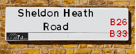
Neighbourhood Policing |
| Police Force: West Midlands |
 View Neighbourhood Crime and Policing View Neighbourhood Crime and Policing |
| Find a Local Neighbourhood Watch Scheme |
Location Details
| Sheldon Heath Road | |
|---|---|

| |
| Latitude | 52.471125 |
| Longitude | -1.784792 |
| OS Easting (X): | 414617 |
| OS Northing (Y): | 285972 |
| OS Grid Reference: | SP146860 |
Known Residential Addresses for Sheldon Heath Road
- 194 - 194A
- 331
- 343
- 107
- WESTHALL COURT, 1 FLAT 65
- WESTHALL COURT, 1 FLAT 4
- WESTHALL COURT, 1 FLAT 19
- WESTHALL COURT, 1 FLAT 2
- WESTHALL COURT, 1 FLAT 10
- WESTHALL COURT, 1 FLAT 16
- WESTHALL COURT, 1 FLAT 25
- WESTHALL COURT, 1 FLAT 54
- WESTHALL COURT, 1 FLAT 43
- WESTHALL COURT, 1 FLAT 23
- WESTHALL COURT, 1 FLAT 60
- WESTHALL COURT, 1 FLAT 73
- WESTHALL COURT, 1 FLAT 31
- WESTHALL COURT, 1 FLAT 12
- WESTHALL COURT, 1 FLAT 42
- WESTHALL COURT, 1 FLAT 58
- WESTHALL COURT, 1 FLAT 30
- WESTHALL COURT, 1 FLAT 9
- 224
- 236
- 384
- SHELDON POLICE STATION
- 152
- SHELDON GARDENS, 490 UNIT 1
- 490 UNIT 2
- 60
- 43
- 41
- 54
- 89
- 155
- 185
- 145
- 149
- 127
- 171
- 189
- 153
- 151
- 121
- 165
- 158
- 120
- 148
- 178
- 160
- 150
- 144
- 190
- 180
- 358
- 281
- 283
- 227
- 265
- 225
- 221
- 223
- 329
- 345
- 80
- 99
- 133
- 135
- 110
- 342
- 344
- 392
- 293
- 305
- 301
- 297
- 309
- 271
- 237
Roads that have a Junction with Sheldon Heath Road
| Street | Junction Type |
|---|---|
| Meadway | junction |
| Broadstone Road | junction |
| The Hays Kent's Moat | junction |
| Fleetwood Grove | junction |
| The Hays Kent's Moat | junction |
| Blakenhale Road | junction |
| Garretts Green Lane | roundabout |
| Garretts Green Lane | roundabout |
| Platt Brook Way | junction |
| Downsfield Road | junction |
| Kenmure Road | junction |
| Chestnuts Avenue | junction |
Sunset and Sunrise times
| Sunrise | 08:15 |
|---|---|
| Sunset | 16:05 |
Latest Weather Conditions
| Observed at Weather Station: | Coleshill 31 December 2024 at 09:00 (4.08 miles away) |
|---|---|
| Current Weather: | Overcast |
| Temperature and Humidity: | 8.5°C (85.3%) |
| Wind Direction and Speed: | SSW (16 mph) |
Population Statistics
| ONS Area Code | E00048162, E00048164, E00048166, E00175795, E00047268, E00047246, E00047252, E00047256 & E00047247 |
|---|---|
| ONS Area Name | Multi-Ethnic Hardship, Private Renting Young Families & Hard-Pressed Ethnic Mix |
| Average Age | 38.09, 37.24, 42.11 & 36.68 |
| Area Population | 1510.00, 1709.00, 1586.00 & 1386.00 |
| Male Population | 708.00, 836.00, 746.00 & 689.00 (48%) |
| Female Population | 802.00, 873.00, 840.00 & 697.00 (52%) |
| Benefit Claimants | 68, 50, 38 & 75 (4%) |
| LSOA Code: | E01009514, E01009517, E01009314 &E01009322 |
|---|---|
| LSOA Name: | Birmingham 062B, Birmingham 062D, Birmingham 069B &Birmingham 069D |
| SOA Code: | 7a &4c |
| SOA Name: | |
| MSOA Code: | E02001888 &E02001895 |
| MSOA Name: | Birmingham 062 &Birmingham 069 |
Nearest Supermarkets
| Asda Sheldon |
|---|
| 105 Kelynmead Road, Sheldon, Birmingham, B33 8LF |
| 0121 600 4600 |
| Distance: 0.51 Miles |
| Directions to Asda Sheldon |
| Iceland Yardley |
|---|
| 128 Church Road, Yardley, Birmingham, B25 8UT |
| 01217840079 |
| Distance: 0.99 Miles |
| Directions to Iceland Yardley |
| Tesco Sheldon Superstore |
|---|
| Coventry Rd, Sheldon, Birmingham, B26 3DY |
| 0345 677 9845 |
| Distance: 1.25 Miles |
| Directions to Tesco Sheldon Superstore |
| Iceland Sheldon |
|---|
| 2154 Coventry Road, Sheldon, Birmingham, B26 3JB |
| 01217423939 |
| Distance: 1.26 Miles |
| Directions to Iceland Sheldon |
Telephone Information
| Area Code |
|---|
| Area Code: 01675 - Coleshill |
| Area Code: 0121 - Birmingham |
| Area Code: 01676 - Meriden |
| Area Code: 01564 - Lapworth |
Broadband Information
| Speed | Average Speed | Median Speed | Maximum Speed | Next-generation access (NGA) | Number of Connections |
|---|---|---|---|---|---|
| Less than 2 Mbps | 11.7 | 8.1 | >=30 | Y | 5 |
Local Government
| Local Council Details |
|---|
| Within the area of Birmingham |
| Visit the Council's Website |
| Council House, Victoria Square, Birmingham &B1 1BB |
| Send email |
| Telephone Number: 0121 303 1111 |
| Local Member of Parliament |
|---|
| Within the Westminster Parliamentary Constituency of Birmingham &Yardley |
| The Member of Parliament is Liam Byrne &Jess Phillips |
| Details for the MP Liam Byrne &Jess Phillips on parliament.uk |
| Details for the MP Liam Byrne &Jess Phillips on theyworkforyou.com |
| In the 2024 General Election Liam Byrne &Jess Phillips won with a majority of 1,566 the result was Lab hold. The total electorate was 77,737 |
| Wards, Parish Councils and County Councils |
|---|
| Ward: Garretts Green &Sheldon Ward |
| Parish: Unparished area |
| Ceremonial County: West Midlands |
Nearest Schools
England Primary Schools
The Shirestone Academy
Address: The Shirestone Academy, Shirestone Road, Tile Cross, Birmingham, West Midlands, B33 0DH
Distance: 0.91 miles
Contact: 01216754686
Oasis Academy Blakenhale Junior
Address: Oasis Academy Blakenhale Junior, Homestead Road, Garretts Green, Birmingham, West Midlands, B33 0XG
Distance: 0.18 miles
Contact: 01217833960
Oasis Academy Blakenhale Infants
Address: Oasis Academy Blakenhale Infants, Blakenhale Road, Garrett's Green, Birmingham, West Midlands, B33 0XD
Distance: 0.20 miles
Contact: 01217833960
Lea Forest Primary Academy
Address: Lea Forest Primary Academy, Hurstcroft Road, Kitts Green, Birmingham, B33 9RD
Distance: 0.83 miles
Contact: 01216753985
Audley Primary School
Address: Audley Primary School, Audley Road, Stechford, Birmingham, West Midlands, B33 9HY
Distance: 1.23 miles
Contact:
Lyndon Green Junior School
Address: Lyndon Green Junior School, Wensley Road, Sheldon, Birmingham, West Midlands, B26 1LU
Distance: 0.75 miles
Contact: 01216752983
The Oval Primary School
Address: The Oval Primary School, Whittington Oval, Yardley, Birmingham, West Midlands, B33 8JG
Distance: 0.78 miles
Contact:
Lyndon Green Infant School
Address: Lyndon Green Infant School, Wychwood Cresent, Sheldon, Birmingham, West Midlands, B26 1LZ
Distance: 0.85 miles
Contact: 01216753543
Yardley Primary School
Address: Yardley Primary School, Harvey Road, Yardley, Birmingham, West Midlands, B26 1TD
Distance: 1.20 miles
Contact: 01214643235
Corpus Christi Catholic Primary School
Address: Corpus Christi Catholic Primary School, Lyttelton Road, Stechford, Birmingham, West Midlands, B33 8BL
Distance: 1.33 miles
Contact: 01216752784
Blakesley Hall Primary School
Address: Blakesley Hall Primary School, Yardley Green Road, Stechford, Birmingham, West Midlands, B33 8TH
Distance: 1.36 miles
Contact: 01217832148
Stechford Primary School
Address: Stechford Primary School, Albert Road, Stechford, Birmingham, B33 8SJ
Distance: 1.33 miles
Contact: 01214643245
St Bernadette's Catholic Primary School
Address: St Bernadette's Catholic Primary School, Hobmoor Road, Yardley, Birmingham, West Midlands, B25 8QL
Distance: 1.75 miles
Contact: 01217837232
Marston Green Infant Academy
Address: Marston Green Infant Academy, Elm Farm Avenue, Marston Green, Birmingham, West Midlands, B37 7AA
Distance: 1.41 miles
Contact: 01217795667
Marston Green Junior School
Address: Marston Green Junior School, Station Road, Marston Green, Birmingham, West Midlands, B37 7BA
Distance: 1.50 miles
Contact: 01217792227
Elms Farm Community Primary School
Address: Elms Farm Community Primary School, Dorncliffe Avenue, Sheldon, Birmingham, West Midlands, B33 0PJ
Distance: 0.70 miles
Contact: 01214644634
Our Lady's Catholic Primary School
Address: Our Lady's Catholic Primary School, East Meadway, Tile Cross, Birmingham, West Midlands, B33 0AU
Distance: 0.98 miles
Contact:
Gossey Lane Academy
Address: Gossey Lane Academy, Gossey Lane, Kitts Green, Birmingham, West Midlands, B33 0DS
Distance: 0.63 miles
Contact: 01214642909
Gossey Lane Junior Infant and Nursery School
Address: Gossey Lane Junior Infant and Nursery School, Gossey Lane, Kitts Green, Birmingham, West Midlands, B33 0DS
Distance: 0.63 miles
Contact:
Stanville Primary School
Address: Stanville Primary School, Stanville Road, Birmingham, West Midlands, B26 3YN
Distance: 0.65 miles
Contact: 01214642322
St Thomas More Catholic Primary School
Address: St Thomas More Catholic Primary School, Horse Shoes Lane, Sheldon, Birmingham, West Midlands, B26 3HU
Distance: 1.08 miles
Contact:
Audley Primary School
Address: Audley Primary School, Audley Road, Stechford, Birmingham, West Midlands, B33 9HY
Distance: 1.23 miles
Contact: 01214643139
The Oval School
Address: The Oval School, Whittington Oval, Yardley, Birmingham, West Midlands, B33 8JG
Distance: 0.78 miles
Contact: 01214643248
Oasis Academy Hobmoor
Address: Oasis Academy Hobmoor, Wash Lane, Yardley, Birmingham, West Midlands, B25 8FD
Distance: 1.49 miles
Contact: 01216753269
Alston Primary School
Address: Alston Primary School, Alston Road, Bordesley Green East, Birmingham, West Midlands, B9 5UN
Distance: 2.03 miles
Contact: 01214641569
Mapledene Primary School
Address: Mapledene Primary School, Mapledene Road, Mapledene Road, Birmingham, Uk, Birmingham, West Midlands, B26 3XE
Distance: 1.05 miles
Contact: 01214642881
Valley Primary
Address: Valley Primary, Old Lode Lane, Solihull, West Midlands, B92 8LW
Distance: 1.65 miles
Contact: 01217434691
England Secondary Schools
King Edward VI Sheldon Heath Academy
Address: King Edward VI Sheldon Heath Academy, Sheldon Heath Road, Sheldon, Birmingham, West Midlands, B26 2RZ
Distance: 0.34 miles
Contact: 01216472471
Tile Cross Academy
Address: Tile Cross Academy, Gressel Lane, Tile Cross, Birmingham, West Midlands, B33 9UF
Distance: 1.05 miles
Contact: 01215666400
The International School
Address: The International School, Gressel Lane, Tile Cross, Birmingham, West Midlands, B33 9UF
Distance: 1.05 miles
Contact:
Cockshut Hill School
Address: Cockshut Hill School, Cockshut Hill, Yardley, Birmingham, West Midlands, B26 2HX
Distance: 0.30 miles
Contact: 01212895900
Cockshut Hill Technology College
Address: Cockshut Hill Technology College, Cockshut Hill, Yardley, Birmingham, West Midlands, B26 2HX
Distance: 0.30 miles
Contact:
Nearest Hospitals
| Brooklands Hospital |
|---|
| Address: Coleshill Road, Marston Green, Birmingham, B37 7HL, |
| NHS Sector |
| Coventry and Warwickshire Partnership NHS Trust |
| Telephone: 0121 329 4900 |
| Visit Hospital Website |
| Distance: 2.76 (miles) |
| Directions from to Brooklands Hospital |
| Heartlands Hospital |
|---|
| Address: Bordesley Green East, Bordesley Green, Birmingham, B9 5SS, |
| Independent Sector |
| University Hospitals Birmingham NHS Foundation Trust |
| Telephone: 0121 424 2000 |
| Visit Hospital Website |
| Distance: 3.22 (miles) |
| Directions from to Heartlands Hospital |
| Tamarind Centre |
|---|
| Address: 165 Yardley Green Road, Bordesley Green, Birmingham, |
| NHS Sector |
| Birmingham and Solihull Mental Health NHS Foundation Trust |
| Telephone: 0121 301 0500 |
| Visit Hospital Website |
| Distance: 3.71 (miles) |
| Directions from to Tamarind Centre |
Nearest Dentists
Dentists
SHELDON DENTAL SURGERY
Address: 197 MEADWAY, BIRMINGHAM, WEST MIDLANDS, B33 8NB
Distance: 0.45 miles
Contact: :
DENTAL SURGERY
Address: 104 LEA VILLAGE, BIRMINGHAM, WEST MIDLANDS, B33 9SD
Distance: 0.79 miles
Contact: :
DENTAL SURGERY
Address: 22 MANOR HOUSE LANE, BIRMINGHAM, WEST MIDLANDS, B26 1PG
Distance: 0.95 miles
Contact: :
21-21A BELL LANE (DENTAL SURGERY)
Address: 21-21A BELL LANE, KITTS GREEN, BIRMINGHAM, WEST MIDLANDS, B33 0HS
Distance: 0.99 miles
Contact: :
BHANDAL DENTAL PRACTICE
Address: 1746 COVENTRY ROAD, YARDLEY, BIRMINGHAM, WEST MIDLANDS, B26 1BG
Distance: 1.13 miles
Contact: :
YEW TREE DENTAL SURGERY
Address: 529 HOB MOOR ROAD, YARDLEY, BIRMINGHAM, WEST MIDLANDS, B25 8TH
Distance: 1.19 miles
Contact: :
Nearest GP Surgeries
Doctors
ARRAN MEDICAL CENTRE BRANCH SURGERY
Address: 194 SHELDON HEATH ROAD, SHELDON, BIRMINGHAM, WEST MIDLANDS, B26 2DR
Distance: 0.08 miles
Contact: :
SHELDON HEATH ROAD SURGERY
Address: 119 SHELDON HEATH ROAD, SHELDON, BIRMINGHAM, WEST MIDLANDS, B26 2DP
Distance: 0.09 miles
Contact: tel: 01217845465
GARRETTS GREEN LANE SURGERY
Address: 172 GARRETTS GREEN LANE, SHELDON, BIRMINGHAM, WEST MIDLANDS, B26 2SB
Distance: 0.25 miles
Contact: tel: 0121 7433003
DOWNSFIELD MEDICAL CENTRE
Address: 315 SHELDON HEATH ROAD, SHELDON, BIRMINGHAM, WEST MIDLANDS, B26 2TY
Distance: 0.36 miles
Contact: tel: 0121 7432626
THE SHELDON MEDICAL CENTRE
Address: 169 CHURCH ROAD, SHELDON, BIRMINGHAM, WEST MIDLANDS, B26 3TT
Distance: 0.79 miles
Contact: tel: 0121 7435511
MIRFIELD SURGERY
Address: 287 KITTS GREEN ROAD, BIRMINGHAM, BIRMINGHAM, WEST MIDLANDS, B33 9SA
Distance: 0.84 miles
Contact: tel: 0121 4110484
Nearest Dispensing Chemists
Pharmacies
PAN PHARMACY
Address: 136 GARRETTS GREEN LANE, SHELDON, BIRMINGHAM, WEST MIDLANDS, B26 2JN
Distance: 0.37 miles
Contact: tel: 01217 432082
PAN PHARMACY
Address: 91-93 PARTRIDGE ROAD, BIRMINGHAM, WEST MIDLANDS, B26 2DD
Distance: 0.42 miles
Contact: tel: 01217 861807
PAN PHARMACY
Address: 299 CHURCH ROAD, SHELDON, BIRMINGHAM, WEST MIDLANDS, B26 3YH
Distance: 0.63 miles
Contact: tel: 0121 7429599
SAINI PHARMACY
Address: 292 KITTS GREEN ROAD, LEA VILLAGE, BIRMINGHAM, B33 9SB
Distance: 0.85 miles
Contact: tel: 01217 842448
PAN PHARMACY
Address: 160-160A COMMON LANE, SHELDON, BIRMINGHAM, B26 3DN
Distance: 0.87 miles
Contact: tel: 01217 432385
SAINI PHARMACY
Address: 38 EAST MEADWAY, TILE CROSS, BIRMINGHAM, B33 0AP
Distance: 0.91 miles
Contact: tel: 01217 832475
Nearest Opticians
Opticians
DIRECT VISION OPTICIANS
Address: 297-299 CHURCH ROAD, SHELDON, BIRMINGHAM, WEST MIDLANDS, B26 3YH
Distance: 0.63 miles
Contact: :
SCRIVENS OPTICIANS (LEA HALL)
Address: 300 KITTS GREEN ROAD, LEA HALL, BIRMINGHAM, WEST MIDLANDS, B33 9SB
Distance: 0.85 miles
Contact: :
J ELLIS OPTICIANS
Address: 146 CHURCH ROAD, YARDLEY, BIRMINGHAM, WEST MIDLANDS, B25 8UT
Distance: 0.99 miles
Contact: :
ONSIGHT DOMICILIARY SERVICES LIMITED
Address: 190 FLAXLEY ROAD, BIRMINGHAM, B33 9HD
Distance: 1.23 miles
Contact: :
SCRIVENS OPTICIANS (SHELDON)
Address: 2162 COVENTRY ROAD, SHELDON, BIRMINGHAM, WEST MIDLANDS, B26 3JB
Distance: 1.26 miles
Contact: :
MAGINNIS OPTICIANS - MARSTON GREEN
Address: 32A HOLLY LANE, MARSTON GREEN, BIRMINGHAM, WEST MIDLANDS, B37 7AE
Distance: 1.26 miles
Contact: :
Transport
Nearest Rail Stations
Lea Hall Station is 0.66 miles away.
Address: Lea Hall station, Lea Hall Road, Lea Hall, West Midlands, B33 8JU
Lea Hall is situated on the Rugby�Birmingham�Stafford line|West Coast Main Line.
Lea Hall Station is staffed on a part time basis.
Marston Green Station is 1.26 miles away.
Address: Marston Green station, Holly Lane, Marston Green, West Midlands, B37 7AB
Marston Green is situated on the Rugby�Birmingham�Stafford line|West Coast Main Line.
Marston Green Station is staffed on a full time basis.