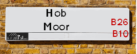
Hob Moor Road is a street located in the city of Birmingham. The street has a length of approximately 2,569 metres.
The street is located within the Birmingham District (B) Council's jurisdiction. They provide various services, like refuse collection, and manage council tax collection. It's situated in the West Midlands region of the UK.
The road has been assigned the Unique Street Reference Numbers of 2706104, 2759174 and 2735883 in the National Street Gazetteer.
The street has the postcodes of B25 8XD, B25 8XB, B25 8UF, B25 8UE, B25 8UB, B25 8TN, B25 8TH, B25 8QL, B10 9JQ, B10 9JH, B10 9JG, B10 9HL, B10 9HJ, B10 9HH, B10 9BU, B10 9BT, B10 9BS, B10 9BH, B10 9AZ and B10 9AY.
It is located within the county of West Midlands, situated in the West Midlands region of the UK. It's 98.97 miles North West from central London., 3.62 miles East from Birmingham, 13.68 miles West from Coventry and 25.52 miles North East from Worcester.
HOB MOOR ROAD is within the Post Town of BIRMINGHAM
Map of Hob Moor Road
| Street Crime (updated 03/12/2024) | ||
|---|---|---|
| Location Note | Central Point of Street - Not Actual Location | |
| MSOA Info | For MSOAs E02001889, E02001892, E02001893 (Statistical Neighbourhood) | |
| Click Hint | Click on a Circle for a detailed breakdown below map. | |
| Crime Levels |
Green = Very Low Yellow = Low Orange = High Red = Very High |
|
| Postcodes | ||
| Icon | Postcodes for Hob Moor Road | |
| Walking Distances | ||
| Distance Info | Green Circle = 10 Minutes Walk (800 metres) | |
Street Crime Data accessed from data.police.uk on 06/10/2024.
Moving to Hob Moor Road?
I can help you uncover potential pitfalls and provide key questions to ask about your new property. With decades of experience as a Local Land Charges Manager, I offer confidential insights to make your move informed and stress-free.
This service is free, but you may wish to make an optional donation to support it. Please include the property name and address in your request as well as anything you wish to focus on.
Contact Me
Do you know why this road is called Hob Moor Road?
What's it like to live here?
Share a Photo of Hob Moor Road
Ask the community a question.
Do you have any questions, memories to share, have any photos or know any facts? We'd love to know more.
Submit Your Comment
Budget Friendly Hotels near Hob Moor Road
| Budget Hotel Name | Distance (miles) |
|---|---|
|
1: Name:Holiday Inn Express Birmingham�South A45 Address: 1270 Coventry Road, Yardley Telephone: Visit Hotel Page |
0.47 |
|
2: Name:Travelodge Birmingham Yardley Address: 1741 Coventry Rd, Birmingham, B26 1DS Telephone: 0871 984 6065 Visit Hotel Page |
0.76 |
|
3: Name:Travelodge Birmingham Sheldon Address: 2225 Coventry Rd, Birmingham, B26 3EH Telephone: 0871 559 1806 Visit Hotel Page |
1.83 |
|
4: Name:Holiday Inn Express Birmingham Star City Address: Cuckoo Road, Heartlands Parkway Telephone: Visit Hotel Page |
2.88 |
|
5: Name:Travelodge Birmingham Fort Dunlop Address: Fort Dunlop, Fort Pkwy, Birmingham, B24 9FD Telephone: 0871 984 6312 Visit Hotel Page |
2.99 |
Hotel Options
Your support helps keep this site running!
If you enjoy using this website, consider making a donation to help me cover hosting costs.
Flats and Apartments in Hob Moor Road
FLAT 2
FLAT 4
FLAT 1
FLAT 2
FLAT 3
FLAT 5
FLAT 6
FLAT 1
FLAT 2
FLAT 4
FLAT 5
FLAT 6
FLAT 8
FLAT 9
FLAT 11
FLAT 12
FLAT 14
FLAT 16
FLAT 17
FLAT 18
FLAT 19
FLAT 22
FLAT 23
FLAT 25
FLAT 1
FLAT 2
FLAT 1
FLAT 3
FLAT 4
FLAT 5
FLAT 6
FLAT 7
FLAT 9
FLAT 11
FLAT 12
FLAT 15
FLAT 17
FLAT 21
FLAT 23
FLAT 24
FLAT 1
FLAT 2
FLAT 1
FLAT 2
FLAT 1
FLAT 4
EPC (Energy Performance Certificate) Information for Hob Moor Road
UPRN: 100070407186
EPC Current: D
EPC Potential: B
Habitable Rooms: 4
Property Type: House
Tenure: rental (social)
Built Form: End-Terrace
Age Band: 1900-1929
Mains Gas: Yes
UPRN: 100070407187
EPC Current: D
EPC Potential: B
Habitable Rooms: 5
Property Type: House
Tenure: Owner-occupied
Built Form: Semi-Detached
Age Band: 1900-1929
Mains Gas: Yes
UPRN: 100070407188
EPC Current: D
EPC Potential: C
Habitable Rooms: 6
Property Type: House
Tenure: rental (private)
Built Form: Mid-Terrace
Age Band: 1900-1929
Mains Gas: Yes
UPRN: 100070407189
EPC Current: E
EPC Potential: C
Habitable Rooms: 3
Property Type: House
Tenure: Owner-occupied
Built Form: End-Terrace
Age Band: 1930-1949
Mains Gas: Yes
UPRN: 100070407190
EPC Current: D
EPC Potential: D
Habitable Rooms: 4
Property Type: House
Tenure: Owner-occupied
Built Form: Semi-Detached
Age Band: 1900-1929
Mains Gas: Yes
UPRN: 100070407191
EPC Current: E
EPC Potential: B
Habitable Rooms: 4
Property Type: House
Tenure: Owner-occupied
Built Form: Mid-Terrace
Age Band: 1930-1949
Mains Gas: Yes
UPRN: 100071445492
EPC Current: D
EPC Potential: C
Habitable Rooms: 2
Property Type: Flat
Tenure: Owner-occupied
Built Form: Semi-Detached
Age Band: 1900-1929
Mains Gas: Yes
UPRN: 100070407193
EPC Current: D
EPC Potential: B
Habitable Rooms: 5
Property Type: House
Tenure: rental (private)
Built Form: Mid-Terrace
Age Band: 1950-1966
Mains Gas: Yes
UPRN: 100070407194
EPC Current: C
EPC Potential: B
Habitable Rooms: 5
Property Type: House
Tenure: Owner-occupied
Built Form: End-Terrace
Age Band: 1930-1949
Mains Gas: Yes
UPRN: 100070407196
EPC Current: D
EPC Potential: B
Habitable Rooms: 4
Property Type: House
Tenure: rental (social)
Built Form: End-Terrace
Age Band: 1930-1949
Mains Gas: Yes
UPRN: 100070407198
EPC Current: D
EPC Potential: B
Habitable Rooms: 4
Property Type: House
Tenure: rental (social)
Built Form: Mid-Terrace
Age Band: 1930-1949
Mains Gas: Yes
UPRN: 100070407200
EPC Current: D
EPC Potential: B
Habitable Rooms: 5
Property Type: House
Tenure: Owner-occupied
Built Form: Mid-Terrace
Age Band: 1900-1929
Mains Gas: Yes
UPRN: 100070407202
EPC Current: D
EPC Potential: B
Habitable Rooms: 5
Property Type: House
Tenure: Owner-occupied
Built Form: End-Terrace
Age Band: 1900-1929
Mains Gas: Yes
UPRN: 100070407204
EPC Current: F
EPC Potential: B
Habitable Rooms: 5
Property Type: House
Tenure: Rented (social)
Built Form: Mid-Terrace
Age Band: 1930-1949
Mains Gas: Yes
UPRN: 100070407208
EPC Current: E
EPC Potential: C
Habitable Rooms: 8
Property Type: House
Tenure: rental (private)
Built Form: Semi-Detached
Age Band: 1930-1949
Mains Gas: Yes
UPRN: 100070407209
EPC Current: D
EPC Potential: B
Habitable Rooms: 5
Property Type: House
Tenure: Owner-occupied
Built Form: Semi-Detached
Age Band: 1900-1929
Mains Gas: Yes
UPRN: 100070407210
EPC Current: D
EPC Potential: B
Habitable Rooms: 5
Property Type: House
Tenure: Rented (social)
Built Form: Mid-Terrace
Age Band: 1930-1949
Mains Gas: Yes
UPRN: 100070407211
EPC Current: E
EPC Potential: B
Habitable Rooms: 4
Property Type: House
Tenure: Owner-occupied
Built Form: Semi-Detached
Age Band: 1900-1929
Mains Gas: Yes
UPRN: 100070407212
EPC Current: D
EPC Potential: C
Habitable Rooms: 5
Property Type: House
Tenure: Owner-occupied
Built Form: End-Terrace
Age Band: 1930-1949
Mains Gas: Yes
UPRN: 100070407213
EPC Current: D
EPC Potential: B
Habitable Rooms: 4
Property Type: House
Tenure: rental (social)
Built Form: End-Terrace
Age Band: 1930-1949
Mains Gas: Yes
UPRN: 100070407214
EPC Current: D
EPC Potential: C
Habitable Rooms: 5
Property Type: House
Tenure: Rented (social)
Built Form: End-Terrace
Age Band: 1930-1949
Mains Gas: Yes
UPRN: 100070407215
EPC Current: E
EPC Potential: C
Habitable Rooms: 5
Property Type: House
Tenure: Owner-occupied
Built Form: End-Terrace
Age Band: 1900-1929
Mains Gas: Yes
UPRN: 100070407216
EPC Current: D
EPC Potential: B
Habitable Rooms: 5
Property Type: House
Tenure: rental (private)
Built Form: Mid-Terrace
Age Band: 1930-1949
Mains Gas: Yes
UPRN: 100070407217
EPC Current: D
EPC Potential: B
Habitable Rooms: 5
Property Type: House
Tenure: Owner-occupied
Built Form: Mid-Terrace
Age Band: 1930-1949
Mains Gas: Yes
UPRN: 100070407218
EPC Current: D
EPC Potential: B
Habitable Rooms: 5
Property Type: House
Tenure: Owner-occupied
Built Form: Semi-Detached
Age Band: 1900-1929
Mains Gas: Yes
UPRN: 100070407220
EPC Current: D
EPC Potential: D
Habitable Rooms: 5
Property Type: House
Tenure: rental (social)
Built Form: Mid-Terrace
Age Band: 1930-1949
Mains Gas: Yes
UPRN: 100070407221
EPC Current: D
EPC Potential: B
Habitable Rooms: 4
Property Type: House
Tenure: Owner-occupied
Built Form: Mid-Terrace
Age Band: 1930-1949
Mains Gas: Yes
UPRN: 100070407222
EPC Current: D
EPC Potential: B
Habitable Rooms: 4
Property Type: House
Tenure: rental (private)
Built Form: Mid-Terrace
Age Band: 1930-1949
Mains Gas: Yes
UPRN: 100070407224
EPC Current: D
EPC Potential: B
Habitable Rooms: 4
Property Type: House
Tenure: Owner-occupied
Built Form: Semi-Detached
Age Band: 1930-1949
Mains Gas: Yes
UPRN: 100070407225
EPC Current: D
EPC Potential: B
Habitable Rooms: 4
Property Type: House
Tenure: Owner-occupied
Built Form: End-Terrace
Age Band: 1950-1966
Mains Gas: Yes
UPRN: 100070407226
EPC Current: E
EPC Potential: C
Habitable Rooms: 8
Property Type: House
Tenure: rental (private)
Built Form: Semi-Detached
Age Band: 1930-1949
Mains Gas: Yes
UPRN: 100070407227
EPC Current: D
EPC Potential: B
Habitable Rooms: 4
Property Type: House
Tenure: Rented (social)
Built Form: End-Terrace
Age Band: 1900-1929
Mains Gas: Yes
UPRN: 100070407230
EPC Current: E
EPC Potential: C
Habitable Rooms: 5
Property Type: House
Tenure: Owner-occupied
Built Form: Mid-Terrace
Age Band: 1930-1949
Mains Gas: Yes
UPRN: 100070407231
EPC Current: D
EPC Potential: D
Habitable Rooms: 5
Property Type: House
Tenure: Owner-occupied
Built Form: End-Terrace
Age Band: 1900-1929
Mains Gas: Yes
UPRN: 100071445423
EPC Current: E
EPC Potential: E
Habitable Rooms: 2
Property Type: House
Tenure: rental (social)
Built Form: End-Terrace
Age Band: 1930-1949
Mains Gas: Yes
UPRN: 100070407233
EPC Current: D
EPC Potential: B
Habitable Rooms: 5
Property Type: House
Tenure: Rented (private)
Built Form: Mid-Terrace
Age Band: 1900-1929
Mains Gas: Yes
UPRN: 100070407234
EPC Current: E
EPC Potential: B
Habitable Rooms: 4
Property Type: House
Tenure: rental (social)
Built Form: Semi-Detached
Age Band: 1900-1929
Mains Gas: Yes
UPRN: 100070407236
EPC Current: E
EPC Potential: C
Habitable Rooms: 5
Property Type: House
Tenure: Owner-occupied
Built Form: End-Terrace
Age Band: 1930-1949
Mains Gas: Yes
UPRN: 100070407237
EPC Current: C
EPC Potential: B
Habitable Rooms: 5
Property Type: House
Tenure: Rented (social)
Built Form: Mid-Terrace
Age Band: 1900-1929
Mains Gas: Yes
UPRN: 100070407238
EPC Current: D
EPC Potential: B
Habitable Rooms: 4
Property Type: House
Tenure: Owner-occupied
Built Form: Mid-Terrace
Age Band: 1930-1949
Mains Gas: Yes
UPRN: 100070407239
EPC Current: E
EPC Potential: C
Habitable Rooms: 6
Property Type: House
Tenure: rental (private)
Built Form: Mid-Terrace
Age Band: 1900-1929
Mains Gas: Yes
UPRN: 100070407240
EPC Current: D
EPC Potential: B
Habitable Rooms: 4
Property Type: House
Tenure: rental (social)
Built Form: Mid-Terrace
Age Band: 1900-1929
Mains Gas: Yes
UPRN: 100070407243
EPC Current: E
EPC Potential: C
Habitable Rooms: 5
Property Type: House
Tenure: Owner-occupied
Built Form: End-Terrace
Age Band: 1930-1949
Mains Gas: Yes
UPRN: 100070407244
EPC Current: D
EPC Potential: B
Habitable Rooms: 4
Property Type: House
Tenure: Owner-occupied
Built Form: Mid-Terrace
Age Band: 1930-1949
Mains Gas: Yes
UPRN: 100070407246
EPC Current: D
EPC Potential: B
Habitable Rooms: 4
Property Type: House
Tenure: Owner-occupied
Built Form: End-Terrace
Age Band: 1930-1949
Mains Gas: Yes
UPRN: 100070407248
EPC Current: D
EPC Potential: B
Habitable Rooms: 4
Property Type: House
Tenure: rental (social)
Built Form: End-Terrace
Age Band: 1930-1949
Mains Gas: Yes
UPRN: 100070407250
EPC Current: D
EPC Potential: B
Habitable Rooms: 4
Property Type: House
Tenure: rental (social)
Built Form: Mid-Terrace
Age Band: 1900-1929
Mains Gas: Yes
UPRN: 100070407251
EPC Current: D
EPC Potential: B
Habitable Rooms: 5
Property Type: House
Tenure: Rented (social)
Built Form: Semi-Detached
Age Band: 1930-1949
Mains Gas: Yes
UPRN: 100070407253
EPC Current: F
EPC Potential: B
Habitable Rooms: 5
Property Type: House
Tenure: rental (social)
Built Form: Semi-Detached
Age Band: 1930-1949
Mains Gas: Yes
UPRN: 100070407257
EPC Current: D
EPC Potential: B
Habitable Rooms: 5
Property Type: House
Tenure: Owner-occupied
Built Form: Mid-Terrace
Age Band: 1900-1929
Mains Gas: Yes
UPRN: 100070407258
EPC Current: D
EPC Potential: B
Habitable Rooms: 4
Property Type: House
Tenure: rental (social)
Built Form: Mid-Terrace
Age Band: 1930-1949
Mains Gas: Yes
UPRN: 100070407260
EPC Current: D
EPC Potential: B
Habitable Rooms: 4
Property Type: House
Tenure: Rented (private)
Built Form: Mid-Terrace
Age Band: 1930-1949
Mains Gas: Yes
UPRN: 100070407261
EPC Current: G
EPC Potential: G
Habitable Rooms: 5
Property Type: House
Tenure: Owner-occupied
Built Form: Semi-Detached
Age Band: 1930-1949
Mains Gas: Yes
UPRN: 100070407264
EPC Current: D
EPC Potential: D
Habitable Rooms: 4
Property Type: House
Tenure: Owner-occupied
Built Form: End-Terrace
Age Band: 1900-1929
Mains Gas: Yes
UPRN: 100070407267
EPC Current: D
EPC Potential: B
Habitable Rooms: 5
Property Type: House
Tenure: Owner-occupied
Built Form: Mid-Terrace
Age Band: 1930-1949
Mains Gas: Yes
UPRN: 100070407269
EPC Current: C
EPC Potential: B
Habitable Rooms: 5
Property Type: House
Tenure: rental (private)
Built Form: Mid-Terrace
Age Band: 1930-1949
Mains Gas: Yes
UPRN: 100070407270
EPC Current: E
EPC Potential: C
Habitable Rooms: 4
Property Type: House
Tenure: rental (social)
Built Form: Mid-Terrace
Age Band: 1930-1949
Mains Gas: Yes
UPRN: 100070407271
EPC Current: D
EPC Potential: B
Habitable Rooms: 5
Property Type: House
Tenure: Rented (social)
Built Form: Mid-Terrace
Age Band: 1930-1949
Mains Gas: Yes
UPRN: 100070407272
EPC Current: E
EPC Potential: C
Habitable Rooms: 4
Property Type: House
Tenure: Rented (social)
Built Form: Mid-Terrace
Age Band: 1930-1949
Mains Gas: Yes
UPRN: 100070407273
EPC Current: D
EPC Potential: B
Habitable Rooms: 5
Property Type: House
Tenure: rental (private)
Built Form: End-Terrace
Age Band: 1900-1929
Mains Gas: Yes
UPRN: 100070407274
EPC Current: D
EPC Potential: B
Habitable Rooms: 6
Property Type: House
Tenure: Owner-occupied
Built Form: End-Terrace
Age Band: 1930-1949
Mains Gas: Yes
UPRN: 100070407275
EPC Current: D
EPC Potential: B
Habitable Rooms: 5
Property Type: House
Tenure: unknown
Built Form: End-Terrace
Age Band: 1930-1949
Mains Gas: Yes
UPRN: 100070407277
EPC Current: E
EPC Potential: C
Habitable Rooms: 5
Property Type: House
Tenure: Owner-occupied
Built Form: Mid-Terrace
Age Band: 1930-1949
Mains Gas: Yes
UPRN: 100070407278
EPC Current: D
EPC Potential: B
Habitable Rooms: 4
Property Type: House
Tenure: Owner-occupied
Built Form: Mid-Terrace
Age Band: 1930-1949
Mains Gas: Yes
UPRN: 100070407279
EPC Current: E
EPC Potential: B
Habitable Rooms: 3
Property Type: House
Tenure: Owner-occupied
Built Form: Mid-Terrace
Age Band: 1900-1929
Mains Gas: Yes
UPRN: 100070407280
EPC Current: D
EPC Potential: B
Habitable Rooms: 4
Property Type: House
Tenure: rental (social)
Built Form: End-Terrace
Age Band: 1930-1949
Mains Gas: Yes
UPRN: 100070407283
EPC Current: D
EPC Potential: B
Habitable Rooms: 6
Property Type: House
Tenure: Owner-occupied
Built Form: Mid-Terrace
Age Band: 1900-1929
Mains Gas: Yes
UPRN: 100070407284
EPC Current: D
EPC Potential: B
Habitable Rooms: 4
Property Type: House
Tenure: Owner-occupied
Built Form: End-Terrace
Age Band: 1900-1929
Mains Gas: Yes
UPRN: 100070407286
EPC Current: E
EPC Potential: C
Habitable Rooms: 5
Property Type: House
Tenure: Owner-occupied
Built Form: Mid-Terrace
Age Band: 1900-1929
Mains Gas: Yes
UPRN: 100070407289
EPC Current: D
EPC Potential: B
Habitable Rooms: 4
Property Type: House
Tenure: rental (social)
Built Form: End-Terrace
Age Band: 1930-1949
Mains Gas: Yes
UPRN: 100070407292
EPC Current: D
EPC Potential: B
Habitable Rooms: 5
Property Type: House
Tenure: Owner-occupied
Built Form: End-Terrace
Age Band: 1900-1929
Mains Gas: Yes
UPRN: 100070407293
EPC Current: D
EPC Potential: B
Habitable Rooms: 4
Property Type: House
Tenure: rental (private)
Built Form: Semi-Detached
Age Band: 1930-1949
Mains Gas: Yes
UPRN: 100070407294
EPC Current: D
EPC Potential: B
Habitable Rooms: 4
Property Type: House
Tenure: rental (social)
Built Form: Semi-Detached
Age Band: 1930-1949
Mains Gas: Yes
UPRN: 100070407295
EPC Current: D
EPC Potential: C
Habitable Rooms: 7
Property Type: House
Tenure: Owner-occupied
Built Form: Semi-Detached
Age Band: 1900-1929
Mains Gas: Yes
UPRN: 100070407296
EPC Current: E
EPC Potential: C
Habitable Rooms: 5
Property Type: House
Tenure: Owner-occupied
Built Form: Semi-Detached
Age Band: 1930-1949
Mains Gas: Yes
UPRN: 100070407297
EPC Current: E
EPC Potential: B
Habitable Rooms: 4
Property Type: House
Tenure: Owner-occupied
Built Form: Semi-Detached
Age Band: 1930-1949
Mains Gas: Yes
UPRN: 100070407298
EPC Current: E
EPC Potential: B
Habitable Rooms: 5
Property Type: House
Tenure: rental (private)
Built Form: Mid-Terrace
Age Band: 1930-1949
Mains Gas: Yes
UPRN: 100070407299
EPC Current: D
EPC Potential: D
Habitable Rooms: 4
Property Type: House
Tenure: rental (social)
Built Form: Mid-Terrace
Age Band: 1900-1929
Mains Gas: Yes
UPRN: 100070407300
EPC Current: D
EPC Potential: B
Habitable Rooms: 5
Property Type: House
Tenure: Owner-occupied
Built Form: End-Terrace
Age Band: 1930-1949
Mains Gas: Yes
UPRN: 100070407302
EPC Current: D
EPC Potential: B
Habitable Rooms: 5
Property Type: House
Tenure: rental (social)
Built Form: Mid-Terrace
Age Band: 1930-1949
Mains Gas: Yes
UPRN: 100070407303
EPC Current: D
EPC Potential: B
Habitable Rooms: 4
Property Type: House
Tenure: Owner-occupied
Built Form: Mid-Terrace
Age Band: 1900-1929
Mains Gas: Yes
UPRN: 100070407305
EPC Current: D
EPC Potential: B
Habitable Rooms: 4
Property Type: House
Tenure: Rented (social)
Built Form: End-Terrace
Age Band: 1930-1949
Mains Gas: Yes
UPRN: 100070407307
EPC Current: D
EPC Potential: B
Habitable Rooms: 4
Property Type: House
Tenure: rental (social)
Built Form: Mid-Terrace
Age Band: 1930-1949
Mains Gas: Yes
UPRN: 100070407308
EPC Current: D
EPC Potential: B
Habitable Rooms: 5
Property Type: House
Tenure: rental (private)
Built Form: Semi-Detached
Age Band: 1900-1929
Mains Gas: Yes
UPRN: 100070407309
EPC Current: C
EPC Potential: B
Habitable Rooms: 8
Property Type: House
Tenure: Rented (social)
Built Form: End-Terrace
Age Band: 1930-1949
Mains Gas: Yes
UPRN: 100070407311
EPC Current: D
EPC Potential: D
Habitable Rooms: 4
Property Type: House
Tenure: rental (social)
Built Form: Mid-Terrace
Age Band: 1900-1929
Mains Gas: Yes
UPRN: 100070407312
EPC Current: D
EPC Potential: B
Habitable Rooms: 5
Property Type: House
Tenure: Owner-occupied
Built Form: End-Terrace
Age Band: 1900-1929
Mains Gas: Yes
UPRN: 100070407314
EPC Current: C
EPC Potential: B
Habitable Rooms: 5
Property Type: House
Tenure: Owner-occupied
Built Form: Mid-Terrace
Age Band: 1900-1929
Mains Gas: Yes
UPRN: 100070407315
EPC Current: D
EPC Potential: B
Habitable Rooms: 4
Property Type: House
Tenure: Owner-occupied
Built Form: Mid-Terrace
Age Band: 1930-1949
Mains Gas: Yes
UPRN: 100070407317
EPC Current: D
EPC Potential: B
Habitable Rooms: 5
Property Type: House
Tenure: Owner-occupied
Built Form: End-Terrace
Age Band: 1930-1949
Mains Gas: Yes
UPRN: 100070407318
EPC Current: D
EPC Potential: C
Habitable Rooms: 4
Property Type: House
Tenure: rental (social)
Built Form: Mid-Terrace
Age Band: 1930-1949
Mains Gas: Yes
UPRN: 100070407320
EPC Current: D
EPC Potential: B
Habitable Rooms: 4
Property Type: House
Tenure: Owner-occupied
Built Form: Mid-Terrace
Age Band: 1930-1949
Mains Gas: Yes
UPRN: 100070407327
EPC Current: D
EPC Potential: C
Habitable Rooms: 6
Property Type: House
Tenure: Owner-occupied
Built Form: Semi-Detached
Age Band: 1930-1949
Mains Gas: Yes
UPRN: 100070407329
EPC Current: E
EPC Potential: B
Habitable Rooms: 4
Property Type: House
Tenure: Owner-occupied
Built Form: Semi-Detached
Age Band: 1930-1949
Mains Gas: Yes
UPRN: 100070407330
EPC Current: D
EPC Potential: C
Habitable Rooms: 8
Property Type: House
Tenure: Owner-occupied
Built Form: Semi-Detached
Age Band: 1930-1949
Mains Gas: Yes
UPRN: 100070407332
EPC Current: E
EPC Potential: C
Habitable Rooms: 6
Property Type: House
Tenure: Owner-occupied
Built Form: Semi-Detached
Age Band: before 1900
Mains Gas: Yes
UPRN: 100070407334
EPC Current: D
EPC Potential: C
Habitable Rooms: 7
Property Type: House
Tenure: Owner-occupied
Built Form: Semi-Detached
Age Band: 1930-1949
Mains Gas: Yes
UPRN: 100070407335
EPC Current: D
EPC Potential: C
Habitable Rooms: 2
Property Type: Flat
Tenure: rental (private)
Built Form: Mid-Terrace
Age Band: 1930-1949
Mains Gas: Yes
UPRN: 100070407336
EPC Current: D
EPC Potential: B
Habitable Rooms: 4
Property Type: House
Tenure: Rented (private)
Built Form: Semi-Detached
Age Band: 1930-1949
Mains Gas: Yes
UPRN: 10024332711
EPC Current: D
EPC Potential: C
Habitable Rooms: 4
Property Type: Maisonette
Tenure: Owner-occupied
Built Form: End-Terrace
Age Band: 1900-1929
Mains Gas: Yes
UPRN: 10023295588
EPC Current: E
EPC Potential: C
Habitable Rooms: 2
Property Type: Flat
Tenure: Owner-occupied
Built Form: End-Terrace
Age Band: 1900-1929
Mains Gas: Yes
UPRN: 100071282332
EPC Current: E
EPC Potential: C
Habitable Rooms: 2
Property Type: Flat
Tenure: Owner-occupied
Built Form: Mid-Terrace
Age Band: 1900-1929
Mains Gas: Yes
UPRN: 100070407340
EPC Current: G
EPC Potential: F
Habitable Rooms: 6
Property Type: House
Tenure: unknown
Built Form: Semi-Detached
Age Band: 1930-1949
Mains Gas: Yes
UPRN: 10024334677
EPC Current: E
EPC Potential: C
Habitable Rooms: 2
Property Type: Flat
Tenure: Owner-occupied
Built Form: End-Terrace
Age Band: 1900-1929
Mains Gas: Yes
UPRN: 100070407341
EPC Current: E
EPC Potential: C
Habitable Rooms: 2
Property Type: Flat
Tenure: Owner-occupied
Built Form: End-Terrace
Age Band: 1900-1929
Mains Gas: Yes
UPRN: 100070407343
EPC Current: E
EPC Potential: C
Habitable Rooms: 3
Property Type: Flat
Tenure: Owner-occupied
Built Form: End-Terrace
Age Band: 1900-1929
Mains Gas: Yes
UPRN: 100070407344
EPC Current: D
EPC Potential: B
Habitable Rooms: 5
Property Type: House
Tenure: Owner-occupied
Built Form: Semi-Detached
Age Band: 1930-1949
Mains Gas: Yes
UPRN: 10024451468
EPC Current: D
EPC Potential: C
Habitable Rooms: 3
Property Type: Flat
Tenure: rental (private)
Built Form: End-Terrace
Age Band: 1930-1949
Mains Gas: Yes
UPRN: 100071282333
EPC Current: D
EPC Potential: C
Habitable Rooms: 4
Property Type: Flat
Tenure: rental (social)
Built Form: Semi-Detached
Age Band: 1930-1949
Mains Gas: Yes
UPRN: 100071282312
EPC Current: C
EPC Potential: C
Habitable Rooms: 3
Property Type: Flat
Tenure: Rented (private)
Built Form: End-Terrace
Age Band: 1967-1975
Mains Gas: Yes
UPRN: 100071282320
EPC Current: C
EPC Potential: C
Habitable Rooms: 3
Property Type: Flat
Tenure: rental (social)
Built Form: End-Terrace
Age Band: 1967-1975
Mains Gas: Yes
UPRN: 100071282326
EPC Current: D
EPC Potential: C
Habitable Rooms: 2
Property Type: Flat
Tenure: rental (social)
Built Form: End-Terrace
Age Band: 1930-1949
Mains Gas: Yes
UPRN: 100071282328
EPC Current: C
EPC Potential: C
Habitable Rooms: 2
Property Type: Flat
Tenure: rental (social)
Built Form: NO DATA!
Age Band: 1930-1949
Mains Gas: Yes
UPRN: 100071282330
EPC Current: C
EPC Potential: C
Habitable Rooms: 2
Property Type: Flat
Tenure: Rented (social)
Built Form: Semi-Detached
Age Band: 1930-1949
Mains Gas: Yes
UPRN: 100071445537
EPC Current: C
EPC Potential: B
Habitable Rooms: 4
Property Type: Flat
Tenure: Rented (social)
Built Form: Semi-Detached
Age Band: 1967-1975
Mains Gas: Yes
UPRN: 100071282334
EPC Current: D
EPC Potential: C
Habitable Rooms: 3
Property Type: Flat
Tenure: rental (social)
Built Form: Mid-Terrace
Age Band: 1930-1949
Mains Gas: Yes
UPRN: 100071282317
EPC Current: D
EPC Potential: D
Habitable Rooms: 2
Property Type: Flat
Tenure: rental (social)
Built Form: NO DATA!
Age Band: 1967-1975
Mains Gas: Yes
UPRN: 100071282321
EPC Current: C
EPC Potential: C
Habitable Rooms: 3
Property Type: Flat
Tenure: rental (social)
Built Form: Mid-Terrace
Age Band: 1950-1966
Mains Gas: Yes
UPRN: 100071282327
EPC Current: C
EPC Potential: C
Habitable Rooms: 2
Property Type: Flat
Tenure: Rented (social)
Built Form: End-Terrace
Age Band: 1930-1949
Mains Gas: Yes
UPRN: 100071282329
EPC Current: D
EPC Potential: C
Habitable Rooms: 2
Property Type: Flat
Tenure: rental (social)
Built Form: End-Terrace
Age Band: 1930-1949
Mains Gas: Yes
UPRN: 100071282331
EPC Current: C
EPC Potential: C
Habitable Rooms: 2
Property Type: Flat
Tenure: rental (social)
Built Form: End-Terrace
Age Band: 1930-1949
Mains Gas: Yes
UPRN: 100071282322
EPC Current: C
EPC Potential: C
Habitable Rooms: 2
Property Type: Flat
Tenure: rental (social)
Built Form: Semi-Detached
Age Band: 1967-1975
Mains Gas: Yes
UPRN: 100071445539
EPC Current: C
EPC Potential: B
Habitable Rooms: 3
Property Type: Flat
Tenure: Rented (social)
Built Form: Semi-Detached
Age Band: 1967-1975
Mains Gas: Yes
UPRN: 100071445540
EPC Current: D
EPC Potential: C
Habitable Rooms: 4
Property Type: Flat
Tenure: rental (social)
Built Form: Semi-Detached
Age Band: 1930-1949
Mains Gas: Yes
UPRN: 100071282315
EPC Current: D
EPC Potential: D
Habitable Rooms: 2
Property Type: Flat
Tenure: rental (social)
Built Form: NO DATA!
Age Band: 1950-1966
Mains Gas: Yes
UPRN: 100071282319
EPC Current: D
EPC Potential: D
Habitable Rooms: 2
Property Type: Flat
Tenure: rental (social)
Built Form: NO DATA!
Age Band: 1967-1975
Mains Gas: Yes
UPRN: 100071282336
EPC Current: C
EPC Potential: B
Habitable Rooms: 3
Property Type: Flat
Tenure: Rented (social)
Built Form: Semi-Detached
Age Band: 1967-1975
Mains Gas: Yes
UPRN: 100071282337
EPC Current: D
EPC Potential: B
Habitable Rooms: 4
Property Type: Flat
Tenure: Owner-occupied
Built Form: Mid-Terrace
Age Band: 1950-1966
Mains Gas: Yes
UPRN: 100071445541
EPC Current: C
EPC Potential: B
Habitable Rooms: 4
Property Type: Flat
Tenure: rental (social)
Built Form: Semi-Detached
Age Band: 1930-1949
Mains Gas: Yes
UPRN: 100071282324
EPC Current: C
EPC Potential: C
Habitable Rooms: 3
Property Type: Flat
Tenure: rental (social)
Built Form: Mid-Terrace
Age Band: 1967-1975
Mains Gas: Yes
UPRN: 100071282338
EPC Current: C
EPC Potential: C
Habitable Rooms: 3
Property Type: Flat
Tenure: rental (private)
Built Form: Enclosed End-Terrace
Age Band: 1930-1949
Mains Gas: Yes
UPRN: 100071445542
EPC Current: D
EPC Potential: C
Habitable Rooms: 3
Property Type: Flat
Tenure: rental (social)
Built Form: NO DATA!
Age Band: 1950-1966
Mains Gas: Yes
UPRN: 100071282325
EPC Current: D
EPC Potential: C
Habitable Rooms: 2
Property Type: Flat
Tenure: Rented (social)
Built Form: End-Terrace
Age Band: 1967-1975
Mains Gas: Yes
UPRN: 100071445543
EPC Current: C
EPC Potential: C
Habitable Rooms: 3
Property Type: Flat
Tenure: Rented (social)
Built Form: Mid-Terrace
Age Band: 1950-1966
Mains Gas: Yes
UPRN: 100071282340
EPC Current: C
EPC Potential: C
Habitable Rooms: 4
Property Type: Flat
Tenure: Rented (social)
Built Form: Semi-Detached
Age Band: 1930-1949
Mains Gas: Yes
UPRN: 100071445545
EPC Current: C
EPC Potential: C
Habitable Rooms: 4
Property Type: Flat
Tenure: rental (private)
Built Form: Semi-Detached
Age Band: 1930-1949
Mains Gas: Yes
UPRN: 100071282341
EPC Current: C
EPC Potential: B
Habitable Rooms: 4
Property Type: Flat
Tenure: Rented (social)
Built Form: Semi-Detached
Age Band: 1950-1966
Mains Gas: Yes
UPRN: 100071282343
EPC Current: C
EPC Potential: B
Habitable Rooms: 3
Property Type: Flat
Tenure: Rented (social)
Built Form: Semi-Detached
Age Band: 1950-1966
Mains Gas: Yes
UPRN: 100071445547
EPC Current: C
EPC Potential: B
Habitable Rooms: 3
Property Type: Flat
Tenure: Rented (social)
Built Form: Mid-Terrace
Age Band: 1967-1975
Mains Gas: Yes
UPRN: 100071445548
EPC Current: C
EPC Potential: B
Habitable Rooms: 4
Property Type: Flat
Tenure: rental (private)
Built Form: Semi-Detached
Age Band: 1930-1949
Mains Gas: Yes
UPRN: 100071282344
EPC Current: C
EPC Potential: B
Habitable Rooms: 4
Property Type: Flat
Tenure: Rented (social)
Built Form: Semi-Detached
Age Band: 1967-1975
Mains Gas: Yes
UPRN: 100071282345
EPC Current: C
EPC Potential: C
Habitable Rooms: 4
Property Type: Flat
Tenure: Owner-occupied
Built Form: Semi-Detached
Age Band: 1967-1975
Mains Gas: Yes
UPRN: 100071445550
EPC Current: D
EPC Potential: C
Habitable Rooms: 3
Property Type: Flat
Tenure: rental (social)
Built Form: Mid-Terrace
Age Band: 1950-1966
Mains Gas: Yes
UPRN: 100071282347
EPC Current: C
EPC Potential: C
Habitable Rooms: 3
Property Type: Flat
Tenure: rental (social)
Built Form: NO DATA!
Age Band: 1930-1949
Mains Gas: Yes
UPRN: 100071282348
EPC Current: C
EPC Potential: C
Habitable Rooms: 4
Property Type: Flat
Tenure: rental (social)
Built Form: NO DATA!
Age Band: 1950-1966
Mains Gas: Yes
UPRN: 100071445552
EPC Current: C
EPC Potential: B
Habitable Rooms: 4
Property Type: Flat
Tenure: Rented (social)
Built Form: Semi-Detached
Age Band: 1950-1966
Mains Gas: Yes
UPRN: 100071282349
EPC Current: C
EPC Potential: B
Habitable Rooms: 4
Property Type: Flat
Tenure: rental (social)
Built Form: Semi-Detached
Age Band: 1950-1966
Mains Gas: Yes
UPRN: 100071282350
EPC Current: D
EPC Potential: C
Habitable Rooms: 3
Property Type: Flat
Tenure: rental (social)
Built Form: NO DATA!
Age Band: 1930-1949
Mains Gas: Yes
UPRN: 100071445556
EPC Current: D
EPC Potential: C
Habitable Rooms: 4
Property Type: House
Tenure: rental (social)
Built Form: Semi-Detached
Age Band: 1950-1966
Mains Gas: Yes
UPRN: 100071282353
EPC Current: F
EPC Potential: C
Habitable Rooms: 4
Property Type: Flat
Tenure: Owner-occupied
Built Form: Semi-Detached
Age Band: 1967-1975
Mains Gas: Yes
UPRN: 100071282354
EPC Current: E
EPC Potential: D
Habitable Rooms: 3
Property Type: Flat
Tenure: unknown
Built Form: Enclosed End-Terrace
Age Band: 1967-1975
Mains Gas: Yes
UPRN: 100071445558
EPC Current: D
EPC Potential: C
Habitable Rooms: 3
Property Type: Flat
Tenure: Rented (social)
Built Form: Mid-Terrace
Age Band: 1950-1966
Mains Gas: Yes
UPRN: 100071445559
EPC Current: D
EPC Potential: C
Habitable Rooms: 3
Property Type: Flat
Tenure: Rented (social)
Built Form: Mid-Terrace
Age Band: 1967-1975
Mains Gas: Yes
UPRN: 100071282356
EPC Current: E
EPC Potential: C
Habitable Rooms: 4
Property Type: Flat
Tenure: Rented (social)
Built Form: Semi-Detached
Age Band: 1930-1949
Mains Gas: Yes
House Sales
| Year | High | Low | Average | Sales |
|---|---|---|---|---|
| 2014 | £115,000 | £103,000 | £116,000 | 5 |
| 2015 | £103,000 | £960,000 | £116,333 | 6 |
| 2016 | £125,000 | £175,000 | £127,286 | 7 |
| 2017 | £57,000 | £62,000 | £140,955 | 11 |
| 2018 | £142,000 | £320,000 | £206,750 | 4 |
| 2019 | £125,000 | £81,000 | £125,429 | 7 |
| 2020 | £175,000 | £90,000 | £139,333 | 3 |
| 2021 | £173,000 | £180,000 | £169,113 | 12 |
| 2022 | £173,000 | £155,000 | £203,625 | 8 |
| 2023 | £255,000 | £110,000 | £219,167 | 6 |
Contains HM Land Registry data © Crown copyright and database right 2024. This data is licensed under the Open Government Licence v3.0.
Nearby Estate Agents
| Name | Address | Website |
|---|---|---|
| Elite Sales & Lettings | 1182 Coventry Road, Yardley, Birmingham,B25 8DA | Visit Website |
| Dixons | 110 Church Road, Yardley, Birmingham, West Midlands, B25 8UX | |
| Dixons Lettings | 110 Church Road, Yardley, Birmingham, B25 8UX | Visit Website |
| Partridge Homes | 167-169 Church Road, Yardley, Birmingham, B25 8UR | Visit Website |
| Partridge Homes | 185 Church Road, Yardley, Birmingham, B25 8UR | Visit Website |
We have found 20 postcodes
Neighbourhood Policing |
| Police Force: West Midlands |
 View Neighbourhood Crime and Policing View Neighbourhood Crime and Policing |
| Find a Local Neighbourhood Watch Scheme |
Location Details
| Hob Moor Road | |
|---|---|

| |
| Latitude | 52.467619 |
| Longitude | -1.817683 |
| OS Easting (X): | 412384 |
| OS Northing (Y): | 285576 |
| OS Grid Reference: | SP124856 |
Known Residential Addresses for Hob Moor Road
- 342
- 207
- 334 FLAT 5
- DANESMOOR HOUSE, 569 FLAT 14
- DANESMOOR HOUSE, 569 FLAT 5
- DANESMOOR HOUSE, 569 FLAT 24
- DANESMOOR HOUSE, 569 FLAT 6
- DANESMOOR HOUSE FLAT 23
- DANESMOOR HOUSE, 569 FLAT 22
- FROGMOOR HOUSE FLAT 12
- PLOT 1
- 255
- 304
- 322
- 548A
- 117
- 215
- 229
- 257
- 252
- 278
- 254
- 276
- 260
- 303
- 287
- 269
- 535
- 539
- 464
- 466
- 424
- 337
- 13
- 95
- 111
- 125
- 119
- 163
- 155
- 147
- 66
- 58
- 86
- 56
- 286
- 250
- 294
- 263
- 271
- 553
- 529
- 531
- 504
- 518
- 480
- 446
- 390
- 374
- 370
- 416
- 395
- 391
- 379
- 373
- 429
Roads that have a Junction with Hob Moor Road
| Street | Junction Type |
|---|---|
| Blake Lane | junction |
| Rostrevor Road | junction |
| Burlington Road | junction |
| St Benedicts Road | junction |
| Hob Moor Close | junction |
| Heather Road | junction |
| Monica Road | junction |
| Fosbrooke Road | junction |
| Starbank Road | junction |
| Newbridge Road | roundabout |
| Kestrel Avenue | junction |
| Millhouse Road | roundabout |
| Rosedale Grove | junction |
| Wash Lane | roundabout |
| Wembley Grove | junction |
| Clements Road | junction |
| Tyne Grove | junction |
| Hythe Grove | junction |
| Hobmoor Croft | junction |
| Church Road (A4040) | roundabout |
| Church Road (A4040) | roundabout |
Sunset and Sunrise times
| Sunrise | 08:15 |
|---|---|
| Sunset | 16:05 |
Latest Weather Conditions
| Observed at Weather Station: | Coleshill 31 December 2024 at 14:00 (5.48 miles away) |
|---|---|
| Current Weather: | Overcast |
| Temperature and Humidity: | 10.4°C (73.9%) |
| Wind Direction and Speed: | SSW (15 mph) |
Population Statistics
| ONS Area Code | E00047356, E00047358, E00047367, E00047366, E00047306, E00047348, E00047359, E00047300, E00045108, E00045118, E00045116, E00045111, E00045117 & E00045123 |
|---|---|
| ONS Area Name | Pakistani Communities, Asian Terraces and Flats, Private Renting Young Families, Achieving Minorities & Multi-Ethnic Hardship |
| Average Age | , 29.02, 30.06, 29.49, 32.21 & 37.86 |
| Male Population | , 911.00, 952.00, 844.00, 789.00 & 778.00 (49%) |
| Female Population | , 886.00, 967.00, 862.00, 885.00 & 821.00 (51%) |
| Benefit Claimants | , 83, 68, 90, 64 & 54 (4%) |
| LSOA Code: | E01033642, E01009325, E01009326, E01009343, E01008898 &E01008881 |
|---|---|
| LSOA Name: | Birmingham 063F, Birmingham 063A, Birmingham 066D, Birmingham 063E, Birmingham 066C &Birmingham 067A |
| SOA Code: | 7b &7a |
| SOA Name: | |
| MSOA Code: | E02001889, E02001892 &E02001893 |
| MSOA Name: | Birmingham 063, Birmingham 066 &Birmingham 067 |
Nearest Supermarkets
| Tesco Yardley Extra |
|---|
| Swan Shopping Centre, Coventry Rd, Birmingham, B26 1AD |
| 0345 671 9465 |
| Distance: 0.38 Miles |
| Directions to Tesco Yardley Extra |
| Iceland Yardley |
|---|
| 128 Church Road, Yardley, Birmingham, B25 8UT |
| 01217840079 |
| Distance: 0.42 Miles |
| Directions to Iceland Yardley |
| Asda Small Heath |
|---|
| 859 Coventry Road, Small Heath, B10 0HH |
| 0121 766 7374 |
| Distance: 1.07 Miles |
| Directions to Asda Small Heath |
| Asda Sheldon |
|---|
| 105 Kelynmead Road, Sheldon, Birmingham, B33 8LF |
| 0121 600 4600 |
| Distance: 1.33 Miles |
| Directions to Asda Sheldon |
Telephone Information
| Area Code |
|---|
| Area Code: 0121 - Birmingham |
| Area Code: 01675 - Coleshill |
| Area Code: 01676 - Meriden |
| Area Code: 01564 - Lapworth |
Broadband Information
| Speed | Average Speed | Median Speed | Maximum Speed | Next-generation access (NGA) | Number of Connections |
|---|---|---|---|---|---|
| Greater than 2 Mbps | 18.7 | 14.3 | >=30 | Y | 8 |
Local Government
| Local Council Details |
|---|
| Within the area of Birmingham |
| Visit the Council's Website |
| Council House, Victoria Square, Birmingham &B1 1BB |
| Send email |
| Telephone Number: 0121 303 1111 |
| Local Member of Parliament |
|---|
| Within the Westminster Parliamentary Constituency of Birmingham, Hodge Hill, Birmingham &Yardley |
| The Member of Parliament is Jess Phillips, Shabana Mahmood &Liam Byrne |
| Details for the MP Jess Phillips, Shabana Mahmood &Liam Byrne on parliament.uk |
| Details for the MP Jess Phillips, Shabana Mahmood &Liam Byrne on theyworkforyou.com |
| In the 2024 General Election Jess Phillips, Shabana Mahmood &Liam Byrne won with a majority of 693 the result was Lab hold. The total electorate was 73,203 |
| Wards, Parish Councils and County Councils |
|---|
| Ward: Small Heath, Bordesley Green, Heartlands, Yardley West & Stechford, Tyseley & Hay Mills &South Yardley Ward |
| Parish: Unparished area |
| Ceremonial County: West Midlands |
Nearest Schools
England Secondary Schools
King Edward VI Sheldon Heath Academy
Address: King Edward VI Sheldon Heath Academy, Sheldon Heath Road, Sheldon, Birmingham, West Midlands, B26 2RZ
Distance: 1.62 miles
Contact: 01216472471
Archbishop Ilsley Catholic School
Address: Archbishop Ilsley Catholic School, Victoria Road, Acocks Green, Birmingham, West Midlands, B27 7XY
Distance: 1.58 miles
Contact:
Starbank School
Address: Starbank School, Starbank Road, Birmingham, West Midlands, B10 9LR
Distance: 0.65 miles
Contact:
Yardleys School
Address: Yardleys School, Reddings Lane, Tyseley, Birmingham, West Midlands, B11 3EY
Distance: 1.72 miles
Contact:
Small Heath School
Address: Small Heath School, Muntz Street, Small Heath, Birmingham, West Midlands, B10 9RX
Distance: 1.61 miles
Contact:
Bordesley Green Girls' School & Sixth Form
Address: Bordesley Green Girls' School & Sixth Form, Bordesley Green Road, Birmingham, B9 4TR
Distance: 1.82 miles
Contact: 01214641881
Cockshut Hill School
Address: Cockshut Hill School, Cockshut Hill, Yardley, Birmingham, West Midlands, B26 2HX
Distance: 1.17 miles
Contact: 01212895900
Cockshut Hill Technology College
Address: Cockshut Hill Technology College, Cockshut Hill, Yardley, Birmingham, West Midlands, B26 2HX
Distance: 1.17 miles
Contact:
Starbank School
Address: Starbank School, Hob Moor Road, Birmingham, B10 9BT
Distance: 0.73 miles
Contact: 01214642638
Saltley Academy
Address: Saltley Academy, Belchers Lane, Bordesley Green, Birmingham, West Midlands, B9 5RX
Distance: 1.28 miles
Contact: 01215666555
Ark Victoria Academy
Address: Ark Victoria Academy, Talbot Way, Small Heath, Birmingham, West Midlands, B10 0HJ
Distance: 1.21 miles
Contact: 01213934459
Waverley School
Address: Waverley School, Yardley Green Road, Bordesley Green, Birmingham, West Midlands, B9 5QA
Distance: 0.83 miles
Contact: 01215666600
Waverley Studio College
Address: Waverley Studio College, 470 Belchers Lane, Bordesley Green, Birmingham, West Midlands, B9 5SX
Distance: 1.00 miles
Contact: 01215666622
Small Heath Leadership Academy
Address: Small Heath Leadership Academy, Muntz Street, Small Heath, Birmingham, West Midlands, B10 9RX
Distance: 1.61 miles
Contact: 01214647997
Ark Boulton Academy
Address: Ark Boulton Academy, Golden Hillock Road, Sparkhill, Birmingham, West Midlands, B11 2QG
Distance: 1.91 miles
Contact: 01217738156
Yardleys School
Address: Yardleys School, Reddings Lane, Tyseley, Birmingham, West Midlands, B11 3EY
Distance: 1.72 miles
Contact: 01214646821
England Primary Schools
Oasis Academy Blakenhale Infants
Address: Oasis Academy Blakenhale Infants, Blakenhale Road, Garrett's Green, Birmingham, West Midlands, B33 0XD
Distance: 1.48 miles
Contact: 01217833960
Audley Primary School
Address: Audley Primary School, Audley Road, Stechford, Birmingham, West Midlands, B33 9HY
Distance: 1.71 miles
Contact:
Lyndon Green Junior School
Address: Lyndon Green Junior School, Wensley Road, Sheldon, Birmingham, West Midlands, B26 1LU
Distance: 1.09 miles
Contact: 01216752983
The Oval Primary School
Address: The Oval Primary School, Whittington Oval, Yardley, Birmingham, West Midlands, B33 8JG
Distance: 1.33 miles
Contact:
Lyndon Green Infant School
Address: Lyndon Green Infant School, Wychwood Cresent, Sheldon, Birmingham, West Midlands, B26 1LZ
Distance: 1.13 miles
Contact: 01216753543
Gilbertstone Primary School
Address: Gilbertstone Primary School, Clay Lane, Birmingham, West Midlands, B26 1EH
Distance: 0.97 miles
Contact: 01214644664
Yardley Primary School
Address: Yardley Primary School, Harvey Road, Yardley, Birmingham, West Midlands, B26 1TD
Distance: 0.34 miles
Contact: 01214643235
Cottesbrooke Junior School
Address: Cottesbrooke Junior School, Cedars Avenue, Birmingham, West Midlands, B27 6JL
Distance: 1.00 miles
Contact:
St Cuthbert's RC Junior and Infant (NC) School
Address: St Cuthbert's RC Junior and Infant (NC) School, Gumbleberrys Close, Off Cotterills Lane, Stechford, Birmingham, West Midlands, B8 2PS
Distance: 1.34 miles
Contact: 01216752205
Corpus Christi Catholic Primary School
Address: Corpus Christi Catholic Primary School, Lyttelton Road, Stechford, Birmingham, West Midlands, B33 8BL
Distance: 0.92 miles
Contact: 01216752784
Blakesley Hall Primary School
Address: Blakesley Hall Primary School, Yardley Green Road, Stechford, Birmingham, West Midlands, B33 8TH
Distance: 0.55 miles
Contact: 01217832148
Stechford Primary School
Address: Stechford Primary School, Albert Road, Stechford, Birmingham, B33 8SJ
Distance: 0.85 miles
Contact: 01214643245
Thornton Primary School
Address: Thornton Primary School, Thornton Road, Ward End, Birmingham, West Midlands, B8 2LQ
Distance: 1.70 miles
Contact: 01213270824
St Bernadette's Catholic Primary School
Address: St Bernadette's Catholic Primary School, Hobmoor Road, Yardley, Birmingham, West Midlands, B25 8QL
Distance: 0.38 miles
Contact: 01217837232
St Benedict's Primary School
Address: St Benedict's Primary School, St Benedict's Road, Birmingham, West Midlands, B10 9DP
Distance: 1.16 miles
Contact: 01214646420
Redhill Primary School
Address: Redhill Primary School, Redhill Road, Hay Mills, Birmingham, West Midlands, B25 8HQ
Distance: 0.78 miles
Contact: 01214646322
Holy Family Catholic Primary School
Address: Holy Family Catholic Primary School, Coventry Road, Small Heath, Birmingham, West Midlands, B10 0HT
Distance: 1.21 miles
Contact: 01216752670
Bordesley Green Primary School
Address: Bordesley Green Primary School, Marchmont Road, Birmingham, West Midlands, B9 5XX
Distance: 1.15 miles
Contact: 01217721601
Marlborough Junior School
Address: Marlborough Junior School, Green Lane, Small Heath, Birmingham, West Midlands, B10 9NY
Distance: 1.41 miles
Contact:
Marlborough Infant School
Address: Marlborough Infant School, Marlborough Road, Small Heath, Birmingham, West Midlands, B10 9NY
Distance: 1.41 miles
Contact:
Audley Primary School
Address: Audley Primary School, Audley Road, Stechford, Birmingham, West Midlands, B33 9HY
Distance: 1.71 miles
Contact: 01214643139
The Oval School
Address: The Oval School, Whittington Oval, Yardley, Birmingham, West Midlands, B33 8JG
Distance: 1.33 miles
Contact: 01214643248
Cottesbrooke Infant and Nursery School
Address: Cottesbrooke Infant and Nursery School, Yardley Road, Acocks Green, Birmingham, West Midlands, B27 6LG
Distance: 1.06 miles
Contact: 01217062742
Oasis Academy Hobmoor
Address: Oasis Academy Hobmoor, Wash Lane, Yardley, Birmingham, West Midlands, B25 8FD
Distance: 0.09 miles
Contact: 01216753269
Alston Primary School
Address: Alston Primary School, Alston Road, Bordesley Green East, Birmingham, West Midlands, B9 5UN
Distance: 1.07 miles
Contact: 01214641569
Somerville Primary (NC) School
Address: Somerville Primary (NC) School, Somerville Road, Small Heath, Birmingham, West Midlands, B10 9EN
Distance: 1.54 miles
Contact: 01216750956
Cedars Academy
Address: Cedars Academy, Cedars Avenue, Birmingham, West Midlands, B27 6JL
Distance: 1.00 miles
Contact: 01214643178
Acocks Green Primary School
Address: Acocks Green Primary School, Westley Road, Acocks Green, Birmingham, West Midlands, B27 7UQ
Distance: 1.53 miles
Contact:
The Olive School, Birmingham
Address: The Olive School, Birmingham, 215 Reddings Lane, Birmingham, West Midlands, B11 3EY
Distance: 1.72 miles
Contact: 01216577100
Al-Furqan Primary School
Address: Al-Furqan Primary School, Reddings Lane, Tyseley, Birmingham, West Midlands, B11 3EY
Distance: 1.72 miles
Contact: 01217772222
Nearest Hospitals
| Heartlands Hospital |
|---|
| Address: Bordesley Green East, Bordesley Green, Birmingham, B9 5SS, |
| Independent Sector |
| University Hospitals Birmingham NHS Foundation Trust |
| Telephone: 0121 424 2000 |
| Visit Hospital Website |
| Distance: 1.63 (miles) |
| Directions from to Heartlands Hospital |
| Tamarind Centre |
|---|
| Address: 165 Yardley Green Road, Bordesley Green, Birmingham, |
| NHS Sector |
| Birmingham and Solihull Mental Health NHS Foundation Trust |
| Telephone: 0121 301 0500 |
| Visit Hospital Website |
| Distance: 1.7 (miles) |
| Directions from to Tamarind Centre |
| Hertford House |
|---|
| Address: 29 Old Warwick Road, Olton, Solihull, B92 7JQ, |
| NHS Sector |
| Birmingham and Solihull Mental Health NHS Foundation Trust |
| Telephone: 0121 678 4860 |
| Visit Hospital Website |
| Distance: 3.32 (miles) |
| Directions from to Hertford House |
Nearest Dentists
Dentists
YEW TREE DENTAL SURGERY
Address: 529 HOB MOOR ROAD, YARDLEY, BIRMINGHAM, WEST MIDLANDS, B25 8TH
Distance: 0.24 miles
Contact: :
DENTAL SURGERY
Address: 1A HENRY ROAD, BIRMINGHAM, WEST MIDLANDS, B25 8AH
Distance: 0.32 miles
Contact: :
BHANDAL DENTAL PRACTICE
Address: 1746 COVENTRY ROAD, YARDLEY, BIRMINGHAM, WEST MIDLANDS, B26 1BG
Distance: 0.62 miles
Contact: :
RICHMOND PRIMARY CARE CENTRE
Address: 299 BORDESLEY GREEN EAST, STECHFORD, BIRMINGHAM, WEST MIDLANDS, B33 8TA
Distance: 0.72 miles
Contact: :
DENTAL SURGERY
Address: 22 MANOR HOUSE LANE, BIRMINGHAM, WEST MIDLANDS, B26 1PG
Distance: 0.76 miles
Contact: :
DENTAL SURGERY
Address: 488 BORDESLEY GREEN, BIRMINGHAM, WEST MIDLANDS, B9 5PA
Distance: 1.27 miles
Contact: :
Nearest GP Surgeries
Doctors
HOBMOOR ROAD SURGERY
Address: 533 HOB MOOR ROAD, YARDLEY, BIRMINGHAM, WEST MIDLANDS, B25 8TH
Distance: 0.24 miles
Contact: tel: 01217 832181
THE SWAN MEDICAL CENTRE
Address: 4 WILLARD RD, SOUTH YARDLEY, BIRMINGHAM, WEST MIDLANDS, B25 8AA
Distance: 0.35 miles
Contact: tel: 0121 7060337
YARDLEY MEDICAL CENTRE
Address: 1222 COVENTRY ROAD, YARDLEY, BIRMINGHAM, WEST MIDLANDS, B25 8BY
Distance: 0.55 miles
Contact: tel: 0121 7721898
ROWLANDS ROAD SURGERY
Address: 15 ROWLANDS ROAD, SOUTH YARDLEY, BIRMINGHAM, WEST MIDLANDS, B26 1AT
Distance: 0.57 miles
Contact: tel: 0121 7066623
IRIDIUM MEDICAL PRACTICE - COVID LOCAL VACCINATION SERVICE 3
Address: 299 BORDESLEY GREEN EAST, STECHFORD, BIRMINGHAM, B33 8TA
Distance: 0.72 miles
Contact: :
IRIDIUM MEDICAL PRACTICE - COVID LOCAL VACCINATION SERVICE
Address: 299 BORDESLEY GREEN EAST, STECHFORD, BIRMINGHAM, B33 8TA
Distance: 0.72 miles
Contact: :
Nearest Dispensing Chemists
Pharmacies
SHAREEF PHARMACY
Address: 149 CHURCH ROAD, YARDLEY, BIRMINGHAM, WEST MIDLANDS, B25 8UP
Distance: 0.28 miles
Contact: tel: 0121 7837135
CHEMYCARE
Address: 159 CHURCH ROAD, YARDLEY, BIRMINGHAM, B25 8UP
Distance: 0.28 miles
Contact: tel: 01217 832316
BOOTS
Address: 51 STONEY LANE, YARDLEY, BIRMINGHAM, WEST MIDLANDS, B25 8RE
Distance: 0.31 miles
Contact: tel: 0121 7832403
YARDLEY PHARMACY
Address: 2 WILLARD ROAD, SOUTH YARDLEY, BIRMINGHAM, WEST MIDLANDS, B25 8AA
Distance: 0.35 miles
Contact: tel: 0121 7062723
TESCO INSTORE PHARMACY
Address: SWAN SHOPPING CENTRE, COVENTRY ROAD, YARDLEY, BIRMINGHAM, WEST MIDLANDS, B26 1AD
Distance: 0.40 miles
Contact: tel: 0121 3719847
HAY MILLS PHARMACY
Address: 1222 COVENTRY ROAD, HAY MILLS, BIRMINGHAM, B25 8BY
Distance: 0.55 miles
Contact: tel: 0121 6241413
Nearest Opticians
Opticians
SPECSAVERS (YARDLEY)
Address: 3 SWAN CENTRE, 20 CHURCH ROAD, YARDLEY, BIRMINGHAM, WEST MIDLANDS, B25 8UJ
Distance: 0.38 miles
Contact: :
KRYSTAL VISION
Address: 1566 SWAN SHOPPING CENTRE, COVENTRY ROAD, YARDLEY, BIRMINGHAM, WEST MIDLANDS, B26 1AD
Distance: 0.40 miles
Contact: :
YARDLEY
Address: SWAN SHOPPING CENTRE, COVENTRY ROAD, YARDLEY, BIRMINGHAM, WEST MIDLANDS, B26 1AD
Distance: 0.40 miles
Contact: :
J ELLIS OPTICIANS
Address: 146 CHURCH ROAD, YARDLEY, BIRMINGHAM, WEST MIDLANDS, B25 8UT
Distance: 0.42 miles
Contact: :
BOOTS OPTICIANS (YARDLEY)
Address: 1321-1323 COVENTRY ROAD, YARDLEY, BIRMINGHAM, WEST MIDLANDS, B25 8LP
Distance: 0.46 miles
Contact: :
VISIONCRAFT
Address: 41 YARDLEY GREEN ROAD, BORDESLEY GREEN, BIRMINGHAM, WEST MIDLANDS, B9 5PU
Distance: 1.06 miles
Contact: :
Transport
Nearest Rail Stations
Stechford Station is 1.22 miles away.
Address: Stechford station, Victoria Road, Stechford, West Midlands, B33 8AJ
Stechford is situated on the Rugby�Birmingham�Stafford line|West Coast Main Line.
Stechford Station is staffed on a part time basis.
Acocks Green Station is 1.26 miles away.
Address: Acocks Green station, Yardley Road, Acocks Green, West Midlands, B27 6EB
Acocks Green is situated on the Chiltern Main Line.
Acocks Green Station is staffed on a part time basis.