Downside Road is a street located in the city of Birmingham. The street has a length of approximately 315 metres.
The street is publicly maintained which means that the road is adopted and Birmingham is responsible for the repair and upkeep of the highway.
The street is located within the Birmingham District (B) Council's jurisdiction. They provide various services, like refuse collection, and manage council tax collection. It's situated in the West Midlands region of the UK.
The road has been assigned the Unique Street Reference Number of 2707820 in the National Street Gazetteer.
The street has the postcodes of B24 8PH and B24 8PG.
It is located within the county of West Midlands, situated in the West Midlands region of the UK. It's 101.87 miles North West from central London., 3.14 miles North East from Birmingham, 15.93 miles North West from Coventry and 27.05 miles North East from Worcester.
DOWNSIDE ROAD is within the Post Town of BIRMINGHAM
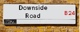
Map of Downside Road
| Street Crime (updated 03/12/2024) | ||
|---|---|---|
| Location Note | Central Point of Street - Not Actual Location | |
| MSOA Info | For MSOA E02001857 (Statistical Neighbourhood) | |
| Click Hint | Click on a Circle for a detailed breakdown below map. | |
| Crime Levels |
Green = Very Low Yellow = Low Orange = High Red = Very High |
|
| Postcodes | ||
| Icon | Postcodes for Downside Road | |
| Walking Distances | ||
| Distance Info | Green Circle = 10 Minutes Walk (800 metres) | |
Street Crime Data accessed from data.police.uk on 06/10/2024.
Moving to Downside Road?
I can help you uncover potential pitfalls and provide key questions to ask about your new property. With decades of experience as a Local Land Charges Manager, I offer confidential insights to make your move informed and stress-free.
This service is free, but you may wish to make an optional donation to support it. Please include the property name and address in your request as well as anything you wish to focus on.
Contact Me
Do you know why this road is called Downside Road?
What's it like to live here?
Share a Photo of Downside Road
Ask the community a question.
Do you have any questions, memories to share, have any photos or know any facts? We'd love to know more.
Submit Your Comment
Budget Friendly Hotels near Downside Road
| Budget Hotel Name | Distance (miles) |
|---|---|
|
1: Name:Holiday Inn Express Birmingham Star City Address: Cuckoo Road, Heartlands Parkway Telephone: Visit Hotel Page |
0.71 |
|
2: Name:Travelodge Birmingham Fort Dunlop Address: Fort Dunlop, Fort Pkwy, Birmingham, B24 9FD Telephone: 0871 984 6312 Visit Hotel Page |
1.53 |
|
3: Name:Holiday Inn Express Birmingham - Castle Bromwich Address: 1200 Chester Rd, Castle Bromwich Telephone: Visit Hotel Page |
2.07 |
|
4: Name:Premier Inn Birmingham City Aston Address: Richard Street Telephone: Visit Hotel Page |
2.13 |
|
5: Name:Premier Inn Birmingham Central East Address: Richard Street Telephone: Visit Hotel Page |
2.13 |
Hotel Options
Your support helps keep this site running!
If you enjoy using this website, consider making a donation to help me cover hosting costs.
EPC (Energy Performance Certificate) Information for Downside Road
UPRN: 100070350513
EPC Current: D
EPC Potential: B
Habitable Rooms: 4
Property Type: House
Tenure: rental (social)
Built Form: End-Terrace
Age Band: 1900-1929
Mains Gas: Yes
UPRN: 100070350514
EPC Current: D
EPC Potential: B
Habitable Rooms: 4
Property Type: House
Tenure: rental (private)
Built Form: End-Terrace
Age Band: 1950-1966
Mains Gas: Yes
UPRN: 100070350516
EPC Current: D
EPC Potential: C
Habitable Rooms: 4
Property Type: House
Tenure: Owner-occupied
Built Form: Mid-Terrace
Age Band: 1900-1929
Mains Gas: Yes
UPRN: 100070350517
EPC Current: G
EPC Potential: G
Habitable Rooms: 4
Property Type: House
Tenure: rental (social)
Built Form: Mid-Terrace
Age Band: 1900-1929
Mains Gas: Yes
UPRN: 100070350518
EPC Current: D
EPC Potential: B
Habitable Rooms: 4
Property Type: House
Tenure: rental (social)
Built Form: Mid-Terrace
Age Band: 1900-1929
Mains Gas: Yes
UPRN: 100070350521
EPC Current: D
EPC Potential: C
Habitable Rooms: 4
Property Type: House
Tenure: rental (private)
Built Form: Mid-Terrace
Age Band: 1930-1949
Mains Gas: Yes
UPRN: 100070350522
EPC Current: D
EPC Potential: B
Habitable Rooms: 5
Property Type: House
Tenure: Rented (private)
Built Form: End-Terrace
Age Band: 1930-1949
Mains Gas: Yes
UPRN: 100070350523
EPC Current: E
EPC Potential: C
Habitable Rooms: 4
Property Type: House
Tenure: Owner-occupied
Built Form: End-Terrace
Age Band: 1900-1929
Mains Gas: Yes
UPRN: 100070350525
EPC Current: E
EPC Potential: C
Habitable Rooms: 3
Property Type: House
Tenure: Owner-occupied
Built Form: End-Terrace
Age Band: 1930-1949
Mains Gas: Yes
UPRN: 100070350526
EPC Current: D
EPC Potential: B
Habitable Rooms: 4
Property Type: House
Tenure: Rented (social)
Built Form: Mid-Terrace
Age Band: 1930-1949
Mains Gas: Yes
UPRN: 100070350527
EPC Current: D
EPC Potential: B
Habitable Rooms: 5
Property Type: House
Tenure: Owner-occupied
Built Form: Mid-Terrace
Age Band: 1930-1949
Mains Gas: Yes
UPRN: 100070350534
EPC Current: D
EPC Potential: B
Habitable Rooms: 5
Property Type: House
Tenure: Owner-occupied
Built Form: Semi-Detached
Age Band: 1930-1949
Mains Gas: Yes
UPRN: 100070350536
EPC Current: E
EPC Potential: D
Habitable Rooms: N/A
Property Type: House
Tenure: Owner-occupied
Built Form: End-Terrace
Age Band: 1900-1929
Mains Gas: Unknown
UPRN: 100070350539
EPC Current: D
EPC Potential: B
Habitable Rooms: 4
Property Type: House
Tenure: Rented (social)
Built Form: Mid-Terrace
Age Band: 1930-1949
Mains Gas: Yes
UPRN: 100070350540
EPC Current: D
EPC Potential: B
Habitable Rooms: 4
Property Type: House
Tenure: rental (social)
Built Form: Mid-Terrace
Age Band: 1900-1929
Mains Gas: Yes
UPRN: 100070350543
EPC Current: D
EPC Potential: B
Habitable Rooms: 4
Property Type: House
Tenure: rental (social)
Built Form: Mid-Terrace
Age Band: 1930-1949
Mains Gas: Yes
UPRN: 100070350545
EPC Current: E
EPC Potential: B
Habitable Rooms: 3
Property Type: House
Tenure: Owner-occupied
Built Form: Mid-Terrace
Age Band: 1930-1949
Mains Gas: Yes
UPRN: 100070350546
EPC Current: D
EPC Potential: B
Habitable Rooms: 4
Property Type: House
Tenure: Owner-occupied
Built Form: End-Terrace
Age Band: 1930-1949
Mains Gas: Yes
UPRN: 100070350547
EPC Current: D
EPC Potential: B
Habitable Rooms: 4
Property Type: House
Tenure: Owner-occupied
Built Form: End-Terrace
Age Band: 1930-1949
Mains Gas: Yes
UPRN: 100070350549
EPC Current: D
EPC Potential: B
Habitable Rooms: 4
Property Type: House
Tenure: rental (social)
Built Form: End-Terrace
Age Band: 1900-1929
Mains Gas: Yes
UPRN: 100070350551
EPC Current: D
EPC Potential: B
Habitable Rooms: 4
Property Type: House
Tenure: rental (social)
Built Form: Mid-Terrace
Age Band: 1900-1929
Mains Gas: Yes
UPRN: 100070350552
EPC Current: D
EPC Potential: B
Habitable Rooms: 4
Property Type: House
Tenure: rental (social)
Built Form: End-Terrace
Age Band: 1930-1949
Mains Gas: Yes
UPRN: 100070350553
EPC Current: D
EPC Potential: C
Habitable Rooms: 6
Property Type: House
Tenure: Owner-occupied
Built Form: Mid-Terrace
Age Band: 1930-1949
Mains Gas: Yes
UPRN: 100070350555
EPC Current: E
EPC Potential: B
Habitable Rooms: 4
Property Type: House
Tenure: Owner-occupied
Built Form: Mid-Terrace
Age Band: 1950-1966
Mains Gas: Yes
UPRN: 100070350556
EPC Current: D
EPC Potential: D
Habitable Rooms: 4
Property Type: House
Tenure: Owner-occupied
Built Form: Mid-Terrace
Age Band: 1930-1949
Mains Gas: Yes
UPRN: 100070350557
EPC Current: D
EPC Potential: B
Habitable Rooms: 4
Property Type: House
Tenure: Rented (social)
Built Form: Mid-Terrace
Age Band: 1930-1949
Mains Gas: Yes
UPRN: 100070350559
EPC Current: D
EPC Potential: D
Habitable Rooms: 5
Property Type: House
Tenure: rental (social)
Built Form: Semi-Detached
Age Band: 1900-1929
Mains Gas: Yes
UPRN: 100070350562
EPC Current: D
EPC Potential: B
Habitable Rooms: 4
Property Type: House
Tenure: Owner-occupied
Built Form: Semi-Detached
Age Band: 1930-1949
Mains Gas: Yes
UPRN: 100070350563
EPC Current: D
EPC Potential: B
Habitable Rooms: 4
Property Type: House
Tenure: Rented (private)
Built Form: Semi-Detached
Age Band: 1930-1949
Mains Gas: Yes
UPRN: 100070350566
EPC Current: D
EPC Potential: B
Habitable Rooms: 5
Property Type: House
Tenure: Owner-occupied
Built Form: Semi-Detached
Age Band: 1950-1966
Mains Gas: Yes
UPRN: 100070350567
EPC Current: D
EPC Potential: B
Habitable Rooms: 4
Property Type: House
Tenure: Owner-occupied
Built Form: Semi-Detached
Age Band: 1930-1949
Mains Gas: Yes
UPRN: 100070350568
EPC Current: E
EPC Potential: C
Habitable Rooms: 5
Property Type: House
Tenure: Owner-occupied
Built Form: Semi-Detached
Age Band: 1900-1929
Mains Gas: Yes
UPRN: 100070350569
EPC Current: E
EPC Potential: B
Habitable Rooms: 4
Property Type: House
Tenure: Owner-occupied
Built Form: Semi-Detached
Age Band: 1900-1929
Mains Gas: Yes
UPRN: 100070350571
EPC Current: F
EPC Potential: F
Habitable Rooms: 4
Property Type: House
Tenure: unknown
Built Form: Semi-Detached
Age Band: 1930-1949
Mains Gas: Yes
UPRN: 100070350573
EPC Current: E
EPC Potential: D
Habitable Rooms: 5
Property Type: House
Tenure: Owner-occupied
Built Form: Semi-Detached
Age Band: 1930-1949
Mains Gas: Yes
UPRN: 100070350575
EPC Current: D
EPC Potential: B
Habitable Rooms: 5
Property Type: House
Tenure: Owner-occupied
Built Form: Semi-Detached
Age Band: 1930-1949
Mains Gas: Yes
UPRN: 100070350576
EPC Current: D
EPC Potential: D
Habitable Rooms: 5
Property Type: House
Tenure: rental (private)
Built Form: Semi-Detached
Age Band: 1930-1949
Mains Gas: Yes
UPRN: 100070350578
EPC Current: E
EPC Potential: C
Habitable Rooms: 6
Property Type: House
Tenure: Owner-occupied
Built Form: Semi-Detached
Age Band: 1930-1949
Mains Gas: Yes
UPRN: 100070350582
EPC Current: D
EPC Potential: B
Habitable Rooms: 5
Property Type: House
Tenure: Owner-occupied
Built Form: Semi-Detached
Age Band: 1930-1949
Mains Gas: Yes
UPRN: 100070350583
EPC Current: D
EPC Potential: B
Habitable Rooms: 5
Property Type: House
Tenure: Rented (private)
Built Form: Semi-Detached
Age Band: 1930-1949
Mains Gas: Yes
UPRN: 100070350584
EPC Current: D
EPC Potential: D
Habitable Rooms: 4
Property Type: Bungalow
Tenure: Owner-occupied
Built Form: Detached
Age Band: 1950-1966
Mains Gas: Yes
House Sales
| Year | High | Low | Average | Sales |
|---|---|---|---|---|
| 2014 | £103,000 | £105,000 | £101,667 | 3 |
| 2016 | £138,000 | £147,000 | £142,500 | 2 |
| 2017 | £148,000 | £111,000 | £129,500 | 2 |
| 2019 | £110,000 | £120,000 | £113,600 | 5 |
| 2020 | £132,000 | £132,000 | £132,000 | 1 |
| 2021 | £175,000 | £169,000 | £172,000 | 2 |
| 2023 | £202,000 | £197,000 | £199,500 | 2 |
Contains HM Land Registry data © Crown copyright and database right 2024. This data is licensed under the Open Government Licence v3.0.
Nearby Estate Agents
| Name | Address | Website |
|---|---|---|
| Burchell Edwards | Unit 3 Queens Court Gravelly Hill North Stockland Green Birmingham B23 6BJ | Visit Website |
| Dixons | 1 Sutton New Road, Erdington, Birmingham, W Midlands, B23 6TJ | |
| Dixons Lettings | 1 Sutton New Road, Erdington, Birmingham, B23 6TJ | Visit Website |
| Henley Charles - Erdington | 1 Reservoir Road, Erdington, Birmingham,B23 6DA | Visit Website |
| Green & Company | 11 York Road, Erdington, Birmingham, B23 6TE | Visit Website |
Neighbourhood Policing |
| Police Force: West Midlands |
 View Neighbourhood Crime and Policing View Neighbourhood Crime and Policing |
| Find a Local Neighbourhood Watch Scheme |
Location Details
| Downside Road | |
|---|---|

| |
| Latitude | 52.510376 |
| Longitude | -1.846896 |
| OS Easting (X): | 410389 |
| OS Northing (Y): | 290327 |
| OS Grid Reference: | SP104903 |
Known Residential Addresses for Downside Road
- 55
- 75
- 61
- 14
- 40
- 60
- 56
- 15
- 27
- 11
- 69
- 20
- 68
- 46
- 18
Roads that have a Junction with Downside Road
| Street | Junction Type |
|---|---|
| Wheelwright Road | junction |
| St Dominic's Road | junction |
Sunset and Sunrise times
| Sunrise | 08:15 |
|---|---|
| Sunset | 16:05 |
Latest Weather Conditions
| Observed at Weather Station: | Coleshill 31 December 2024 at 03:00 (6.97 miles away) |
|---|---|
| Current Weather: | Overcast |
| Temperature and Humidity: | 7.7°C (89.4%) |
| Wind Direction and Speed: | SSW (10 mph) |
Population Statistics
| ONS Area Code | E00047648 & E00047650 |
|---|---|
| ONS Area Name | Achieving Minorities & Private Renting Young Families |
| Average Age | 36.54 |
| Area Population | 1452.00 |
| Male Population | 702.00 (48%) |
| Female Population | 750.00 (52%) |
| Benefit Claimants | 79 (5%) |
| LSOA Code: | E01009400 |
|---|---|
| LSOA Name: | Birmingham 031E |
| SOA Code: | 7a |
| SOA Name: | |
| MSOA Code: | E02001857 |
| MSOA Name: | Birmingham 031 |
Nearest Supermarkets
| Tesco Erdington Six Ways Express |
|---|
| Gravelly Hill, Erdington, Birmingham, B23 7NR |
| 0345 675 7081 |
| Distance: 0.79 Miles |
| Directions to Tesco Erdington Six Ways Express |
| Iceland Erdington High St |
|---|
| 194/198 High Street, Erdington, Birmingham, B23 6SJ |
| 01213828515 |
| Distance: 0.89 Miles |
| Directions to Iceland Erdington High St |
| Iceland Washwood Heath |
|---|
| 52 The Fox Goose Centre, Birmingham, B8 2EP |
| 01217837468 |
| Distance: 1.61 Miles |
| Directions to Iceland Washwood Heath |
| Tesco Birmingham Hodge Hill Superstore |
|---|
| Coleshill Rd, Hodge Hill, B36 8DT |
| 0345 671 9451 |
| Distance: 1.63 Miles |
| Directions to Tesco Birmingham Hodge Hill Superstore |
Telephone Information
| Dialling Code | Telephone Exchange | Telephone Cabinet | Fibre to the Cabinet or Fibre to the Premises |
|---|---|---|---|
| 0121 | ERDINGTON - CMERD | P39 | FTTC |
Broadband Information
| Speed | Average Speed | Median Speed | Maximum Speed | Next-generation access (NGA) | Number of Connections |
|---|---|---|---|---|---|
| Greater than 2 Mbps | 15.7 | 7.6 | >=30 | Y | 26 |
Local Government
| Local Council Details |
|---|
| Within the area of Birmingham |
| Visit the Council's Website |
| Council House, Victoria Square, Birmingham &B1 1BB |
| Send email |
| Telephone Number: 0121 303 1111 |
| Local Member of Parliament |
|---|
| Within the Westminster Parliamentary Constituency of Birmingham &Erdington |
| The Member of Parliament is Paulette Hamilton |
| Details for the MP Paulette Hamilton on parliament.uk |
| Details for the MP Paulette Hamilton on theyworkforyou.com |
| In the 2024 General Election Paulette Hamilton won with a majority of 7,019 the result was Lab hold. The total electorate was 77,463 |
| Wards, Parish Councils and County Councils |
|---|
| Ward: Gravelly Hill Ward |
| Parish: Unparished area |
| Ceremonial County: West Midlands |
Nearest Schools
England Secondary Schools
Hodge Hill Girls' School
Address: Hodge Hill Girls' School, Bromford Road, Hodge Hill, Birmingham, West Midlands, B36 8EY
Distance: 1.34 miles
Contact: 01214643094
Hodge Hill College
Address: Hodge Hill College, Bromford Road, Hodge Hill, Birmingham, West Midlands, B36 8HB
Distance: 1.27 miles
Contact: 01217837807
St Edmund Campion Catholic School & Sixth Form Centre
Address: St Edmund Campion Catholic School & Sixth Form Centre, Sutton Road, Erdington, Birmingham, West Midlands, B23 5XA
Distance: 1.59 miles
Contact:
Kingsbury School and Sports College
Address: Kingsbury School and Sports College, Kingsbury Road, Erdington, Birmingham, West Midlands, B24 8RE
Distance: 0.46 miles
Contact:
Erdington Academy
Address: Erdington Academy, Kingsbury Road, Erdington, Birmingham, West Midlands, B24 8RE
Distance: 0.46 miles
Contact: 01213731080
Stockland Green School
Address: Stockland Green School, Slade Road, Erdington, Birmingham, West Midlands, B23 7JH
Distance: 1.02 miles
Contact: 01215664300
King Edward VI Aston School
Address: King Edward VI Aston School, Frederick Road, Aston, Birmingham, West Midlands, B6 6DJ
Distance: 1.70 miles
Contact: 01213271130
King Edward VI Aston School
Address: King Edward VI Aston School, Frederick Road, Aston, Birmingham, West Midlands, B6 6DJ
Distance: 1.70 miles
Contact:
England Primary Schools
Gunter Primary School
Address: Gunter Primary School, Gunter Road, Birmingham, West Midlands, B24 0RU
Distance: 1.83 miles
Contact: 01214642367
Ward End Primary School
Address: Ward End Primary School, Ingleton Road, Birmingham, West Midlands, B8 2RA
Distance: 1.08 miles
Contact: 01214645424
St Peter and St Paul RC Junior and Infant School
Address: St Peter and St Paul RC Junior and Infant School, Kingsbury Road, Erdington, Birmingham, West Midlands, B24 9ND
Distance: 1.10 miles
Contact:
Saint Barnabas Church of England Primary School
Address: Saint Barnabas Church of England Primary School, Spring Lane, Erdington, Birmingham, West Midlands, B24 9BY
Distance: 0.95 miles
Contact:
Birches Green Infant School
Address: Birches Green Infant School, Birches Green Road, Erdington, Birmingham, West Midlands, B24 9SR
Distance: 0.91 miles
Contact:
Birches Green Junior School
Address: Birches Green Junior School, Birches Green Road, Erdington, Birmingham, West Midlands, B24 9SR
Distance: 0.91 miles
Contact:
Abbey Catholic Primary School
Address: Abbey Catholic Primary School, Sutton Road, Erdington, Birmingham, West Midlands, B23 6QL
Distance: 1.36 miles
Contact:
Osborne Primary School
Address: Osborne Primary School, Osborne Road, Erdington, Birmingham, West Midlands, B23 6TY
Distance: 1.19 miles
Contact:
Featherstone Primary School
Address: Featherstone Primary School, Glenville Drive, Birmingham, West Midlands, B23 6PR
Distance: 1.12 miles
Contact: 01216759740
Erdington Hall Primary School
Address: Erdington Hall Primary School, Ryland Road, Erdington, Birmingham, West Midlands, B24 8JJ
Distance: 0.24 miles
Contact: 01214643122
Slade Primary School
Address: Slade Primary School, Slade Road, Erdington, Birmingham, West Midlands, B23 7PX
Distance: 0.52 miles
Contact: 01216750618
St Mary and St John Junior and Infant School
Address: St Mary and St John Junior and Infant School, Beaufort Road, Erdington, Birmingham, West Midlands, B23 7NB
Distance: 0.45 miles
Contact:
Marsh Hill Primary School
Address: Marsh Hill Primary School, Marsh Hill, Erdington, Birmingham, West Midlands, B23 7HY
Distance: 1.37 miles
Contact: 01214642920
E-ACT Nechells Academy
Address: E-ACT Nechells Academy, Eliot Street, Nechells, Birmingham, West Midlands, B7 5LB
Distance: 0.81 miles
Contact: 01214642102
St Clement's Church of England Academy
Address: St Clement's Church of England Academy, Butlin Street, Nechells, Birmingham, West Midlands, B7 5NS
Distance: 1.11 miles
Contact: 01214644652
Manor Park Primary Academy
Address: Manor Park Primary Academy, Church Lane, Aston, Birmingham, West Midlands, B6 5UQ
Distance: 1.36 miles
Contact: 01213271023
Manor Park Primary School
Address: Manor Park Primary School, Church Lane, Aston, Birmingham, West Midlands, B6 5UQ
Distance: 1.36 miles
Contact:
St Joseph's Catholic Primary School
Address: St Joseph's Catholic Primary School, Rocky Lane, Nechells, Birmingham, West Midlands, B7 5HA
Distance: 1.47 miles
Contact:
Aston Tower Community Primary School
Address: Aston Tower Community Primary School, Upper Sutton Street, Aston, Birmingham, West Midlands, B6 5BE
Distance: 1.85 miles
Contact: 01213270339
Aston Tower Community Primary School
Address: Aston Tower Community Primary School, Upper Sutton Street, Aston, Birmingham, West Midlands, B6 5BE
Distance: 1.85 miles
Contact:
Mansfield Green E-ACT Academy
Address: Mansfield Green E-ACT Academy, Albert Road, Aston, Birmingham, West Midlands, B6 5NH
Distance: 2.04 miles
Contact: 01214646590
Prince Albert Junior and Infant School
Address: Prince Albert Junior and Infant School, Albert Road, Aston, Birmingham, West Midlands, B6 5NH
Distance: 2.04 miles
Contact:
Nearest Hospitals
| Ardenleigh |
|---|
| Address: 385 Kingsbury Road, Erdington, Birmingham, B24 9SA, |
| NHS Sector |
| Birmingham and Solihull Mental Health NHS Foundation Trust |
| Telephone: 0121 301 4411 |
| Visit Hospital Website |
| Distance: 1.14 (miles) |
| Directions from to Ardenleigh |
| Eden Unit |
|---|
| Address: Fentham Road, 355 Slade Road, Erdington, Birmingham, B23 6AL, |
| Independent Sector |
| Birmingham and Solihull Mental Health NHS Foundation Trust |
| Telephone: 0121 301 7369 |
| Visit Hospital Website |
| Distance: 1.15 (miles) |
| Directions from to Eden Unit |
| Forward House |
|---|
| Address: Entrance D, 71 Fentham Road, Erdington, Birmingham, B23 6AL, |
| NHS Sector |
| Birmingham and Solihull Mental Health NHS Foundation Trust |
| Telephone: 0121 301 5922 |
| Visit Hospital Website |
| Distance: 1.15 (miles) |
| Directions from to Forward House |
Nearest Dentists
Dentists
SMILES 4 U
Address: 62 GRAVELLY HILL, BIRMINGHAM, WEST MIDLANDS, B23 7PF
Distance: 0.30 miles
Contact: :
DENTAL SURGERY
Address: 129 GRAVELLY HILL NORTH, ERDINGTON, BIRMINGHAM, WEST MIDLANDS, B23 6BJ
Distance: 0.71 miles
Contact: :
DENTAL SURGERY
Address: 32 SUMMER ROAD, ERDINGTON, BIRMINGHAM, WEST MIDLANDS, B23 6XA
Distance: 0.87 miles
Contact: :
STOCKLAND GREEN HEALTH CENTRE
Address: 192 RESERVOIR ROAD, ERDINGTON, BIRMINGHAM, B23 6DJ
Distance: 1.03 miles
Contact: :
DENTAL SURGERY
Address: 554 WASHWOOD HEATH ROAD, BIRMINGHAM, WEST MIDLANDS, B8 2HF
Distance: 1.18 miles
Contact: :
DENTAL SURGERY
Address: 820 WASHWOOD HEATH ROAD, BIRMINGHAM, WEST MIDLANDS, B8 2NW
Distance: 1.52 miles
Contact: :
Nearest GP Surgeries
Doctors
KINGSBURY ROAD MEDICAL CENTRE
Address: 273 KINGSBURY ROAD, ERDINGTON, BIRMINGHAM, WEST MIDLANDS, B24 8RD
Distance: 0.48 miles
Contact: tel: 01213 827539
MMP - ERDINGTON MEDICAL CENTRE
Address: 103 WOOD END ROAD, BIRMINGHAM, B24 8NT
Distance: 0.58 miles
Contact: :
ERDINGTON MEDICAL CENTRE - COVID LOCAL VACCINATION SERVICE
Address: 103 WOOD END ROAD, ERDINGTON, BIRMINGHAM, B24 8NT
Distance: 0.58 miles
Contact: :
ERDINGTON MEDICAL CENTRE - COVID LOCAL VACCINATION SERVICE 2
Address: 103 WOOD END ROAD, ERDINGTON, BIRMINGHAM, B24 8NT
Distance: 0.58 miles
Contact: :
RESERVOIR ROAD SURGERY
Address: 192 RESERVOIR ROAD, ERDINGTON, BIRMINGHAM, WEST MIDLANDS, B23 6DJ
Distance: 1.03 miles
Contact: tel: 0121 4652950
TUDOR PRACTICE STOCKLAND GREEN
Address: STOCKLAND GREEN HEALTH CENTRE, 192 RESERVOIR ROAD, ERDINGTON, BIRMINGHAM, WEST MIDLANDS, B23 6DJ
Distance: 1.03 miles
Contact: tel: 0121 4652900
Nearest Dispensing Chemists
Pharmacies
YOUR LOCAL PHARMACY
Address: 238 WHEELWRIGHT ROAD, BIRMINGHAM, B24 8EH
Distance: 0.39 miles
Contact: tel: 01213 734445
MW PHILLIPS (SUTTON COLDFIELD) LTD
Address: 273 KINGSBURY ROAD, ERDINGTON, BIRMINGHAM, WEST MIDLANDS, B24 8RD
Distance: 0.48 miles
Contact: tel: 0121 3776042
WOOD END PHARMACY
Address: 103 WOOD END ROAD, BIRMINGHAM, WEST MIDLANDS, B24 8NT
Distance: 0.58 miles
Contact: tel: 0121 3500614
SUMMERHILL SERVICES LIMITED
Address: VENTURE HOUSE, SLADE ROAD, ERDINGTON, BIRMINGHAM, B23 7JX
Distance: 0.67 miles
Contact: tel: 01213 015161
IPHARM (UK) LTD
Address: UNIT 4A, 11 JAMESON ROAD, ASTON, BIRMINGHAM, WEST MIDLANDS, B6 7SJ
Distance: 0.83 miles
Contact: tel: 0121 3287138
ERDINGTON DAY NIGHT CHEMIST
Address: 213 HIGH STREET, ERDINGTON, BIRMINGHAM, WEST MIDLANDS, B23 6SS
Distance: 0.88 miles
Contact: tel: 0121 3827477
Nearest Opticians
Opticians
TAHA INVESTMENT LTD T/A IDEAL EYES OPTICIANS
Address: 16 POWICK ROAD, BIRMINGHAM, WEST MIDLANDS, B23 7NY
Distance: 0.46 miles
Contact: :
COSTCO WHOLSALE UK LTD
Address: 100 WATSON ROAD, NECHELLS, BIRMINGHAM, WEST MIDLANDS, B7 5SA
Distance: 0.53 miles
Contact: :
SPECS DIRECT ERDINGTON
Address: 184 SLADE ROAD, BIRMINGHAM, WEST MIDLANDS, B23 7RJ
Distance: 0.54 miles
Contact: :
MOBILE PROFESSIONAL EYECARE (ERDINGTON)
Address: 11 SHIPLEY FIELDS, ERDINGTON, BIRMINGHAM, WEST MIDLANDS, B24 9BW
Distance: 0.79 miles
Contact: :
HNS OPTICAL
Address: 240 HIGH STREET, ERDINGTON, BIRMINGHAM, B23 6SN
Distance: 0.82 miles
Contact: :
SCRIVENS OPTICIANS (ERDINGTON)
Address: 246 HIGH STREET, ERDINGTON, BIRMINGHAM, WEST MIDLANDS, B23 6SN
Distance: 0.82 miles
Contact: :
Transport
Nearest Rail Stations
Gravelly Hill Station is 0.40 miles away.
Address: Gravelly Hill station, Hunton Hill, Gravelly Hill, West Midlands, B23 7NH
Gravelly Hill is situated on the Bristol to Brimingham Line.
Gravelly Hill Station is staffed on a full time basis.
Aston Station is 1.11 miles away.
Address: Aston station, Lichfield Road, Aston, West Midlands, B6 7PR
Aston is situated on the Chase Line|Bristol to Brimingham Line.
Aston Station is staffed on a part time basis.