
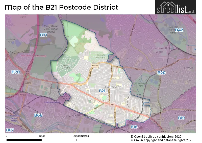
Map of the B21 Postcode District
Explore the postcode district by using our interactive map.
Circles represent recorded crime; the larger the circle, the higher the crime rates.
Your support helps keep this site running!
If you enjoy using this website, consider buying me a coffee to help cover hosting costs.
Where is the B21 District?
To give you an idea where the district is located we have created the following table showing nearby towns.
Nearest Towns to B21
| Town | Distance (miles) | Direction |
|---|---|---|
| Smethwick | 1.64 | SW |
| West Bromwich | 2.25 | WNW |
| Birmingham | 2.82 | SE |
| Oldbury | 2.97 | W |
| Wednesbury | 4.21 | NW |
| Tipton | 4.49 | WNW |
| Rowley Regis | 4.55 | WSW |
| Blackheath | 4.69 | WSW |
| Walsall | 5.44 | NNW |
| Darlaston | 5.47 | NW |
| Dudley | 5.78 | W |
| Halesowen | 6.24 | SW |
| Royal Sutton Coldfield | 6.34 | NE |
| Coseley | 6.35 | WNW |
| Aldridge | 6.68 | N |
| Bilston | 6.74 | WNW |
| Willenhall | 6.79 | NW |
| Brierley Hill | 7.18 | WSW |
| Sedgley | 7.72 | WNW |
| Bloxwich | 7.75 | NNW |
The post town for this district is BIRMINGHAM.
Postcode Information for District B21 (Total Geographical Postcodes: 817)
| Location | Post Town | Sector | Number of Postcodes |
|---|---|---|---|
| BIRMINGHAM | BIRMINGHAM | B21 0 | 207 |
| Handsworth | BIRMINGHAM | B21 9 | 160 |
| BIRMINGHAM | BIRMINGHAM | B21 9 | 149 |
| BIRMINGHAM | BIRMINGHAM | B21 8 | 133 |
| Handsworth | BIRMINGHAM | B21 0 | 110 |
| Handsworth | BIRMINGHAM | B21 8 | 57 |
| Middlemore Industrial Estate | BIRMINGHAM | B21 0 | 1 |
Retail and Shopping in B21
Street
Town
Locality
Number of Shops
Central Postcode
View on Google Maps
SOHO ROAD
BIRMINGHAM
324
B21 9SA
View on Google Maps
ROOKERY ROAD
BIRMINGHAM
HANDSWORTH
93
B21 9QZ
View on Google Maps
HOLYHEAD ROAD
BIRMINGHAM
53
B21 0HH
View on Google Maps
GROVE LANE
BIRMINGHAM
HANDSWORTH
51
B21 9HA
View on Google Maps
NINEVEH ROAD
BIRMINGHAM
23
B21 0TE
View on Google Maps
OXHILL ROAD
BIRMINGHAM
15
B21 9RH
View on Google Maps
ALBERT ROAD
BIRMINGHAM
HANDSWORTH
6
B21 9JT
View on Google Maps
BOULTON ROAD
BIRMINGHAM
6
B21 0RE
View on Google Maps
QUEENS HEAD ROAD
BIRMINGHAM
6
B21 0QG
View on Google Maps
SANDWELL ROAD
BIRMINGHAM
6
B21 8PD
View on Google Maps
| Street | Town | Locality | Number of Shops | Central Postcode | View on Google Maps |
|---|---|---|---|---|---|
| SOHO ROAD | BIRMINGHAM | 324 | B21 9SA | View on Google Maps | |
| ROOKERY ROAD | BIRMINGHAM | HANDSWORTH | 93 | B21 9QZ | View on Google Maps |
| HOLYHEAD ROAD | BIRMINGHAM | 53 | B21 0HH | View on Google Maps | |
| GROVE LANE | BIRMINGHAM | HANDSWORTH | 51 | B21 9HA | View on Google Maps |
| NINEVEH ROAD | BIRMINGHAM | 23 | B21 0TE | View on Google Maps | |
| OXHILL ROAD | BIRMINGHAM | 15 | B21 9RH | View on Google Maps | |
| ALBERT ROAD | BIRMINGHAM | HANDSWORTH | 6 | B21 9JT | View on Google Maps |
| BOULTON ROAD | BIRMINGHAM | 6 | B21 0RE | View on Google Maps | |
| QUEENS HEAD ROAD | BIRMINGHAM | 6 | B21 0QG | View on Google Maps | |
| SANDWELL ROAD | BIRMINGHAM | 6 | B21 8PD | View on Google Maps |
The primary settlement in the B21 postcode district is Handsworth, located in the county of West Midlands. The most significant postal town in this district is Birmingham, which is also in the county of West Midlands.
When it comes to local government, postal geography often disregards political borders. However, this district intersects the following councils: the district mostly encompasses the Birmingham District (B) area with a total of 432 postal codes.
The largest settlements in the B21 postal code are BIRMINGHAM and Handsworth.
The B21 Postcode shares a border with B20 (BIRMINGHAM, Handsworth), B66 (SMETHWICK), B18 (BIRMINGHAM, Hockley), B19 (BIRMINGHAM, Lozells, Handsworth) and B71 (WEST BROMWICH).


Dentists in the B21 District
| # | Name | Address | Type | Contact |
|---|---|---|---|---|
| 1 | Dental Surgery | 276 ROOKERY ROAD , HANDSWORTH , BIRMINGHAM , WEST MIDLANDS , B21 9QG | GENERAL DENTAL PRACTICE | |
| 2 | Handsworth Dental Care | 119 HOLYHEAD ROAD , BIRMINGHAM , WEST MIDLANDS , B21 0HH | GENERAL DENTAL PRACTICE | |
| 3 | Grove Lane Dental Surgery | 105 GROVE LANE , HANDSWORTH , BIRMINGHAM , WEST MIDLANDS , B21 9HF | GENERAL DENTAL PRACTICE | |
| 4 | Dental Surgery | 220 ROOKERY ROAD , HANDSWORTH , BIRMINGHAM , WEST MIDLANDS , B21 9QG | GENERAL DENTAL PRACTICE | |
| 5 | Hapi Dental | 271 SOHO ROAD , BIRMINGHAM , WEST MIDLANDS , B21 9SA | GENERAL DENTAL PRACTICE | |
| 6 | 78 Soho Road (dental Practice) | 78 SOHO ROAD , BIRMINGHAM , WEST MIDLANDS , B21 9BN | GENERAL DENTAL PRACTICE | |
| 7 | 247-251 | SOHO ROAD , BIRMINGHAM , WEST MIDLANDS , B21 9RY | GENERAL DENTAL PRACTICE |
Doctors in the B21 District
| # | Name | Address | Type | Contact |
|---|---|---|---|---|
| 1 | Soho Road Health Centre | , HANDSWORTH , BIRMINGHAM , WEST MIDLANDS , B21 9RY | GP PRACTICE | |
| 2 | Soho Health Centre | , HANDSWORTH , BIRMINGHAM , WEST MIDLANDS , B21 9RY | GP PRACTICE | |
| 3 | Handsworth Medical Pract. | , HANDSWORTH , BIRMINGHAM , WEST MIDLANDS , B21 9NH | GP PRACTICE | |
| 4 | Kirpal Medical Practice | , HANDSWORTH , BIRMINGHAM , WEST MIDLANDS , B21 9RY | GP PRACTICE | |
| 5 | Soho Road Primary Care Centre | , BIRMINGHAM , WEST MIDLANDS , B21 9RY | GP PRACTICE | |
| 6 | Holyhead Primary Health Care Centre | , HANDSWORTH , BIRMINGHAM , B21 0HL | GP PRACTICE | |
| 7 | Modality St James | , BIRMINGHAM , WEST MIDLANDS , B21 0HR | BRANCH SURGERY |
Chemists in the B21 District
| # | Name | Address | Type | Contact |
|---|---|---|---|---|
| 1 | Nishkam Pharmacy | 21 SOHO ROAD , HANDSWORTH , BIRMINGHAM , WEST MIDLANDS , B21 9SN | PHARMACY | |
| 2 | Gill Pharmacy | 341 ROOKERY ROAD , HANDSWORTH , BIRMINGHAM , WEST MIDLANDS , B21 9PP | PHARMACY | |
| 3 | Marks Chemist | 144 SOHO ROAD , HANDSWORTH , BIRMINGHAM , WEST MIDLANDS , B21 9LN | PHARMACY | |
| 4 | Deu-chem Ltd | 269 SOHO ROAD , HANDSWORTH , BIRMINGHAM , WEST MIDLANDS , B21 9SA | PHARMACY | |
| 5 | Soho Pharmacy | 249 SOHO ROAD , HANDSWORTH , BIRMINGHAM , B21 9RY | PHARMACY | |
| 6 | Click4prescriptions | 2 TRAFALGAR ROAD , HANDSWORTH , BIRMINGHAM , B21 9NH | PHARMACY | |
| 7 | Handsworth Pharmacy | 77 HOLYHEAD ROAD , HANDSWORTH , BIRMINGHAM , B21 0LG | PHARMACY |
Opticians in the B21 District
| # | Name | Address | Type | Contact |
|---|---|---|---|---|
| 1 | BANSAL OPTICIANS | 381 SOHO ROAD , HANDSWORTH , BIRMINGHAM , WEST MIDLANDS , B21 9SF | OPTICAL SITE | |
| 2 | K G MILES | 349A SOHO ROAD , HANDSWORTH , BIRMINGHAM , WEST MIDLANDS , B21 9SE | OPTICAL SITE | |
| 3 | EUROSPEX OPTICIANS (HANDSWORTH) | 332 SOHO ROAD , HANDSWORTH , BIRMINGHAM , WEST MIDLANDS , B21 9NA | OPTICAL SITE | |
| 4 | WARD OPTICIANS (HANDSWORTH) | 76 OXHILL ROAD , HANDSWORTH , BIRMINGHAM , WEST MIDLANDS , B21 9RH | OPTICAL SITE | |
| 5 | CLEAR VISION OPTICAL LTD (HANDSWORTH) | 81 ROOKERY ROAD , HANDSWORTH , BIRMINGHAM , WEST MIDLANDS , B21 9QX | OPTICAL SITE | |
| 6 | ONCAR EYE CENTRE | YORK HOUSE , 98 SOHO ROAD , BIRMINGHAM , B21 9DP | OPTICAL SITE | |
| 7 | VS5 LIMITED - HANDSWORTH | 127 HOLYHEAD ROAD , HANDSWORTH , BIRMINGHAM , B21 0HH | OPTICAL SITE |
Schools in the Sector
Wattville Primary School
Phase: Primary
Address: Wattville Road , Handsworth , Birmingham
Postcode: B21 0DP
Headteacher: Mrs Joanne Roach (Headteacher)
Ofsted Rating: Special Measures
Holyhead School
Phase: Secondary
Address: Milestone Lane , Handsworth , Birmingham
Postcode: B21 0HN
Headteacher: Mr David Knox (Principal)
Ofsted Rating: Good
Myles Academy
Phase: Not applicable
Address: Unit 7, 3B Business Village , Alexandra Road , Handsworth , Birmingham
Postcode: B21 0PD
Headteacher: Ms Tash Hughes ()
Ofsted Rating: Good
James Watt Primary School
Phase: Primary
Address: Boulton Road , Soho , Birmingham
Postcode: B21 0RE
Headteacher: Mrs Tracey Smith (Acting Headteacher)
Ofsted Rating: Good
Oasis Academy Boulton
Phase: Primary
Address: Boulton Road , Handsworth , Birmingham
Postcode: B21 0RE
Headteacher: Mrs Shilpa Rathore (Principal)
Ofsted Rating: Good
St Michael's CofE Primary Academy, Handsworth
Phase: Primary
Address: Piers Road , Handsworth , Birmingham
Postcode: B21 0UX
Headteacher: Mr Philip Hynan ()
Ofsted Rating: Requires improvement
Hamilton School
Phase: Not applicable
Address: Hamilton Road , Handsworth , Birmingham
Postcode: B21 8AH
Headteacher: Ms Katie Williams (Headteacher)
Ofsted Rating: Outstanding
St Augustine's Catholic Primary School
Phase: Primary
Address: Avenue Road , Handsworth , Birmingham
Postcode: B21 8ED
Headteacher: Mrs Mary Stanley (Headteacher)
Ofsted Rating: Good
St John Wall Catholic School
Phase: Secondary
Address: Oxhill Road , Handsworth , Birmingham
Postcode: B21 8HH
Headteacher: Ms Katherine Marston (Executive Headteacher)
Ofsted Rating: Good
V.A.S.E Academy
Phase: Not applicable
Address: Park Lane , Birmingham
Postcode: B21 8LE
Headteacher: Mr Muhammed Majid ()
Ofsted Rating: Good
St James Church of England Primary School, Handsworth
Phase: Primary
Address: Sandwell Road , Birmingham
Postcode: B21 8NH
Headteacher: Mrs Sarah Smith (Headteacher)
Ofsted Rating: Good
King Edward VI Handsworth School
Phase: Secondary
Address: Rose Hill Road , Birmingham
Postcode: B21 9AR
Headteacher: Miss Clare Berry (Headteacher)
Ofsted Rating: Outstanding
Handsworth Grammar School
Phase: Secondary
Address: Grove Lane , Handsworth , Birmingham
Postcode: B21 9ET
Headteacher: Mr S N Bird (Headteacher)
Ofsted Rating: Outstanding
King Edward VI Handsworth Grammar School for Boys
Phase: Secondary
Address: Grove Lane , Handsworth , Birmingham
Postcode: B21 9ET
Headteacher: Mr Tim Johnson (Headteacher)
Ofsted Rating: Outstanding
Grove School
Phase: Primary
Address: Dawson Road , Handsworth , Birmingham
Postcode: B21 9HB
Headteacher: Ms Justine Baker (Headteacher)
Ofsted Rating: Good
Wilkes Green Infant School (NC)
Phase: Primary
Address: Antrobus Road , Handsworth , Birmingham
Postcode: B21 9NT
Headteacher: Mr Mangal Singh (Headteacher)
Ofsted Rating: Special Measures
William Murdoch Primary School
Phase: Primary
Address: Antrobus Road , Handsworth , Birmingham
Postcode: B21 9NT
Headteacher: Mr Mangal Singh (Headteacher)
Ofsted Rating: Good
Rookery School
Phase: Primary
Address: Rookery Road , Handsworth , Birmingham
Postcode: B21 9PY
Headteacher: Miss Seema Samuel (Partner Headteacher)
Ofsted Rating: Good
Nishkam Primary School Birmingham
Phase: Primary
Address: 3-11 Soho Road , Handsworth , Birmingham
Postcode: B21 9SN
Headteacher: Mrs Gurpreet Kaur (Headteacher)
Ofsted Rating: Outstanding
Stations in the Sector
No stations found in this postcode district.
Accessable Motorway Junctions
M5 J1
Average Driving Time from within the district: 3.67
Average Driving Distance: 1.68
Number of Postcodes that can access the Motorway Junction: 433
M5 J2
Average Driving Time from within the district: 6.23
Average Driving Distance: 3.91
Number of Postcodes that can access the Motorway Junction: 433
M6 J6
Average Driving Time from within the district: 6.57
Average Driving Distance: 3.53
Number of Postcodes that can access the Motorway Junction: 432
M6 J7
Average Driving Time from within the district: 7.54
Average Driving Distance: 4.42
Number of Postcodes that can access the Motorway Junction: 433
M6 J9
Average Driving Time from within the district: 8.28
Average Driving Distance: 6.43
Number of Postcodes that can access the Motorway Junction: 1
Weather Forecast for West Bromwich Albion F.C.
| Time Period | Icon | Description | Temperature | Rain Probability | Wind |
|---|---|---|---|---|---|
| 12:00 to 15:00 | Overcast | 5.0°C (feels like 2.0°C) | 8.00% | S 9 mph | |
| 15:00 to 18:00 | Overcast | 6.0°C (feels like 3.0°C) | 8.00% | S 9 mph | |
| 18:00 to 21:00 | Cloudy | 5.0°C (feels like 2.0°C) | 7.00% | SSE 9 mph | |
| 21:00 to 00:00 | Overcast | 4.0°C (feels like 0.0°C) | 7.00% | S 11 mph |
| Time Period | Icon | Description | Temperature | Rain Probability | Wind |
|---|---|---|---|---|---|
| 00:00 to 03:00 | Overcast | 3.0°C (feels like -1.0°C) | 8.00% | S 11 mph | |
| 03:00 to 06:00 | Overcast | 3.0°C (feels like -1.0°C) | 8.00% | SSE 11 mph | |
| 06:00 to 09:00 | Partly cloudy (night) | 2.0°C (feels like -2.0°C) | 3.00% | SSE 11 mph | |
| 09:00 to 12:00 | Partly cloudy (day) | 2.0°C (feels like -2.0°C) | 5.00% | S 9 mph | |
| 12:00 to 15:00 | Cloudy | 5.0°C (feels like 1.0°C) | 6.00% | S 9 mph | |
| 15:00 to 18:00 | Cloudy | 6.0°C (feels like 3.0°C) | 7.00% | SSW 9 mph | |
| 18:00 to 21:00 | Cloudy | 4.0°C (feels like 2.0°C) | 5.00% | SSW 7 mph | |
| 21:00 to 00:00 | Clear night | 4.0°C (feels like 0.0°C) | 2.00% | SSW 9 mph |
| Time Period | Icon | Description | Temperature | Rain Probability | Wind |
|---|---|---|---|---|---|
| 00:00 to 03:00 | Cloudy | 3.0°C (feels like 0.0°C) | 5.00% | SSW 9 mph | |
| 03:00 to 06:00 | Cloudy | 3.0°C (feels like -1.0°C) | 5.00% | SSW 9 mph | |
| 06:00 to 09:00 | Overcast | 3.0°C (feels like -1.0°C) | 8.00% | SSW 9 mph | |
| 09:00 to 12:00 | Overcast | 3.0°C (feels like 0.0°C) | 9.00% | SSW 11 mph | |
| 12:00 to 15:00 | Overcast | 6.0°C (feels like 3.0°C) | 8.00% | SSW 11 mph | |
| 15:00 to 18:00 | Cloudy | 8.0°C (feels like 5.0°C) | 5.00% | SSW 11 mph | |
| 18:00 to 21:00 | Cloudy | 6.0°C (feels like 3.0°C) | 6.00% | SSW 13 mph | |
| 21:00 to 00:00 | Cloudy | 6.0°C (feels like 2.0°C) | 6.00% | SSW 13 mph |
| Time Period | Icon | Description | Temperature | Rain Probability | Wind |
|---|---|---|---|---|---|
| 00:00 to 03:00 | Overcast | 6.0°C (feels like 2.0°C) | 11.00% | SSW 16 mph | |
| 03:00 to 06:00 | Overcast | 6.0°C (feels like 2.0°C) | 16.00% | SSW 16 mph | |
| 06:00 to 09:00 | Overcast | 6.0°C (feels like 2.0°C) | 20.00% | SSW 16 mph | |
| 09:00 to 12:00 | Overcast | 7.0°C (feels like 3.0°C) | 22.00% | SSW 16 mph | |
| 12:00 to 15:00 | Overcast | 8.0°C (feels like 5.0°C) | 22.00% | SSW 16 mph | |
| 15:00 to 18:00 | Light rain | 9.0°C (feels like 6.0°C) | 46.00% | SW 13 mph | |
| 18:00 to 21:00 | Partly cloudy (night) | 7.0°C (feels like 4.0°C) | 14.00% | WSW 11 mph | |
| 21:00 to 00:00 | Partly cloudy (night) | 6.0°C (feels like 3.0°C) | 8.00% | WSW 11 mph |
| Postal Sector | Delivery Office |
|---|---|
| B21 0 | Handsworth Delivery Office |
| B21 8 | Handsworth Delivery Office |
| B21 9 | Handsworth Delivery Office |
| B | 2 | 1 | - | X | X | X |
| B | 2 | 1 | Space | Numeric | Letter | Letter |
Street List for the B21 District
Current Monthly Rental Prices
| # Bedrooms | Min Price | Max Price | Avg Price |
|---|---|---|---|
| £2,916 | £2,916 | £2,916 | |
| 1 | £43 | £100 | £72 |
Current House Prices
| # Bedrooms | Min Price | Max Price | Avg Price |
|---|---|---|---|
| £749,999 | £749,999 | £749,999 | |
| 2 | £240,000 | £240,000 | £240,000 |
| 3 | £240,000 | £280,000 | £256,883 |
| 4 | £240,000 | £350,000 | £302,143 |
| 5 | £299,950 | £360,000 | £328,317 |
| 6 | £299,950 | £499,950 | £377,475 |
Estate Agents
| Logo | Name | Brand Name | Address | Contact Number |
|---|---|---|---|---|
 | Great Barr | Connells | 907 Walsall Road, Great Barr, B42 1TN | 0121 387 6334 |
 | Birmingham | Virdee Estates | 235-237 Rookery Road, Handsworth, Birmingham, B21 9PU | 0121 387 6414 |
 | Handsworth | Henley Charles | 306 Rookery Road, Handsworth, Birmingham, B21 9QG | 0121 387 6484 |
 | Handsworth | Hunters | 304 Rookery Road, Handsworth, Birmingham, B21 9QG | 0121 387 6455 |
 | Great Barr | Green & Company | 937 Walsall Road, Great Barr, Birmingham, B42 1TN | 0121 387 6644 |
Yearly House Price Averages for the District
| Type of Property | 2018 Average | 2018 Sales | 2017 Average | 2017 Sales | 2016 Average | 2016 Sales | 2015 Average | 2015 Sales |
|---|---|---|---|---|---|---|---|---|
| Detached | £213,167 | 3 | £170,533 | 3 | £171,750 | 4 | £163,400 | 5 |
| Semi-Detached | £153,499 | 47 | £136,638 | 45 | £138,308 | 35 | £129,184 | 35 |
| Terraced | £120,275 | 152 | £104,724 | 170 | £104,380 | 157 | £99,773 | 161 |
| Flats | £0 | 0 | £115,000 | 3 | £0 | 0 | £60,000 | 2 |