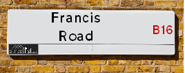
Francis Road is a street located in the city of Birmingham. The street has a length of approximately 426 metres.
The street is publicly maintained which means that the road is adopted and Birmingham is responsible for the repair and upkeep of the highway.
The street is located within the Birmingham District (B) Council's jurisdiction. They provide various services, like refuse collection, and manage council tax collection. It's situated in the West Midlands region of the UK.
The road has been assigned the Unique Street Reference Number of 2701640 in the National Street Gazetteer.
The street has the postcodes of B16 8SP, B16 8SN, B16 8JE and B16 8SU.
It is located within the county of West Midlands, situated in the West Midlands region of the UK. It's 102.61 miles North West from central London., 0.98 miles West from Birmingham, 18.07 miles West from Coventry and 23.17 miles North East from Worcester.
FRANCIS ROAD is within the Post Town of BIRMINGHAM
Map of Francis Road
| Street Crime (updated 14/01/2025) | ||
|---|---|---|
| Location Note | Central Point of Street - Not Actual Location | |
| MSOA Info | For MSOA E02006897 (Statistical Neighbourhood) | |
| Click Hint | Click on a Circle for a detailed breakdown below map. | |
| Crime Levels |
Green = Very Low Yellow = Low Orange = High Red = Very High |
|
| Postcodes | ||
| Icon | Postcodes for Francis Road | |
| Walking Distances | ||
| Distance Info | Green Circle = 10 Minutes Walk (800 metres) | |
Street Crime Data accessed from data.police.uk on 06/10/2024.
Moving to Francis Road?
I can help you uncover potential pitfalls and provide key questions to ask about your new property. With decades of experience as a Local Land Charges Manager, I offer confidential insights to make your move informed and stress-free.
This service is free, but you may wish to make an optional donation to support it. Please include the property name and address in your request as well as anything you wish to focus on.
Contact Me
Do you know why this road is called Francis Road?
What's it like to live here?
Share a Photo of Francis Road
Ask the community a question.
Do you have any questions, memories to share, have any photos or know any facts? We'd love to know more.
Submit Your Comment
Find Homes to Rent in Birmingham

Budget Friendly Hotels near Francis Road
| Budget Hotel Name | Distance (miles) |
|---|---|
|
1: Name:Travelodge Birmingham Central Broadway Plaza Address: 220 Ladywood Middleway, Birmingham, B16 8LP Telephone: 0871 984 6325 Visit Hotel Page |
0.05 |
|
2: Name:Premier Inn Birmingham City Centre Broad Street Address: Essington Street Telephone: Visit Hotel Page |
0.33 |
|
3: Name:Premier Inn Birmingham Broad Street Brindley Place Address: Essington Street Telephone: Visit Hotel Page |
0.33 |
|
4: Name:Travelodge Birmingham Central Address: 230 Broad St, Birmingham, B15 1AY Telephone: 0871 984 6064 Visit Hotel Page |
0.45 |
|
5: Name:Premier Inn Birmingham City Centre Bridge Street Address: 20 Bridge Street Telephone: Visit Hotel Page |
0.63 |
Hotel Options
Your support helps keep this site running!
If you enjoy using this website, consider making a donation to help me cover hosting costs.
Flats and Apartments in Francis Road
FLAT 1
FLAT 2
FLAT 3
FLAT 4
FLAT 5
FLAT 6
FLAT 1
FLAT 2
FLAT 3
FLAT 4
FLAT 5
FLAT 6
FLAT 1
FLAT 2
FLAT 3
FLAT 5
FLAT 6
FLAT 7
FLAT 8
FLAT 10
FLAT 11
FLAT 12
FLAT 14
FLAT 15
FLAT 16
FLAT 17
FLAT 18
FLAT 19
FLAT 20
FLAT 21
FLAT 22
FLAT 23
FLAT 24
FLAT 25
FLAT 26
FLAT 27
FLAT 28
FLAT 29
FLAT 30
FLAT 31
FLAT 32
FLAT 33
FLAT 34
FLAT 35
FLAT 1
FLAT 2
FLAT 3
FLAT 4
FLAT 5
FLAT 6
FLAT 1
FLAT 2
FLAT 3
FLAT 4
FLAT 5
FLAT 6
EPC (Energy Performance Certificate) Information for Francis Road
UPRN: 100071276400
EPC Current: C
EPC Potential: C
Habitable Rooms: 3
Property Type: Flat
Tenure: Rented (private)
Built Form: Semi-Detached
Age Band: 1967-1975
Mains Gas: No
UPRN: 100071276405
EPC Current: C
EPC Potential: B
Habitable Rooms: 3
Property Type: Flat
Tenure: Owner-occupied
Built Form: Enclosed End-Terrace
Age Band: 1967-1975
Mains Gas: No
UPRN: 10023505518
EPC Current: C
EPC Potential: B
Habitable Rooms: 2
Property Type: Flat
Tenure: rental (private)
Built Form: Mid-Terrace
Age Band: 2003-2006
Mains Gas: No
UPRN: 10024334273
EPC Current: E
EPC Potential: C
Habitable Rooms: 2
Property Type: Flat
Tenure: rental (private)
Built Form: Mid-Terrace
Age Band: 1996-2002
Mains Gas: Yes
UPRN: 10023505520
EPC Current: C
EPC Potential: B
Habitable Rooms: 2
Property Type: Flat
Tenure: Rented (private)
Built Form: Mid-Terrace
Age Band: 1996-2002
Mains Gas: No
UPRN: 10023505521
EPC Current: D
EPC Potential: C
Habitable Rooms: 2
Property Type: Flat
Tenure: rental (private)
Built Form: Enclosed Mid-Terrace
Age Band: 2003-2006
Mains Gas: No
UPRN: 10091112733
EPC Current: D
EPC Potential: C
Habitable Rooms: 2
Property Type: Maisonette
Tenure: rental (private)
Built Form: End-Terrace
Age Band: 2003-2006
Mains Gas: No
UPRN: 100070371970
EPC Current: D
EPC Potential: B
Habitable Rooms: 8
Property Type: House
Tenure: Owner-occupied
Built Form: Mid-Terrace
Age Band: before 1900
Mains Gas: Yes
UPRN: 100070371949
EPC Current: C
EPC Potential: B
Habitable Rooms: 7
Property Type: House
Tenure: Rented (private)
Built Form: Mid-Terrace
Age Band: 1900-1929
Mains Gas: Yes
UPRN: 100070371950
EPC Current: E
EPC Potential: C
Habitable Rooms: 11
Property Type: House
Tenure: rental (private)
Built Form: End-Terrace
Age Band: 1900-1929
Mains Gas: Yes
UPRN: 10090318699
EPC Current: D
EPC Potential: C
Habitable Rooms: 2
Property Type: Flat
Tenure: rental (private)
Built Form: Semi-Detached
Age Band: 1991-1995
Mains Gas: Yes
UPRN: 10023505477
EPC Current: C
EPC Potential: B
Habitable Rooms: 2
Property Type: Flat
Tenure: rental (private)
Built Form: End-Terrace
Age Band: 2003-2006
Mains Gas: No
UPRN: 10023505478
EPC Current: B
EPC Potential: B
Habitable Rooms: 3
Property Type: Flat
Tenure: Rented (private)
Built Form: Enclosed Mid-Terrace
Age Band: 2003-2006
Mains Gas: No
UPRN: 10023505479
EPC Current: C
EPC Potential: B
Habitable Rooms: 3
Property Type: Flat
Tenure: Owner-occupied
Built Form: Mid-Terrace
Age Band: 2003-2006
Mains Gas: No
UPRN: 10023505480
EPC Current: B
EPC Potential: B
Habitable Rooms: 3
Property Type: Flat
Tenure: Owner-occupied
Built Form: Semi-Detached
Age Band: 2003-2006
Mains Gas: No
UPRN: 10023505481
EPC Current: D
EPC Potential: C
Habitable Rooms: 3
Property Type: Flat
Tenure: rental (private)
Built Form: Enclosed Mid-Terrace
Age Band: 2003-2006
Mains Gas: No
UPRN: 10023505482
EPC Current: C
EPC Potential: B
Habitable Rooms: 3
Property Type: Flat
Tenure: Rented (private)
Built Form: Mid-Terrace
Age Band: 2003-2006
Mains Gas: No
UPRN: 10023505483
EPC Current: D
EPC Potential: B
Habitable Rooms: 3
Property Type: Flat
Tenure: rental (private)
Built Form: Mid-Terrace
Age Band: 1996-2002
Mains Gas: No
UPRN: 10023505485
EPC Current: B
EPC Potential: B
Habitable Rooms: 2
Property Type: Flat
Tenure: Owner-occupied
Built Form: Mid-Terrace
Age Band: 2003-2006
Mains Gas: No
UPRN: 10023505487
EPC Current: C
EPC Potential: B
Habitable Rooms: 3
Property Type: Flat
Tenure: rental (private)
Built Form: End-Terrace
Age Band: 2003-2006
Mains Gas: No
UPRN: 10023505488
EPC Current: C
EPC Potential: B
Habitable Rooms: 3
Property Type: Maisonette
Tenure: Owner-occupied
Built Form: Mid-Terrace
Age Band: 2003-2006
Mains Gas: No
UPRN: 10023505490
EPC Current: C
EPC Potential: B
Habitable Rooms: 3
Property Type: Flat
Tenure: Rented (private)
Built Form: Mid-Terrace
Age Band: 1991-1995
Mains Gas: No
UPRN: 10023505491
EPC Current: B
EPC Potential: B
Habitable Rooms: 3
Property Type: Flat
Tenure: Owner-occupied
Built Form: Mid-Terrace
Age Band: 2003-2006
Mains Gas: No
UPRN: 10023505492
EPC Current: B
EPC Potential: B
Habitable Rooms: 3
Property Type: Flat
Tenure: rental (private)
Built Form: Mid-Terrace
Age Band: 1996-2002
Mains Gas: No
UPRN: 10023505493
EPC Current: B
EPC Potential: B
Habitable Rooms: 3
Property Type: Flat
Tenure: Owner-occupied
Built Form: Mid-Terrace
Age Band: 2003-2006
Mains Gas: No
UPRN: 10023505494
EPC Current: C
EPC Potential: B
Habitable Rooms: 3
Property Type: Flat
Tenure: rental (private)
Built Form: Mid-Terrace
Age Band: 2003-2006
Mains Gas: No
UPRN: 10023505495
EPC Current: C
EPC Potential: B
Habitable Rooms: 2
Property Type: Flat
Tenure: Owner-occupied
Built Form: Detached
Age Band: 2007 onwards
Mains Gas: No
UPRN: 10023505496
EPC Current: D
EPC Potential: C
Habitable Rooms: 3
Property Type: Flat
Tenure: rental (private)
Built Form: Mid-Terrace
Age Band: 1996-2002
Mains Gas: No
UPRN: 10023505497
EPC Current: C
EPC Potential: C
Habitable Rooms: 3
Property Type: Flat
Tenure: Owner-occupied
Built Form: End-Terrace
Age Band: 2003-2006
Mains Gas: No
UPRN: 10023505498
EPC Current: C
EPC Potential: C
Habitable Rooms: 3
Property Type: Flat
Tenure: rental (private)
Built Form: End-Terrace
Age Band: 1991-1995
Mains Gas: No
UPRN: 10023505499
EPC Current: C
EPC Potential: B
Habitable Rooms: 1
Property Type: Flat
Tenure: Owner-occupied
Built Form: Mid-Terrace
Age Band: 2003-2006
Mains Gas: No
UPRN: 10023505500
EPC Current: C
EPC Potential: B
Habitable Rooms: 2
Property Type: Flat
Tenure: rental (private)
Built Form: Mid-Terrace
Age Band: 1996-2002
Mains Gas: No
UPRN: 10023505501
EPC Current: D
EPC Potential: C
Habitable Rooms: 2
Property Type: Flat
Tenure: rental (private)
Built Form: End-Terrace
Age Band: 1996-2002
Mains Gas: No
UPRN: 10023505502
EPC Current: B
EPC Potential: B
Habitable Rooms: 3
Property Type: Flat
Tenure: Owner-occupied
Built Form: Mid-Terrace
Age Band: 2003-2006
Mains Gas: No
UPRN: 10023505503
EPC Current: C
EPC Potential: B
Habitable Rooms: 3
Property Type: Flat
Tenure: Owner-occupied
Built Form: Mid-Terrace
Age Band: 1991-1995
Mains Gas: No
UPRN: 10023505504
EPC Current: C
EPC Potential: B
Habitable Rooms: 3
Property Type: Flat
Tenure: Rented (private)
Built Form: Mid-Terrace
Age Band: 2003-2006
Mains Gas: No
UPRN: 10023505505
EPC Current: D
EPC Potential: C
Habitable Rooms: 3
Property Type: Flat
Tenure: rental (private)
Built Form: Mid-Terrace
Age Band: 2003-2006
Mains Gas: No
UPRN: 10023505506
EPC Current: D
EPC Potential: C
Habitable Rooms: 2
Property Type: Flat
Tenure: rental (private)
Built Form: End-Terrace
Age Band: 2003-2006
Mains Gas: Yes
UPRN: 10023505507
EPC Current: C
EPC Potential: C
Habitable Rooms: 3
Property Type: Flat
Tenure: Rented (private)
Built Form: Mid-Terrace
Age Band: 1996-2002
Mains Gas: No
UPRN: 10023505508
EPC Current: D
EPC Potential: C
Habitable Rooms: 3
Property Type: Flat
Tenure: Owner-occupied
Built Form: Mid-Terrace
Age Band: 2003-2006
Mains Gas: No
UPRN: 10023505509
EPC Current: E
EPC Potential: C
Habitable Rooms: 2
Property Type: Flat
Tenure: Owner-occupied
Built Form: End-Terrace
Age Band: 1996-2002
Mains Gas: No
UPRN: 10023505510
EPC Current: C
EPC Potential: C
Habitable Rooms: 3
Property Type: Flat
Tenure: rental (private)
Built Form: End-Terrace
Age Band: 2003-2006
Mains Gas: No
UPRN: 10023505511
EPC Current: E
EPC Potential: C
Habitable Rooms: 3
Property Type: Flat
Tenure: rental (private)
Built Form: Semi-Detached
Age Band: 1996-2002
Mains Gas: No
UPRN: 10023505512
EPC Current: D
EPC Potential: C
Habitable Rooms: 3
Property Type: Flat
Tenure: rental (private)
Built Form: End-Terrace
Age Band: 2003-2006
Mains Gas: No
UPRN: 10023505450
EPC Current: C
EPC Potential: B
Habitable Rooms: 3
Property Type: Flat
Tenure: Rented (private)
Built Form: Mid-Terrace
Age Band: 2003-2006
Mains Gas: No
UPRN: 10023505451
EPC Current: D
EPC Potential: C
Habitable Rooms: 2
Property Type: Flat
Tenure: rental (private)
Built Form: Mid-Terrace
Age Band: 2003-2006
Mains Gas: No
UPRN: 10023505452
EPC Current: B
EPC Potential: B
Habitable Rooms: 2
Property Type: Flat
Tenure: Rented (private)
Built Form: Mid-Terrace
Age Band: 2007-2011
Mains Gas: No
UPRN: 10023505453
EPC Current: C
EPC Potential: B
Habitable Rooms: 2
Property Type: Flat
Tenure: Rented (private)
Built Form: Mid-Terrace
Age Band: 2003-2006
Mains Gas: No
UPRN: 10023505454
EPC Current: D
EPC Potential: C
Habitable Rooms: 2
Property Type: Flat
Tenure: Owner-occupied
Built Form: Mid-Terrace
Age Band: 1996-2002
Mains Gas: No
UPRN: 10023505455
EPC Current: D
EPC Potential: B
Habitable Rooms: 2
Property Type: Flat
Tenure: Owner-occupied
Built Form: Mid-Terrace
Age Band: 2003-2006
Mains Gas: No
UPRN: 10023505456
EPC Current: C
EPC Potential: B
Habitable Rooms: 2
Property Type: Flat
Tenure: rental (private)
Built Form: Mid-Terrace
Age Band: 1996-2002
Mains Gas: No
UPRN: 10023505457
EPC Current: D
EPC Potential: C
Habitable Rooms: 2
Property Type: Flat
Tenure: Rented (private)
Built Form: Mid-Terrace
Age Band: 2003-2006
Mains Gas: No
UPRN: 10023505459
EPC Current: D
EPC Potential: B
Habitable Rooms: 3
Property Type: Flat
Tenure: rental (private)
Built Form: End-Terrace
Age Band: 1996-2002
Mains Gas: No
UPRN: 10023505460
EPC Current: C
EPC Potential: B
Habitable Rooms: 2
Property Type: Flat
Tenure: rental (private)
Built Form: Mid-Terrace
Age Band: 2003-2006
Mains Gas: No
UPRN: 10023505461
EPC Current: B
EPC Potential: B
Habitable Rooms: 2
Property Type: Flat
Tenure: Rented (private)
Built Form: Mid-Terrace
Age Band: 1996-2002
Mains Gas: No
UPRN: 10023505462
EPC Current: C
EPC Potential: C
Habitable Rooms: 2
Property Type: Flat
Tenure: rental (private)
Built Form: Mid-Terrace
Age Band: 1991-1995
Mains Gas: No
UPRN: 10023505463
EPC Current: C
EPC Potential: B
Habitable Rooms: 2
Property Type: Flat
Tenure: Rented (private)
Built Form: Semi-Detached
Age Band: 1996-2002
Mains Gas: No
UPRN: 10023505464
EPC Current: C
EPC Potential: B
Habitable Rooms: 2
Property Type: Flat
Tenure: Rented (private)
Built Form: Semi-Detached
Age Band: 1996-2002
Mains Gas: No
UPRN: 10023505465
EPC Current: C
EPC Potential: B
Habitable Rooms: 2
Property Type: Flat
Tenure: Rented (private)
Built Form: Enclosed Mid-Terrace
Age Band: 2003-2006
Mains Gas: No
UPRN: 10023505466
EPC Current: B
EPC Potential: B
Habitable Rooms: 2
Property Type: Flat
Tenure: Owner-occupied
Built Form: Mid-Terrace
Age Band: 2003-2006
Mains Gas: No
UPRN: 10023505467
EPC Current: B
EPC Potential: B
Habitable Rooms: 3
Property Type: Flat
Tenure: rental (private)
Built Form: Enclosed End-Terrace
Age Band: 2003-2006
Mains Gas: No
UPRN: 10023505468
EPC Current: D
EPC Potential: C
Habitable Rooms: 4
Property Type: Flat
Tenure: rental (private)
Built Form: End-Terrace
Age Band: 2003-2006
Mains Gas: No
UPRN: 10023505469
EPC Current: D
EPC Potential: C
Habitable Rooms: 3
Property Type: Flat
Tenure: rental (private)
Built Form: Mid-Terrace
Age Band: 2003-2006
Mains Gas: No
UPRN: 10023505470
EPC Current: D
EPC Potential: C
Habitable Rooms: 3
Property Type: Flat
Tenure: Owner-occupied
Built Form: Mid-Terrace
Age Band: 1996-2002
Mains Gas: No
UPRN: 10023505471
EPC Current: D
EPC Potential: C
Habitable Rooms: 3
Property Type: Maisonette
Tenure: Owner-occupied
Built Form: Mid-Terrace
Age Band: 2003-2006
Mains Gas: No
UPRN: 10023505472
EPC Current: C
EPC Potential: C
Habitable Rooms: 3
Property Type: Flat
Tenure: Owner-occupied
Built Form: Mid-Terrace
Age Band: 1996-2002
Mains Gas: No
UPRN: 10023505473
EPC Current: C
EPC Potential: B
Habitable Rooms: 3
Property Type: Flat
Tenure: Rented (private)
Built Form: Mid-Terrace
Age Band: 2003-2006
Mains Gas: No
UPRN: 10023505474
EPC Current: C
EPC Potential: B
Habitable Rooms: 3
Property Type: Flat
Tenure: Owner-occupied
Built Form: Mid-Terrace
Age Band: 2003-2006
Mains Gas: No
UPRN: 10023505475
EPC Current: C
EPC Potential: C
Habitable Rooms: 3
Property Type: Flat
Tenure: Rented (private)
Built Form: Mid-Terrace
Age Band: 1996-2002
Mains Gas: No
UPRN: 10023505476
EPC Current: D
EPC Potential: C
Habitable Rooms: 3
Property Type: Flat
Tenure: Rented (private)
Built Form: End-Terrace
Age Band: 2003-2006
Mains Gas: No
UPRN: 10023505513
EPC Current: C
EPC Potential: B
Habitable Rooms: 1
Property Type: Flat
Tenure: rental (private)
Built Form: Mid-Terrace
Age Band: 2003-2006
Mains Gas: No
UPRN: 10023505514
EPC Current: C
EPC Potential: B
Habitable Rooms: 1
Property Type: Flat
Tenure: Rented (private)
Built Form: Mid-Terrace
Age Band: 1996-2002
Mains Gas: No
UPRN: 10023505515
EPC Current: B
EPC Potential: B
Habitable Rooms: 1
Property Type: Flat
Tenure: Rented (private)
Built Form: Mid-Terrace
Age Band: 1996-2002
Mains Gas: No
UPRN: 10023505516
EPC Current: D
EPC Potential: B
Habitable Rooms: 4
Property Type: House
Tenure: rental (private)
Built Form: Mid-Terrace
Age Band: 1900-1929
Mains Gas: Yes
UPRN: 100071276373
EPC Current: C
EPC Potential: C
Habitable Rooms: 2
Property Type: Flat
Tenure: Rented (social)
Built Form: Semi-Detached
Age Band: 1976-1982
Mains Gas: No
UPRN: 100071276379
EPC Current: C
EPC Potential: C
Habitable Rooms: 2
Property Type: Flat
Tenure: Rented (social)
Built Form: End-Terrace
Age Band: 1976-1982
Mains Gas: No
UPRN: 100071276385
EPC Current: D
EPC Potential: C
Habitable Rooms: 2
Property Type: Flat
Tenure: Rented (social)
Built Form: Detached
Age Band: 1983-1990
Mains Gas: No
UPRN: 100071276391
EPC Current: C
EPC Potential: C
Habitable Rooms: 2
Property Type: Flat
Tenure: Rented (social)
Built Form: Semi-Detached
Age Band: 1976-1982
Mains Gas: No
UPRN: 100071276397
EPC Current: D
EPC Potential: C
Habitable Rooms: 2
Property Type: Flat
Tenure: Rented (social)
Built Form: Semi-Detached
Age Band: 1950-1966
Mains Gas: No
UPRN: 100071276374
EPC Current: D
EPC Potential: C
Habitable Rooms: 2
Property Type: Flat
Tenure: Rented (social)
Built Form: Detached
Age Band: 1976-1982
Mains Gas: No
UPRN: 100071276380
EPC Current: C
EPC Potential: C
Habitable Rooms: 2
Property Type: Maisonette
Tenure: Rented (social)
Built Form: Semi-Detached
Age Band: 1976-1982
Mains Gas: No
UPRN: 100071276386
EPC Current: C
EPC Potential: C
Habitable Rooms: 2
Property Type: Flat
Tenure: Owner-occupied
Built Form: Semi-Detached
Age Band: 1996-2002
Mains Gas: No
UPRN: 100071276392
EPC Current: D
EPC Potential: C
Habitable Rooms: 2
Property Type: Flat
Tenure: Rented (social)
Built Form: Detached
Age Band: 1983-1990
Mains Gas: No
UPRN: 100071276398
EPC Current: D
EPC Potential: D
Habitable Rooms: 2
Property Type: Flat
Tenure: Rented (social)
Built Form: Detached
Age Band: 1967-1975
Mains Gas: Yes
UPRN: 100071276399
EPC Current: F
EPC Potential: C
Habitable Rooms: 2
Property Type: Flat
Tenure: rental (social)
Built Form: Semi-Detached
Age Band: 1950-1966
Mains Gas: No
UPRN: 100071276375
EPC Current: E
EPC Potential: C
Habitable Rooms: 2
Property Type: Flat
Tenure: rental (social)
Built Form: Mid-Terrace
Age Band: 1967-1975
Mains Gas: No
UPRN: 100071276381
EPC Current: C
EPC Potential: C
Habitable Rooms: 2
Property Type: Flat
Tenure: Rented (social)
Built Form: End-Terrace
Age Band: 1976-1982
Mains Gas: No
UPRN: 100071276387
EPC Current: E
EPC Potential: C
Habitable Rooms: 3
Property Type: Flat
Tenure: rental (social)
Built Form: Detached
Age Band: 1967-1975
Mains Gas: No
UPRN: 100071276393
EPC Current: C
EPC Potential: B
Habitable Rooms: 3
Property Type: Flat
Tenure: Rented (social)
Built Form: Semi-Detached
Age Band: 1976-1982
Mains Gas: No
UPRN: 100071276376
EPC Current: E
EPC Potential: C
Habitable Rooms: 2
Property Type: Flat
Tenure: rental (social)
Built Form: End-Terrace
Age Band: 1967-1975
Mains Gas: No
UPRN: 100071276382
EPC Current: C
EPC Potential: B
Habitable Rooms: 2
Property Type: Flat
Tenure: Rented (social)
Built Form: Mid-Terrace
Age Band: 1976-1982
Mains Gas: No
UPRN: 100071276388
EPC Current: C
EPC Potential: B
Habitable Rooms: 3
Property Type: Flat
Tenure: Rented (social)
Built Form: Semi-Detached
Age Band: 1976-1982
Mains Gas: No
UPRN: 100071276394
EPC Current: C
EPC Potential: C
Habitable Rooms: 3
Property Type: Flat
Tenure: Rented (social)
Built Form: Semi-Detached
Age Band: 1976-1982
Mains Gas: No
UPRN: 100071276377
EPC Current: E
EPC Potential: D
Habitable Rooms: 2
Property Type: Flat
Tenure: rental (social)
Built Form: Mid-Terrace
Age Band: 1967-1975
Mains Gas: No
UPRN: 100071276383
EPC Current: E
EPC Potential: C
Habitable Rooms: 2
Property Type: Flat
Tenure: rental (social)
Built Form: End-Terrace
Age Band: 1967-1975
Mains Gas: No
UPRN: 100071276389
EPC Current: E
EPC Potential: D
Habitable Rooms: 3
Property Type: Flat
Tenure: rental (social)
Built Form: Detached
Age Band: 1967-1975
Mains Gas: No
UPRN: 100071276395
EPC Current: E
EPC Potential: C
Habitable Rooms: 3
Property Type: Flat
Tenure: rental (social)
Built Form: Semi-Detached
Age Band: 1967-1975
Mains Gas: No
UPRN: 100071276401
EPC Current: C
EPC Potential: C
Habitable Rooms: 3
Property Type: Flat
Tenure: Rented (social)
Built Form: Mid-Terrace
Age Band: 1950-1966
Mains Gas: No
UPRN: 100071276402
EPC Current: E
EPC Potential: D
Habitable Rooms: 2
Property Type: Flat
Tenure: rental (social)
Built Form: Semi-Detached
Age Band: 1950-1966
Mains Gas: No
UPRN: 100071276378
EPC Current: E
EPC Potential: C
Habitable Rooms: 2
Property Type: Flat
Tenure: rental (social)
Built Form: End-Terrace
Age Band: 1967-1975
Mains Gas: No
UPRN: 100071276384
EPC Current: E
EPC Potential: D
Habitable Rooms: 2
Property Type: Flat
Tenure: rental (social)
Built Form: Mid-Terrace
Age Band: 1967-1975
Mains Gas: No
UPRN: 100071276390
EPC Current: D
EPC Potential: C
Habitable Rooms: 3
Property Type: Flat
Tenure: Rented (private)
Built Form: Mid-Terrace
Age Band: 1976-1982
Mains Gas: No
UPRN: 100071276396
EPC Current: C
EPC Potential: C
Habitable Rooms: 3
Property Type: Flat
Tenure: Rented (social)
Built Form: Semi-Detached
Age Band: 1976-1982
Mains Gas: No
UPRN: 100071276403
EPC Current: D
EPC Potential: D
Habitable Rooms: 2
Property Type: Flat
Tenure: rental (social)
Built Form: Enclosed End-Terrace
Age Band: 1950-1966
Mains Gas: No
UPRN: 100071276404
EPC Current: C
EPC Potential: C
Habitable Rooms: 3
Property Type: Flat
Tenure: Rented (social)
Built Form: Mid-Terrace
Age Band: 1950-1966
Mains Gas: No
UPRN: 100071276406
EPC Current: C
EPC Potential: C
Habitable Rooms: 2
Property Type: Flat
Tenure: Rented (social)
Built Form: Semi-Detached
Age Band: 1950-1966
Mains Gas: No
UPRN: 100071276407
EPC Current: C
EPC Potential: C
Habitable Rooms: 2
Property Type: Flat
Tenure: Rented (social)
Built Form: Semi-Detached
Age Band: 1950-1966
Mains Gas: No
UPRN: 100071276408
EPC Current: D
EPC Potential: D
Habitable Rooms: 3
Property Type: Flat
Tenure: Owner-occupied
Built Form: Semi-Detached
Age Band: 1950-1966
Mains Gas: No
UPRN: 100071276409
EPC Current: C
EPC Potential: C
Habitable Rooms: 3
Property Type: Flat
Tenure: Rented (social)
Built Form: Mid-Terrace
Age Band: 1950-1966
Mains Gas: No
UPRN: 100071276410
EPC Current: C
EPC Potential: C
Habitable Rooms: 2
Property Type: Flat
Tenure: Rented (social)
Built Form: Semi-Detached
Age Band: 1950-1966
Mains Gas: No
UPRN: 100071276411
EPC Current: C
EPC Potential: C
Habitable Rooms: 2
Property Type: Flat
Tenure: Rented (social)
Built Form: Semi-Detached
Age Band: 1950-1966
Mains Gas: Yes
UPRN: 100071276412
EPC Current: C
EPC Potential: C
Habitable Rooms: 3
Property Type: Flat
Tenure: Rented (social)
Built Form: Semi-Detached
Age Band: 1967-1975
Mains Gas: Yes
UPRN: 100071276413
EPC Current: C
EPC Potential: C
Habitable Rooms: 3
Property Type: Flat
Tenure: Owner-occupied
Built Form: Mid-Terrace
Age Band: 1991-1995
Mains Gas: Yes
UPRN: 100071276414
EPC Current: C
EPC Potential: C
Habitable Rooms: 2
Property Type: Flat
Tenure: Rented (social)
Built Form: Semi-Detached
Age Band: 1950-1966
Mains Gas: No
UPRN: 100071276415
EPC Current: E
EPC Potential: D
Habitable Rooms: 2
Property Type: Flat
Tenure: rental (social)
Built Form: Semi-Detached
Age Band: 1950-1966
Mains Gas: No
UPRN: 100071276416
EPC Current: C
EPC Potential: B
Habitable Rooms: 3
Property Type: Flat
Tenure: rental (private)
Built Form: Mid-Terrace
Age Band: 1967-1975
Mains Gas: No
UPRN: 100071276417
EPC Current: E
EPC Potential: D
Habitable Rooms: 3
Property Type: Flat
Tenure: rental (social)
Built Form: Semi-Detached
Age Band: 1950-1966
Mains Gas: No
UPRN: 100071276418
EPC Current: E
EPC Potential: C
Habitable Rooms: 2
Property Type: Flat
Tenure: Rented (social)
Built Form: Semi-Detached
Age Band: 1950-1966
Mains Gas: No
UPRN: 100071276419
EPC Current: C
EPC Potential: C
Habitable Rooms: 2
Property Type: Flat
Tenure: Rented (social)
Built Form: Semi-Detached
Age Band: 1950-1966
Mains Gas: No
UPRN: 100071276420
EPC Current: E
EPC Potential: D
Habitable Rooms: 3
Property Type: Flat
Tenure: rental (social)
Built Form: Semi-Detached
Age Band: 1950-1966
Mains Gas: No
UPRN: 100071276421
EPC Current: C
EPC Potential: C
Habitable Rooms: 3
Property Type: Flat
Tenure: Rented (social)
Built Form: Mid-Terrace
Age Band: 1950-1966
Mains Gas: No
UPRN: 100071276422
EPC Current: D
EPC Potential: D
Habitable Rooms: 2
Property Type: Flat
Tenure: Rented (social)
Built Form: Semi-Detached
Age Band: 1967-1975
Mains Gas: Yes
UPRN: 100071276423
EPC Current: C
EPC Potential: C
Habitable Rooms: 2
Property Type: Flat
Tenure: Rented (social)
Built Form: Semi-Detached
Age Band: 1950-1966
Mains Gas: No
UPRN: 100071276424
EPC Current: E
EPC Potential: C
Habitable Rooms: 3
Property Type: Flat
Tenure: rental (social)
Built Form: Enclosed End-Terrace
Age Band: 1950-1966
Mains Gas: No
UPRN: 100071276425
EPC Current: D
EPC Potential: C
Habitable Rooms: 3
Property Type: Flat
Tenure: rental (private)
Built Form: Semi-Detached
Age Band: 1950-1966
Mains Gas: No
UPRN: 100071276426
EPC Current: C
EPC Potential: C
Habitable Rooms: 2
Property Type: Flat
Tenure: Rented (social)
Built Form: Semi-Detached
Age Band: 1950-1966
Mains Gas: No
UPRN: 100071276427
EPC Current: F
EPC Potential: E
Habitable Rooms: 2
Property Type: Flat
Tenure: rental (social)
Built Form: Semi-Detached
Age Band: 1950-1966
Mains Gas: No
UPRN: 100071276428
EPC Current: F
EPC Potential: E
Habitable Rooms: 3
Property Type: Flat
Tenure: rental (social)
Built Form: End-Terrace
Age Band: 1950-1966
Mains Gas: No
UPRN: 100071276429
EPC Current: E
EPC Potential: C
Habitable Rooms: 3
Property Type: Flat
Tenure: Owner-occupied
Built Form: Enclosed End-Terrace
Age Band: 1967-1975
Mains Gas: No
UPRN: 100071276430
EPC Current: D
EPC Potential: C
Habitable Rooms: 2
Property Type: Flat
Tenure: Rented (social)
Built Form: Semi-Detached
Age Band: 1950-1966
Mains Gas: No
UPRN: 10023505484
EPC Current: D
EPC Potential: C
Habitable Rooms: 2
Property Type: Flat
Tenure: Owner-occupied
Built Form: Mid-Terrace
Age Band: 1996-2002
Mains Gas: No
UPRN: 10023505486
EPC Current: C
EPC Potential: B
Habitable Rooms: 3
Property Type: Flat
Tenure: Rented (private)
Built Form: End-Terrace
Age Band: 2003-2006
Mains Gas: No
UPRN: 10023505489
EPC Current: D
EPC Potential: B
Habitable Rooms: 2
Property Type: Flat
Tenure: Rented (private)
Built Form: Mid-Terrace
Age Band: 1996-2002
Mains Gas: No
House Sales
| Year | High | Low | Average | Sales |
|---|---|---|---|---|
| 2014 | £123,000 | £84,000 | £114,667 | 3 |
| 2015 | £130,000 | £121,950 | £116,738 | 4 |
| 2016 | £144,000 | £110,000 | £127,000 | 5 |
| 2017 | £121,000 | £102,000 | £104,429 | 7 |
| 2018 | £150,000 | £113,500 | £131,750 | 2 |
| 2019 | £717,000 | £141,000 | £140,333 | 3 |
| 2020 | £375,000 | £205,000 | £242,000 | 3 |
| 2021 | £740,000 | £90,000 | £415,000 | 2 |
| 2023 | £115,000 | £110,000 | £118,625 | 4 |
| 2024 | £1,449,750 | £116,100 | £782,925 | 2 |
Contains HM Land Registry data © Crown copyright and database right 2025. This data is licensed under the Open Government Licence v3.0.
Nearby Estate Agents
| Name | Address | Website |
|---|---|---|
| Fine & Country | 83-85 Hagley Road, Birmingham, B16 8QG | Visit Website |
| Pennycuick Collins | 54 Hagley Road Birmingham B16 8PE | Visit Website |
| Seven Living | Colmore Tang House Broadway Birmingham B15 1BJ | |
| A.H Field | Pinnacle House, 8 Harborne Road, Edgbaston, Birmingham B15 3AA | Visit Website |
| Fishers | 30 Harborne Road, Edgbaston, Birmingham, B15 3AA | Visit Website |
Neighbourhood Policing |
| Police Force: West Midlands |
 View Neighbourhood Crime and Policing View Neighbourhood Crime and Policing |
| Find a Local Neighbourhood Watch Scheme |
Location Details
| Francis Road | |
|---|---|

| |
| Latitude | 52.474076 |
| Longitude | -1.922819 |
| OS Easting (X): | 405241 |
| OS Northing (Y): | 286282 |
| OS Grid Reference: | SP052863 |
Known Residential Addresses for Francis Road
- BRADBEER HOUSE FLAT 4
- BRADBEER HOUSE FLAT 18
- BRADBEER HOUSE FLAT 9
- 32 FLAT 1
- 33 FLAT 5
- 32 FLAT 6
- 32 FLAT 5
- BROADWAY PLAZA, 18 105 THE RED APARTMENTS
- BROADWAY PLAZA, 19 49 THE BLUE APARTMENTS
- BROADWAY PLAZA, 19 54 THE BLUE APARTMENTS
- BROADWAY PLAZA, 18 81 THE RED APARTMENTS
- BROADWAY PLAZA, 19 75 THE BLUE APARTMENTS
- BROADWAY PLAZA, 19 24 THE BLUE APARTMENTS
- BROADWAY PLAZA, 19 52 THE BLUE APARTMENTS
- BROADWAY PLAZA, 18 98 THE RED APARTMENTS
- BROADWAY PLAZA, 19 69 THE BLUE APARTMENTS
- BROADWAY PLAZA, 18 92 THE RED APARTMENTS
- BROADWAY PLAZA, 18 99 THE RED APARTMENTS
- BROADWAY PLAZA, 19 72 THE BLUE APARTMENTS
- BROADWAY PLAZA, 18 101 THE RED APARTMENTS
- BROADWAY PLAZA, 19 59 THE BLUE APARTMENTS
- BROADWAY PLAZA, 19 64 THE BLUE APARTMENTS
- BROADWAY PLAZA, 18 80 THE RED APARTMENTS
- BROADWAY PLAZA, 19 107 THE BLUE APARTMENTS
- BROADWAY PLAZA, 19 65 THE BLUE APARTMENTS
- BROADWAY PLAZA, 19 43 THE BLUE APARTMENTS
- BROADWAY PLAZA, 19 71 THE BLUE APARTMENTS
- 71
- 78 - 79
- 77
- 30
Roads that have a Junction with Francis Road
| Street | Junction Type |
|---|---|
| Ladywood Road | pseudo node |
| Leyburn Road | junction |
| Skipton Road | junction |
| Arden Grove | junction |
| Huntly Road | junction |
| Duchess Road | junction |
| Hagley Road (A4540) | junction |
Sunset and Sunrise times
| Sunrise | 07:44 |
|---|---|
| Sunset | 16:57 |
Latest Weather Conditions
| Observed at Weather Station: | Coleshill 2 February 2025 at 00:00 (9.85 miles away) |
|---|---|
| Current Weather: | Overcast |
| Temperature and Humidity: | 4.8°C (83.1%) |
| Wind Direction and Speed: | S (10 mph) |
Population Statistics
| ONS Area Code | E00046397, E00046395, E00175717 & E00046398 |
|---|---|
| ONS Area Name | Established Renting Families, Multi-Ethnic Professional Service Workers & Young Families and Students |
| Average Age | & 32.75 |
| Male Population | & 758.00 (53%) |
| Female Population | & 661.00 (47%) |
| Benefit Claimants | & 154 (11%) |
| LSOA Code: | E01033639 &E01009143 |
|---|---|
| LSOA Name: | Birmingham 136D &Birmingham 136A |
| SOA Code: | 6a |
| SOA Name: | |
| MSOA Code: | E02006897 |
| MSOA Name: | Birmingham 136 |
Nearest Supermarkets
| Morrisons Edgbaston |
|---|
| 30 Hagley Road, Birmingham B15 1TR |
| 0121 456 1492 |
| Distance: 0.24 Miles |
| Directions to Morrisons Edgbaston |
| Sainsburys Brindley Place Local |
|---|
| 10 Brindley Place, Birmingham, England, B1 2JB |
| 1216436132 |
| Distance: 0.45 Miles |
| Directions to Sainsburys Brindley Place Local |
| Tesco Bath Row Birmingham Express |
|---|
| 165 Granville St, Birmingham, B1 1JW |
| 0345 675 7103 |
| Distance: 0.67 Miles |
| Directions to Tesco Bath Row Birmingham Express |
| Tesco Birmingham Mailbox Express |
|---|
| 150 Wharfside St, The Mailbox, Birmingham, B1 1XL |
| 0345 026 9115 |
| Distance: 0.73 Miles |
| Directions to Tesco Birmingham Mailbox Express |
Telephone Information
| Dialling Code | Telephone Exchange | Telephone Cabinet | Fibre to the Cabinet or Fibre to the Premises |
|---|---|---|---|
| 0121 | EDGBASTON - CMEDG | P54 | FTTP |
Local Government
| Local Council Details |
|---|
| Within the area of Birmingham |
| Visit the Council's Website |
| Council House, Victoria Square, Birmingham &B1 1BB |
| Send email |
| Telephone Number: 0121 303 1111 |
| Local Member of Parliament |
|---|
| Within the Westminster Parliamentary Constituency of Birmingham &Ladywood |
| The Member of Parliament is Shabana Mahmood |
| Details for the MP Shabana Mahmood on parliament.uk |
| Details for the MP Shabana Mahmood on theyworkforyou.com |
| In the 2024 General Election Shabana Mahmood won with a majority of 3,421 the result was Lab hold. The total electorate was 83,693 |
| Wards, Parish Councils and County Councils |
|---|
| Ward: Ladywood Ward |
| Parish: Unparished area |
| Ceremonial County: West Midlands |
Nearest Schools
England Primary Schools
St Anne's Catholic Primary School
Address: St Anne's Catholic Primary School, Lowe Street, Camp Hill, Birmingham, West Midlands, B12 0ER
Distance: 1.85 miles
Contact: 01216755037
Heath Mount Primary School
Address: Heath Mount Primary School, Knutsford Street, Balsall Heath, BIRMINGHAM, West Midlands, B12 9SR
Distance: 1.68 miles
Contact:
Chandos Primary School
Address: Chandos Primary School, Vaughton Street South, Highgate, Birmingham, West Midlands, B12 0YN
Distance: 1.35 miles
Contact: 01214643881
Chandos Primary School
Address: Chandos Primary School, Vaughton Street South, Highgate, Birmingham, West Midlands, B12 0YN
Distance: 1.35 miles
Contact:
Percy Shurmer Academy
Address: Percy Shurmer Academy, Longmore Street, Balsall Heath, Birmingham, West Midlands, B12 9ED
Distance: 1.49 miles
Contact: 01214643431
St Catherine of Siena Catholic Primary School
Address: St Catherine of Siena Catholic Primary School, Great Colmore Street, Lee Bank, Birmingham, West Midlands, B15 2AY
Distance: 0.89 miles
Contact: 01216921051
St Thomas' Church of England VA Primary School
Address: St Thomas' Church of England VA Primary School, Great Colmore Street, Birmingham, West Midlands, B15 2AT
Distance: 0.85 miles
Contact:
Oasis Academy Woodview
Address: Oasis Academy Woodview, Woodview Drive, Edgbaston, Birmingham, West Midlands, B15 2HU
Distance: 0.85 miles
Contact: 01214404202
Brookfields Primary School
Address: Brookfields Primary School, 2 Hingeston Street, Hockley, Birmingham, West Midlands, B18 6PU
Distance: 1.07 miles
Contact:
St Francis Catholic Primary School
Address: St Francis Catholic Primary School, Nursery Road, Handsworth, Birmingham, West Midlands, B19 1PH
Distance: 1.67 miles
Contact: 01214645072
Nelson Junior and Infant School
Address: Nelson Junior and Infant School, King Edward's Road, Ladywood, Birmingham, West Midlands, B1 2PJ
Distance: 0.55 miles
Contact: 01214642201
St John's & St Peter's CofE Academy
Address: St John's & St Peter's CofE Academy, St Vincent Street West, Ladywood, Birmingham, West Midlands, B16 8RN
Distance: 0.26 miles
Contact: 01216751398
Benson Community School
Address: Benson Community School, Benson Road, Hockley, Birmingham, West Midlands, B18 5TD
Distance: 1.67 miles
Contact: 01215544913
The Oratory Roman Catholic Primary School
Address: The Oratory Roman Catholic Primary School, Oliver Road, Ladywood, Birmingham, West Midlands, B16 9ER
Distance: 0.35 miles
Contact: 01214540600
St Edmund's Catholic Primary School
Address: St Edmund's Catholic Primary School, Rosebery Street, Springhill, Birmingham, West Midlands, B18 7PA
Distance: 0.89 miles
Contact:
St George's Church of England Primary School
Address: St George's Church of England Primary School, Beaufort Road, Edgbaston, Birmingham, West Midlands, B16 8HY
Distance: 0.23 miles
Contact: 01214642789
Chad Vale Primary School
Address: Chad Vale Primary School, Nursery Road, Edgbaston, Birmingham, West Midlands, B15 3JU
Distance: 1.15 miles
Contact: 01214647329
St Patrick and St Edmund's Catholic Primary School
Address: St Patrick and St Edmund's Catholic Primary School, Dudley Road, Birmingham, West Midlands, B18 7QW
Distance: 0.92 miles
Contact: 01212473947
Barford Primary School
Address: Barford Primary School, Barford Road, Ladywood, Birmingham, West Midlands, B16 0EF
Distance: 0.85 miles
Contact: 01214643765
City Road Primary School
Address: City Road Primary School, Cavendish Road, Rotton Park, Birmingham, West Midlands, B16 0HL
Distance: 1.14 miles
Contact:
Summerfield Primary School
Address: Summerfield Primary School, Cuthbert Road, Winson Green, Birmingham, West Midlands, B18 4AH
Distance: 1.25 miles
Contact: 01216752355
Shireland Hall Primary Academy
Address: Shireland Hall Primary Academy, Montague Road, Smethwick, West Midlands, B66 4PW
Distance: 1.54 miles
Contact: 01215586331
Cape Primary School
Address: Cape Primary School, Cape Hill, Smethwick, West Midlands, B66 4SH
Distance: 1.58 miles
Contact: 01215581667
St Matthew's CofE Primary School
Address: St Matthew's CofE Primary School, Windmill Lane, Smethwick, West Midlands, B66 3LX
Distance: 1.86 miles
Contact: 01215581651
George Dixon Primary School
Address: George Dixon Primary School, City Road, Edgbaston, Birmingham, West Midlands, B17 8LE
Distance: 1.44 miles
Contact: 01216752775
Anglesey Primary School
Address: Anglesey Primary School, Anglesey Street, Anglesey Street, Lozells, Birmingham, Uk, Birmingham, West Midlands, B19 1RA
Distance: 1.83 miles
Contact: 01214644388
Oasis Academy Foundry
Address: Oasis Academy Foundry, Foundry Road, Birmingham, West Midlands, B18 4LP
Distance: 1.60 miles
Contact: 01212508850
Oasis Academy Boulton
Address: Oasis Academy Boulton, Boulton Road, Handsworth, Birmingham, West Midlands, B21 0RE
Distance: 1.94 miles
Contact: 01214644228
James Watt Primary School
Address: James Watt Primary School, Boulton Road, Soho, Birmingham, West Midlands, B21 0RE
Distance: 1.94 miles
Contact: 01214644736
St Philip's Catholic Primary School
Address: St Philip's Catholic Primary School, Messenger Road, Smethwick, West Midlands, B66 3DU
Distance: 2.08 miles
Contact: 01215581643
England Secondary Schools
Ark St Alban's Academy
Address: Ark St Alban's Academy, Conybere Street, Birmingham, West Midlands, B12 0YH
Distance: 1.62 miles
Contact: 01214461300
Central Academy
Address: Central Academy, Newhall Street, Ladywood, Birmingham, West Midlands, B3 1SJ
Distance: 0.94 miles
Contact:
City Academy Birmingham
Address: City Academy Birmingham, 23 Langley Walk, Ladywood, Birmingham, West Midlands, B15 2EF
Distance: 0.67 miles
Contact:
Jewellery Quarter Academy
Address: Jewellery Quarter Academy, St George's Court, 1 Albion Street, Birmingham, West Midlands, B1 3AA
Distance: 0.78 miles
Contact: 01217297220
Harborne Academy
Address: Harborne Academy, Harborne Road, Edgbaston, Birmingham, West Midlands, B15 3JL
Distance: 1.07 miles
Contact: 01214642737
St Paul's School for Girls
Address: St Paul's School for Girls, Vernon Road, Edgbaston, Birmingham, West Midlands, B16 9SL
Distance: 0.77 miles
Contact: 01214540895
George Dixon Academy
Address: George Dixon Academy, Portland Road, Edgbaston, Birmingham, West Midlands, B16 9GD
Distance: 1.38 miles
Contact: 01215666565
Lordswood Boys' School
Address: Lordswood Boys' School, Hagley Road, Birmingham, West Midlands, B17 8BJ
Distance: 1.84 miles
Contact:
Nishkam High School
Address: Nishkam High School, Great King Street North, Birmingham, West Midlands, B19 2LF
Distance: 1.63 miles
Contact: 01213487660
England Higher Schools
Joseph Chamberlain Sixth Form College
Address: Joseph Chamberlain Sixth Form College, Belgrave Road, Highgate, Birmingham, West Midlands, B12 9FF
Distance: 1.76 miles
Contact: 01214462223
Nearest Hospitals
| The Westbourne Centre |
|---|
| Address: 53 Church Road, Edgbaston, Birmingham, |
| Independent Sector |
| Ramsay Healthcare UK Operations Limited |
| Telephone: 0121 456 0880 |
| Visit Hospital Website |
| Distance: 0.78 (miles) |
| Directions from to The Westbourne Centre |
| City Hospital |
|---|
| Address: Dudley Road, Dudley Road, Birmingham, B18 7QH, |
| NHS Sector |
| Sandwell and West Birmingham Hospitals NHS Trust |
| Telephone: 0121 554 3801 |
| Visit Hospital Website |
| Distance: 1.74 (miles) |
| Directions from to City Hospital |
| BMI The Edgbaston Hospital |
|---|
| Address: 22 Somerset Road, Edgbaston, Birmingham, B15 2QQ, |
| Independent Sector |
| BMI Healthcare |
| Telephone: 0121 456 2000 |
| Visit Hospital Website |
| Distance: 1.95 (miles) |
| Directions from to BMI The Edgbaston Hospital |
Nearest Dentists
Dentists
HIGHFIELD DENTAL CLINIC
Address: 2 HIGHFIELD ROAD, EDGBASTON, BIRMINGHAM, B15 3ED
Distance: 0.26 miles
Contact: http: HTTP://WWW.HIGHFIELDDENTAL.CO.UK
DENTAL SURGERY
Address: 18 ISLINGTON ROW MIDDLEWAY, BIRMINGHAM, WEST MIDLANDS, B15 1LD
Distance: 0.27 miles
Contact: :
DENTAL SURGERY
Address: 280 MONUMENT ROAD, BIRMINGHAM, WEST MIDLANDS, B16 8XP
Distance: 0.31 miles
Contact: :
SIGNATURE ORTHODONTICS LTD
Address: 38 HARBORNE ROAD, BIRMINGHAM, B15 3HE
Distance: 0.35 miles
Contact: :
LIBERTY PLACE
Address: UNIT 4-5, LIBERTY PLACE, SHEEPCOTE STREET, BIRMINGHAM, B16 8AE
Distance: 0.42 miles
Contact: :
DENTAL SURGERY
Address: 78 HARBORNE ROAD, BIRMINGHAM, WEST MIDLANDS, B15 3HN
Distance: 0.51 miles
Contact: :
Nearest GP Surgeries
Doctors
KARIS MEDICAL CENTRE
Address: WATERWORKS ROAD, EDGBASTON, BIRMINGHAM, WEST MIDLANDS, B16 9AL
Distance: 0.37 miles
Contact: tel: 0121 4550542
BROADWAY HEALTH CENTRE
Address: COPE STREET, BIRMINGHAM, WEST MIDLANDS, B18 7BA
Distance: 0.60 miles
Contact: tel: 0121 2506105
MODALITY ATTWOOD GREEN
Address: ATTWOOD GREEN HEALTH CENTRE, 30 BATH ROW, BIRMINGHAM, WEST MIDLANDS, B15 1LZ
Distance: 0.61 miles
Contact: :
BATH ROW MEDICAL PRACTICE - COVID LOCAL VACCINATION SERVICE 2
Address: 30 BATH ROW, BIRMINGHAM, B15 1LZ
Distance: 0.61 miles
Contact: :
BATH ROW MEDICAL PRACTICE
Address: FIRST FLOOR, COLSTON SUITE, ATTWOOD GREENN HC, 30 BATH ROW, EDGBASTON, BIRMINGHAM, WEST MIDLANDS, B15 1LZ
Distance: 0.61 miles
Contact: tel: 0121 6224846
HOCKLEY MEDICAL PRACTICE
Address: 60 LION COURT, CARVER STREET, BIRMINGHAM, WEST MIDLANDS, B1 3AL
Distance: 0.88 miles
Contact: tel: 0121 5541757
Nearest Dispensing Chemists
Pharmacies
FIVE WAYS PHARMACY
Address: 192A ST VINCENT STREET WEST, LADYWOOD, BIRMINGHAM, WEST MIDLANDS, B16 8RP
Distance: 0.25 miles
Contact: tel: 01216 302680
NOOR PHARMACY
Address: WATERWORKS ROAD, EDGBASTON, BIRMINGHAM, WEST MIDLANDS, B16 9AL
Distance: 0.37 miles
Contact: tel: 0121 4545118
BOOTS
Address: 2A BRINDLEY PLACE, BIRMINGHAM, WEST MIDLANDS, B1 2JB
Distance: 0.48 miles
Contact: tel: 01216 434872
R & R PHARMACY
Address: COPE STREET, BIRMINGHAM, WEST MIDLANDS, B18 7BA
Distance: 0.60 miles
Contact: tel: 0121 4543747
ATTWOOD GREEN PHARMACY
Address: ATTWOOD GREEN HEALTH CENTRE, 30 BATH ROW, BIRMINGHAM, WEST MIDLANDS, B15 1LZ
Distance: 0.61 miles
Contact: tel: 0121 6667582
LADYWOOD PHARMACY
Address: 16 KING EDWARDS ROAD, LADYWOOD, BIRMINGHAM, WEST MIDLANDS, B1 2PZ
Distance: 0.67 miles
Contact: tel: 01214 547559
Nearest Opticians
Opticians
EYE OPTICIANS - EDGBASTON
Address: ISLINGTON ROW, EDGBASTON, BIRMINGHAM, WEST MIDLANDS, B15 1LD
Distance: 0.27 miles
Contact: :
EDGBASTON EYE CLINIC - 38 HARBORNE ROAD
Address: 38 HARBORNE ROAD, EDGBASTON, BIRMINGHAM, WEST MIDLANDS, B15 3HE
Distance: 0.35 miles
Contact: :
SCRIVENS OPTICIANS (EDGBASTON)
Address: SCRIVENS HOUSE, 60 ISLINGTON ROW MIDDLEWAY, EDGBASTON, BIRMINGHAM, WEST MIDLANDS, B15 1PH
Distance: 0.43 miles
Contact: :
EYE Q OPTICIANS
Address: 5 THE WATERS EDGE, BRIDLEYPLACE, BIRMINGHAM, WEST MIDLANDS, B1 2HL
Distance: 0.54 miles
Contact: :
BOOTS OPTICIANS T/A AB OPTICAL
Address: 235-237 HAGLEY ROAD, EDGBASTON, BIRMINGHAM, WEST MIDLANDS, B16 9RR
Distance: 0.73 miles
Contact: :
MYOPTICS OPTICIANS
Address: 44 RYLAND ROAD, EDGBASTON, BIRMINGHAM, B15 2BN
Distance: 0.75 miles
Contact: :
Transport
Nearest Rail Stations
Five Ways Station is 0.46 miles away.
Address: Five Ways station, Islington Row, Edgbaston, West Midlands, B15 1SF
Five Ways is situated on the Bristol to Brimingham Line.
Five Ways Station is staffed on a part time basis.
Birmingham New Street Station is 1.07 miles away.
Address: Birmingham New Street station, Station Street, Birmingham, West Midlands, B2 4QA
Birmingham New Street is situated on the Chiltern Main Line|Birmingham to Peterborough Line|Bristol to Brimingham Line|Chase Line|Rugby�Birmingham�Stafford line|West Coast Main Line.
Birmingham New Street Station is staffed on a full time basis.