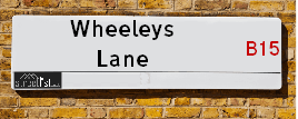
Wheeleys Lane is a street located in the city of Birmingham. The street has a length of approximately 245 metres.
The street is publicly maintained which means that the road is adopted and Birmingham is responsible for the repair and upkeep of the highway.
The street is located within the Birmingham District (B) Council's jurisdiction. They provide various services, like refuse collection, and manage council tax collection. It's situated in the West Midlands region of the UK.
The road has been assigned the Unique Street Reference Number of 2702493 and 2759136 in the National Street Gazetteer.
The street has the postcodes of B15 2EB, B15 2DX and B15 2DW.
It is located within the county of West Midlands, situated in the West Midlands region of the UK. It's 102.13 miles North West from central London., 0.65 miles South West from Birmingham, 17.55 miles West from Coventry and 23.32 miles North East from Worcester.
WHEELEYS LANE is within the Post Town of BIRMINGHAM
Moving to Wheeleys Lane?
I can help you uncover potential pitfalls and provide key questions to ask about your new property. With decades of experience as a Local Land Charges Manager, I offer confidential insights to make your move informed and stress-free.
This service is free, but you may wish to make an optional donation to support it. Please include the property name and address in your request as well as anything you wish to focus on.
Contact Me
Do you know why this road is called Wheeleys Lane?
What's it like to live here?
Ask the community a question.
Do you have any questions, memories to share or know any facts? We'd love to know more.
Map of Wheeleys Lane
| Street Crime (updated 02/11/2024) | ||
|---|---|---|
| Location Note | Central Point of Street - Not Actual Location | |
| MSOA Info | For MSOAs E02006897, E02006895 (Statistical Neighbourhood) | |
| Click Hint | Click on a Circle for a detailed breakdown below map. | |
| Crime Levels |
Green = Very Low Yellow = Low Orange = High Red = Very High |
|
| Postcodes | ||
| Icon | Postcodes for Wheeleys Lane | |
| Walking Distances | ||
| Distance Info | Green Circle = 10 Minutes Walk (800 metres) | |
Street Crime Data accessed from data.police.uk on 06/10/2024.
Budget Friendly Hotels near Wheeleys Lane
| Budget Hotel Name | Distance (miles) |
|---|---|
|
1: Name:Travelodge Birmingham Central Address: 230 Broad St, Birmingham, B15 1AY Telephone: 0871 984 6064 Visit Hotel Page |
0.30 |
|
2: Name:Premier Inn Birmingham City Centre Broad Street Address: Essington Street Telephone: Visit Hotel Page |
0.31 |
|
3: Name:Premier Inn Birmingham Broad Street Brindley Place Address: Essington Street Telephone: Visit Hotel Page |
0.31 |
|
4: Name:Premier Inn Birmingham City Centre Bridge Street Address: 20 Bridge Street Telephone: Visit Hotel Page |
0.34 |
|
5: Name:Premier Inn Birmingham Broad Street - Canal Side Address: Bridge Street Telephone: Visit Hotel Page |
0.36 |
Hotel Options
Your support helps keep this site running!
If you enjoy using this website, consider buying me a coffee to help cover hosting costs.
Flats and Apartments in Wheeleys Lane
FLAT 1
FLAT 2
FLAT 4
FLAT 5
FLAT 6
FLAT 10
FLAT 11
FLAT 12
FLAT 14
FLAT 15
FLAT 16
FLAT 17
FLAT 19
FLAT 20
FLAT 22
FLAT 23
FLAT 24
FLAT 25
FLAT 26
FLAT 27
FLAT 28
FLAT 29
FLAT 30
FLAT 31
FLAT 32
FLAT 33
FLAT 34
FLAT 35
FLAT 36
FLAT 37
FLAT 38
FLAT 39
FLAT 42
FLAT 43
FLAT 44
FLAT 45
FLAT 46
FLAT 48
FLAT 50
FLAT 51
FLAT 52
FLAT 53
FLAT 56
FLAT 58
FLAT 59
FLAT 60
FLAT 61
FLAT 62
FLAT 63
FLAT 64
FLAT 65
FLAT 66
FLAT 68
FLAT 70
FLAT 71
FLAT 72
FLAT 74
APARTMENT
APARTMENT 1
APARTMENT 2
APARTMENT 3
APARTMENT 4
APARTMENT 5
APARTMENT 6
APARTMENT 7
APARTMENT 8
APARTMENT 9
APARTMENT 10
APARTMENT 11
APARTMENT 12
APARTMENT 14
APARTMENT 15
APARTMENT 16
APARTMENT 17
APARTMENT 19
APARTMENT 20
APARTMENT 21
APARTMENT 22
APARTMENT 23
APARTMENT 24
APARTMENT 25
APARTMENT 26
APARTMENT 27
APARTMENT
APARTMENT 1
APARTMENT 2
APARTMENT 3
APARTMENT 4
APARTMENT 5
APARTMENT 6
APARTMENT 7
APARTMENT 8
APARTMENT 9
APARTMENT 11
APARTMENT 12
APARTMENT 14
APARTMENT 15
APARTMENT 16
APARTMENT 18
APARTMENT 20
APARTMENT 21
APARTMENT 22
APARTMENT 23
APARTMENT 24
APARTMENT 25
APARTMENT 27
APARTMENT 28
APARTMENT 29
APARTMENT 30
APARTMENT 31
APARTMENT 32
APARTMENT 33
APARTMENT 34
APARTMENT 35
APARTMENT 36
APARTMENT 37
APARTMENT 38
APARTMENT 1
APARTMENT 2
APARTMENT 3
APARTMENT 4
APARTMENT 5
APARTMENT 6
APARTMENT 7
APARTMENT 8
APARTMENT 9
APARTMENT 10
APARTMENT 12
APARTMENT 14
APARTMENT 15
APARTMENT 16
APARTMENT 17
EPC (Energy Performance Certificate) Information for Wheeleys Lane
UPRN: 10023295405
EPC Current: C
EPC Potential: C
Habitable Rooms: 2
Property Type: Flat
Tenure: Rented (private)
Built Form: Enclosed Mid-Terrace
Age Band: 1996-2002
Mains Gas: No
UPRN: 100071307932
EPC Current: C
EPC Potential: C
Habitable Rooms: 2
Property Type: Flat
Tenure: Rented (social)
Built Form: Semi-Detached
Age Band: 1976-1982
Mains Gas: Yes
UPRN: 10023295430
EPC Current: C
EPC Potential: C
Habitable Rooms: 2
Property Type: Flat
Tenure: Rented (private)
Built Form: Mid-Terrace
Age Band: 2003-2006
Mains Gas: Yes
UPRN: 10023295428
EPC Current: C
EPC Potential: C
Habitable Rooms: 2
Property Type: Flat
Tenure: rental (private)
Built Form: Mid-Terrace
Age Band: 1996-2002
Mains Gas: No
UPRN: 100071307936
EPC Current: C
EPC Potential: C
Habitable Rooms: 2
Property Type: Flat
Tenure: Rented (social)
Built Form: Detached
Age Band: 1976-1982
Mains Gas: Yes
UPRN: 10023295433
EPC Current: C
EPC Potential: C
Habitable Rooms: 2
Property Type: Flat
Tenure: rental (private)
Built Form: End-Terrace
Age Band: 1996-2002
Mains Gas: No
UPRN: 100071307938
EPC Current: E
EPC Potential: C
Habitable Rooms: 2
Property Type: Flat
Tenure: Rented (private)
Built Form: Semi-Detached
Age Band: 1976-1982
Mains Gas: No
UPRN: 10023295435
EPC Current: C
EPC Potential: C
Habitable Rooms: 3
Property Type: Flat
Tenure: Rented (private)
Built Form: End-Terrace
Age Band: 2003-2006
Mains Gas: No
UPRN: 10023295458
EPC Current: C
EPC Potential: C
Habitable Rooms: 3
Property Type: Flat
Tenure: Owner-occupied
Built Form: Enclosed Mid-Terrace
Age Band: 2003-2006
Mains Gas: No
UPRN: 10023295407
EPC Current: D
EPC Potential: D
Habitable Rooms: 2
Property Type: Flat
Tenure: Owner-occupied
Built Form: Mid-Terrace
Age Band: 2003-2006
Mains Gas: Yes
UPRN: 100071307946
EPC Current: C
EPC Potential: C
Habitable Rooms: 2
Property Type: Flat
Tenure: Rented (social)
Built Form: Detached
Age Band: 1976-1982
Mains Gas: Yes
UPRN: 100071307949
EPC Current: C
EPC Potential: C
Habitable Rooms: 2
Property Type: Flat
Tenure: Rented (social)
Built Form: Semi-Detached
Age Band: 1976-1982
Mains Gas: Yes
UPRN: 10023295432
EPC Current: C
EPC Potential: C
Habitable Rooms: 3
Property Type: Flat
Tenure: Owner-occupied
Built Form: Mid-Terrace
Age Band: 2003-2006
Mains Gas: Yes
UPRN: 10023295454
EPC Current: C
EPC Potential: C
Habitable Rooms: 2
Property Type: Flat
Tenure: Owner-occupied
Built Form: Semi-Detached
Age Band: 2003-2006
Mains Gas: Yes
UPRN: 10023295434
EPC Current: C
EPC Potential: C
Habitable Rooms: 3
Property Type: Flat
Tenure: Rented (private)
Built Form: End-Terrace
Age Band: 2007-2011
Mains Gas: No
UPRN: 10023295392
EPC Current: C
EPC Potential: B
Habitable Rooms: 4
Property Type: House
Tenure: rental (private)
Built Form: End-Terrace
Age Band: 2003-2006
Mains Gas: Yes
UPRN: 10023295441
EPC Current: C
EPC Potential: B
Habitable Rooms: 4
Property Type: House
Tenure: Owner-occupied
Built Form: Mid-Terrace
Age Band: 2003-2006
Mains Gas: Yes
UPRN: 10023295411
EPC Current: C
EPC Potential: B
Habitable Rooms: 6
Property Type: House
Tenure: Owner-occupied
Built Form: Mid-Terrace
Age Band: 2003-2006
Mains Gas: Yes
UPRN: 100071307968
EPC Current: C
EPC Potential: B
Habitable Rooms: 2
Property Type: Flat
Tenure: Rented (social)
Built Form: Semi-Detached
Age Band: 1976-1982
Mains Gas: Yes
UPRN: 100071307969
EPC Current: C
EPC Potential: C
Habitable Rooms: 2
Property Type: Flat
Tenure: Rented (social)
Built Form: Mid-Terrace
Age Band: 1976-1982
Mains Gas: Yes
UPRN: 10023295412
EPC Current: C
EPC Potential: B
Habitable Rooms: 5
Property Type: House
Tenure: Owner-occupied
Built Form: Mid-Terrace
Age Band: 1996-2002
Mains Gas: Yes
UPRN: 10023295413
EPC Current: C
EPC Potential: B
Habitable Rooms: 4
Property Type: House
Tenure: Rented (social)
Built Form: Mid-Terrace
Age Band: 2003-2006
Mains Gas: Yes
UPRN: 10023295409
EPC Current: C
EPC Potential: B
Habitable Rooms: 5
Property Type: House
Tenure: Owner-occupied
Built Form: Mid-Terrace
Age Band: 2003-2006
Mains Gas: Yes
UPRN: 100071307975
EPC Current: C
EPC Potential: C
Habitable Rooms: 2
Property Type: Flat
Tenure: Rented (social)
Built Form: Mid-Terrace
Age Band: 1976-1982
Mains Gas: Yes
UPRN: 10023295393
EPC Current: C
EPC Potential: B
Habitable Rooms: 5
Property Type: House
Tenure: Owner-occupied
Built Form: Mid-Terrace
Age Band: 2003-2006
Mains Gas: Yes
UPRN: 100071307977
EPC Current: C
EPC Potential: C
Habitable Rooms: 2
Property Type: Flat
Tenure: Rented (social)
Built Form: End-Terrace
Age Band: 1976-1982
Mains Gas: Yes
UPRN: 10023295394
EPC Current: C
EPC Potential: B
Habitable Rooms: 5
Property Type: House
Tenure: Owner-occupied
Built Form: End-Terrace
Age Band: 2003-2006
Mains Gas: Yes
UPRN: 100071307982
EPC Current: C
EPC Potential: C
Habitable Rooms: 2
Property Type: Flat
Tenure: Rented (social)
Built Form: End-Terrace
Age Band: 1976-1982
Mains Gas: Yes
UPRN: 100071307983
EPC Current: C
EPC Potential: C
Habitable Rooms: 2
Property Type: Flat
Tenure: Rented (social)
Built Form: End-Terrace
Age Band: 1976-1982
Mains Gas: Yes
UPRN: 100071307985
EPC Current: D
EPC Potential: B
Habitable Rooms: 2
Property Type: Flat
Tenure: Rented (private)
Built Form: End-Terrace
Age Band: 1976-1982
Mains Gas: No
UPRN: 100071307995
EPC Current: C
EPC Potential: C
Habitable Rooms: 2
Property Type: Flat
Tenure: Rented (social)
Built Form: Semi-Detached
Age Band: 1976-1982
Mains Gas: Yes
UPRN: 100071307997
EPC Current: C
EPC Potential: C
Habitable Rooms: 2
Property Type: Flat
Tenure: Rented (social)
Built Form: Semi-Detached
Age Band: 1976-1982
Mains Gas: Yes
UPRN: 100071308001
EPC Current: C
EPC Potential: C
Habitable Rooms: 2
Property Type: Flat
Tenure: Owner-occupied
Built Form: End-Terrace
Age Band: 1976-1982
Mains Gas: Yes
UPRN: 10023295429
EPC Current: C
EPC Potential: C
Habitable Rooms: 3
Property Type: Flat
Tenure: Rented (private)
Built Form: Semi-Detached
Age Band: 2003-2006
Mains Gas: No
UPRN: 10023295438
EPC Current: B
EPC Potential: B
Habitable Rooms: 3
Property Type: Flat
Tenure: rental (private)
Built Form: Detached
Age Band: 2003-2006
Mains Gas: Yes
UPRN: 10023295378
EPC Current: C
EPC Potential: C
Habitable Rooms: 3
Property Type: Flat
Tenure: Rented (social)
Built Form: Mid-Terrace
Age Band: 2003-2006
Mains Gas: Yes
UPRN: 10023295381
EPC Current: C
EPC Potential: C
Habitable Rooms: 2
Property Type: Flat
Tenure: Rented (social)
Built Form: Semi-Detached
Age Band: 2003-2006
Mains Gas: No
UPRN: 10023295403
EPC Current: C
EPC Potential: C
Habitable Rooms: 3
Property Type: Flat
Tenure: Owner-occupied
Built Form: End-Terrace
Age Band: 2003-2006
Mains Gas: No
UPRN: 10023295467
EPC Current: C
EPC Potential: C
Habitable Rooms: 3
Property Type: Flat
Tenure: Rented (social)
Built Form: Semi-Detached
Age Band: 2003-2006
Mains Gas: Yes
UPRN: 10023295376
EPC Current: C
EPC Potential: C
Habitable Rooms: 3
Property Type: Flat
Tenure: rental (private)
Built Form: End-Terrace
Age Band: 2003-2006
Mains Gas: No
UPRN: 10023295418
EPC Current: B
EPC Potential: B
Habitable Rooms: 3
Property Type: House
Tenure: rental (private)
Built Form: Semi-Detached
Age Band: 2003-2006
Mains Gas: Unknown
UPRN: 10023512658
EPC Current: C
EPC Potential: C
Habitable Rooms: 3
Property Type: Flat
Tenure: Rented (social)
Built Form: Semi-Detached
Age Band: 2003-2006
Mains Gas: Yes
UPRN: 10023295398
EPC Current: C
EPC Potential: C
Habitable Rooms: 3
Property Type: Flat
Tenure: rental (private)
Built Form: Mid-Terrace
Age Band: 2003-2006
Mains Gas: Yes
UPRN: 10023295397
EPC Current: B
EPC Potential: B
Habitable Rooms: 3
Property Type: Flat
Tenure: Owner-occupied
Built Form: End-Terrace
Age Band: 2003-2006
Mains Gas: No
UPRN: 10023295415
EPC Current: B
EPC Potential: B
Habitable Rooms: 3
Property Type: Flat
Tenure: Rented (social)
Built Form: Semi-Detached
Age Band: 2003-2006
Mains Gas: Yes
UPRN: 10023295384
EPC Current: B
EPC Potential: B
Habitable Rooms: 3
Property Type: Flat
Tenure: rental (private)
Built Form: Enclosed End-Terrace
Age Band: 2003-2006
Mains Gas: Yes
UPRN: 10023295402
EPC Current: C
EPC Potential: B
Habitable Rooms: 3
Property Type: Flat
Tenure: rental (private)
Built Form: End-Terrace
Age Band: 2003-2006
Mains Gas: No
UPRN: 10023295468
EPC Current: B
EPC Potential: B
Habitable Rooms: 3
Property Type: Flat
Tenure: Rented (social)
Built Form: Mid-Terrace
Age Band: 2003-2006
Mains Gas: Yes
UPRN: 10023295426
EPC Current: B
EPC Potential: B
Habitable Rooms: 3
Property Type: Flat
Tenure: Rented (private)
Built Form: Semi-Detached
Age Band: 2003-2006
Mains Gas: No
UPRN: 10023295401
EPC Current: B
EPC Potential: B
Habitable Rooms: 3
Property Type: Flat
Tenure: rental (private)
Built Form: Mid-Terrace
Age Band: 2003-2006
Mains Gas: Yes
UPRN: 10023295456
EPC Current: B
EPC Potential: B
Habitable Rooms: 3
Property Type: Flat
Tenure: Rented (social)
Built Form: End-Terrace
Age Band: 1996-2002
Mains Gas: Yes
UPRN: 10023295380
EPC Current: C
EPC Potential: C
Habitable Rooms: 2
Property Type: Flat
Tenure: Owner-occupied
Built Form: End-Terrace
Age Band: 2003-2006
Mains Gas: No
UPRN: 10023295404
EPC Current: B
EPC Potential: B
Habitable Rooms: 3
Property Type: Flat
Tenure: Owner-occupied
Built Form: Mid-Terrace
Age Band: 2003-2006
Mains Gas: No
UPRN: 10023295417
EPC Current: B
EPC Potential: B
Habitable Rooms: 3
Property Type: Flat
Tenure: Rented (social)
Built Form: Semi-Detached
Age Band: 2003-2006
Mains Gas: Yes
UPRN: 10023295425
EPC Current: B
EPC Potential: B
Habitable Rooms: 3
Property Type: Flat
Tenure: unknown
Built Form: Enclosed Mid-Terrace
Age Band: 2007 onwards
Mains Gas: No
UPRN: 10023295452
EPC Current: B
EPC Potential: B
Habitable Rooms: 2
Property Type: Flat
Tenure: rental (private)
Built Form: Mid-Terrace
Age Band: 2003-2006
Mains Gas: No
UPRN: 10023295469
EPC Current: B
EPC Potential: B
Habitable Rooms: 3
Property Type: Flat
Tenure: Rented (social)
Built Form: Enclosed Mid-Terrace
Age Band: 1996-2002
Mains Gas: Yes
UPRN: 10023295386
EPC Current: C
EPC Potential: B
Habitable Rooms: 3
Property Type: Flat
Tenure: rental (private)
Built Form: Enclosed Mid-Terrace
Age Band: 2003-2006
Mains Gas: Yes
UPRN: 10023295439
EPC Current: C
EPC Potential: C
Habitable Rooms: 3
Property Type: Flat
Tenure: Rented (private)
Built Form: End-Terrace
Age Band: 2003-2006
Mains Gas: No
UPRN: 10023295375
EPC Current: B
EPC Potential: B
Habitable Rooms: 3
Property Type: Flat
Tenure: Rented (social)
Built Form: Semi-Detached
Age Band: 2003-2006
Mains Gas: Yes
UPRN: 10023295459
EPC Current: D
EPC Potential: D
Habitable Rooms: 3
Property Type: Flat
Tenure: Owner-occupied
Built Form: Mid-Terrace
Age Band: 2003-2006
Mains Gas: Yes
UPRN: 10023295374
EPC Current: B
EPC Potential: B
Habitable Rooms: 3
Property Type: Flat
Tenure: Rented (social)
Built Form: Mid-Terrace
Age Band: 2003-2006
Mains Gas: Yes
UPRN: 10023295387
EPC Current: C
EPC Potential: C
Habitable Rooms: 3
Property Type: Flat
Tenure: Rented (private)
Built Form: Mid-Terrace
Age Band: 2003-2006
Mains Gas: No
UPRN: 10023295400
EPC Current: C
EPC Potential: C
Habitable Rooms: 2
Property Type: Flat
Tenure: rental (private)
Built Form: Semi-Detached
Age Band: 2003-2006
Mains Gas: No
UPRN: 10023295379
EPC Current: C
EPC Potential: C
Habitable Rooms: 2
Property Type: Flat
Tenure: Rented (social)
Built Form: Semi-Detached
Age Band: 2003-2006
Mains Gas: No
UPRN: 10023295460
EPC Current: C
EPC Potential: C
Habitable Rooms: 3
Property Type: Flat
Tenure: Rented (private)
Built Form: End-Terrace
Age Band: 2003-2006
Mains Gas: No
UPRN: 10023295416
EPC Current: B
EPC Potential: B
Habitable Rooms: 3
Property Type: Flat
Tenure: Rented (social)
Built Form: Semi-Detached
Age Band: 2003-2006
Mains Gas: Yes
UPRN: 10023295431
EPC Current: C
EPC Potential: C
Habitable Rooms: 3
Property Type: Flat
Tenure: rental (private)
Built Form: End-Terrace
Age Band: 2003-2006
Mains Gas: No
UPRN: 10023295463
EPC Current: C
EPC Potential: C
Habitable Rooms: 3
Property Type: Flat
Tenure: rental (private)
Built Form: Enclosed Mid-Terrace
Age Band: 2003-2006
Mains Gas: Yes
UPRN: 10023295470
EPC Current: B
EPC Potential: B
Habitable Rooms: 3
Property Type: Flat
Tenure: rental (private)
Built Form: Mid-Terrace
Age Band: 2003-2006
Mains Gas: Yes
UPRN: 10023295382
EPC Current: C
EPC Potential: B
Habitable Rooms: 3
Property Type: Flat
Tenure: rental (private)
Built Form: Mid-Terrace
Age Band: 2003-2006
Mains Gas: No
UPRN: 10023295442
EPC Current: C
EPC Potential: C
Habitable Rooms: 3
Property Type: Flat
Tenure: Rented (private)
Built Form: End-Terrace
Age Band: 2003-2006
Mains Gas: No
UPRN: 10023295422
EPC Current: B
EPC Potential: B
Habitable Rooms: 3
Property Type: Flat
Tenure: rental (social)
Built Form: Mid-Terrace
Age Band: 2003-2006
Mains Gas: Yes
UPRN: 10023295423
EPC Current: C
EPC Potential: C
Habitable Rooms: 3
Property Type: Flat
Tenure: Owner-occupied
Built Form: End-Terrace
Age Band: 2003-2006
Mains Gas: Yes
UPRN: 10023295451
EPC Current: B
EPC Potential: B
Habitable Rooms: 3
Property Type: Flat
Tenure: rental (private)
Built Form: Enclosed End-Terrace
Age Band: 2003-2006
Mains Gas: Yes
UPRN: 10023295465
EPC Current: C
EPC Potential: C
Habitable Rooms: 3
Property Type: Flat
Tenure: Rented (social)
Built Form: Semi-Detached
Age Band: 2003-2006
Mains Gas: Yes
UPRN: 10023295377
EPC Current: B
EPC Potential: B
Habitable Rooms: 3
Property Type: Flat
Tenure: Owner-occupied
Built Form: Mid-Terrace
Age Band: 2003-2006
Mains Gas: No
UPRN: 10023295385
EPC Current: C
EPC Potential: C
Habitable Rooms: 3
Property Type: Flat
Tenure: Rented (social)
Built Form: Detached
Age Band: 1996-2002
Mains Gas: Yes
UPRN: 10023295457
EPC Current: B
EPC Potential: B
Habitable Rooms: 2
Property Type: Flat
Tenure: Rented (private)
Built Form: Mid-Terrace
Age Band: 2003-2006
Mains Gas: No
UPRN: 10023295464
EPC Current: B
EPC Potential: B
Habitable Rooms: 3
Property Type: Flat
Tenure: Rented (private)
Built Form: Enclosed Mid-Terrace
Age Band: 2003-2006
Mains Gas: Yes
UPRN: 10023295436
EPC Current: C
EPC Potential: C
Habitable Rooms: 3
Property Type: Flat
Tenure: Owner-occupied
Built Form: End-Terrace
Age Band: 2007 onwards
Mains Gas: No
UPRN: 10023295408
EPC Current: B
EPC Potential: B
Habitable Rooms: 3
Property Type: Flat
Tenure: rental (private)
Built Form: Mid-Terrace
Age Band: 2003-2006
Mains Gas: No
UPRN: 10023295421
EPC Current: B
EPC Potential: B
Habitable Rooms: 2
Property Type: Flat
Tenure: Owner-occupied
Built Form: Detached
Age Band: 2003-2006
Mains Gas: No
UPRN: 10023295437
EPC Current: B
EPC Potential: B
Habitable Rooms: 3
Property Type: Flat
Tenure: Rented (private)
Built Form: Mid-Terrace
Age Band: 2003-2006
Mains Gas: Yes
UPRN: 10023295444
EPC Current: B
EPC Potential: B
Habitable Rooms: 3
Property Type: Flat
Tenure: rental (private)
Built Form: End-Terrace
Age Band: 2003-2006
Mains Gas: Yes
UPRN: 10023295424
EPC Current: B
EPC Potential: B
Habitable Rooms: 3
Property Type: Flat
Tenure: Rented (private)
Built Form: Mid-Terrace
Age Band: 2003-2006
Mains Gas: No
UPRN: 10023295445
EPC Current: C
EPC Potential: C
Habitable Rooms: 3
Property Type: Flat
Tenure: Owner-occupied
Built Form: Enclosed Mid-Terrace
Age Band: 2003-2006
Mains Gas: Yes
UPRN: 10023295383
EPC Current: C
EPC Potential: C
Habitable Rooms: 2
Property Type: Flat
Tenure: Rented (private)
Built Form: Mid-Terrace
Age Band: 2003-2006
Mains Gas: No
UPRN: 10023295446
EPC Current: C
EPC Potential: C
Habitable Rooms: 3
Property Type: Flat
Tenure: Owner-occupied
Built Form: Mid-Terrace
Age Band: 1967-1975
Mains Gas: No
UPRN: 10023295414
EPC Current: C
EPC Potential: C
Habitable Rooms: 3
Property Type: Flat
Tenure: Rented (private)
Built Form: Mid-Terrace
Age Band: 2003-2006
Mains Gas: No
UPRN: 10023295447
EPC Current: B
EPC Potential: B
Habitable Rooms: 3
Property Type: Flat
Tenure: Owner-occupied
Built Form: Mid-Terrace
Age Band: 2003-2006
Mains Gas: Yes
UPRN: 10023295396
EPC Current: C
EPC Potential: C
Habitable Rooms: 3
Property Type: Flat
Tenure: Owner-occupied
Built Form: Mid-Terrace
Age Band: 1996-2002
Mains Gas: Yes
UPRN: 10023295410
EPC Current: C
EPC Potential: C
Habitable Rooms: 2
Property Type: Flat
Tenure: rental (private)
Built Form: Mid-Terrace
Age Band: 2003-2006
Mains Gas: No
UPRN: 10023295420
EPC Current: B
EPC Potential: B
Habitable Rooms: 3
Property Type: Flat
Tenure: Owner-occupied
Built Form: Mid-Terrace
Age Band: 2007 onwards
Mains Gas: Yes
UPRN: 10023295448
EPC Current: C
EPC Potential: B
Habitable Rooms: 3
Property Type: Flat
Tenure: rental (private)
Built Form: Enclosed End-Terrace
Age Band: 2003-2006
Mains Gas: Yes
UPRN: 10023295427
EPC Current: C
EPC Potential: C
Habitable Rooms: 3
Property Type: Flat
Tenure: Owner-occupied
Built Form: End-Terrace
Age Band: 2003-2006
Mains Gas: No
UPRN: 10023295449
EPC Current: C
EPC Potential: B
Habitable Rooms: 3
Property Type: Flat
Tenure: Owner-occupied
Built Form: Mid-Terrace
Age Band: 2003-2006
Mains Gas: No
UPRN: 10023295462
EPC Current: C
EPC Potential: C
Habitable Rooms: 2
Property Type: Flat
Tenure: rental (private)
Built Form: Enclosed End-Terrace
Age Band: 2003-2006
Mains Gas: Yes
UPRN: 10023295450
EPC Current: B
EPC Potential: B
Habitable Rooms: 3
Property Type: Flat
Tenure: rental (private)
Built Form: Detached
Age Band: 2003-2006
Mains Gas: Yes
UPRN: 10023295388
EPC Current: C
EPC Potential: C
Habitable Rooms: 2
Property Type: Flat
Tenure: Owner-occupied
Built Form: Semi-Detached
Age Band: 2003-2006
Mains Gas: Yes
UPRN: 10023295389
EPC Current: B
EPC Potential: B
Habitable Rooms: 3
Property Type: Flat
Tenure: Rented (private)
Built Form: End-Terrace
Age Band: 2003-2006
Mains Gas: No
UPRN: 10023295455
EPC Current: C
EPC Potential: C
Habitable Rooms: 3
Property Type: Flat
Tenure: Rented (private)
Built Form: End-Terrace
Age Band: 1996-2002
Mains Gas: No
UPRN: 10023295453
EPC Current: C
EPC Potential: C
Habitable Rooms: 2
Property Type: Flat
Tenure: Owner-occupied
Built Form: Enclosed Mid-Terrace
Age Band: 2003-2006
Mains Gas: No
UPRN: 10023295390
EPC Current: B
EPC Potential: B
Habitable Rooms: 3
Property Type: Flat
Tenure: rental (private)
Built Form: NO DATA!
Age Band: 2003-2006
Mains Gas: Yes
UPRN: 10023295391
EPC Current: B
EPC Potential: B
Habitable Rooms: 3
Property Type: Flat
Tenure: Rented (private)
Built Form: Semi-Detached
Age Band: 2003-2006
Mains Gas: No
UPRN: 10023295399
EPC Current: B
EPC Potential: B
Habitable Rooms: 2
Property Type: Flat
Tenure: Owner-occupied
Built Form: Detached
Age Band: 2003-2006
Mains Gas: No
UPRN: 10023295461
EPC Current: C
EPC Potential: C
Habitable Rooms: 4
Property Type: Flat
Tenure: Owner-occupied
Built Form: Detached
Age Band: 2003-2006
Mains Gas: No
UPRN: 10023295406
EPC Current: C
EPC Potential: C
Habitable Rooms: 4
Property Type: Flat
Tenure: Owner-occupied
Built Form: End-Terrace
Age Band: 2003-2006
Mains Gas: No
UPRN: 100071307930
EPC Current: C
EPC Potential: C
Habitable Rooms: 2
Property Type: Flat
Tenure: Rented (private)
Built Form: End-Terrace
Age Band: 1976-1982
Mains Gas: Yes
UPRN: 100071307931
EPC Current: C
EPC Potential: C
Habitable Rooms: 2
Property Type: Flat
Tenure: Rented (private)
Built Form: End-Terrace
Age Band: 1991-1995
Mains Gas: Yes
UPRN: 100071307933
EPC Current: C
EPC Potential: C
Habitable Rooms: 2
Property Type: Flat
Tenure: Rented (private)
Built Form: End-Terrace
Age Band: 1976-1982
Mains Gas: Yes
UPRN: 100071307934
EPC Current: C
EPC Potential: C
Habitable Rooms: 2
Property Type: Flat
Tenure: Rented (private)
Built Form: End-Terrace
Age Band: 1976-1982
Mains Gas: Yes
UPRN: 100071307935
EPC Current: C
EPC Potential: C
Habitable Rooms: 2
Property Type: Flat
Tenure: Owner-occupied
Built Form: Semi-Detached
Age Band: 1976-1982
Mains Gas: Yes
UPRN: 100071307939
EPC Current: C
EPC Potential: C
Habitable Rooms: 2
Property Type: Flat
Tenure: Rented (private)
Built Form: Mid-Terrace
Age Band: 1976-1982
Mains Gas: Yes
UPRN: 100071307940
EPC Current: C
EPC Potential: C
Habitable Rooms: 2
Property Type: Flat
Tenure: Rented (private)
Built Form: Mid-Terrace
Age Band: 1976-1982
Mains Gas: Yes
UPRN: 100071307941
EPC Current: C
EPC Potential: B
Habitable Rooms: 2
Property Type: Flat
Tenure: rental (social)
Built Form: Mid-Terrace
Age Band: 1983-1990
Mains Gas: Yes
UPRN: 100071307942
EPC Current: C
EPC Potential: C
Habitable Rooms: 2
Property Type: Flat
Tenure: Rented (private)
Built Form: Mid-Terrace
Age Band: 1976-1982
Mains Gas: Yes
UPRN: 100071307943
EPC Current: C
EPC Potential: C
Habitable Rooms: 2
Property Type: Flat
Tenure: Owner-occupied
Built Form: Semi-Detached
Age Band: 1983-1990
Mains Gas: No
UPRN: 100071307944
EPC Current: C
EPC Potential: C
Habitable Rooms: 2
Property Type: Flat
Tenure: Rented (private)
Built Form: Mid-Terrace
Age Band: 1976-1982
Mains Gas: Yes
UPRN: 100071307945
EPC Current: C
EPC Potential: C
Habitable Rooms: 2
Property Type: Flat
Tenure: Owner-occupied
Built Form: Semi-Detached
Age Band: 1976-1982
Mains Gas: Yes
UPRN: 100071307947
EPC Current: E
EPC Potential: B
Habitable Rooms: 2
Property Type: Flat
Tenure: rental (private)
Built Form: Detached
Age Band: 1976-1982
Mains Gas: No
UPRN: 100071307948
EPC Current: C
EPC Potential: C
Habitable Rooms: 2
Property Type: Flat
Tenure: Rented (private)
Built Form: Mid-Terrace
Age Band: 1976-1982
Mains Gas: Yes
UPRN: 100071307950
EPC Current: C
EPC Potential: C
Habitable Rooms: 2
Property Type: Flat
Tenure: Rented (private)
Built Form: Mid-Terrace
Age Band: 1976-1982
Mains Gas: Yes
UPRN: 100071307951
EPC Current: C
EPC Potential: C
Habitable Rooms: 2
Property Type: Flat
Tenure: Owner-occupied
Built Form: End-Terrace
Age Band: 1967-1975
Mains Gas: Yes
UPRN: 100071307952
EPC Current: D
EPC Potential: C
Habitable Rooms: 2
Property Type: Flat
Tenure: unknown
Built Form: Mid-Terrace
Age Band: 1976-1982
Mains Gas: Yes
UPRN: 100071307953
EPC Current: C
EPC Potential: C
Habitable Rooms: 2
Property Type: Flat
Tenure: Rented (private)
Built Form: End-Terrace
Age Band: 1976-1982
Mains Gas: Yes
UPRN: 100071307954
EPC Current: D
EPC Potential: C
Habitable Rooms: 2
Property Type: Flat
Tenure: Owner-occupied
Built Form: End-Terrace
Age Band: 1983-1990
Mains Gas: Yes
UPRN: 100071307955
EPC Current: C
EPC Potential: C
Habitable Rooms: 2
Property Type: Flat
Tenure: Rented (private)
Built Form: Mid-Terrace
Age Band: 1976-1982
Mains Gas: Yes
UPRN: 100071307956
EPC Current: C
EPC Potential: C
Habitable Rooms: 2
Property Type: Flat
Tenure: rental (social)
Built Form: Mid-Terrace
Age Band: 1983-1990
Mains Gas: Yes
UPRN: 100071307957
EPC Current: C
EPC Potential: C
Habitable Rooms: 2
Property Type: Flat
Tenure: rental (social)
Built Form: Mid-Terrace
Age Band: 1983-1990
Mains Gas: Yes
UPRN: 100071307958
EPC Current: C
EPC Potential: C
Habitable Rooms: 2
Property Type: Flat
Tenure: Rented (private)
Built Form: Mid-Terrace
Age Band: 1976-1982
Mains Gas: Yes
UPRN: 100071307959
EPC Current: D
EPC Potential: C
Habitable Rooms: 2
Property Type: Flat
Tenure: rental (private)
Built Form: End-Terrace
Age Band: 1967-1975
Mains Gas: Yes
UPRN: 100071307960
EPC Current: C
EPC Potential: C
Habitable Rooms: 2
Property Type: Flat
Tenure: Rented (private)
Built Form: Mid-Terrace
Age Band: 1976-1982
Mains Gas: Yes
UPRN: 100071307961
EPC Current: C
EPC Potential: C
Habitable Rooms: 2
Property Type: Flat
Tenure: Rented (private)
Built Form: End-Terrace
Age Band: 1976-1982
Mains Gas: Yes
UPRN: 100071307962
EPC Current: C
EPC Potential: C
Habitable Rooms: 2
Property Type: Flat
Tenure: Rented (private)
Built Form: Mid-Terrace
Age Band: 1976-1982
Mains Gas: Yes
UPRN: 100071307963
EPC Current: C
EPC Potential: C
Habitable Rooms: 2
Property Type: Flat
Tenure: Rented (private)
Built Form: Mid-Terrace
Age Band: 1976-1982
Mains Gas: Yes
UPRN: 100071307964
EPC Current: D
EPC Potential: B
Habitable Rooms: 2
Property Type: Flat
Tenure: rental (social)
Built Form: Mid-Terrace
Age Band: 1983-1990
Mains Gas: Yes
UPRN: 100071307965
EPC Current: C
EPC Potential: C
Habitable Rooms: 2
Property Type: Flat
Tenure: rental (social)
Built Form: Semi-Detached
Age Band: 1976-1982
Mains Gas: Yes
UPRN: 100071307966
EPC Current: C
EPC Potential: C
Habitable Rooms: 2
Property Type: Flat
Tenure: Rented (private)
Built Form: Mid-Terrace
Age Band: 1976-1982
Mains Gas: Yes
UPRN: 100071307967
EPC Current: C
EPC Potential: C
Habitable Rooms: 2
Property Type: Flat
Tenure: Rented (private)
Built Form: Mid-Terrace
Age Band: 1976-1982
Mains Gas: Yes
UPRN: 100071307970
EPC Current: C
EPC Potential: C
Habitable Rooms: 2
Property Type: Flat
Tenure: Rented (private)
Built Form: Mid-Terrace
Age Band: 1976-1982
Mains Gas: Yes
UPRN: 100071307971
EPC Current: E
EPC Potential: C
Habitable Rooms: 2
Property Type: Flat
Tenure: rental (private)
Built Form: End-Terrace
Age Band: 1976-1982
Mains Gas: Yes
UPRN: 100071307972
EPC Current: C
EPC Potential: C
Habitable Rooms: 2
Property Type: Flat
Tenure: Rented (private)
Built Form: Mid-Terrace
Age Band: 1976-1982
Mains Gas: Yes
UPRN: 100071307973
EPC Current: C
EPC Potential: C
Habitable Rooms: 2
Property Type: Flat
Tenure: Rented (private)
Built Form: Mid-Terrace
Age Band: 1976-1982
Mains Gas: Yes
UPRN: 100071307974
EPC Current: D
EPC Potential: D
Habitable Rooms: 2
Property Type: Flat
Tenure: rental (private)
Built Form: End-Terrace
Age Band: 1967-1975
Mains Gas: Yes
UPRN: 100071307976
EPC Current: C
EPC Potential: C
Habitable Rooms: 2
Property Type: Flat
Tenure: Rented (private)
Built Form: Mid-Terrace
Age Band: 1976-1982
Mains Gas: Yes
UPRN: 100071307978
EPC Current: C
EPC Potential: C
Habitable Rooms: 2
Property Type: Flat
Tenure: Rented (private)
Built Form: End-Terrace
Age Band: 1976-1982
Mains Gas: Yes
UPRN: 100071307979
EPC Current: C
EPC Potential: C
Habitable Rooms: 2
Property Type: Flat
Tenure: Rented (private)
Built Form: End-Terrace
Age Band: 1976-1982
Mains Gas: Yes
UPRN: 100071307980
EPC Current: C
EPC Potential: C
Habitable Rooms: 2
Property Type: Flat
Tenure: rental (private)
Built Form: Mid-Terrace
Age Band: 1983-1990
Mains Gas: Yes
UPRN: 100071307981
EPC Current: C
EPC Potential: C
Habitable Rooms: 3
Property Type: Flat
Tenure: Owner-occupied
Built Form: Mid-Terrace
Age Band: 1983-1990
Mains Gas: Yes
UPRN: 100071307984
EPC Current: C
EPC Potential: C
Habitable Rooms: 2
Property Type: Flat
Tenure: Rented (private)
Built Form: End-Terrace
Age Band: 1976-1982
Mains Gas: Yes
UPRN: 100071307986
EPC Current: C
EPC Potential: C
Habitable Rooms: 3
Property Type: Flat
Tenure: Rented (private)
Built Form: Mid-Terrace
Age Band: 1996-2002
Mains Gas: No
UPRN: 100071307987
EPC Current: C
EPC Potential: C
Habitable Rooms: 2
Property Type: Flat
Tenure: Rented (private)
Built Form: End-Terrace
Age Band: 1976-1982
Mains Gas: Yes
UPRN: 100071307988
EPC Current: C
EPC Potential: C
Habitable Rooms: 2
Property Type: Flat
Tenure: Rented (private)
Built Form: End-Terrace
Age Band: 1976-1982
Mains Gas: Yes
UPRN: 100071307989
EPC Current: C
EPC Potential: C
Habitable Rooms: 2
Property Type: Flat
Tenure: Rented (private)
Built Form: Mid-Terrace
Age Band: 1976-1982
Mains Gas: Yes
UPRN: 100071307990
EPC Current: C
EPC Potential: C
Habitable Rooms: 2
Property Type: Flat
Tenure: Rented (private)
Built Form: Mid-Terrace
Age Band: 1976-1982
Mains Gas: Yes
UPRN: 100071307991
EPC Current: C
EPC Potential: C
Habitable Rooms: 2
Property Type: Flat
Tenure: rental (social)
Built Form: Mid-Terrace
Age Band: 1983-1990
Mains Gas: Yes
UPRN: 100071307992
EPC Current: C
EPC Potential: C
Habitable Rooms: 2
Property Type: Flat
Tenure: Rented (private)
Built Form: End-Terrace
Age Band: 1976-1982
Mains Gas: Yes
UPRN: 100071307993
EPC Current: C
EPC Potential: C
Habitable Rooms: 2
Property Type: Flat
Tenure: Rented (private)
Built Form: Mid-Terrace
Age Band: 1976-1982
Mains Gas: Yes
UPRN: 100071307994
EPC Current: C
EPC Potential: C
Habitable Rooms: 2
Property Type: Flat
Tenure: rental (private)
Built Form: End-Terrace
Age Band: 1983-1990
Mains Gas: Yes
UPRN: 100071307996
EPC Current: C
EPC Potential: C
Habitable Rooms: 2
Property Type: Flat
Tenure: Owner-occupied
Built Form: Detached
Age Band: 1991-1995
Mains Gas: Yes
UPRN: 100071307998
EPC Current: C
EPC Potential: C
Habitable Rooms: 2
Property Type: Flat
Tenure: Rented (private)
Built Form: Mid-Terrace
Age Band: 1976-1982
Mains Gas: Yes
UPRN: 100071307999
EPC Current: C
EPC Potential: C
Habitable Rooms: 2
Property Type: Flat
Tenure: Rented (private)
Built Form: End-Terrace
Age Band: 1976-1982
Mains Gas: Yes
UPRN: 100071308000
EPC Current: D
EPC Potential: B
Habitable Rooms: 2
Property Type: Flat
Tenure: Rented (private)
Built Form: End-Terrace
Age Band: 1976-1982
Mains Gas: No
UPRN: 100071308002
EPC Current: C
EPC Potential: C
Habitable Rooms: 2
Property Type: Flat
Tenure: Rented (private)
Built Form: End-Terrace
Age Band: 1976-1982
Mains Gas: Yes
House Sales
| Year | High | Low | Average | Sales |
|---|---|---|---|---|
| 2014 | £230,000 | £55,500 | £100,211 | 14 |
| 2015 | £150,000 | £80,000 | £160,463 | 8 |
| 2016 | £164,950 | £91,500 | £171,994 | 8 |
| 2017 | £206,000 | £80,000 | £144,750 | 8 |
| 2018 | £128,000 | £122,000 | £158,875 | 4 |
| 2019 | £335,000 | £120,000 | £198,833 | 6 |
| 2020 | £202,000 | £100,000 | £164,333 | 3 |
| 2022 | £135,000 | £135,000 | £135,000 | 1 |
| 2023 | £193,000 | £194,000 | £222,333 | 3 |
Contains HM Land Registry data © Crown copyright and database right 2024. This data is licensed under the Open Government Licence v3.0.
Nearby Estate Agents
| Name | Address | Website |
|---|---|---|
| Midland Heart Managing Agents for Cygnet | Bath Row, Birmingham, B15 1LZ | |
| Tudors Estates | 6 Ridley Street, Birmingham, B1 1SA | Visit Website |
| LIV.24 | 8 Islington Row Middleway, Edgbaston, Birmingham, B15 1LD | Visit Website |
| Davidson Estates - Edgbaston | 14 Frederick Road, Edgbaston,B15 1JD | |
| Nicholas Humphreys | RM FF09, 119 Holloway Head Birmingham B1 1QP | Visit Website |
Neighbourhood Policing |
| Police Force: West Midlands |
 View Neighbourhood Crime and Policing View Neighbourhood Crime and Policing |
| Find a Local Neighbourhood Watch Scheme |
Location Details
| Wheeleys Lane | |
|---|---|

| |
| Latitude | 52.471970 |
| Longitude | -1.910933 |
| OS Easting (X): | 406049 |
| OS Northing (Y): | 286048 |
| OS Grid Reference: | SP060860 |
Known Residential Addresses for Wheeleys Lane
- WATERSIDE FLAT 17
- WATERSIDE FLAT 24
- WATERSIDE FLAT 6
- WATERSIDE FLAT 26
- WATERSIDE FLAT 19
- WATERSIDE FLAT 68
- WATERSIDE FLAT 72
- 9
- WATERSIDE FLAT 43
- 18 APARTMENT 11
- 26 APARTMENT 21
- 26 APARTMENT 16
- 26 APARTMENT 38
- 26 APARTMENT 24
- 18 APARTMENT 8
- 26 APARTMENT 22
- 26 APARTMENT 27
- 26 APARTMENT 8
- 18 APARTMENT 26
- 2
- 18 APARTMENT 16
- 18 APARTMENT 1
- 18 APARTMENT 27
- 16
- 26 APARTMENT 36
- 26 APARTMENT 20
- 26 APARTMENT 1
- 26 APARTMENT 23
- 26 APARTMENT 29
- 26 APARTMENT 34
- 26 APARTMENT 4
- 26 APARTMENT 37
- 26 APARTMENT 26
- 18 APARTMENT 9
- 28
- 26 APARTMENT 6
- 18 APARTMENT 17
- 18 APARTMENT 4
- 18 APARTMENT 19
- 26 APARTMENT 5
- 18 APARTMENT 7
- 18 APARTMENT 24
- 26 APARTMENT 2
- 6
- 36
- 38
Roads that have a Junction with Wheeleys Lane
| Street | Junction Type |
|---|---|
| Bath Row (B4127) | junction |
| Longleat Avenue | junction |
| Islington Row Middleway (A4540) | junction |
| Wheeleys Road | pseudo node |
Sunset and Sunrise times
| Sunrise | 08:14 |
|---|---|
| Sunset | 15:58 |
Latest Weather Conditions
| Observed at Weather Station: | Coleshill 22 December 2024 at 09:00 (9.36 miles away) |
|---|---|
| Current Weather: | Sunny day |
| Temperature and Humidity: | 3.2°C (79.5%) |
| Wind Direction and Speed: | W (11 mph) |
Population Statistics
| ONS Area Code | E00175768, E00175699 & E00175700 |
|---|---|
| ONS Area Name | Multi-Ethnic Professional Service Workers, Multicultural Student Neighbourhoods & Constrained Neighbourhoods |
| Average Age | 32.12 & |
| Area Population | 1923.00 & |
| Male Population | 1098.00 & (57%) |
| Female Population | 825.00 & (43%) |
| Benefit Claimants | 220 & (11%) |
| LSOA Code: | E01009146 &E01033626 |
|---|---|
| LSOA Name: | Birmingham 136B &Birmingham 134D |
| SOA Code: | 1a &6a |
| SOA Name: | |
| MSOA Code: | E02006897 &E02006895 |
| MSOA Name: | Birmingham 136 &Birmingham 134 |
Nearest Supermarkets
| Tesco Bath Row Birmingham Express |
|---|
| 165 Granville St, Birmingham, B1 1JW |
| 0345 675 7103 |
| Distance: 0.19 Miles |
| Directions to Tesco Bath Row Birmingham Express |
| Morrisons Edgbaston |
|---|
| 30 Hagley Road, Birmingham B15 1TR |
| 0121 456 1492 |
| Distance: 0.3 Miles |
| Directions to Morrisons Edgbaston |
| Sainsburys Brindley Place Local |
|---|
| 10 Brindley Place, Birmingham, England, B1 2JB |
| 1216436132 |
| Distance: 0.32 Miles |
| Directions to Sainsburys Brindley Place Local |
| Tesco Birmingham Mailbox Express |
|---|
| 150 Wharfside St, The Mailbox, Birmingham, B1 1XL |
| 0345 026 9115 |
| Distance: 0.33 Miles |
| Directions to Tesco Birmingham Mailbox Express |
Telephone Information
| Area Code |
|---|
| Area Code: 0121 - Birmingham |
| Area Code: 01384 - Dudley |
| Area Code: 01922 - Walsall |
| Area Code: 01675 - Coleshill |
Broadband Information
| Speed | Average Speed | Median Speed | Maximum Speed | Next-generation access (NGA) | Number of Connections |
|---|---|---|---|---|---|
| Greater than 2 Mbps | 12 | 13 | 16.4 | N | 6 |
Local Government
| Local Council Details |
|---|
| Within the area of Birmingham |
| Visit the Council's Website |
| Council House, Victoria Square, Birmingham &B1 1BB |
| Send email |
| Telephone Number: 0121 303 1111 |
| Local Member of Parliament |
|---|
| Within the Westminster Parliamentary Constituency of Birmingham &Ladywood |
| The Member of Parliament is Shabana Mahmood |
| Details for the MP Shabana Mahmood on parliament.uk |
| Details for the MP Shabana Mahmood on theyworkforyou.com |
| In the 2024 General Election Shabana Mahmood won with a majority of 3,421 the result was Lab hold. The total electorate was 83,693 |
| Wards, Parish Councils and County Councils |
|---|
| Ward: Ladywood Ward |
| Parish: Unparished area |
| Ceremonial County: West Midlands |
Nearest Schools
England Primary Schools
Nelson Mandela School
Address: Nelson Mandela School, Colville Road, Sparkbrook, Nelson Mandela Community School, Birmingham, West Midlands, B12 8EH
Distance: 1.85 miles
Contact: 01217723055
Ladypool Primary School
Address: Ladypool Primary School, Stratford Road, Sparkbrook, Birmingham, West Midlands, B11 1QT
Distance: 1.75 miles
Contact: 01214647002
St Anne's Catholic Primary School
Address: St Anne's Catholic Primary School, Lowe Street, Camp Hill, Birmingham, West Midlands, B12 0ER
Distance: 1.34 miles
Contact: 01216755037
Park Hill Primary School
Address: Park Hill Primary School, Alcester Road, Birmingham, West Midlands, B13 8BB
Distance: 1.72 miles
Contact: 01214493004
Ark Tindal Primary Academy
Address: Ark Tindal Primary Academy, Tindal Street, Balsall Heath, Birmingham, West Midlands, B12 9QS
Distance: 1.45 miles
Contact: 01214643049
Heath Mount Primary School
Address: Heath Mount Primary School, Knutsford Street, Balsall Heath, BIRMINGHAM, West Midlands, B12 9SR
Distance: 1.20 miles
Contact:
Chandos Primary School
Address: Chandos Primary School, Vaughton Street South, Highgate, Birmingham, West Midlands, B12 0YN
Distance: 0.83 miles
Contact: 01214643881
Chandos Primary School
Address: Chandos Primary School, Vaughton Street South, Highgate, Birmingham, West Midlands, B12 0YN
Distance: 0.83 miles
Contact:
St Chad's Catholic Primary School
Address: St Chad's Catholic Primary School, Hospital Street, Newtown, Birmingham, West Midlands, B19 3XD
Distance: 1.48 miles
Contact:
Percy Shurmer Academy
Address: Percy Shurmer Academy, Longmore Street, Balsall Heath, Birmingham, West Midlands, B12 9ED
Distance: 0.99 miles
Contact: 01214643431
St Catherine of Siena Catholic Primary School
Address: St Catherine of Siena Catholic Primary School, Great Colmore Street, Lee Bank, Birmingham, West Midlands, B15 2AY
Distance: 0.37 miles
Contact: 01216921051
St Thomas' Church of England VA Primary School
Address: St Thomas' Church of England VA Primary School, Great Colmore Street, Birmingham, West Midlands, B15 2AT
Distance: 0.33 miles
Contact:
Oasis Academy Woodview
Address: Oasis Academy Woodview, Woodview Drive, Edgbaston, Birmingham, West Midlands, B15 2HU
Distance: 0.39 miles
Contact: 01214404202
Brookfields Primary School
Address: Brookfields Primary School, 2 Hingeston Street, Hockley, Birmingham, West Midlands, B18 6PU
Distance: 1.26 miles
Contact:
Nelson Junior and Infant School
Address: Nelson Junior and Infant School, King Edward's Road, Ladywood, Birmingham, West Midlands, B1 2PJ
Distance: 0.67 miles
Contact: 01214642201
St John's & St Peter's CofE Academy
Address: St John's & St Peter's CofE Academy, St Vincent Street West, Ladywood, Birmingham, West Midlands, B16 8RN
Distance: 0.63 miles
Contact: 01216751398
The Oratory Roman Catholic Primary School
Address: The Oratory Roman Catholic Primary School, Oliver Road, Ladywood, Birmingham, West Midlands, B16 9ER
Distance: 0.86 miles
Contact: 01214540600
St Edmund's Catholic Primary School
Address: St Edmund's Catholic Primary School, Rosebery Street, Springhill, Birmingham, West Midlands, B18 7PA
Distance: 1.16 miles
Contact:
St George's Church of England Primary School
Address: St George's Church of England Primary School, Beaufort Road, Edgbaston, Birmingham, West Midlands, B16 8HY
Distance: 0.74 miles
Contact: 01214642789
Chad Vale Primary School
Address: Chad Vale Primary School, Nursery Road, Edgbaston, Birmingham, West Midlands, B15 3JU
Distance: 1.51 miles
Contact: 01214647329
St Patrick and St Edmund's Catholic Primary School
Address: St Patrick and St Edmund's Catholic Primary School, Dudley Road, Birmingham, West Midlands, B18 7QW
Distance: 1.32 miles
Contact: 01212473947
Barford Primary School
Address: Barford Primary School, Barford Road, Ladywood, Birmingham, West Midlands, B16 0EF
Distance: 1.30 miles
Contact: 01214643765
City Road Primary School
Address: City Road Primary School, Cavendish Road, Rotton Park, Birmingham, West Midlands, B16 0HL
Distance: 1.64 miles
Contact:
Summerfield Primary School
Address: Summerfield Primary School, Cuthbert Road, Winson Green, Birmingham, West Midlands, B18 4AH
Distance: 1.70 miles
Contact: 01216752355
Cape Primary School
Address: Cape Primary School, Cape Hill, Smethwick, West Midlands, B66 4SH
Distance: 2.08 miles
Contact: 01215581667
George Dixon Primary School
Address: George Dixon Primary School, City Road, Edgbaston, Birmingham, West Midlands, B17 8LE
Distance: 1.96 miles
Contact: 01216752775
St George's Church of England Academy, Newtown
Address: St George's Church of England Academy, Newtown, St George's Street, Birmingham, B19 3QY
Distance: 1.31 miles
Contact: 01218182139
Chilwell Croft Academy
Address: Chilwell Croft Academy, Chilwell Croft, Newtown, Birmingham, West Midlands, B19 2QH
Distance: 1.66 miles
Contact: 01214643402
Oasis Academy Foundry
Address: Oasis Academy Foundry, Foundry Road, Birmingham, West Midlands, B18 4LP
Distance: 2.01 miles
Contact: 01212508850
England Secondary Schools
Ark St Alban's Academy
Address: Ark St Alban's Academy, Conybere Street, Birmingham, West Midlands, B12 0YH
Distance: 1.10 miles
Contact: 01214461300
Central Academy
Address: Central Academy, Newhall Street, Ladywood, Birmingham, West Midlands, B3 1SJ
Distance: 0.84 miles
Contact:
City Academy Birmingham
Address: City Academy Birmingham, 23 Langley Walk, Ladywood, Birmingham, West Midlands, B15 2EF
Distance: 0.15 miles
Contact:
Jewellery Quarter Academy
Address: Jewellery Quarter Academy, St George's Court, 1 Albion Street, Birmingham, West Midlands, B1 3AA
Distance: 0.86 miles
Contact: 01217297220
Harborne Academy
Address: Harborne Academy, Harborne Road, Edgbaston, Birmingham, West Midlands, B15 3JL
Distance: 1.35 miles
Contact: 01214642737
St Paul's School for Girls
Address: St Paul's School for Girls, Vernon Road, Edgbaston, Birmingham, West Midlands, B16 9SL
Distance: 1.29 miles
Contact: 01214540895
George Dixon Academy
Address: George Dixon Academy, Portland Road, Edgbaston, Birmingham, West Midlands, B16 9GD
Distance: 1.90 miles
Contact: 01215666565
England Higher Schools
Joseph Chamberlain Sixth Form College
Address: Joseph Chamberlain Sixth Form College, Belgrave Road, Highgate, Birmingham, West Midlands, B12 9FF
Distance: 1.25 miles
Contact: 01214462223
Nearest Hospitals
| The Westbourne Centre |
|---|
| Address: 53 Church Road, Edgbaston, Birmingham, |
| Independent Sector |
| Ramsay Healthcare UK Operations Limited |
| Telephone: 0121 456 0880 |
| Visit Hospital Website |
| Distance: 0.96 (miles) |
| Directions from to The Westbourne Centre |
| BMI The Priory Hospital |
|---|
| Address: Priory Road, Edgbaston, Birmingham, B5 7UG, |
| Independent Sector |
| BMI Healthcare |
| Telephone: 0121 4402323 |
| Visit Hospital Website |
| Distance: 1.73 (miles) |
| Directions from to BMI The Priory Hospital |
| Birmingham Children's Hospital |
|---|
| Address: Steelhouse Lane, Birmingham, |
| Independent Sector |
| Oxford University Hospitals NHS Foundation Trust |
| Distance: 1.81 (miles) |
| Directions from to Birmingham Children's Hospital |
Nearest Dentists
Dentists
ATTWOOD GREEN HEALTH CENTRE
Address: 30 BATH ROW, BIRMINGHAM, WEST MIDLANDS, B15 1LZ
Distance: 0.11 miles
Contact: :
MYCOL LTD
Address: 18 ELVETHAM ROAD, BIRMINGHAM, B15 2LY
Distance: 0.19 miles
Contact: :
BIRMINGHAM DENTAL SPECIALISTS
Address: 9 WATERFRONT WALK, BIRMINGHAM, B1 1TX
Distance: 0.23 miles
Contact: :
DENTAL SURGERY
Address: 18 ISLINGTON ROW MIDDLEWAY, BIRMINGHAM, WEST MIDLANDS, B15 1LD
Distance: 0.26 miles
Contact: :
LIBERTY PLACE
Address: UNIT 4-5, LIBERTY PLACE, SHEEPCOTE STREET, BIRMINGHAM, B16 8AE
Distance: 0.57 miles
Contact: :
HIGHFIELD DENTAL CLINIC
Address: 2 HIGHFIELD ROAD, EDGBASTON, BIRMINGHAM, B15 3ED
Distance: 0.66 miles
Contact: http: HTTP://WWW.HIGHFIELDDENTAL.CO.UK
Nearest GP Surgeries
Doctors
MODALITY ATTWOOD GREEN
Address: ATTWOOD GREEN HEALTH CENTRE, 30 BATH ROW, BIRMINGHAM, WEST MIDLANDS, B15 1LZ
Distance: 0.11 miles
Contact: :
BATH ROW MEDICAL PRACTICE - COVID LOCAL VACCINATION SERVICE 2
Address: 30 BATH ROW, BIRMINGHAM, B15 1LZ
Distance: 0.11 miles
Contact: :
BATH ROW MEDICAL PRACTICE
Address: FIRST FLOOR, COLSTON SUITE, ATTWOOD GREENN HC, 30 BATH ROW, EDGBASTON, BIRMINGHAM, WEST MIDLANDS, B15 1LZ
Distance: 0.11 miles
Contact: tel: 0121 6224846
BELLEVUE MEDICAL CENTRE
Address: 6 BELLEVUE, EDGBASTON, BIRMINGHAM, WEST MIDLANDS, B5 7LX
Distance: 0.62 miles
Contact: tel: 0121 4462000
HALCYON MEDICAL
Address: UNIT 8, 24 MARTINEAU PLACE, BIRMINGHAM, B2 4UH
Distance: 0.87 miles
Contact: tel: 01212 039999
KARIS MEDICAL CENTRE
Address: WATERWORKS ROAD, EDGBASTON, BIRMINGHAM, WEST MIDLANDS, B16 9AL
Distance: 0.89 miles
Contact: tel: 0121 4550542
Nearest Dispensing Chemists
Pharmacies
ATTWOOD GREEN PHARMACY
Address: ATTWOOD GREEN HEALTH CENTRE, 30 BATH ROW, BIRMINGHAM, WEST MIDLANDS, B15 1LZ
Distance: 0.11 miles
Contact: tel: 0121 6667582
BOOTS
Address: 2A BRINDLEY PLACE, BIRMINGHAM, WEST MIDLANDS, B1 2JB
Distance: 0.43 miles
Contact: tel: 01216 434872
HYATT PHARMACY
Address: 49 BRISTOL ROAD, BIRMINGHAM, WEST MIDLANDS, B5 7TU
Distance: 0.64 miles
Contact: tel: 0121 4466186
FIVE WAYS PHARMACY
Address: 192A ST VINCENT STREET WEST, LADYWOOD, BIRMINGHAM, WEST MIDLANDS, B16 8RP
Distance: 0.67 miles
Contact: tel: 01216 302680
PERSHORE PHARMACY
Address: 71 PERSHORE ROAD, EDGBASTON, BIRMINGHAM, B5 7NX
Distance: 0.71 miles
Contact: tel: 01214 401210
BELLEVUE PHARMACY
Address: 69 PERSHORE ROAD, BIRMINGHAM, WEST MIDLANDS, B5 7NX
Distance: 0.71 miles
Contact: tel: 0121 2490940
Nearest Opticians
Opticians
SCRIVENS OPTICIANS (EDGBASTON)
Address: SCRIVENS HOUSE, 60 ISLINGTON ROW MIDDLEWAY, EDGBASTON, BIRMINGHAM, WEST MIDLANDS, B15 1PH
Distance: 0.11 miles
Contact: :
EYE OPTICIANS - EDGBASTON
Address: ISLINGTON ROW, EDGBASTON, BIRMINGHAM, WEST MIDLANDS, B15 1LD
Distance: 0.26 miles
Contact: :
MYOPTICS OPTICIANS
Address: 44 RYLAND ROAD, EDGBASTON, BIRMINGHAM, B15 2BN
Distance: 0.30 miles
Contact: :
EYE Q OPTICIANS
Address: 5 THE WATERS EDGE, BRIDLEYPLACE, BIRMINGHAM, WEST MIDLANDS, B1 2HL
Distance: 0.43 miles
Contact: :
PICCADILLY OPTICIANS
Address: 13 PICCADILLY ARCADE, BIRMINGHAM, WEST MIDLANDS, B2 4HD
Distance: 0.67 miles
Contact: :
VISION EXPRESS (BIRMINGHAM)
Address: UNIT 5/6, THE PALLASADES, BIRMINGHAM, WEST MIDLANDS, B2 4XA
Distance: 0.68 miles
Contact: :
Transport
Nearest Rail Stations
Five Ways Station is 0.10 miles away.
Address: Five Ways station, Islington Row, Edgbaston, West Midlands, B15 1SF
Five Ways is situated on the Bristol to Brimingham Line.
Five Ways Station is staffed on a part time basis.
Birmingham New Street Station is 0.68 miles away.
Address: Birmingham New Street station, Station Street, Birmingham, West Midlands, B2 4QA
Birmingham New Street is situated on the Chiltern Main Line|Birmingham to Peterborough Line|Bristol to Brimingham Line|Chase Line|Rugby�Birmingham�Stafford line|West Coast Main Line.
Birmingham New Street Station is staffed on a full time basis.