Howard Road East is a street located in the city of Birmingham. The street has a length of approximately 337 metres.
The street is located within the Birmingham District (B) Council's jurisdiction. They provide various services, like refuse collection, and manage council tax collection. It's situated in the West Midlands region of the UK.
The road has been assigned the Unique Street Reference Number of 2703338 and 2759106 in the National Street Gazetteer.
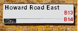
The street has the postcodes of B13 0RZ, B13 0RY and B13 0RQ.
It is located within the county of West Midlands, situated in the West Midlands region of the UK. It's 99.5 miles North West from central London., 3.6 miles South from Birmingham, 16.18 miles West from Coventry and 21.41 miles North East from Worcester.
Map of Howard Road East
| Postcodes | ||
|---|---|---|
| Icon | Postcodes for Howard Road East | |
| Walking Distances | ||
| Distance Info | Green Circle = 10 Minutes Walk (800 metres) | |
Street Crime Data accessed from data.police.uk on 06/10/2024.
Moving to Howard Road East?
I can help you uncover potential pitfalls and provide key questions to ask about your new property. With decades of experience as a Local Land Charges Manager, I offer confidential insights to make your move informed and stress-free.
This service is free, but you may wish to make an optional donation to support it. Please include the property name and address in your request as well as anything you wish to focus on.
Contact Me
Do you know why this road is called Howard Road East?
What's it like to live here?
Share a Photo of Howard Road East
Ask the community a question.
Do you have any questions, memories to share, have any photos or know any facts? We'd love to know more.
Submit Your Comment
Budget Friendly Hotels near Howard Road East
| Budget Hotel Name | Distance (miles) |
|---|---|
|
1: Name:Travelodge Birmingham Maypole Address: Maypole Lane, Birmingham, B14 5JF Telephone: 0871 559 1896 Visit Hotel Page |
1.57 |
|
2: Name:Premier Inn Birmingham South Hall Green Address: Stratford Road Telephone: Visit Hotel Page |
2.28 |
|
3: Name:ibis budget Birmingham Centre Address: Great Colmore Street Telephone: Visit Hotel Page |
3.07 |
|
4: Name:Travelodge Birmingham Central Bull Ring Address: Upper Dean St, Birmingham, B5 4SG Telephone: 0871 984 6468 Visit Hotel Page |
3.30 |
|
5: Name:easyHotel Birmingham Address: 81 John Bright Street Telephone: Visit Hotel Page |
3.45 |
Hotel Options
Your support helps keep this site running!
If you enjoy using this website, consider making a donation to help me cover hosting costs.
Nearby Estate Agents
| Name | Address | Website |
|---|---|---|
| Dixons | 59 Alcester Road South, Birmingham, West Midlands, B14 7JG | |
| Connells | 93 High Street, Kings Heath, B14 7BW | Visit Website |
| Connells Lettings | 93 High Street, Kings Heath, Birmingham, B14 7BW | Visit Website |
| Heritage Estate Agency | 91 High Street Kings Heath Birmingham B14 7BH | Visit Website |
| Robert Oulsnam & Company | 20 High Street, Kings Heath, Birmingham, B14 7JT |
Neighbourhood Policing |
| Police Force: West Midlands |
 View Neighbourhood Crime and Policing View Neighbourhood Crime and Policing |
| Find a Local Neighbourhood Watch Scheme |
Location Details
| Howard Road East | |
|---|---|

| |
| Latitude | 52.427534 |
| Longitude | -1.890534 |
| OS Easting (X): | 407442 |
| OS Northing (Y): | 281108 |
| OS Grid Reference: | SP074811 |
Roads that have a Junction with Howard Road East
| Street | Junction Type |
|---|---|
| Haunch Lane | roundabout |
| Alcester Road South (A435) | junction |
Sunset and Sunrise times
| Sunrise | 08:15 |
|---|---|
| Sunset | 16:05 |
Latest Weather Conditions
| Observed at Weather Station: | Coleshill 31 December 2024 at 15:00 (9.23 miles away) |
|---|---|
| Current Weather: | Partly cloudy (day) |
| Temperature and Humidity: | 10.9°C (73.5%) |
| Wind Direction and Speed: | SSW (15 mph) |
Population Statistics
| ONS Area Code | E00045526 |
|---|---|
| ONS Area Name | Achieving Minorities |
| Average Age | 42.14 |
| Area Population | 1707.00 |
| Male Population | 847.00 (50%) |
| Female Population | 860.00 (50%) |
| Benefit Claimants | 20 (1%) |
| LSOA Code: | E01008968 |
|---|---|
| LSOA Name: | Birmingham 110B |
| SOA Code: | 3b |
| SOA Name: | |
| MSOA Code: | E02001936 |
| MSOA Name: | Birmingham 110 |
Nearest Supermarkets
| Sainsburys Kings Heath |
|---|
| 38-54 Alcester Road South, Birmingham, England, B14 7PT |
| 0121 444 3251 |
| Distance: 0.28 Miles |
| Directions to Sainsburys Kings Heath |
| Iceland Kings Heath |
|---|
| Unit 10 Institutes Road, Kings Heath, Birmingham, B14 7EG |
| 01214441862 |
| Distance: 0.43 Miles |
| Directions to Iceland Kings Heath |
| Tesco Kings Heath Express |
|---|
| 281-289 Alcester Rd South, Birmingham, B14 6EB |
| 0345 674 6533 |
| Distance: 0.44 Miles |
| Directions to Tesco Kings Heath Express |
| Asda Kings Heath |
|---|
| 99 High Street, Kings Heath, Birmingham, B14 7BW |
| 0121 483 4410 |
| Distance: 0.53 Miles |
| Directions to Asda Kings Heath |
Telephone Information
| Area Code |
|---|
| Area Code: 0121 - Birmingham |
| Area Code: 01564 - Lapworth |
| Area Code: 01527 - Redditch |
Local Government
| Local Council Details |
|---|
| Within the area of Birmingham |
| Visit the Council's Website |
| Council House, Victoria Square, Birmingham &B1 1BB |
| Send email |
| Telephone Number: 0121 303 1111 |
| Local Member of Parliament |
|---|
| Within the Westminster Parliamentary Constituency of Birmingham &Selly Oak |
| The Member of Parliament is Alistair Carns |
| Details for the MP Alistair Carns on parliament.uk |
| Details for the MP Alistair Carns on theyworkforyou.com |
| In the 2024 General Election Alistair Carns won with a majority of 11,537 the result was Lab hold. The total electorate was 75,678 |
| Wards, Parish Councils and County Councils |
|---|
| Ward: Billesley Ward |
| Ceremonial County: West Midlands |
Nearest Schools
England Primary Schools
St Bernard's Catholic Primary School
Address: St Bernard's Catholic Primary School, Wake Green Road, Moseley, Birmingham, West Midlands, B13 9QE
Distance: 1.38 miles
Contact: 01214643795
Our Lady of Lourdes Catholic Primary School
Address: Our Lady of Lourdes Catholic Primary School, Trittiford Road, Yardley Wood, Birmingham, West Midlands, B13 0EU
Distance: 1.34 miles
Contact: 01214442684
Yardley Wood Community Primary School
Address: Yardley Wood Community Primary School, School Road, Yardley Wood, Birmingham, West Midlands, B14 4ER
Distance: 1.45 miles
Contact: 01216752456
Highters Heath Community School
Address: Highters Heath Community School, Highters Heath Lane, Kings Heath, Birmingham, West Midlands, B14 4LY
Distance: 1.36 miles
Contact:
King David Primary School
Address: King David Primary School, Alcester Road, Moseley, Birmingham, West Midlands, B13 8EY
Distance: 1.20 miles
Contact: 01214493364
Hollywood Primary School
Address: Hollywood Primary School, Pickenham Road, Hollywood, Birmingham, West Midlands, B14 4TG
Distance: 1.80 miles
Contact:
St Dunstan's Catholic Primary School
Address: St Dunstan's Catholic Primary School, Drayton Road, Kings Heath, Birmingham, West Midlands, B14 7LP
Distance: 0.33 miles
Contact: 01214644648
Grendon Primary School
Address: Grendon Primary School, Grendon Road, Kings Heath, Birmingham, West Midlands, B14 4RB
Distance: 1.11 miles
Contact: 01214742460
Allens Croft Primary School
Address: Allens Croft Primary School, Allens Croft Road, Kings Heath, Birmingham, West Midlands, B14 6RP
Distance: 1.10 miles
Contact: 01216752611
Colmore Infant and Nursery School
Address: Colmore Infant and Nursery School, Colmore Road, Kings Heath, Birmingham, West Midlands, B14 6AJ
Distance: 0.40 miles
Contact: 01214642820
Colmore Junior School
Address: Colmore Junior School, Colmore Road, Kings Heath, Birmingham, West Midlands, B14 6AJ
Distance: 0.40 miles
Contact: 01214642843
Woodthorpe Junior and Infant School
Address: Woodthorpe Junior and Infant School, Greenwood Close, Kings Heath, Birmingham, West Midlands, B14 6ET
Distance: 0.66 miles
Contact: 01214645203
St Alban's Catholic Primary School
Address: St Alban's Catholic Primary School, Broad Lane, Kings Heath, Birmingham, West Midlands, B14 5AL
Distance: 0.85 miles
Contact: 01214446530
Stirchley Primary School
Address: Stirchley Primary School, Pershore Road, Birmingham, West Midlands, B30 2JL
Distance: 1.34 miles
Contact:
Broadmeadow Infant School
Address: Broadmeadow Infant School, Monyhull Hall Road, Kings Norton, Birmingham, West Midlands, B30 3QJ
Distance: 1.47 miles
Contact: 01214644266
Broadmeadow Junior School
Address: Broadmeadow Junior School, Monyhull Hall Road, Kings Norton, Birmingham, West Midlands, B30 3QJ
Distance: 1.47 miles
Contact: 01214641717
Cotteridge Primary School
Address: Cotteridge Primary School, Breedon Road, Cotteridge, Birmingham, West Midlands, B30 2HT
Distance: 1.59 miles
Contact: 01214642865
Billesley Primary School
Address: Billesley Primary School, Trittiford Road, Billesley, Birmingham, West Midlands, B13 0ES
Distance: 0.93 miles
Contact: 01216752800
Peterbrook Primary School
Address: Peterbrook Primary School, High Street, Solihull Lodge, Shirley, Solihull, West Midlands, B90 1HR
Distance: 2.04 miles
Contact: 01214302545
Kings Heath Primary School
Address: Kings Heath Primary School, Valentine Road, Kings Heath, Birmingham, West Midlands, B14 7AJ
Distance: 0.71 miles
Contact: 01214649202
Wheelers Lane Primary School
Address: Wheelers Lane Primary School, Wheelers Lane, Kings Heath, Birmingham, West Midlands, B13 0SF
Distance: 0.14 miles
Contact: 01214642551
St Jude's Catholic Primary School
Address: St Jude's Catholic Primary School, St Jude's Close, Maypole, Birmingham, West Midlands, B14 5PD
Distance: 1.49 miles
Contact: 01214645069
Moor Green Primary Academy
Address: Moor Green Primary Academy, Moor Green Lane, Moseley, Birmingham, B13 8QP
Distance: 1.08 miles
Contact: 01214645662
Stirchley Primary School
Address: Stirchley Primary School, Pershore Road, Stirchley, Birmingham, West Midlands, B30 2JL
Distance: 1.34 miles
Contact: 01214582989
England Secondary Schools
Moseley School and Sixth Form
Address: Moseley School and Sixth Form, Wake Green Road, Moseley, Birmingham, West Midlands, B13 9UU
Distance: 1.39 miles
Contact: 01215666444
Swanshurst School
Address: Swanshurst School, Brook Lane, Billesley, Birmingham, West Midlands, B13 0TW
Distance: 0.71 miles
Contact: 01214642400
Queensbridge School
Address: Queensbridge School, Queensbridge Road, Moseley, Birmingham, West Midlands, B13 8QB
Distance: 0.90 miles
Contact: 01214645566
Kings Heath Boys
Address: Kings Heath Boys, Chamberlain Road, Kings Heath, Birmingham, West Midlands, B13 0QP
Distance: 0.45 miles
Contact: 01214644454
Bishop Challoner Catholic College
Address: Bishop Challoner Catholic College, Institute Road, Kings Heath, Birmingham, West Midlands, B14 7EG
Distance: 0.43 miles
Contact: 01214444161
Wheelers Lane Technology College
Address: Wheelers Lane Technology College, Wheelers Lane, Kings Heath, Birmingham, West Midlands, B13 0SF
Distance: 0.14 miles
Contact: 01214442864
King Edward VI Camp Hill School for Boys
Address: King Edward VI Camp Hill School for Boys, Vicarage Road, Kings Heath, Birmingham, West Midlands, B14 7QJ
Distance: 0.55 miles
Contact:
King Edward VI Camp Hill School for Girls
Address: King Edward VI Camp Hill School for Girls, Vicarage Road, Kings Heath, Birmingham, West Midlands, B14 7QJ
Distance: 0.55 miles
Contact:
Hall Green School
Address: Hall Green School, Southam Road, Hall Green, Birmingham, West Midlands, B28 0AA
Distance: 1.76 miles
Contact: 01216288787
King Edward VI Camp Hill School for Boys
Address: King Edward VI Camp Hill School for Boys, Vicarage Road, Kings Heath, Birmingham, West Midlands, B14 7QJ
Distance: 0.55 miles
Contact: 01214443188
King Edward VI Camp Hill School for Girls
Address: King Edward VI Camp Hill School for Girls, Vicarage Road, Kings Heath, Birmingham, West Midlands, B14 7QJ
Distance: 0.55 miles
Contact: 01214442150
Nearest Hospitals
| Name | Address | Postcode | Distance | Map |
|---|
Nearest Dentists
Dentists
| Name | Address | Postcode | Distance | Map |
|---|
Nearest GP Surgeries
Doctors
KINGSFIELD MEDICAL CENTRE
Address: 146 ALCESTER ROAD SOUTH, KINGS HEATH, BIRMINGHAM, WEST MIDLANDS, B14 6AA
Distance: 0.11 miles
Contact: tel: 0121 4442054
FEATHERSTONE MEDICAL CENTRE
Address: 158 ALCESTER ROAD SOUTH, KINGS HEATH, BIRMINGHAM, WEST MIDLANDS, B14 6AA
Distance: 0.11 miles
Contact: tel: 0121 4441186
ALL SAINTS MEDICAL CENTRE SURGERY
Address: 2A VICARAGE ROAD, KINGS HEATH, BIRMINGHAM, WEST MIDLANDS, B14 7QA
Distance: 0.35 miles
Contact: :
ALL SAINTS MEDICAL CENTRE - COVID LOCAL VACCINATION SERVICE
Address: 2A VICARAGE ROAD, KINGS HEATH, BIRMINGHAM, B14 7RA
Distance: 0.37 miles
Contact: :
ALL SAINTS MEDICAL CENTRE - COVID LOCAL VACCINATION SERVICE 2
Address: 2A VICARAGE ROAD, KINGS HEATH, BIRMINGHAM, B14 7RA
Distance: 0.37 miles
Contact: :
POPLAR PRIMARY CARE CENTRE
Address: 58-64 POPLAR ROAD, KINGS HEATH, BIRMINGHAM, WEST MIDLANDS, B14 7AG
Distance: 0.61 miles
Contact: tel: 0121 4658314
Nearest Dispensing Chemists
Pharmacies
| Name | Address | Postcode | Telephone | Map | Distance in Km |
|---|
Nearest Opticians
Opticians
BOOTS OPTICIANS (ALCESTER ROAD SOUTH - KINGS HEATH)
Address: 51A ALCESTER ROAD SOUTH, KINGS HEATH, BIRMINGHAM, WEST MIDLANDS, B14 7JQ
Distance: 0.31 miles
Contact: :
PORTLAND EYECARE LTD (KINGS HEATH)
Address: 1 INSTITUTE ROAD, KINGS HEATH, BIRMINGHAM, WEST MIDLANDS, B14 7EG
Distance: 0.43 miles
Contact: :
SCRIVENS OPTICIANS (KINGS HEATH)
Address: 124 HIGH STREET, KINGS HEATH, BIRMINGHAM, WEST MIDLANDS, B14 7LG
Distance: 0.46 miles
Contact: :
SPECSAVERS (KINGS HEATH, BIRMINGHAM)
Address: 132 HIGH STREET, KINGS HEATH, BIRMINGHAM, WEST MIDLANDS, B14 7LG
Distance: 0.46 miles
Contact: :
BOOTS OPTICIANS (HIGH STREET - KINGS HEATH)
Address: 115 HIGH STREET, KINGS HEATH, BIRMINGHAM, WEST MIDLANDS, B14 7BW
Distance: 0.52 miles
Contact: :
MIDLAND PRIMARY EYECARE LTD
Address: 3 STACEY DRIVE, BIRMINGHAM, B13 0QT
Distance: 0.60 miles
Contact: :
Transport
Nearest Rail Stations
Bournville Station is 1.51 miles away.
Address: Bournville station, Bournville Lane, Bournville, West Midlands, B30 1LG
Bournville is situated on the Bristol to Brimingham Line.
Bournville Station is staffed on a part time basis.
Yardley Wood Station is 1.58 miles away.
Address: Yardley Wood station, Highfield Road, Yardley Wood, West Midlands, B28 0BY
Yardley Wood is situated on the North Warwickshire (Shakespeare Line) Line.
Yardley Wood Station is staffed on a part time basis.