Brandwood Road is a street located in the city of Birmingham. The street has a length of approximately 1,326 metres.
The street is publicly maintained which means that the road is adopted and Birmingham is responsible for the repair and upkeep of the highway.
The street is located within the Birmingham District (B) Council's jurisdiction. They provide various services, like refuse collection, and manage council tax collection. It's situated in the West Midlands region of the UK.
The road has been assigned the Unique Street Reference Numbers of 2700346, 2759215, 2700511 and 2759212 in the National Street Gazetteer.
The street has the postcodes of B14 6PX, B14 6PU, B14 6PN, B14 6PL, B14 6LD, B14 6HB, B14 6HA, B14 6BX, B14 6BT and B14 6BH.
It is located within the county of West Midlands, situated in the West Midlands region of the UK. It's 99.46 miles North West from central London., 4.2 miles South from Birmingham, 16.6 miles West from Coventry and 20.63 miles North East from Worcester.
BRANDWOOD ROAD is within the Post Town of BIRMINGHAM
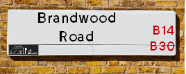
Map of Brandwood Road
| Street Crime (updated 03/12/2024) | ||
|---|---|---|
| Location Note | Central Point of Street - Not Actual Location | |
| MSOA Info | For MSOAs E02001936, E02001944 (Statistical Neighbourhood) | |
| Click Hint | Click on a Circle for a detailed breakdown below map. | |
| Crime Levels |
Green = Very Low Yellow = Low Orange = High Red = Very High |
|
| Postcodes | ||
| Icon | Postcodes for Brandwood Road | |
| Walking Distances | ||
| Distance Info | Green Circle = 10 Minutes Walk (800 metres) | |
Street Crime Data accessed from data.police.uk on 06/10/2024.
Moving to Brandwood Road?
I can help you uncover potential pitfalls and provide key questions to ask about your new property. With decades of experience as a Local Land Charges Manager, I offer confidential insights to make your move informed and stress-free.
This service is free, but you may wish to make an optional donation to support it. Please include the property name and address in your request as well as anything you wish to focus on.
Contact Me
Do you know why this road is called Brandwood Road?
What's it like to live here?
Share a Photo of Brandwood Road
Ask the community a question.
Do you have any questions, memories to share, have any photos or know any facts? We'd love to know more.
Submit Your Comment
Budget Friendly Hotels near Brandwood Road
| Budget Hotel Name | Distance (miles) |
|---|---|
|
1: Name:Travelodge Birmingham Maypole Address: Maypole Lane, Birmingham, B14 5JF Telephone: 0871 559 1896 Visit Hotel Page |
1.13 |
|
2: Name:Premier Inn Birmingham South Hall Green Address: Stratford Road Telephone: Visit Hotel Page |
2.72 |
|
3: Name:ibis budget Birmingham Centre Address: Great Colmore Street Telephone: Visit Hotel Page |
3.67 |
|
4: Name:Premier Inn Birmingham South Longbridge Station Address: 1 High Street Telephone: Visit Hotel Page |
3.85 |
|
5: Name:Travelodge Birmingham Central Bull Ring Address: Upper Dean St, Birmingham, B5 4SG Telephone: 0871 984 6468 Visit Hotel Page |
3.93 |
Hotel Options
Your support helps keep this site running!
If you enjoy using this website, consider making a donation to help me cover hosting costs.
Flats and Apartments in Brandwood Road
FLAT 2
FLAT 3
FLAT 5
FLAT 6
FLAT 7
FLAT 10
FLAT 11
FLAT 12
FLAT 14
FLAT 19
FLAT 2
FLAT 3
FLAT 5
FLAT 6
FLAT 8
FLAT 9
FLAT 10
FLAT 11
EPC (Energy Performance Certificate) Information for Brandwood Road
UPRN: 100070303660
EPC Current: D
EPC Potential: B
Habitable Rooms: 5
Property Type: House
Tenure: Owner-occupied
Built Form: Semi-Detached
Age Band: 1950-1966
Mains Gas: Yes
UPRN: 100070303661
EPC Current: E
EPC Potential: B
Habitable Rooms: 5
Property Type: House
Tenure: Owner-occupied
Built Form: Semi-Detached
Age Band: 1930-1949
Mains Gas: Yes
UPRN: 100070303662
EPC Current: D
EPC Potential: B
Habitable Rooms: 4
Property Type: House
Tenure: Owner-occupied
Built Form: Semi-Detached
Age Band: 1950-1966
Mains Gas: Yes
UPRN: 100070303664
EPC Current: C
EPC Potential: B
Habitable Rooms: 5
Property Type: House
Tenure: Owner-occupied
Built Form: Detached
Age Band: 1967-1975
Mains Gas: Yes
UPRN: 100070303665
EPC Current: D
EPC Potential: B
Habitable Rooms: 5
Property Type: House
Tenure: Owner-occupied
Built Form: Semi-Detached
Age Band: 1930-1949
Mains Gas: Yes
UPRN: 100070303668
EPC Current: D
EPC Potential: B
Habitable Rooms: 5
Property Type: House
Tenure: Owner-occupied
Built Form: Semi-Detached
Age Band: 1900-1929
Mains Gas: Yes
UPRN: 100070303669
EPC Current: D
EPC Potential: C
Habitable Rooms: 7
Property Type: House
Tenure: Owner-occupied
Built Form: Semi-Detached
Age Band: 1900-1929
Mains Gas: Yes
UPRN: 100070303670
EPC Current: D
EPC Potential: B
Habitable Rooms: 5
Property Type: House
Tenure: Owner-occupied
Built Form: Semi-Detached
Age Band: 1900-1929
Mains Gas: Yes
UPRN: 100070303674
EPC Current: D
EPC Potential: C
Habitable Rooms: 8
Property Type: House
Tenure: Owner-occupied
Built Form: Semi-Detached
Age Band: 1930-1949
Mains Gas: Yes
UPRN: 100071264921
EPC Current: E
EPC Potential: C
Habitable Rooms: 2
Property Type: Flat
Tenure: Rented (private)
Built Form: Mid-Terrace
Age Band: 1967-1975
Mains Gas: No
UPRN: 100071264922
EPC Current: E
EPC Potential: C
Habitable Rooms: 3
Property Type: Flat
Tenure: Owner-occupied
Built Form: Mid-Terrace
Age Band: 1967-1975
Mains Gas: No
UPRN: 100070303679
EPC Current: D
EPC Potential: B
Habitable Rooms: 5
Property Type: House
Tenure: Owner-occupied
Built Form: Semi-Detached
Age Band: 1930-1949
Mains Gas: Yes
UPRN: 100070303680
EPC Current: E
EPC Potential: C
Habitable Rooms: 7
Property Type: House
Tenure: rental (private)
Built Form: Semi-Detached
Age Band: 1930-1949
Mains Gas: Yes
UPRN: 100070303681
EPC Current: C
EPC Potential: C
Habitable Rooms: 8
Property Type: House
Tenure: Owner-occupied
Built Form: Semi-Detached
Age Band: 1930-1949
Mains Gas: Yes
UPRN: 100070303683
EPC Current: F
EPC Potential: D
Habitable Rooms: 5
Property Type: House
Tenure: Owner-occupied
Built Form: Semi-Detached
Age Band: 1930-1949
Mains Gas: Yes
UPRN: 100070303684
EPC Current: E
EPC Potential: C
Habitable Rooms: 7
Property Type: House
Tenure: Owner-occupied
Built Form: Semi-Detached
Age Band: 1900-1929
Mains Gas: Yes
UPRN: 100070303685
EPC Current: D
EPC Potential: B
Habitable Rooms: 5
Property Type: House
Tenure: Owner-occupied
Built Form: Semi-Detached
Age Band: 1930-1949
Mains Gas: Yes
UPRN: 100070303686
EPC Current: D
EPC Potential: B
Habitable Rooms: 7
Property Type: House
Tenure: Owner-occupied
Built Form: Semi-Detached
Age Band: 1930-1949
Mains Gas: Yes
UPRN: 100070303688
EPC Current: D
EPC Potential: B
Habitable Rooms: 7
Property Type: House
Tenure: Owner-occupied
Built Form: Semi-Detached
Age Band: 1930-1949
Mains Gas: Yes
UPRN: 100070303689
EPC Current: D
EPC Potential: B
Habitable Rooms: 4
Property Type: House
Tenure: Owner-occupied
Built Form: Semi-Detached
Age Band: 1930-1949
Mains Gas: Yes
UPRN: 100070303690
EPC Current: D
EPC Potential: C
Habitable Rooms: 9
Property Type: House
Tenure: Owner-occupied
Built Form: Detached
Age Band: 1930-1949
Mains Gas: Yes
UPRN: 100070303691
EPC Current: D
EPC Potential: B
Habitable Rooms: 6
Property Type: House
Tenure: Owner-occupied
Built Form: Semi-Detached
Age Band: 1930-1949
Mains Gas: Yes
UPRN: 100070303694
EPC Current: D
EPC Potential: C
Habitable Rooms: 7
Property Type: House
Tenure: Owner-occupied
Built Form: Semi-Detached
Age Band: 1900-1929
Mains Gas: Yes
UPRN: 100070303695
EPC Current: D
EPC Potential: B
Habitable Rooms: 7
Property Type: House
Tenure: Owner-occupied
Built Form: Semi-Detached
Age Band: 1930-1949
Mains Gas: Yes
UPRN: 100070303702
EPC Current: D
EPC Potential: D
Habitable Rooms: 5
Property Type: House
Tenure: unknown
Built Form: Semi-Detached
Age Band: 1930-1949
Mains Gas: Yes
UPRN: 100070303706
EPC Current: D
EPC Potential: D
Habitable Rooms: 5
Property Type: House
Tenure: Owner-occupied
Built Form: Semi-Detached
Age Band: 1930-1949
Mains Gas: Yes
UPRN: 100070303707
EPC Current: D
EPC Potential: C
Habitable Rooms: 7
Property Type: House
Tenure: Owner-occupied
Built Form: Semi-Detached
Age Band: 1930-1949
Mains Gas: Yes
UPRN: 100070303708
EPC Current: D
EPC Potential: B
Habitable Rooms: 6
Property Type: House
Tenure: Owner-occupied
Built Form: Semi-Detached
Age Band: 1930-1949
Mains Gas: Yes
UPRN: 100070303709
EPC Current: D
EPC Potential: C
Habitable Rooms: 7
Property Type: House
Tenure: Owner-occupied
Built Form: Semi-Detached
Age Band: 1930-1949
Mains Gas: Yes
UPRN: 100070303710
EPC Current: E
EPC Potential: C
Habitable Rooms: 5
Property Type: House
Tenure: Owner-occupied
Built Form: Semi-Detached
Age Band: 1930-1949
Mains Gas: Yes
UPRN: 100070303711
EPC Current: D
EPC Potential: B
Habitable Rooms: 5
Property Type: House
Tenure: Owner-occupied
Built Form: Semi-Detached
Age Band: 1930-1949
Mains Gas: Yes
UPRN: 100070303714
EPC Current: F
EPC Potential: B
Habitable Rooms: 5
Property Type: House
Tenure: Owner-occupied
Built Form: Semi-Detached
Age Band: 1930-1949
Mains Gas: Yes
UPRN: 100070303715
EPC Current: C
EPC Potential: B
Habitable Rooms: 6
Property Type: House
Tenure: Owner-occupied
Built Form: Detached
Age Band: 1950-1966
Mains Gas: Yes
UPRN: 100070303716
EPC Current: E
EPC Potential: D
Habitable Rooms: 6
Property Type: House
Tenure: Owner-occupied
Built Form: Semi-Detached
Age Band: 1930-1949
Mains Gas: Yes
UPRN: 100070303717
EPC Current: D
EPC Potential: B
Habitable Rooms: 5
Property Type: House
Tenure: Owner-occupied
Built Form: Semi-Detached
Age Band: 1930-1949
Mains Gas: Yes
UPRN: 100070303718
EPC Current: D
EPC Potential: B
Habitable Rooms: 5
Property Type: House
Tenure: Owner-occupied
Built Form: Semi-Detached
Age Band: 1930-1949
Mains Gas: Yes
UPRN: 100070303720
EPC Current: D
EPC Potential: C
Habitable Rooms: 5
Property Type: House
Tenure: Rented (private)
Built Form: Semi-Detached
Age Band: 1900-1929
Mains Gas: Yes
UPRN: 100070303721
EPC Current: E
EPC Potential: D
Habitable Rooms: 7
Property Type: House
Tenure: Owner-occupied
Built Form: Semi-Detached
Age Band: 1930-1949
Mains Gas: Yes
UPRN: 100070303724
EPC Current: E
EPC Potential: D
Habitable Rooms: 5
Property Type: House
Tenure: Owner-occupied
Built Form: Semi-Detached
Age Band: 1930-1949
Mains Gas: Yes
UPRN: 100070303726
EPC Current: D
EPC Potential: B
Habitable Rooms: 5
Property Type: House
Tenure: Owner-occupied
Built Form: Semi-Detached
Age Band: 1930-1949
Mains Gas: Yes
UPRN: 100070303727
EPC Current: D
EPC Potential: B
Habitable Rooms: 5
Property Type: House
Tenure: Owner-occupied
Built Form: Semi-Detached
Age Band: 1900-1929
Mains Gas: Yes
UPRN: 100070303728
EPC Current: C
EPC Potential: B
Habitable Rooms: 4
Property Type: House
Tenure: Owner-occupied
Built Form: End-Terrace
Age Band: 1967-1975
Mains Gas: Yes
UPRN: 100070303732
EPC Current: D
EPC Potential: B
Habitable Rooms: 6
Property Type: House
Tenure: Owner-occupied
Built Form: Semi-Detached
Age Band: 1930-1949
Mains Gas: Yes
UPRN: 100070303735
EPC Current: D
EPC Potential: B
Habitable Rooms: 5
Property Type: House
Tenure: Owner-occupied
Built Form: Semi-Detached
Age Band: 1900-1929
Mains Gas: Yes
UPRN: 100070303736
EPC Current: D
EPC Potential: B
Habitable Rooms: 7
Property Type: House
Tenure: Owner-occupied
Built Form: Semi-Detached
Age Band: 1930-1949
Mains Gas: Yes
UPRN: 100070303737
EPC Current: D
EPC Potential: B
Habitable Rooms: 5
Property Type: House
Tenure: Owner-occupied
Built Form: Semi-Detached
Age Band: 1900-1929
Mains Gas: Yes
UPRN: 100070303739
EPC Current: D
EPC Potential: B
Habitable Rooms: 6
Property Type: House
Tenure: Owner-occupied
Built Form: Semi-Detached
Age Band: 1930-1949
Mains Gas: Yes
UPRN: 100070303741
EPC Current: E
EPC Potential: D
Habitable Rooms: 5
Property Type: House
Tenure: Owner-occupied
Built Form: Semi-Detached
Age Band: 1930-1949
Mains Gas: Yes
UPRN: 100070303743
EPC Current: G
EPC Potential: B
Habitable Rooms: 6
Property Type: House
Tenure: Owner-occupied
Built Form: Semi-Detached
Age Band: 1930-1949
Mains Gas: Yes
UPRN: 100070303747
EPC Current: D
EPC Potential: B
Habitable Rooms: 4
Property Type: House
Tenure: unknown
Built Form: Semi-Detached
Age Band: 1900-1929
Mains Gas: Yes
UPRN: 100070303748
EPC Current: E
EPC Potential: D
Habitable Rooms: 7
Property Type: House
Tenure: Owner-occupied
Built Form: Semi-Detached
Age Band: 1930-1949
Mains Gas: Yes
UPRN: 100070303749
EPC Current: D
EPC Potential: B
Habitable Rooms: 5
Property Type: House
Tenure: Owner-occupied
Built Form: Semi-Detached
Age Band: 1930-1949
Mains Gas: Yes
UPRN: 100070303750
EPC Current: D
EPC Potential: C
Habitable Rooms: 6
Property Type: House
Tenure: Owner-occupied
Built Form: Semi-Detached
Age Band: 1930-1949
Mains Gas: Yes
UPRN: 100070303751
EPC Current: F
EPC Potential: E
Habitable Rooms: 6
Property Type: House
Tenure: Owner-occupied
Built Form: Semi-Detached
Age Band: 1930-1949
Mains Gas: Yes
UPRN: 100070303754
EPC Current: E
EPC Potential: C
Habitable Rooms: 5
Property Type: House
Tenure: Owner-occupied
Built Form: Semi-Detached
Age Band: 1950-1966
Mains Gas: Yes
UPRN: 100070303755
EPC Current: E
EPC Potential: D
Habitable Rooms: 5
Property Type: House
Tenure: Owner-occupied
Built Form: Semi-Detached
Age Band: 1930-1949
Mains Gas: Yes
UPRN: 100070303757
EPC Current: E
EPC Potential: C
Habitable Rooms: 6
Property Type: House
Tenure: Owner-occupied
Built Form: Detached
Age Band: 1930-1949
Mains Gas: Yes
UPRN: 100070303758
EPC Current: E
EPC Potential: C
Habitable Rooms: 6
Property Type: House
Tenure: Rented (social)
Built Form: Semi-Detached
Age Band: 1930-1949
Mains Gas: No
UPRN: 100070303759
EPC Current: D
EPC Potential: B
Habitable Rooms: 5
Property Type: House
Tenure: Owner-occupied
Built Form: Semi-Detached
Age Band: 1930-1949
Mains Gas: Yes
UPRN: 100070303760
EPC Current: D
EPC Potential: B
Habitable Rooms: 5
Property Type: House
Tenure: Owner-occupied
Built Form: Semi-Detached
Age Band: 1930-1949
Mains Gas: Yes
UPRN: 100070303761
EPC Current: D
EPC Potential: B
Habitable Rooms: 5
Property Type: House
Tenure: Owner-occupied
Built Form: Semi-Detached
Age Band: 1930-1949
Mains Gas: Yes
UPRN: 100070303763
EPC Current: D
EPC Potential: C
Habitable Rooms: 8
Property Type: House
Tenure: Owner-occupied
Built Form: Detached
Age Band: 1930-1949
Mains Gas: Yes
UPRN: 100070303766
EPC Current: D
EPC Potential: B
Habitable Rooms: 5
Property Type: House
Tenure: Owner-occupied
Built Form: Semi-Detached
Age Band: 1930-1949
Mains Gas: Yes
UPRN: 100070303767
EPC Current: D
EPC Potential: B
Habitable Rooms: 7
Property Type: House
Tenure: Owner-occupied
Built Form: Semi-Detached
Age Band: 1900-1929
Mains Gas: Yes
UPRN: 100070303768
EPC Current: D
EPC Potential: B
Habitable Rooms: 5
Property Type: House
Tenure: Owner-occupied
Built Form: Semi-Detached
Age Band: 1900-1929
Mains Gas: Yes
UPRN: 100070303769
EPC Current: D
EPC Potential: B
Habitable Rooms: 7
Property Type: House
Tenure: Owner-occupied
Built Form: Semi-Detached
Age Band: 1900-1929
Mains Gas: Yes
UPRN: 100070303770
EPC Current: D
EPC Potential: C
Habitable Rooms: 5
Property Type: House
Tenure: Owner-occupied
Built Form: Semi-Detached
Age Band: 1930-1949
Mains Gas: Yes
UPRN: 100070303771
EPC Current: E
EPC Potential: C
Habitable Rooms: 8
Property Type: House
Tenure: Owner-occupied
Built Form: Semi-Detached
Age Band: 1930-1949
Mains Gas: Yes
UPRN: 100070303772
EPC Current: D
EPC Potential: B
Habitable Rooms: 5
Property Type: House
Tenure: Rented (private)
Built Form: Semi-Detached
Age Band: 1930-1949
Mains Gas: Yes
UPRN: 100070303775
EPC Current: E
EPC Potential: C
Habitable Rooms: 7
Property Type: House
Tenure: Owner-occupied
Built Form: Semi-Detached
Age Band: 1930-1949
Mains Gas: Yes
UPRN: 100070303776
EPC Current: E
EPC Potential: C
Habitable Rooms: 6
Property Type: House
Tenure: Owner-occupied
Built Form: Semi-Detached
Age Band: 1900-1929
Mains Gas: Yes
UPRN: 100070303777
EPC Current: E
EPC Potential: B
Habitable Rooms: 7
Property Type: House
Tenure: Owner-occupied
Built Form: Semi-Detached
Age Band: 1930-1949
Mains Gas: Yes
UPRN: 100070303781
EPC Current: D
EPC Potential: C
Habitable Rooms: 5
Property Type: House
Tenure: Owner-occupied
Built Form: Semi-Detached
Age Band: 1967-1975
Mains Gas: Yes
UPRN: 100070303783
EPC Current: D
EPC Potential: B
Habitable Rooms: 5
Property Type: House
Tenure: Owner-occupied
Built Form: Semi-Detached
Age Band: 1950-1966
Mains Gas: Yes
UPRN: 100070303785
EPC Current: D
EPC Potential: C
Habitable Rooms: 7
Property Type: House
Tenure: Not defined - use in the case of a new dwelling fo
Built Form: Detached
Age Band: 1930-1949
Mains Gas: Yes
UPRN: 100070303786
EPC Current: E
EPC Potential: D
Habitable Rooms: 5
Property Type: House
Tenure: Owner-occupied
Built Form: Semi-Detached
Age Band: 1930-1949
Mains Gas: Yes
UPRN: 100070303787
EPC Current: D
EPC Potential: B
Habitable Rooms: 5
Property Type: House
Tenure: rental (private)
Built Form: Semi-Detached
Age Band: 1930-1949
Mains Gas: Yes
UPRN: 100070303788
EPC Current: D
EPC Potential: B
Habitable Rooms: 5
Property Type: House
Tenure: Owner-occupied
Built Form: Semi-Detached
Age Band: 1930-1949
Mains Gas: Yes
UPRN: 100070303789
EPC Current: D
EPC Potential: B
Habitable Rooms: 4
Property Type: House
Tenure: Owner-occupied
Built Form: Semi-Detached
Age Band: 1930-1949
Mains Gas: Yes
UPRN: 100070303790
EPC Current: D
EPC Potential: C
Habitable Rooms: 4
Property Type: House
Tenure: Owner-occupied
Built Form: Semi-Detached
Age Band: 1950-1966
Mains Gas: Yes
UPRN: 100070303795
EPC Current: D
EPC Potential: B
Habitable Rooms: 4
Property Type: House
Tenure: Owner-occupied
Built Form: Semi-Detached
Age Band: 1967-1975
Mains Gas: Yes
UPRN: 100070303798
EPC Current: C
EPC Potential: C
Habitable Rooms: 4
Property Type: Flat
Tenure: Owner-occupied
Built Form: Semi-Detached
Age Band: 1950-1966
Mains Gas: Yes
UPRN: 100070303799
EPC Current: C
EPC Potential: C
Habitable Rooms: 4
Property Type: Flat
Tenure: rental (social)
Built Form: Semi-Detached
Age Band: 1950-1966
Mains Gas: Yes
UPRN: 100070303800
EPC Current: C
EPC Potential: C
Habitable Rooms: 5
Property Type: Flat
Tenure: rental (social)
Built Form: NO DATA!
Age Band: 1950-1966
Mains Gas: Yes
UPRN: 100070303801
EPC Current: D
EPC Potential: C
Habitable Rooms: 4
Property Type: Maisonette
Tenure: rental (private)
Built Form: Semi-Detached
Age Band: 1950-1966
Mains Gas: Yes
UPRN: 100070303802
EPC Current: C
EPC Potential: C
Habitable Rooms: 4
Property Type: Maisonette
Tenure: Owner-occupied
Built Form: Semi-Detached
Age Band: 1950-1966
Mains Gas: Yes
UPRN: 100070303803
EPC Current: D
EPC Potential: B
Habitable Rooms: 5
Property Type: House
Tenure: Owner-occupied
Built Form: Semi-Detached
Age Band: 1967-1975
Mains Gas: Yes
UPRN: 100070303804
EPC Current: D
EPC Potential: D
Habitable Rooms: 4
Property Type: Flat
Tenure: Rented (social)
Built Form: Semi-Detached
Age Band: 1976-1982
Mains Gas: Yes
UPRN: 100070303806
EPC Current: E
EPC Potential: B
Habitable Rooms: 5
Property Type: House
Tenure: Owner-occupied
Built Form: Detached
Age Band: 1950-1966
Mains Gas: Yes
UPRN: 100070303807
EPC Current: C
EPC Potential: B
Habitable Rooms: 5
Property Type: House
Tenure: Owner-occupied
Built Form: Semi-Detached
Age Band: 1950-1966
Mains Gas: Yes
UPRN: 100070303811
EPC Current: C
EPC Potential: B
Habitable Rooms: 7
Property Type: House
Tenure: Owner-occupied
Built Form: Semi-Detached
Age Band: 1967-1975
Mains Gas: Yes
UPRN: 100070303813
EPC Current: C
EPC Potential: B
Habitable Rooms: 4
Property Type: House
Tenure: Owner-occupied
Built Form: Semi-Detached
Age Band: 1967-1975
Mains Gas: Yes
UPRN: 100070303814
EPC Current: E
EPC Potential: C
Habitable Rooms: 5
Property Type: House
Tenure: Owner-occupied
Built Form: Semi-Detached
Age Band: 1930-1949
Mains Gas: Yes
UPRN: 100070303819
EPC Current: D
EPC Potential: B
Habitable Rooms: 6
Property Type: House
Tenure: Owner-occupied
Built Form: Semi-Detached
Age Band: 1930-1949
Mains Gas: Yes
UPRN: 100070303820
EPC Current: E
EPC Potential: B
Habitable Rooms: 5
Property Type: House
Tenure: Owner-occupied
Built Form: Semi-Detached
Age Band: 1930-1949
Mains Gas: Yes
UPRN: 100070303821
EPC Current: D
EPC Potential: B
Habitable Rooms: 5
Property Type: House
Tenure: Owner-occupied
Built Form: Semi-Detached
Age Band: 1900-1929
Mains Gas: Yes
UPRN: 100070303827
EPC Current: D
EPC Potential: B
Habitable Rooms: 6
Property Type: House
Tenure: Owner-occupied
Built Form: Semi-Detached
Age Band: 1930-1949
Mains Gas: Yes
UPRN: 100070303829
EPC Current: E
EPC Potential: D
Habitable Rooms: 5
Property Type: House
Tenure: Owner-occupied
Built Form: Semi-Detached
Age Band: 1950-1966
Mains Gas: Yes
UPRN: 100070303831
EPC Current: D
EPC Potential: B
Habitable Rooms: 6
Property Type: House
Tenure: Owner-occupied
Built Form: Semi-Detached
Age Band: 1930-1949
Mains Gas: Yes
UPRN: 100070303834
EPC Current: D
EPC Potential: B
Habitable Rooms: 7
Property Type: House
Tenure: Owner-occupied
Built Form: Semi-Detached
Age Band: 1930-1949
Mains Gas: Yes
UPRN: 100070303836
EPC Current: D
EPC Potential: B
Habitable Rooms: 5
Property Type: House
Tenure: Owner-occupied
Built Form: Semi-Detached
Age Band: 1930-1949
Mains Gas: Yes
UPRN: 100070303837
EPC Current: D
EPC Potential: B
Habitable Rooms: 7
Property Type: House
Tenure: Owner-occupied
Built Form: Semi-Detached
Age Band: 1900-1929
Mains Gas: Yes
UPRN: 100070303838
EPC Current: E
EPC Potential: B
Habitable Rooms: 4
Property Type: House
Tenure: Owner-occupied
Built Form: Semi-Detached
Age Band: 1930-1949
Mains Gas: Yes
UPRN: 100070303840
EPC Current: D
EPC Potential: B
Habitable Rooms: 4
Property Type: House
Tenure: Owner-occupied
Built Form: Mid-Terrace
Age Band: 1900-1929
Mains Gas: Yes
UPRN: 100070303842
EPC Current: D
EPC Potential: B
Habitable Rooms: 5
Property Type: House
Tenure: Owner-occupied
Built Form: Semi-Detached
Age Band: 1930-1949
Mains Gas: Yes
UPRN: 100070303843
EPC Current: E
EPC Potential: B
Habitable Rooms: 7
Property Type: House
Tenure: Owner-occupied
Built Form: Semi-Detached
Age Band: 1930-1949
Mains Gas: Yes
UPRN: 100070303844
EPC Current: D
EPC Potential: B
Habitable Rooms: 4
Property Type: House
Tenure: Owner-occupied
Built Form: Semi-Detached
Age Band: 1930-1949
Mains Gas: Yes
UPRN: 100070303850
EPC Current: E
EPC Potential: D
Habitable Rooms: 5
Property Type: House
Tenure: Owner-occupied
Built Form: Semi-Detached
Age Band: 1930-1949
Mains Gas: Yes
UPRN: 100070303851
EPC Current: D
EPC Potential: B
Habitable Rooms: 7
Property Type: House
Tenure: Owner-occupied
Built Form: Semi-Detached
Age Band: 1930-1949
Mains Gas: Yes
UPRN: 100070303852
EPC Current: E
EPC Potential: B
Habitable Rooms: 4
Property Type: House
Tenure: Owner-occupied
Built Form: Semi-Detached
Age Band: 1930-1949
Mains Gas: Yes
UPRN: 100070303853
EPC Current: D
EPC Potential: B
Habitable Rooms: 4
Property Type: House
Tenure: Owner-occupied
Built Form: Semi-Detached
Age Band: 1950-1966
Mains Gas: Yes
UPRN: 100070303854
EPC Current: D
EPC Potential: B
Habitable Rooms: 5
Property Type: House
Tenure: Owner-occupied
Built Form: Semi-Detached
Age Band: 1930-1949
Mains Gas: Yes
UPRN: 100070303855
EPC Current: D
EPC Potential: C
Habitable Rooms: 5
Property Type: House
Tenure: Owner-occupied
Built Form: Semi-Detached
Age Band: 1950-1966
Mains Gas: Yes
UPRN: 100070303856
EPC Current: D
EPC Potential: C
Habitable Rooms: 6
Property Type: House
Tenure: Owner-occupied
Built Form: Semi-Detached
Age Band: 1930-1949
Mains Gas: Yes
UPRN: 100070303861
EPC Current: D
EPC Potential: B
Habitable Rooms: 5
Property Type: House
Tenure: Owner-occupied
Built Form: Semi-Detached
Age Band: 1930-1949
Mains Gas: Yes
UPRN: 100071264895
EPC Current: F
EPC Potential: D
Habitable Rooms: 2
Property Type: Flat
Tenure: rental (private)
Built Form: Semi-Detached
Age Band: 1967-1975
Mains Gas: No
UPRN: 100071264907
EPC Current: E
EPC Potential: D
Habitable Rooms: 2
Property Type: Flat
Tenure: Owner-occupied
Built Form: End-Terrace
Age Band: 1967-1975
Mains Gas: No
UPRN: 100071264908
EPC Current: E
EPC Potential: C
Habitable Rooms: 3
Property Type: Flat
Tenure: rental (private)
Built Form: Mid-Terrace
Age Band: 1976-1982
Mains Gas: No
UPRN: 100071264896
EPC Current: D
EPC Potential: C
Habitable Rooms: 3
Property Type: Flat
Tenure: Owner-occupied
Built Form: Semi-Detached
Age Band: 1950-1966
Mains Gas: No
UPRN: 100071264910
EPC Current: E
EPC Potential: C
Habitable Rooms: 2
Property Type: Flat
Tenure: Owner-occupied
Built Form: Mid-Terrace
Age Band: 1950-1966
Mains Gas: No
UPRN: 100071264898
EPC Current: E
EPC Potential: B
Habitable Rooms: 3
Property Type: Flat
Tenure: Rented (private)
Built Form: End-Terrace
Age Band: 1950-1966
Mains Gas: No
UPRN: 100071264911
EPC Current: F
EPC Potential: D
Habitable Rooms: 2
Property Type: Flat
Tenure: rental (private)
Built Form: Semi-Detached
Age Band: 1967-1975
Mains Gas: No
UPRN: 100071264899
EPC Current: E
EPC Potential: B
Habitable Rooms: 2
Property Type: Flat
Tenure: rental (private)
Built Form: Mid-Terrace
Age Band: 1967-1975
Mains Gas: No
UPRN: 100071264912
EPC Current: D
EPC Potential: B
Habitable Rooms: 3
Property Type: Flat
Tenure: Owner-occupied
Built Form: End-Terrace
Age Band: 1967-1975
Mains Gas: No
UPRN: 100071264901
EPC Current: D
EPC Potential: C
Habitable Rooms: 3
Property Type: Flat
Tenure: Owner-occupied
Built Form: Mid-Terrace
Age Band: 1950-1966
Mains Gas: No
UPRN: 100071264902
EPC Current: E
EPC Potential: D
Habitable Rooms: 3
Property Type: Flat
Tenure: Owner-occupied
Built Form: Enclosed End-Terrace
Age Band: 1967-1975
Mains Gas: No
UPRN: 100071264914
EPC Current: C
EPC Potential: C
Habitable Rooms: 4
Property Type: Flat
Tenure: Rented (social)
Built Form: Mid-Terrace
Age Band: 1967-1975
Mains Gas: No
UPRN: 100071264915
EPC Current: D
EPC Potential: C
Habitable Rooms: 2
Property Type: Flat
Tenure: Owner-occupied
Built Form: Mid-Terrace
Age Band: 1950-1966
Mains Gas: No
UPRN: 100071264903
EPC Current: E
EPC Potential: D
Habitable Rooms: 2
Property Type: Flat
Tenure: Owner-occupied
Built Form: Mid-Terrace
Age Band: 1950-1966
Mains Gas: No
UPRN: 100071264916
EPC Current: D
EPC Potential: C
Habitable Rooms: 2
Property Type: Flat
Tenure: Owner-occupied
Built Form: Semi-Detached
Age Band: 1991-1995
Mains Gas: No
UPRN: 100071264904
EPC Current: E
EPC Potential: C
Habitable Rooms: 2
Property Type: Flat
Tenure: Rented (private)
Built Form: Mid-Terrace
Age Band: 1950-1966
Mains Gas: No
UPRN: 100071264917
EPC Current: D
EPC Potential: C
Habitable Rooms: 3
Property Type: Flat
Tenure: Owner-occupied
Built Form: Enclosed End-Terrace
Age Band: 1967-1975
Mains Gas: No
UPRN: 100071264918
EPC Current: F
EPC Potential: C
Habitable Rooms: 2
Property Type: Flat
Tenure: rental (private)
Built Form: Mid-Terrace
Age Band: 1967-1975
Mains Gas: No
UPRN: 100071264923
EPC Current: E
EPC Potential: D
Habitable Rooms: 3
Property Type: Flat
Tenure: rental (private)
Built Form: End-Terrace
Age Band: 1967-1975
Mains Gas: No
House Sales
| Year | High | Low | Average | Sales |
|---|---|---|---|---|
| 2014 | £136,000 | £199,500 | £189,745 | 10 |
| 2015 | £200,000 | £75,000 | £152,083 | 6 |
| 2016 | £224,000 | £115,500 | £247,117 | 9 |
| 2017 | £385,000 | £270,865 | £240,260 | 11 |
| 2018 | £388,000 | £110,000 | £243,875 | 8 |
| 2019 | £322,500 | £250,000 | £264,313 | 8 |
| 2020 | £350,000 | £546,000 | £295,700 | 10 |
| 2021 | £235,000 | £347,000 | £325,169 | 15 |
| 2022 | £280,000 | £330,000 | £367,600 | 10 |
| 2023 | £350,000 | £128,000 | £296,000 | 6 |
Contains HM Land Registry data © Crown copyright and database right 2024. This data is licensed under the Open Government Licence v3.0.
Nearby Estate Agents
| Name | Address | Website |
|---|---|---|
| Spectra Property Services | 281 Vicarage Road, Kings Heath, Birmingham, B14 7NE | Visit Website |
| Dixons | 59 Alcester Road South, Birmingham, West Midlands, B14 7JG | |
| Oakton Estates | 1513 Pershore Road, Stirchley, Birmingham, B30 2JL | Visit Website |
| Robert Oulsnam & Company | 1394 & 1396 Pershore Road, Stirchley, Birmingham, B30 2PH | |
| Leaders Lettings | 1880 Pershore Road, Kings Norton, Birmingham, B30 3AS | Visit Website |
We have found 10 postcodes
Neighbourhood Policing |
| Police Force: West Midlands |
 View Neighbourhood Crime and Policing View Neighbourhood Crime and Policing |
| Find a Local Neighbourhood Watch Scheme |
Location Details
| Brandwood Road | |
|---|---|

| |
| Latitude | 52.418497 |
| Longitude | -1.901375 |
| OS Easting (X): | 406706 |
| OS Northing (Y): | 280102 |
| OS Grid Reference: | SP067801 |
Known Residential Addresses for Brandwood Road
- 148
- 186
- 33
- 59
- 121
- 173
- KINGMEAD HOUSE, 221 FLAT 7
- KINGMEAD HOUSE, 221 FLAT 5
- KINGMEAD HOUSE, 221 FLAT 11
- KINGMEAD HOUSE, 221 FLAT 2
- QUEENS WOOD HOUSE, 219 FLAT 8
- KINGMEAD HOUSE, 221 FLAT 17
- QUEENS WOOD HOUSE, 219 FLAT 9
- KINGMEAD HOUSE, 221 FLAT 18
- 235
- 12
- 2
- 24
- 38
- 34
- 10
- 6
- 22
- 66
- 52
- 84
- 50
- 58
- 88
- 80
- 96
- 72
- 100
- 128
- 188
- 116
- 114
- 182
- 146
- 126
- 154
- 110
- 156
- 5
- 51
- 11
- 53
- 27
- 29
- 31
- 240
- 248
- 264
- 274
- 262
- 250
- 103
- 89
- 127
- 139
- 163
- 133
- 217
- 215
- 227
- 263
- 251
- 245
- 233
- 225
- 237
- 64
- 92
- 130
- 1
- 39
- 226
- 111
Roads that have a Junction with Brandwood Road
| Street | Junction Type |
|---|---|
| Damar Croft | junction |
| Brandwood Park Road | junction |
| Broad Lane | junction |
| Broad Lane | junction |
| Brandwood Crescent | junction |
| Monyhull Hall Road | pseudo node |
| Oakwood Drive | junction |
| Westhouse Grove | junction |
| Wyche Avenue | junction |
| Cocksmead Croft | junction |
| Branscombe Close | junction |
| Woodthorpe Road | junction |
| Yarningale Road | junction |
| Brandwood Grove | junction |
| Dawberry Fields Road | junction |
| Hannon Road | junction |
| Marldon Road | junction |
| Listowel Road | junction |
| Featherstone Road | junction |
Sunset and Sunrise times
| Sunrise | 08:15 |
|---|---|
| Sunset | 16:05 |
Latest Weather Conditions
| Observed at Weather Station: | Coleshill 31 December 2024 at 09:00 (9.90 miles away) |
|---|---|
| Current Weather: | Overcast |
| Temperature and Humidity: | 8.5°C (85.3%) |
| Wind Direction and Speed: | SSW (16 mph) |
Population Statistics
| ONS Area Code | E00045498, E00045536, E00045557, E00045523, E00045563 & E00045560 |
|---|---|
| ONS Area Name | Multi-Ethnic Professionals with Families, Achieving Minorities, Private Renting Young Families & Multi-Ethnic Suburbia |
| Average Age | 42.14, 42.77, 34.19 & 39.09 |
| Area Population | 1707.00, 1687.00, 2881.00 & 1906.00 |
| Male Population | 847.00, 822.00, 1455.00 & 918.00 (49%) |
| Female Population | 860.00, 865.00, 1426.00 & 988.00 (51%) |
| Benefit Claimants | 20, 22, 45 & 46 (2%) |
| LSOA Code: | E01008968, E01008967, E01008974 &E01008973 |
|---|---|
| LSOA Name: | Birmingham 110B, Birmingham 110A, Birmingham 118C &Birmingham 118B |
| SOA Code: | 3b &3d |
| SOA Name: | |
| MSOA Code: | E02001936 &E02001944 |
| MSOA Name: | Birmingham 110 &Birmingham 118 |
Nearest Supermarkets
| Tesco Kings Heath Express |
|---|
| 281-289 Alcester Rd South, Birmingham, B14 6EB |
| 0345 674 6533 |
| Distance: 0.45 Miles |
| Directions to Tesco Kings Heath Express |
| Sainsburys Kings Heath |
|---|
| 38-54 Alcester Road South, Birmingham, England, B14 7PT |
| 0121 444 3251 |
| Distance: 0.94 Miles |
| Directions to Sainsburys Kings Heath |
| Iceland Maypole Birmingham |
|---|
| 949 Alcester Road South, Maypole, Birmingham, B14 5JA |
| 01214302285 |
| Distance: 1.02 Miles |
| Directions to Iceland Maypole Birmingham |
| Iceland Kings Heath |
|---|
| Unit 10 Institutes Road, Kings Heath, Birmingham, B14 7EG |
| 01214441862 |
| Distance: 1.15 Miles |
| Directions to Iceland Kings Heath |
Telephone Information
| Area Code |
|---|
| Area Code: 0121 - Birmingham |
| Area Code: 01527 - Redditch |
| Area Code: 01564 - Lapworth |
Broadband Information
| Speed | Average Speed | Median Speed | Maximum Speed | Next-generation access (NGA) | Number of Connections |
|---|---|---|---|---|---|
| Less than 2 Mbps | 23.7 | 20 | >=30 | Y | 15 |
Local Government
| Local Council Details |
|---|
| Within the area of Birmingham |
| Visit the Council's Website |
| Council House, Victoria Square, Birmingham &B1 1BB |
| Send email |
| Telephone Number: 0121 303 1111 |
| Local Member of Parliament |
|---|
| Within the Westminster Parliamentary Constituency of Birmingham &Selly Oak |
| The Member of Parliament is Alistair Carns &Tahir Ali |
| Details for the MP Alistair Carns &Tahir Ali on parliament.uk |
| Details for the MP Alistair Carns &Tahir Ali on theyworkforyou.com |
| In the 2024 General Election Alistair Carns &Tahir Ali won with a majority of 11,537 the result was Lab hold. The total electorate was 75,678 |
| Wards, Parish Councils and County Councils |
|---|
| Ward: Brandwood & King's Heath Ward |
| Parish: Unparished area |
| Ceremonial County: West Midlands |
Nearest Schools
England Primary Schools
Our Lady of Lourdes Catholic Primary School
Address: Our Lady of Lourdes Catholic Primary School, Trittiford Road, Yardley Wood, Birmingham, West Midlands, B13 0EU
Distance: 1.76 miles
Contact: 01214442684
Highters Heath Community School
Address: Highters Heath Community School, Highters Heath Lane, Kings Heath, Birmingham, West Midlands, B14 4LY
Distance: 1.30 miles
Contact:
Hollywood Primary School
Address: Hollywood Primary School, Pickenham Road, Hollywood, Birmingham, West Midlands, B14 4TG
Distance: 1.45 miles
Contact:
St Dunstan's Catholic Primary School
Address: St Dunstan's Catholic Primary School, Drayton Road, Kings Heath, Birmingham, West Midlands, B14 7LP
Distance: 1.04 miles
Contact: 01214644648
Grendon Primary School
Address: Grendon Primary School, Grendon Road, Kings Heath, Birmingham, West Midlands, B14 4RB
Distance: 0.94 miles
Contact: 01214742460
Allens Croft Primary School
Address: Allens Croft Primary School, Allens Croft Road, Kings Heath, Birmingham, West Midlands, B14 6RP
Distance: 0.59 miles
Contact: 01216752611
Colmore Infant and Nursery School
Address: Colmore Infant and Nursery School, Colmore Road, Kings Heath, Birmingham, West Midlands, B14 6AJ
Distance: 0.59 miles
Contact: 01214642820
Colmore Junior School
Address: Colmore Junior School, Colmore Road, Kings Heath, Birmingham, West Midlands, B14 6AJ
Distance: 0.59 miles
Contact: 01214642843
Woodthorpe Junior and Infant School
Address: Woodthorpe Junior and Infant School, Greenwood Close, Kings Heath, Birmingham, West Midlands, B14 6ET
Distance: 0.17 miles
Contact: 01214645203
St Alban's Catholic Primary School
Address: St Alban's Catholic Primary School, Broad Lane, Kings Heath, Birmingham, West Midlands, B14 5AL
Distance: 0.53 miles
Contact: 01214446530
The Oaks Primary School
Address: The Oaks Primary School, Bells Lane, Druids Heath, Birmingham, West Midlands, B14 5RY
Distance: 0.93 miles
Contact:
Bells Farm Primary School
Address: Bells Farm Primary School, Bells Farm Close, Druids Heath, Birmingham, West Midlands, B14 5QP
Distance: 0.85 miles
Contact: 01216758666
Stirchley Primary School
Address: Stirchley Primary School, Pershore Road, Birmingham, West Midlands, B30 2JL
Distance: 1.01 miles
Contact:
Broadmeadow Infant School
Address: Broadmeadow Infant School, Monyhull Hall Road, Kings Norton, Birmingham, West Midlands, B30 3QJ
Distance: 0.69 miles
Contact: 01214644266
Broadmeadow Junior School
Address: Broadmeadow Junior School, Monyhull Hall Road, Kings Norton, Birmingham, West Midlands, B30 3QJ
Distance: 0.69 miles
Contact: 01214641717
Cotteridge Primary School
Address: Cotteridge Primary School, Breedon Road, Cotteridge, Birmingham, West Midlands, B30 2HT
Distance: 1.01 miles
Contact: 01214642865
Kings Norton Junior and Infant School
Address: Kings Norton Junior and Infant School, Pershore Road South, Kings Norton, Birmingham, West Midlands, B30 3EU
Distance: 1.28 miles
Contact:
Billesley Primary School
Address: Billesley Primary School, Trittiford Road, Billesley, Birmingham, West Midlands, B13 0ES
Distance: 1.46 miles
Contact: 01216752800
Wheelers Lane Primary School
Address: Wheelers Lane Primary School, Wheelers Lane, Kings Heath, Birmingham, West Midlands, B13 0SF
Distance: 0.88 miles
Contact: 01214642551
St Jude's Catholic Primary School
Address: St Jude's Catholic Primary School, St Jude's Close, Maypole, Birmingham, West Midlands, B14 5PD
Distance: 1.00 miles
Contact: 01214645069
Stirchley Primary School
Address: Stirchley Primary School, Pershore Road, Stirchley, Birmingham, West Midlands, B30 2JL
Distance: 1.01 miles
Contact: 01214582989
St Paul's Catholic Primary School
Address: St Paul's Catholic Primary School, Sisefield Road, Kings Norton, Birmingham, West Midlands, B38 9JB
Distance: 1.62 miles
Contact: 01214641546
England Secondary Schools
Swanshurst School
Address: Swanshurst School, Brook Lane, Billesley, Birmingham, West Midlands, B13 0TW
Distance: 1.38 miles
Contact: 01214642400
Kings Heath Boys
Address: Kings Heath Boys, Chamberlain Road, Kings Heath, Birmingham, West Midlands, B13 0QP
Distance: 0.90 miles
Contact: 01214644454
Bishop Challoner Catholic College
Address: Bishop Challoner Catholic College, Institute Road, Kings Heath, Birmingham, West Midlands, B14 7EG
Distance: 1.15 miles
Contact: 01214444161
Wheelers Lane Technology College
Address: Wheelers Lane Technology College, Wheelers Lane, Kings Heath, Birmingham, West Midlands, B13 0SF
Distance: 0.88 miles
Contact: 01214442864
King Edward VI Camp Hill School for Boys
Address: King Edward VI Camp Hill School for Boys, Vicarage Road, Kings Heath, Birmingham, West Midlands, B14 7QJ
Distance: 0.87 miles
Contact:
King Edward VI Camp Hill School for Girls
Address: King Edward VI Camp Hill School for Girls, Vicarage Road, Kings Heath, Birmingham, West Midlands, B14 7QJ
Distance: 0.87 miles
Contact:
King Edward VI Camp Hill School for Boys
Address: King Edward VI Camp Hill School for Boys, Vicarage Road, Kings Heath, Birmingham, West Midlands, B14 7QJ
Distance: 0.87 miles
Contact: 01214443188
King Edward VI Camp Hill School for Girls
Address: King Edward VI Camp Hill School for Girls, Vicarage Road, Kings Heath, Birmingham, West Midlands, B14 7QJ
Distance: 0.87 miles
Contact: 01214442150
Ark Kings Academy
Address: Ark Kings Academy, Shannon Road, Kings Norton, Birmingham, West Midlands, B38 9DE
Distance: 1.90 miles
Contact: 01214594451
Nearest Hospitals
| Grove Avenue |
|---|
| Address: 32 Grove Avenue, Moseley, Birmingham, |
| NHS Sector |
| Birmingham and Solihull Mental Health NHS Foundation Trust |
| Telephone: 0121 678 4004 |
| Visit Hospital Website |
| Distance: 2.81 (miles) |
| Directions from to Grove Avenue |
| Juniper Centre |
|---|
| Address: Moseley Hall Hospital site, Alcester Road, Moseley, Birmingham, |
| NHS Sector |
| Birmingham and Solihull Mental Health NHS Foundation Trust |
| Telephone: 0121 301 5700 |
| Visit Hospital Website |
| Distance: 3.1 (miles) |
| Directions from to Juniper Centre |
| Moseley Hall Hospital |
|---|
| Address: Alcester Road, Birmingham, |
| NHS Sector |
| Birmingham Community Healthcare NHS Foundation Trust |
| Telephone: 0121 466 6000 |
| Visit Hospital Website |
| Distance: 3.1 (miles) |
| Directions from to Moseley Hall Hospital |
Nearest Dentists
Dentists
DENTAL SURGERY
Address: 31 LIVINGSTONE ROAD, KINGS HEATH, BIRMINGHAM, WEST MIDLANDS, B14 6DJ
Distance: 0.42 miles
Contact: :
DENTAL SURGERY
Address: 262 ALCESTER ROAD SOUTH, BIRMINGHAM, WEST MIDLANDS, B14 6DR
Distance: 0.47 miles
Contact: :
MIDLANDS SMILE CENTRES
Address: 306 VICARAGE ROAD, KINGS HEATH, BIRMINGHAM, B14 7NH
Distance: 0.67 miles
Contact: :
DENTAL SURGERY
Address: 145 BELLS LANE, BIRMINGHAM, WEST MIDLANDS, B14 5QJ
Distance: 0.90 miles
Contact: :
DENTAL SURGERY
Address: 1493 PERSHORE ROAD, STIRCHLEY, BIRMINGHAM, WEST MIDLANDS, B30 2JL
Distance: 1.01 miles
Contact: :
DENTAL SURGERY
Address: 1032 ALCESTER ROAD SOUTH, BIRMINGHAM, WEST MIDLANDS, B14 5NG
Distance: 1.07 miles
Contact: :
Nearest GP Surgeries
Doctors
OLD PRIORY SURGERY
Address: 319 VICARAGE ROAD, KINGS HEATH, BIRMINGHAM, WEST MIDLANDS, B14 7NN
Distance: 0.62 miles
Contact: :
VICARAGE ROAD SURGERY
Address: 302 VICARAGE ROAD, KINGS HEATH, BIRMINGHAM, B14 7NH
Distance: 0.67 miles
Contact: :
KINGSFIELD MEDICAL CENTRE
Address: 146 ALCESTER ROAD SOUTH, KINGS HEATH, BIRMINGHAM, WEST MIDLANDS, B14 6AA
Distance: 0.70 miles
Contact: tel: 0121 4442054
FEATHERSTONE MEDICAL CENTRE
Address: 158 ALCESTER ROAD SOUTH, KINGS HEATH, BIRMINGHAM, WEST MIDLANDS, B14 6AA
Distance: 0.70 miles
Contact: tel: 0121 4441186
KEYNELL COVERT
Address: 33 KEYNELL COVERT, KINGS NORTON, BIRMINGHAM, WEST MIDLANDS, B30 3QT
Distance: 0.82 miles
Contact: tel: 0121 4582619
KEYNELL COVERT
Address: KINGS NORTON, BIRMINGHAM, WEST MIDLANDS, B30 3QT
Distance: 0.82 miles
Contact: :
Nearest Dispensing Chemists
Pharmacies
BOOTS
Address: 137 MONYHULL HALL ROAD, KINGS NORTON, BIRMINGHAM, WEST MIDLANDS, B30 3QG
Distance: 0.58 miles
Contact: tel: 0121 4582756
KINGS HEATH PHARMACY
Address: 294 VICARAGE ROAD, KINGS HEATH, BIRMINGHAM, WEST MIDLANDS, B14 7NH
Distance: 0.67 miles
Contact: tel: 0121 4445049
VICARAGE ROAD PHARMACY
Address: 280 VICARAGE ROAD, KINGS HEATH, BIRMINGHAM, B14 7NH
Distance: 0.67 miles
Contact: tel: 01214 441764
ASKERS CHEMIST
Address: 146 ALCESTER ROAD SOUTH, KINGS HEATH, BIRMINGHAM, WEST MIDLANDS, B14 6AA
Distance: 0.70 miles
Contact: tel: 0121 4446234
WHITES PHARMACY
Address: 788 ALCESTER ROAD SOUTH, KINGS HEATH, BIRMINGHAM, WEST MIDLANDS, B14 5EZ
Distance: 0.80 miles
Contact: tel: 0121 4305435
DRUIDS HEATH PHARMACY
Address: DRUIDS HEATH POST OFFICE, 17 POUND ROAD, KINGS HEATH, BIRMINGHAM, WEST MIDLANDS, B14 5SB
Distance: 0.92 miles
Contact: tel: 0121 4305535
Nearest Opticians
Opticians
VINCENT ROBERTS OPTOMETRISTS
Address: 267 ALCESTER ROAD SOUTH, KINGSHEATH, BIRMINGHAM, WEST MIDLANDS, B14 6EP
Distance: 0.53 miles
Contact: :
KINGS OPTICIANS (MAYPOLE)
Address: 786 ALCESTER ROAD SOUTH, BIRMINGHAM, WEST MIDLANDS, B14 5EZ
Distance: 0.80 miles
Contact: :
BROADMEADOW HEALTH CENTRE
Address: KEYNELL COVERT, BIRMINGHAM, B30 3QT
Distance: 0.82 miles
Contact: :
MIDLAND PRIMARY EYECARE LTD
Address: 3 STACEY DRIVE, BIRMINGHAM, B13 0QT
Distance: 0.97 miles
Contact: :
BOOTS OPTICIANS (ALCESTER ROAD SOUTH - KINGS HEATH)
Address: 51A ALCESTER ROAD SOUTH, KINGS HEATH, BIRMINGHAM, WEST MIDLANDS, B14 7JQ
Distance: 0.99 miles
Contact: :
PENZER OPTICIANS
Address: 1024 ALCESTER ROAD SOUTH, MAYPOLE, BIRMINGHAM, WEST MIDLANDS, B14 5NG
Distance: 1.07 miles
Contact: :
Transport
Nearest Rail Stations
Bournville Station is 1.21 miles away.
Address: Bournville station, Bournville Lane, Bournville, West Midlands, B30 1LG
Bournville is situated on the Bristol to Brimingham Line.
Bournville Station is staffed on a part time basis.
Kings Norton Station is 1.41 miles away.
Address: Kings Norton station, Pershore Road South, Kings Norton, West Midlands, B30 3EG
Kings Norton is situated on the Bristol to Brimingham Line.
Kings Norton Station is staffed on a part time basis.