Henlow Road is a street located in the city of Birmingham. The street has a length of approximately 527 metres.
The street is publicly maintained which means that the road is adopted and Birmingham is responsible for the repair and upkeep of the highway.
The street is located within the Birmingham District (B) Council's jurisdiction. They provide various services, like refuse collection, and manage council tax collection. It's situated in the West Midlands region of the UK.
The road has been assigned the Unique Street Reference Number of 2700441 in the National Street Gazetteer.
The street has the postcodes of B14 5DY, B14 5DX, B14 5DT, B14 5DS and B14 5DP.
It is located within the county of West Midlands, situated in the West Midlands region of the UK. It's 98.4 miles North West from central London., 5.03 miles South from Birmingham, 15.84 miles West from Coventry and 20.57 miles North East from Worcester.
HENLOW ROAD is within the Post Town of BIRMINGHAM
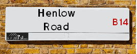
Map of Henlow Road
| Street Crime (updated 14/01/2025) | ||
|---|---|---|
| Location Note | Central Point of Street - Not Actual Location | |
| MSOA Info | For MSOA E02001948 (Statistical Neighbourhood) | |
| Click Hint | Click on a Circle for a detailed breakdown below map. | |
| Crime Levels |
Green = Very Low Yellow = Low Orange = High Red = Very High |
|
| Postcodes | ||
| Icon | Postcodes for Henlow Road | |
| Walking Distances | ||
| Distance Info | Green Circle = 10 Minutes Walk (800 metres) | |
Street Crime Data accessed from data.police.uk on 06/10/2024.
Moving to Henlow Road?
I can help you uncover potential pitfalls and provide key questions to ask about your new property. With decades of experience as a Local Land Charges Manager, I offer confidential insights to make your move informed and stress-free.
This service is free, but you may wish to make an optional donation to support it. Please include the property name and address in your request as well as anything you wish to focus on.
Contact Me
Do you know why this road is called Henlow Road?
What's it like to live here?
Share a Photo of Henlow Road
Ask the community a question.
Do you have any questions, memories to share, have any photos or know any facts? We'd love to know more.
Submit Your Comment
Find Homes to Rent in Birmingham

Budget Friendly Hotels near Henlow Road
| Budget Hotel Name | Distance (miles) |
|---|---|
|
1: Name:Travelodge Birmingham Maypole Address: Maypole Lane, Birmingham, B14 5JF Telephone: 0871 559 1896 Visit Hotel Page |
0.19 |
|
2: Name:Premier Inn Birmingham South Hall Green Address: Stratford Road Telephone: Visit Hotel Page |
2.23 |
|
3: Name:Premier Inn Solihull South M42 Address: Stratford Road Telephone: Visit Hotel Page |
3.87 |
|
4: Name:Premier Inn Solihull Town Centre Address: Station Road Telephone: Visit Hotel Page |
4.31 |
|
5: Name:Premier Inn Birmingham South Longbridge Station Address: 1 High Street Telephone: Visit Hotel Page |
4.33 |
Hotel Options
Your support helps keep this site running!
If you enjoy using this website, consider making a donation to help me cover hosting costs.
EPC (Energy Performance Certificate) Information for Henlow Road
UPRN: 100070402002
EPC Current: F
EPC Potential: B
Habitable Rooms: 5
Property Type: House
Tenure: Owner-occupied
Built Form: Semi-Detached
Age Band: 1900-1929
Mains Gas: Yes
UPRN: 100070402003
EPC Current: D
EPC Potential: B
Habitable Rooms: 5
Property Type: House
Tenure: rental (private)
Built Form: Detached
Age Band: 1983-1990
Mains Gas: Yes
UPRN: 100070402005
EPC Current: E
EPC Potential: B
Habitable Rooms: 4
Property Type: House
Tenure: Owner-occupied
Built Form: Detached
Age Band: 1930-1949
Mains Gas: Yes
UPRN: 100070402008
EPC Current: E
EPC Potential: B
Habitable Rooms: 5
Property Type: House
Tenure: Owner-occupied
Built Form: Semi-Detached
Age Band: 1930-1949
Mains Gas: Yes
UPRN: 100070402009
EPC Current: E
EPC Potential: B
Habitable Rooms: 5
Property Type: House
Tenure: Owner-occupied
Built Form: Semi-Detached
Age Band: 1930-1949
Mains Gas: Yes
UPRN: 100070402011
EPC Current: D
EPC Potential: C
Habitable Rooms: 4
Property Type: House
Tenure: Owner-occupied
Built Form: Semi-Detached
Age Band: 1930-1949
Mains Gas: Yes
UPRN: 100070402012
EPC Current: F
EPC Potential: C
Habitable Rooms: 5
Property Type: House
Tenure: Owner-occupied
Built Form: Semi-Detached
Age Band: 1930-1949
Mains Gas: Yes
UPRN: 100070402016
EPC Current: E
EPC Potential: B
Habitable Rooms: 5
Property Type: House
Tenure: Owner-occupied
Built Form: Semi-Detached
Age Band: 1900-1929
Mains Gas: Yes
UPRN: 100070402018
EPC Current: D
EPC Potential: B
Habitable Rooms: 5
Property Type: House
Tenure: Owner-occupied
Built Form: Semi-Detached
Age Band: 1930-1949
Mains Gas: Yes
UPRN: 100070402020
EPC Current: E
EPC Potential: C
Habitable Rooms: 5
Property Type: House
Tenure: Owner-occupied
Built Form: Semi-Detached
Age Band: 1930-1949
Mains Gas: Yes
UPRN: 100070402021
EPC Current: D
EPC Potential: B
Habitable Rooms: 5
Property Type: House
Tenure: rental (private)
Built Form: Semi-Detached
Age Band: 1930-1949
Mains Gas: Yes
UPRN: 100070402022
EPC Current: D
EPC Potential: B
Habitable Rooms: 6
Property Type: House
Tenure: Owner-occupied
Built Form: Semi-Detached
Age Band: 1930-1949
Mains Gas: Yes
UPRN: 100070402023
EPC Current: D
EPC Potential: B
Habitable Rooms: 5
Property Type: House
Tenure: Owner-occupied
Built Form: Semi-Detached
Age Band: 1930-1949
Mains Gas: Yes
UPRN: 100070402027
EPC Current: D
EPC Potential: C
Habitable Rooms: 5
Property Type: House
Tenure: Owner-occupied
Built Form: Semi-Detached
Age Band: 1930-1949
Mains Gas: Yes
UPRN: 100070402029
EPC Current: F
EPC Potential: B
Habitable Rooms: 3
Property Type: House
Tenure: Owner-occupied
Built Form: Semi-Detached
Age Band: 1930-1949
Mains Gas: Yes
UPRN: 100070402032
EPC Current: D
EPC Potential: B
Habitable Rooms: 4
Property Type: House
Tenure: Owner-occupied
Built Form: Semi-Detached
Age Band: 1900-1929
Mains Gas: Yes
UPRN: 100070402037
EPC Current: D
EPC Potential: B
Habitable Rooms: 5
Property Type: House
Tenure: Owner-occupied
Built Form: Semi-Detached
Age Band: 1930-1949
Mains Gas: Yes
UPRN: 100070402038
EPC Current: E
EPC Potential: B
Habitable Rooms: 4
Property Type: House
Tenure: Owner-occupied
Built Form: Semi-Detached
Age Band: 1930-1949
Mains Gas: Yes
UPRN: 100070402039
EPC Current: E
EPC Potential: C
Habitable Rooms: 5
Property Type: House
Tenure: Owner-occupied
Built Form: Semi-Detached
Age Band: 1930-1949
Mains Gas: Yes
UPRN: 100070402043
EPC Current: D
EPC Potential: B
Habitable Rooms: 5
Property Type: House
Tenure: Owner-occupied
Built Form: Semi-Detached
Age Band: 1930-1949
Mains Gas: Yes
UPRN: 100070402045
EPC Current: D
EPC Potential: B
Habitable Rooms: 4
Property Type: House
Tenure: Owner-occupied
Built Form: Semi-Detached
Age Band: 1930-1949
Mains Gas: Yes
UPRN: 100070402046
EPC Current: D
EPC Potential: B
Habitable Rooms: 5
Property Type: House
Tenure: Owner-occupied
Built Form: Mid-Terrace
Age Band: 1930-1949
Mains Gas: Yes
UPRN: 100070402047
EPC Current: D
EPC Potential: C
Habitable Rooms: 6
Property Type: Bungalow
Tenure: Owner-occupied
Built Form: Detached
Age Band: 1930-1949
Mains Gas: Yes
UPRN: 100070402050
EPC Current: F
EPC Potential: B
Habitable Rooms: 5
Property Type: House
Tenure: Owner-occupied
Built Form: Semi-Detached
Age Band: 1930-1949
Mains Gas: Yes
UPRN: 100070402051
EPC Current: E
EPC Potential: C
Habitable Rooms: 5
Property Type: House
Tenure: rental (private)
Built Form: Semi-Detached
Age Band: 1900-1929
Mains Gas: Yes
UPRN: 100070402054
EPC Current: D
EPC Potential: B
Habitable Rooms: 4
Property Type: House
Tenure: Owner-occupied
Built Form: Semi-Detached
Age Band: 1930-1949
Mains Gas: Yes
UPRN: 100070402055
EPC Current: D
EPC Potential: D
Habitable Rooms: 5
Property Type: House
Tenure: rental (private)
Built Form: Semi-Detached
Age Band: 1950-1966
Mains Gas: Yes
UPRN: 100070402056
EPC Current: D
EPC Potential: B
Habitable Rooms: 5
Property Type: House
Tenure: rental (private)
Built Form: Mid-Terrace
Age Band: 1930-1949
Mains Gas: Yes
UPRN: 100070402058
EPC Current: C
EPC Potential: B
Habitable Rooms: 4
Property Type: House
Tenure: Owner-occupied
Built Form: Mid-Terrace
Age Band: 1930-1949
Mains Gas: Yes
UPRN: 100070402060
EPC Current: D
EPC Potential: D
Habitable Rooms: 5
Property Type: House
Tenure: rental (private)
Built Form: End-Terrace
Age Band: 1930-1949
Mains Gas: Yes
UPRN: 10024330612
EPC Current: C
EPC Potential: B
Habitable Rooms: 4
Property Type: House
Tenure: rental (private)
Built Form: Detached
Age Band: 2007 onwards
Mains Gas: Yes
UPRN: 100070402062
EPC Current: D
EPC Potential: B
Habitable Rooms: 5
Property Type: House
Tenure: Owner-occupied
Built Form: End-Terrace
Age Band: 1930-1949
Mains Gas: Yes
UPRN: 100070402063
EPC Current: E
EPC Potential: B
Habitable Rooms: 6
Property Type: House
Tenure: Owner-occupied
Built Form: Semi-Detached
Age Band: 1996-2002
Mains Gas: No
UPRN: 100070402064
EPC Current: D
EPC Potential: B
Habitable Rooms: 5
Property Type: House
Tenure: Owner-occupied
Built Form: Mid-Terrace
Age Band: 1930-1949
Mains Gas: Yes
UPRN: 100070402067
EPC Current: D
EPC Potential: B
Habitable Rooms: 5
Property Type: House
Tenure: rental (private)
Built Form: Mid-Terrace
Age Band: 1900-1929
Mains Gas: Yes
UPRN: 100070402068
EPC Current: E
EPC Potential: B
Habitable Rooms: 5
Property Type: House
Tenure: Owner-occupied
Built Form: End-Terrace
Age Band: 1930-1949
Mains Gas: Yes
UPRN: 100070402070
EPC Current: D
EPC Potential: B
Habitable Rooms: 5
Property Type: House
Tenure: Owner-occupied
Built Form: End-Terrace
Age Band: 1930-1949
Mains Gas: Yes
UPRN: 100070402071
EPC Current: E
EPC Potential: B
Habitable Rooms: 4
Property Type: House
Tenure: Owner-occupied
Built Form: End-Terrace
Age Band: 1930-1949
Mains Gas: Yes
UPRN: 100070402073
EPC Current: D
EPC Potential: B
Habitable Rooms: 5
Property Type: House
Tenure: Owner-occupied
Built Form: Semi-Detached
Age Band: 1930-1949
Mains Gas: Yes
UPRN: 100070402081
EPC Current: D
EPC Potential: B
Habitable Rooms: 5
Property Type: House
Tenure: Rented (private)
Built Form: Mid-Terrace
Age Band: 1900-1929
Mains Gas: Yes
UPRN: 100070402084
EPC Current: D
EPC Potential: B
Habitable Rooms: 5
Property Type: House
Tenure: Owner-occupied
Built Form: Mid-Terrace
Age Band: 1930-1949
Mains Gas: Yes
UPRN: 100070402089
EPC Current: D
EPC Potential: B
Habitable Rooms: 4
Property Type: House
Tenure: Owner-occupied
Built Form: End-Terrace
Age Band: 1930-1949
Mains Gas: Yes
UPRN: 100070402090
EPC Current: D
EPC Potential: D
Habitable Rooms: 5
Property Type: House
Tenure: Owner-occupied
Built Form: End-Terrace
Age Band: 1930-1949
Mains Gas: Yes
UPRN: 100070402093
EPC Current: E
EPC Potential: B
Habitable Rooms: 5
Property Type: House
Tenure: Owner-occupied
Built Form: Mid-Terrace
Age Band: 1930-1949
Mains Gas: Yes
UPRN: 100070402094
EPC Current: D
EPC Potential: B
Habitable Rooms: 5
Property Type: House
Tenure: Owner-occupied
Built Form: Mid-Terrace
Age Band: 1900-1929
Mains Gas: Yes
UPRN: 100070402095
EPC Current: D
EPC Potential: B
Habitable Rooms: 5
Property Type: House
Tenure: Owner-occupied
Built Form: Mid-Terrace
Age Band: 1930-1949
Mains Gas: Yes
UPRN: 100070402098
EPC Current: D
EPC Potential: C
Habitable Rooms: 5
Property Type: House
Tenure: Owner-occupied
Built Form: Semi-Detached
Age Band: 1930-1949
Mains Gas: Yes
UPRN: 100070402102
EPC Current: D
EPC Potential: B
Habitable Rooms: 4
Property Type: House
Tenure: Owner-occupied
Built Form: Mid-Terrace
Age Band: 1930-1949
Mains Gas: Yes
UPRN: 100070402104
EPC Current: D
EPC Potential: D
Habitable Rooms: 5
Property Type: House
Tenure: Owner-occupied
Built Form: Mid-Terrace
Age Band: 1930-1949
Mains Gas: Yes
UPRN: 100070402105
EPC Current: D
EPC Potential: B
Habitable Rooms: 5
Property Type: House
Tenure: Owner-occupied
Built Form: End-Terrace
Age Band: 1930-1949
Mains Gas: Yes
UPRN: 100070402106
EPC Current: D
EPC Potential: C
Habitable Rooms: 5
Property Type: House
Tenure: Owner-occupied
Built Form: Semi-Detached
Age Band: 1900-1929
Mains Gas: Yes
House Sales
| Year | High | Low | Average | Sales |
|---|---|---|---|---|
| 2014 | £122,950 | £122,950 | £122,950 | 1 |
| 2015 | £149,950 | £135,000 | £141,650 | 3 |
| 2016 | £148,500 | £210,000 | £174,500 | 3 |
| 2017 | £180,450 | £175,000 | £177,725 | 2 |
| 2018 | £177,000 | £225,000 | £189,238 | 4 |
| 2019 | £210,000 | £225,000 | £217,500 | 2 |
| 2020 | £132,000 | £200,000 | £166,000 | 2 |
| 2021 | £246,500 | £235,000 | £220,500 | 3 |
| 2022 | £193,000 | £240,000 | £230,250 | 8 |
| 2023 | £263,000 | £250,000 | £227,667 | 3 |
Contains HM Land Registry data © Crown copyright and database right 2025. This data is licensed under the Open Government Licence v3.0.
Nearby Estate Agents
| Name | Address | Website |
|---|---|---|
| Leaders Sales | 234/236 Sladepool Farm Road, Maypole Birmingham, B14 5EE | Visit Website |
| Kelly Homes | 7 Drakes Cross Parade, Alcester Road, Wythall, B47 5HD | Visit Website |
| Kelly Homes | 7 Drakes Cross Parade, Alcester Road, Wythall, Birmingham, B47 5HD | Visit Website |
| Melvyn Danes | 321 Alcester Road, Wythall, Birmingham, B47 5HJ | Visit Website |
| Spectra Property Services | 281 Vicarage Road, Kings Heath, Birmingham, B14 7NE | Visit Website |
Neighbourhood Policing |
| Police Force: West Midlands |
 View Neighbourhood Crime and Policing View Neighbourhood Crime and Policing |
| Find a Local Neighbourhood Watch Scheme |
Location Details
| Henlow Road | |
|---|---|

| |
| Latitude | 52.407284 |
| Longitude | -1.883706 |
| OS Easting (X): | 407910 |
| OS Northing (Y): | 278856 |
| OS Grid Reference: | SP079789 |
Known Residential Addresses for Henlow Road
- 58
- 6
- 75
- 116
- 84
- 76
- 56
- 42
- 68
- 54
- 26
- 10
- 63
- 25
- 67
- 113
- 87
- 102
- 88
- 27
- 73
- 57
- 123
- 107
- 93
- 111
Roads that have a Junction with Henlow Road
| Street | Junction Type |
|---|---|
| Maypole Lane | junction |
| Myrtle Avenue | junction |
| Stot Fold Road | junction |
| Hawkhurst Road | junction |
| Nuthurst Grove | junction |
| Sladepool Farm Road | junction |
Sunset and Sunrise times
| Sunrise | 07:55 |
|---|---|
| Sunset | 16:45 |
Latest Weather Conditions
| Observed at Weather Station: | Coleshill 26 January 2025 at 05:00 (9.62 miles away) |
|---|---|
| Current Weather: | Overcast |
| Temperature and Humidity: | 3.1°C (91.1%) |
| Wind Direction and Speed: | S (8 mph) |
Population Statistics
| ONS Area Code | E00045359, E00045361 & E00045365 |
|---|---|
| ONS Area Name | Private Renting Young Families, Industrious Transitions & Older Workers and Retirement |
| Average Age | 38.47 & 43.69 |
| Area Population | 1392.00 & 1459.00 |
| Male Population | 678.00 & 707.00 (49%) |
| Female Population | 714.00 & 752.00 (51%) |
| Benefit Claimants | 22 & 23 (2%) |
| LSOA Code: | E01008947 &E01008948 |
|---|---|
| LSOA Name: | Birmingham 122C &Birmingham 122D |
| SOA Code: | 3d &5b |
| SOA Name: | |
| MSOA Code: | E02001948 |
| MSOA Name: | Birmingham 122 |
Nearest Supermarkets
| Iceland Maypole Birmingham |
|---|
| 949 Alcester Road South, Maypole, Birmingham, B14 5JA |
| 01214302285 |
| Distance: 0.15 Miles |
| Directions to Iceland Maypole Birmingham |
| Sainsburys Maypole |
|---|
| 1059-1061 Alcester Road South, Birmingham, England, B14 5TN |
| 0121 474 3102 |
| Distance: 0.21 Miles |
| Directions to Sainsburys Maypole |
| Tesco Birmingham Alcester Express |
|---|
| 71 Alcester Rd, Hollywood, Birmingham, B47 5PN |
| 0345 671 9620 |
| Distance: 0.73 Miles |
| Directions to Tesco Birmingham Alcester Express |
| Tesco Kings Heath Express |
|---|
| 281-289 Alcester Rd South, Birmingham, B14 6EB |
| 0345 674 6533 |
| Distance: 1.02 Miles |
| Directions to Tesco Kings Heath Express |
Telephone Information
| Area Code |
|---|
| Area Code: 0121 - Birmingham |
| Area Code: 01564 - Lapworth |
| Area Code: 01527 - Redditch |
Broadband Information
| Speed | Average Speed | Median Speed | Maximum Speed | Next-generation access (NGA) | Number of Connections |
|---|---|---|---|---|---|
| Greater than 2 Mbps | >=30 | 22.4 | >=30 | Y | 19 |
Local Government
| Local Council Details |
|---|
| Within the area of Birmingham |
| Visit the Council's Website |
| Council House, Victoria Square, Birmingham &B1 1BB |
| Send email |
| Telephone Number: 0121 303 1111 |
| Local Member of Parliament |
|---|
| Within the Westminster Parliamentary Constituency of Birmingham &Selly Oak |
| The Member of Parliament is Alistair Carns |
| Details for the MP Alistair Carns on parliament.uk |
| Details for the MP Alistair Carns on theyworkforyou.com |
| In the 2024 General Election Alistair Carns won with a majority of 11,537 the result was Lab hold. The total electorate was 75,678 |
| Wards, Parish Councils and County Councils |
|---|
| Ward: Highter's Heath Ward |
| Parish: Unparished area |
| Ceremonial County: West Midlands |
Nearest Schools
England Primary Schools
Yardley Wood Community Primary School
Address: Yardley Wood Community Primary School, School Road, Yardley Wood, Birmingham, West Midlands, B14 4ER
Distance: 1.07 miles
Contact: 01216752456
Highters Heath Community School
Address: Highters Heath Community School, Highters Heath Lane, Kings Heath, Birmingham, West Midlands, B14 4LY
Distance: 0.52 miles
Contact:
Hollywood Primary School
Address: Hollywood Primary School, Pickenham Road, Hollywood, Birmingham, West Midlands, B14 4TG
Distance: 0.39 miles
Contact:
Grendon Primary School
Address: Grendon Primary School, Grendon Road, Kings Heath, Birmingham, West Midlands, B14 4RB
Distance: 0.38 miles
Contact: 01214742460
Colmore Infant and Nursery School
Address: Colmore Infant and Nursery School, Colmore Road, Kings Heath, Birmingham, West Midlands, B14 6AJ
Distance: 1.53 miles
Contact: 01214642820
Colmore Junior School
Address: Colmore Junior School, Colmore Road, Kings Heath, Birmingham, West Midlands, B14 6AJ
Distance: 1.53 miles
Contact: 01214642843
Woodthorpe Junior and Infant School
Address: Woodthorpe Junior and Infant School, Greenwood Close, Kings Heath, Birmingham, West Midlands, B14 6ET
Distance: 1.00 miles
Contact: 01214645203
St Alban's Catholic Primary School
Address: St Alban's Catholic Primary School, Broad Lane, Kings Heath, Birmingham, West Midlands, B14 5AL
Distance: 0.61 miles
Contact: 01214446530
The Oaks Primary School
Address: The Oaks Primary School, Bells Lane, Druids Heath, Birmingham, West Midlands, B14 5RY
Distance: 0.76 miles
Contact:
Bells Farm Primary School
Address: Bells Farm Primary School, Bells Farm Close, Druids Heath, Birmingham, West Midlands, B14 5QP
Distance: 0.99 miles
Contact: 01216758666
Broadmeadow Infant School
Address: Broadmeadow Infant School, Monyhull Hall Road, Kings Norton, Birmingham, West Midlands, B30 3QJ
Distance: 1.11 miles
Contact: 01214644266
Broadmeadow Junior School
Address: Broadmeadow Junior School, Monyhull Hall Road, Kings Norton, Birmingham, West Midlands, B30 3QJ
Distance: 1.11 miles
Contact: 01214641717
Burman Infant School
Address: Burman Infant School, Velsheda Road, Shirley, Solihull, West Midlands, B90 2JW
Distance: 1.94 miles
Contact: 01217441843
Mill Lodge Primary School
Address: Mill Lodge Primary School, Aqueduct Road, Shirley, Solihull, West Midlands, B90 1BT
Distance: 1.35 miles
Contact: 01214303010
Peterbrook Primary School
Address: Peterbrook Primary School, High Street, Solihull Lodge, Shirley, Solihull, West Midlands, B90 1HR
Distance: 1.10 miles
Contact: 01214302545
Coppice Primary School
Address: Coppice Primary School, Shawhurst Lane, Hollywood, Birmingham, West Midlands, B47 5JN
Distance: 1.21 miles
Contact: 01564826709
Wheelers Lane Primary School
Address: Wheelers Lane Primary School, Wheelers Lane, Kings Heath, Birmingham, West Midlands, B13 0SF
Distance: 1.43 miles
Contact: 01214642551
Meadow Green Primary School
Address: Meadow Green Primary School, Meadow Road, Wythall, Birmingham, West Midlands, B47 6EQ
Distance: 2.18 miles
Contact: 01564823495
St Jude's Catholic Primary School
Address: St Jude's Catholic Primary School, St Jude's Close, Maypole, Birmingham, West Midlands, B14 5PD
Distance: 0.26 miles
Contact: 01214645069
England Secondary Schools
Kings Heath Boys
Address: Kings Heath Boys, Chamberlain Road, Kings Heath, Birmingham, West Midlands, B13 0QP
Distance: 1.14 miles
Contact: 01214644454
Wheelers Lane Technology College
Address: Wheelers Lane Technology College, Wheelers Lane, Kings Heath, Birmingham, West Midlands, B13 0SF
Distance: 1.43 miles
Contact: 01214442864
Woodrush High School
Address: Woodrush High School, Shawhurst Lane, Wythall, Worcestershire, B47 5JW
Distance: 1.33 miles
Contact: 01564823777
Nearest Hospitals
| Grove Avenue |
|---|
| Address: 32 Grove Avenue, Moseley, Birmingham, |
| NHS Sector |
| Birmingham and Solihull Mental Health NHS Foundation Trust |
| Telephone: 0121 678 4004 |
| Visit Hospital Website |
| Distance: 3.78 (miles) |
| Directions from to Grove Avenue |
| Juniper Centre |
|---|
| Address: Moseley Hall Hospital site, Alcester Road, Moseley, Birmingham, |
| NHS Sector |
| Birmingham and Solihull Mental Health NHS Foundation Trust |
| Telephone: 0121 301 5700 |
| Visit Hospital Website |
| Distance: 4.34 (miles) |
| Directions from to Juniper Centre |
| Moseley Hall Hospital |
|---|
| Address: Alcester Road, Birmingham, |
| NHS Sector |
| Birmingham Community Healthcare NHS Foundation Trust |
| Telephone: 0121 466 6000 |
| Visit Hospital Website |
| Distance: 4.34 (miles) |
| Directions from to Moseley Hall Hospital |
Nearest Dentists
Dentists
DENTAL SURGERY
Address: 1032 ALCESTER ROAD SOUTH, BIRMINGHAM, WEST MIDLANDS, B14 5NG
Distance: 0.21 miles
Contact: :
DENTAL SURGERY
Address: 159 PRINCE OF WALES LANE, BIRMINGHAM, WEST MIDLANDS, B14 4LR
Distance: 0.64 miles
Contact: :
DENTAL SURGERY
Address: 262 ALCESTER ROAD SOUTH, BIRMINGHAM, WEST MIDLANDS, B14 6DR
Distance: 1.13 miles
Contact: :
DENTAL SURGERY
Address: 145 BELLS LANE, BIRMINGHAM, WEST MIDLANDS, B14 5QJ
Distance: 1.19 miles
Contact: :
DENTAL SURGERY
Address: 31 LIVINGSTONE ROAD, KINGS HEATH, BIRMINGHAM, WEST MIDLANDS, B14 6DJ
Distance: 1.25 miles
Contact: :
MIDLANDS SMILE CENTRES
Address: 306 VICARAGE ROAD, KINGS HEATH, BIRMINGHAM, B14 7NH
Distance: 1.71 miles
Contact: :
Nearest GP Surgeries
Doctors
MAYPOLE HEALTH SURGERY Y
Address: 10 SLADEPOOL FARM ROAD, KINGS HEATH, BIRMINGHAM, WEST MIDLANDS, B14 5DJ
Distance: 0.17 miles
Contact: tel: 0121 4302829
MAYPOLE HEALTH CENTRE A
Address: 10 SLADEPOOL FARM ROAD, KINGS HEATH, BIRMINGHAM, WEST MIDLANDS, B14 5DJ
Distance: 0.17 miles
Contact: :
GRAFTON ROAD SURGERY
Address: 11 GRAFTON ROAD, SHIRLEY, SOLIHULL, WEST MIDLANDS, B90 1NG
Distance: 0.64 miles
Contact: tel: 0121 4744686
DRUIDS HEATH SURGERY
Address: 27 POUND ROAD, DRUIDS HEATH, BIRMINGHAM, WEST MIDLANDS, B14 5SB
Distance: 0.65 miles
Contact: tel: 0121 4305461
KEYNELL COVERT
Address: 33 KEYNELL COVERT, KINGS NORTON, BIRMINGHAM, WEST MIDLANDS, B30 3QT
Distance: 1.19 miles
Contact: tel: 0121 4582619
KEYNELL COVERT
Address: KINGS NORTON, BIRMINGHAM, WEST MIDLANDS, B30 3QT
Distance: 1.19 miles
Contact: :
Nearest Dispensing Chemists
Pharmacies
BOOTS
Address: 1005 ALCESTER ROAD SOUTH, MAYPOLE, BIRMINGHAM, WEST MIDLANDS, B14 5JA
Distance: 0.17 miles
Contact: tel: 0121 4305155
WHITES PHARMACY
Address: 788 ALCESTER ROAD SOUTH, KINGS HEATH, BIRMINGHAM, WEST MIDLANDS, B14 5EZ
Distance: 0.31 miles
Contact: tel: 0121 4305435
PRINCE OF WALES PHARMACY
Address: 161 PRINCE OF WALES LANE, WARSTOCK, BIRMINGHAM, B14 4LR
Distance: 0.64 miles
Contact: tel: 01214 742581
DRUIDS HEATH PHARMACY
Address: DRUIDS HEATH POST OFFICE, 17 POUND ROAD, KINGS HEATH, BIRMINGHAM, WEST MIDLANDS, B14 5SB
Distance: 0.65 miles
Contact: tel: 0121 4305535
BROWNS PHARMACY
Address: 1054 YARDLEY WOOD ROAD, WARSTOCK, BIRMINGHAM, B14 4BW
Distance: 0.77 miles
Contact: tel: 0121 4742048
BOOTS
Address: 137 MONYHULL HALL ROAD, KINGS NORTON, BIRMINGHAM, WEST MIDLANDS, B30 3QG
Distance: 1.07 miles
Contact: tel: 0121 4582756
Nearest Opticians
Opticians
PENZER OPTICIANS
Address: 1024 ALCESTER ROAD SOUTH, MAYPOLE, BIRMINGHAM, WEST MIDLANDS, B14 5NG
Distance: 0.21 miles
Contact: :
KINGS OPTICIANS (MAYPOLE)
Address: 786 ALCESTER ROAD SOUTH, BIRMINGHAM, WEST MIDLANDS, B14 5EZ
Distance: 0.31 miles
Contact: :
VINCENT ROBERTS OPTOMETRISTS
Address: 267 ALCESTER ROAD SOUTH, KINGSHEATH, BIRMINGHAM, WEST MIDLANDS, B14 6EP
Distance: 0.64 miles
Contact: :
SCHOOL ROAD OPTICIANS
Address: 22 SCHOOL ROAD, YARDLEY WOOD, BIRMINGHAM, WEST MIDLANDS, B14 4BJ
Distance: 0.70 miles
Contact: :
VISION FIRST OPTICIANS (SHIRLEY)
Address: 5 OXHILL ROAD, SHIRLEY, SOLIHULL, WEST MIDLANDS, B90 1LR
Distance: 0.94 miles
Contact: :
MIDLAND PRIMARY EYECARE LTD
Address: 3 STACEY DRIVE, BIRMINGHAM, B13 0QT
Distance: 1.05 miles
Contact: :
Transport
Nearest Rail Stations
Yardley Wood Station is 1.58 miles away.
Address: Yardley Wood station, Highfield Road, Yardley Wood, West Midlands, B28 0BY
Yardley Wood is situated on the North Warwickshire (Shakespeare Line) Line.
Yardley Wood Station is staffed on a part time basis.
Shirley Station is 1.65 miles away.
Address: Shirley station, Haslucks Green Road, Shirley, West Midlands, B90 2NE
Shirley is situated on the North Warwickshire (Shakespeare Line) Line.
Shirley Station is staffed on a part time basis.