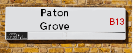
Paton Grove in the city of BIRMINGHAM in Moseley
About Paton Grove
Paton Grove is a street located in the city of Birmingham. It uses the postcode B13 9TG. The street has a length of approximately 185 metres.
The street is publicly maintained which means that the road is adopted and Birmingham is responsible for the repair and upkeep of the highway.
The street is located within the Birmingham District (B) Council's jurisdiction. They provide various services, like refuse collection, and manage council tax collection. It's situated in the West Midlands region of the UK.
The road has been assigned the Unique Street Reference Number of 2703480 in the National Street Gazetteer.
It is located within the county of West Midlands, situated in the West Midlands region of the UK. It's 100.03 miles North West from central London., 2.65 miles South from Birmingham, 16.15 miles West from Coventry and 22.25 miles North East from Worcester.
PATON GROVE is within the Post Town of BIRMINGHAM

Do you know why this road is called Paton Grove?
What's it like to live here?
Ask the community a question.
Do you have any questions, memories to share or know any facts? We'd love to know more.
Map of Paton Grove
| Street Crime (updated 02/11/2024) | ||
|---|---|---|
| Location Note | Central Point of Street - Not Actual Location | |
| MSOA Info | For MSOA E02001918 (Statistical Neighbourhood) | |
| Click Hint | Click on a Circle for a detailed breakdown below map. | |
| Crime Levels |
Green = Very Low Yellow = Low Orange = High Red = Very High |
|
| Postcodes | ||
| Icon | Postcodes for Paton Grove | |
| Walking Distances | ||
| Distance Info | Green Circle = 10 Minutes Walk (800 metres) | |
Street Crime Data accessed from data.police.uk on 06/10/2024.
Budget Friendly Hotels near Paton Grove
| Budget Hotel Name | Distance (miles) |
|---|---|
|
1: Name:ibis budget Birmingham Centre Address: Great Colmore Street Telephone: Visit Hotel Page |
2.12 |
|
2: Name:Travelodge Birmingham Central Bull Ring Address: Upper Dean St, Birmingham, B5 4SG Telephone: 0871 984 6468 Visit Hotel Page |
2.32 |
|
3: Name:easyHotel Birmingham Address: 81 John Bright Street Telephone: Visit Hotel Page |
2.50 |
|
4: Name:Premier Inn Birmingham South Hall Green Address: Stratford Road Telephone: Visit Hotel Page |
2.50 |
|
5: Name:Travelodge Birmingham Maypole Address: Maypole Lane, Birmingham, B14 5JF Telephone: 0871 559 1896 Visit Hotel Page |
2.55 |
Your support helps keep this site running!
If you enjoy using this website, consider buying me a coffee to help cover hosting costs.
House Sales
| Year | High | Low | Average | Sales |
|---|---|---|---|---|
| 2015 | £185,000 | £180,000 | £184,000 | 3 |
| 2016 | £218,000 | £230,000 | £224,000 | 2 |
| 2017 | £232,159 | £272,000 | £252,080 | 2 |
| 2018 | £225,000 | £225,000 | £225,000 | 1 |
| 2019 | £226,000 | £226,000 | £226,000 | 1 |
| 2020 | £280,000 | £260,000 | £270,000 | 2 |
| 2021 | £285,000 | £280,000 | £282,500 | 2 |
| 2022 | £305,000 | £305,000 | £305,000 | 1 |
| 2023 | £275,000 | £271,000 | £278,493 | 4 |
Contains HM Land Registry data © Crown copyright and database right 2024. This data is licensed under the Open Government Licence v3.0.
Nearby Estate Agents
| Name | Address | Website |
|---|---|---|
| Nicholas George Ltd | 86 St. Marys Row, Moseley, Birmingham, B13 9EF | Visit Website |
| OpenRent | St. Marys Row, Moseley, Birmingham, B13 8HW | |
| Rice Chamberlains LLP | 27/29 St Marys Row, Moseley, Birmingham, B13 8HW | Visit Website |
| Glovers Estate Agents | 33 High Street, Kings Heath, Birmingham, B14 7BB | Visit Website |
| Dixons | 95 Alcester Road, Birmingham, West Midlands, B13 8DD |
We have found 1 postcode
Neighbourhood Policing |
| Police Force: West Midlands |
 View Neighbourhood Crime and Policing View Neighbourhood Crime and Policing |
| Find a Local Neighbourhood Watch Scheme |
Location Details
| Paton Grove | |
|---|---|

| |
| Latitude | 52.441894 |
| Longitude | -1.887267 |
| OS Easting (X): | 407662 |
| OS Northing (Y): | 282705 |
| OS Grid Reference: | SP077827 |
Roads that have a Junction with Paton Grove
| Street | Junction Type |
|---|---|
| School Road | junction |
Sunset and Sunrise times
| Sunrise | 07:38 |
|---|---|
| Sunset | 16:08 |
Latest Weather Conditions
| Observed at Weather Station: | Coleshill 21 November 2024 at 23:00 (8.75 miles away) |
|---|---|
| Current Weather: | Clear night |
| Temperature and Humidity: | 0.5°C (84.4%) |
| Wind Direction and Speed: | SW (5 mph) |
Population Statistics
| ONS Area Code | E00046581 |
|---|---|
| ONS Area Name | Achieving Minorities |
| Average Age | 40.79 |
| Area Population | 1572.00 |
| Male Population | 786.00 (50%) |
| Female Population | 786.00 (50%) |
| Benefit Claimants | 33 (2%) |
| LSOA Code: | E01009187 |
|---|---|
| LSOA Name: | Birmingham 092C |
| SOA Code: | 3c |
| SOA Name: | |
| MSOA Code: | E02001918 |
| MSOA Name: | Birmingham 092 |
Nearest Supermarkets
| Sainsburys Alcester Road Local |
|---|
| 158-162 Alcester Road, Birmingham, England, B13 8HS |
| 1214496499 |
| Distance: 0.39 Miles |
| Directions to Sainsburys Alcester Road Local |
| Asda Kings Heath |
|---|
| 99 High Street, Kings Heath, Birmingham, B14 7BW |
| 0121 483 4410 |
| Distance: 0.5 Miles |
| Directions to Asda Kings Heath |
| Iceland Kings Heath |
|---|
| Unit 10 Institutes Road, Kings Heath, Birmingham, B14 7EG |
| 01214441862 |
| Distance: 0.58 Miles |
| Directions to Iceland Kings Heath |
| Sainsburys Kings Heath |
|---|
| 38-54 Alcester Road South, Birmingham, England, B14 7PT |
| 0121 444 3251 |
| Distance: 0.78 Miles |
| Directions to Sainsburys Kings Heath |
Telephone Information
| Area Code |
|---|
| Area Code: 0121 - Birmingham |
| Area Code: 01675 - Coleshill |
| Area Code: 01564 - Lapworth |
Broadband Information
| Speed | Average Speed | Median Speed | Maximum Speed | Next-generation access (NGA) | Number of Connections |
|---|---|---|---|---|---|
| Less than 2 Mbps | 21.3 | 18.4 | >=30 | Y | 33 |
Local Government
| Local Council Details |
|---|
| Within the area of Birmingham |
| Visit the Council's Website |
| Council House, Victoria Square, Birmingham &B1 1BB |
| Send email |
| Telephone Number: 0121 303 1111 |
| Local Member of Parliament |
|---|
| Within the Westminster Parliamentary Constituency of Birmingham &Hall Green |
| The Member of Parliament is Tahir Ali |
| Details for the MP Tahir Ali on parliament.uk |
| Details for the MP Tahir Ali on theyworkforyou.com |
| In the 2024 General Election Tahir Ali won with a majority of 5,656 the result was Lab hold. The total electorate was 76,936 |
| Wards, Parish Councils and County Councils |
|---|
| Ward: Moseley Ward |
| Parish: Unparished area |
| Ceremonial County: West Midlands |
Nearest Schools
England Primary Schools
English Martyrs' Catholic Primary School
Address: English Martyrs' Catholic Primary School, Evelyn Road, Sparkhill, English Martyrs Rc Junior & Infant School, Birmingham, West Midlands, B11 3JW
Distance: 1.18 miles
Contact: 01214643150
St Bernard's Catholic Primary School
Address: St Bernard's Catholic Primary School, Wake Green Road, Moseley, Birmingham, West Midlands, B13 9QE
Distance: 1.07 miles
Contact: 01214643795
Anderton Park Primary School
Address: Anderton Park Primary School, Dennis Road, Sparkhill, Birmingham, West Midlands, B12 8BL
Distance: 0.81 miles
Contact: 01214641581
St John and Monica Catholic Primary School
Address: St John and Monica Catholic Primary School, Chantry Road, Moseley, Birmingham, West Midlands, B13 8DW
Distance: 0.67 miles
Contact: 01214645868
St Martin de Porres Catholic Primary School
Address: St Martin de Porres Catholic Primary School, Oakland Road, Moseley, Birmingham, West Midlands, B13 9DN
Distance: 0.49 miles
Contact: 01214645500
Moseley Church of England Primary School
Address: Moseley Church of England Primary School, Oxford Road, Moseley, Birmingham, West Midlands, B13 9EH
Distance: 0.20 miles
Contact: 01214490441
Nelson Mandela School
Address: Nelson Mandela School, Colville Road, Sparkbrook, Nelson Mandela Community School, Birmingham, West Midlands, B12 8EH
Distance: 1.16 miles
Contact: 01217723055
King David Primary School
Address: King David Primary School, Alcester Road, Moseley, Birmingham, West Midlands, B13 8EY
Distance: 0.23 miles
Contact: 01214493364
St Dunstan's Catholic Primary School
Address: St Dunstan's Catholic Primary School, Drayton Road, Kings Heath, Birmingham, West Midlands, B14 7LP
Distance: 0.69 miles
Contact: 01214644648
Park Hill Primary School
Address: Park Hill Primary School, Alcester Road, Birmingham, West Midlands, B13 8BB
Distance: 0.67 miles
Contact: 01214493004
Ark Tindal Primary Academy
Address: Ark Tindal Primary Academy, Tindal Street, Balsall Heath, Birmingham, West Midlands, B12 9QS
Distance: 0.95 miles
Contact: 01214643049
St John's CofE Primary School
Address: St John's CofE Primary School, Stratford Road, Sparkhill, Birmingham, West Midlands, B11 4EA
Distance: 1.10 miles
Contact: 01216751469
Springfield Primary Academy
Address: Springfield Primary Academy, Springfield Road, Moseley, Birmingham, West Midlands, B13 9NY
Distance: 1.18 miles
Contact: 01214643618
Springfield Primary School
Address: Springfield Primary School, Springfield Road, Moseley, Birmingham, West Midlands, B13 9NY
Distance: 1.18 miles
Contact:
Clifton Primary School
Address: Clifton Primary School, Brunswick Road, Balsall Heath, Birmingham, West Midlands, B12 8NX
Distance: 1.08 miles
Contact: 01214642926
Kings Heath Primary School
Address: Kings Heath Primary School, Valentine Road, Kings Heath, Birmingham, West Midlands, B14 7AJ
Distance: 0.30 miles
Contact: 01214649202
England Secondary Schools
Moseley School and Sixth Form
Address: Moseley School and Sixth Form, Wake Green Road, Moseley, Birmingham, West Midlands, B13 9UU
Distance: 0.99 miles
Contact: 01215666444
Queensbridge School
Address: Queensbridge School, Queensbridge Road, Moseley, Birmingham, West Midlands, B13 8QB
Distance: 0.40 miles
Contact: 01214645566
Bishop Challoner Catholic College
Address: Bishop Challoner Catholic College, Institute Road, Kings Heath, Birmingham, West Midlands, B14 7EG
Distance: 0.58 miles
Contact: 01214444161
Nearest Hospitals
| Grove Avenue |
|---|
| Address: 32 Grove Avenue, Moseley, Birmingham, |
| NHS Sector |
| Birmingham and Solihull Mental Health NHS Foundation Trust |
| Telephone: 0121 678 4004 |
| Visit Hospital Website |
| Distance: 0.25 (miles) |
| Directions from to Grove Avenue |
| Juniper Centre |
|---|
| Address: Moseley Hall Hospital site, Alcester Road, Moseley, Birmingham, |
| NHS Sector |
| Birmingham and Solihull Mental Health NHS Foundation Trust |
| Telephone: 0121 301 5700 |
| Visit Hospital Website |
| Distance: 0.59 (miles) |
| Directions from to Juniper Centre |
| Moseley Hall Hospital |
|---|
| Address: Alcester Road, Birmingham, |
| NHS Sector |
| Birmingham Community Healthcare NHS Foundation Trust |
| Telephone: 0121 466 6000 |
| Visit Hospital Website |
| Distance: 0.59 (miles) |
| Directions from to Moseley Hall Hospital |
Nearest Dentists
Dentists
DENTAL SURGERY
Address: 9 SALISBURY ROAD, MOSELEY, BIRMINGHAM, WEST MIDLANDS, B13 8JS
Distance: 0.33 miles
Contact: :
MANGO TREE DENTAL
Address: 11 WAKE GREEN ROAD, BIRMINGHAM, B13 9HB
Distance: 0.33 miles
Contact: :
JAMES HULL DENTAL CARE
Address: 108 HIGH STREET, KINGS HEATH, BIRMINGHAM, WEST MIDLANDS, B14 7LG
Distance: 0.60 miles
Contact: :
DENTAL SURGERY
Address: 3 CROMER ROAD, BIRMINGHAM, WEST MIDLANDS, B12 9QP
Distance: 0.92 miles
Contact: :
DENTAL SURGERY
Address: 286 LADYPOOL ROAD, BIRMINGHAM, WEST MIDLANDS, B12 8JU
Distance: 1.02 miles
Contact: :
S. BIRMINGHAM COMMUNITY HEALTH
Address: BALSALL HEATH HEALTH CENTRE, 43 EDWARD ROAD, BIRMINGHAM, WEST MIDLANDS, B12 9LP
Distance: 1.07 miles
Contact: :
Nearest GP Surgeries
Doctors
DR ABDEL-MALEK
Address: 119 SCHOOL ROAD, MOSELEY, BIRMINGHAM, WEST MIDLANDS, B13 9TX
Distance: 0.30 miles
Contact: tel: 01217530615
MOSELEY MEDICAL CENTRE
Address: 21 SALISBURY ROAD, MOSELEY, BIRMINGHAM, WEST MIDLANDS, B13 8JS
Distance: 0.33 miles
Contact: tel: 0121 4490122
WAKE GREEN SURGERY
Address: 7 WAKE GREEN ROAD, MOSELEY, BIRMINGHAM, WEST MIDLANDS, B13 9HD
Distance: 0.33 miles
Contact: tel: 0121 4490300
POPLAR PRIMARY CARE CENTRE
Address: 58-64 POPLAR ROAD, KINGS HEATH, BIRMINGHAM, WEST MIDLANDS, B14 7AG
Distance: 0.41 miles
Contact: tel: 0121 4658314
ALL SAINTS MEDICAL CENTRE - COVID LOCAL VACCINATION SERVICE
Address: 2A VICARAGE ROAD, KINGS HEATH, BIRMINGHAM, B14 7RA
Distance: 0.75 miles
Contact: :
ALL SAINTS MEDICAL CENTRE - COVID LOCAL VACCINATION SERVICE 2
Address: 2A VICARAGE ROAD, KINGS HEATH, BIRMINGHAM, B14 7RA
Distance: 0.75 miles
Contact: :
Nearest Dispensing Chemists
Pharmacies
PHARMACY CARE MATTERS
Address: 197 ALCESTER ROAD, BIRMINGHAM, WEST MIDLANDS, B13 8PX
Distance: 0.24 miles
Contact: tel: 0121 4490089
CHEMYCARE PHARMACY
Address: 2D WAKE GREEN ROAD, MOSELEY, BIRMINGHAM, B13 9EZ
Distance: 0.29 miles
Contact: tel: 01214 497423
BAGGALEY CHEMIST
Address: 131 ALCESTER ROAD, MOSELEY, BIRMINGHAM, WEST MIDLANDS, B13 8JP
Distance: 0.29 miles
Contact: tel: 0121 4490096
BOOTS
Address: 145-147 HIGH STREET, KINGS HEATH, BIRMINGHAM, WEST MIDLANDS, B14 7DG
Distance: 0.58 miles
Contact: tel: 0121 4441016
TWILIGHT PHARMACY
Address: 128-130 HIGH STREET, KINGS HEATH, BIRMINGHAM, WEST MIDLANDS, B14 7LG
Distance: 0.60 miles
Contact: tel: 01214 441179
FAKIR CHEMIST
Address: 2A CHURCH ROAD, MOSELEY, BIRMINGHAM, WEST MIDLANDS, B13 9AG
Distance: 0.68 miles
Contact: tel: 0121 4492719
Nearest Opticians
Opticians
Transport
Nearest Rail Stations
Hall Green Station is 1.79 miles away.
Address: Hall Green station, off Stratford Road, Hall Green, West Midlands, B28 8AA
Hall Green is situated on the North Warwickshire (Shakespeare Line) Line.
Hall Green Station is staffed on a part time basis.
Small Heath Station is 1.91 miles away.
Address: Small Heath station, Golden Hillock Road, Small Heath, West Midlands, B10 0DP
Small Heath is situated on the Chiltern Main Line|North Warwickshire (Shakespeare Line) Line.
Small Heath Station is staffed on a part time basis.