Stratford Road is a street located in the city of Birmingham and in Box Trees and in the village of Hockley Heath and in the village of Lapworth and near the village of Lapworth and in the town of Solihull and near the town of Solihull. The street has a length of approximately 25,231 metres.
The street is publicly maintained which means that the road is adopted and Birmingham is responsible for the repair and upkeep of the highway.
The street is located within the Solihull District (B), Birmingham District (B) and Stratford-on-Avon District Council's jurisdiction. They provide various services, like refuse collection, and manage council tax collection. It's situated in the West Midlands region of the UK.
The road has been assigned the Unique Street Reference Numbers of 35010198, 2735947, 2759013, 35010034, 35080127, 35006674, 35010035, 35080138, 35010194, 2707019, 35000014, 2735946, 38301981, 35010197, 35006669, 35007179, 35010200, 35007248, 35005205, 35000010, 35007180, 35007184, 35006672, 35007183, 38303233, 35007181, 35007246, 2703320, 2759227, 35007178, 35010202, 35007251, 35010199, 2706927, 35010196, 35007253, 35007177, 35007252 and 35007250 in the National Street Gazetteer.
The street has the postcodes of B94 6QT, B94 6QS, B94 6NY, B94 6NW, B94 6NU, B94 6NT, B94 6NS, B94 6NN, B94 6NL, B94 6NJ, B94 6EA, B94 6DZ, B94 6DX, B94 6DP, B94 6BD, B94 5PD, B94 5PB, B94 5NW, B94 5NP, B94 5NN, B94 5NJ, B94 5NH, B90 4EP, B90 4EL, B90 4EF, B90 4EE, B90 4ED, B90 4BS, B90 4BQ, B90 4BN, B90 4BL, B90 4BG, B90 4BE, B90 4BD, B90 4BB, B90 4BA, B90 4AY, B90 4AU, B90 4AT, B90 4AQ, B90 4AE, B90 4AA, B90 3ND, B90 3NB, B90 3LU, B90 3LT, B90 3LS, B90 3LP, B90 3DW, B90 3DN, B90 3BW, B90 3BS, B90 3BQ, B90 3BL, B90 3BH, B90 3BD, B90 3BB, B90 3AY, B90 3AX, B90 3AU, B90 3AR, B90 3AQ, B90 3AP, B90 3AL, B90 3AJ, B90 3AH, B90 3AG, B90 3AF, B90 3AE, B90 3AD, B90 3AA, B28 9JB, B28 9JA, B28 9HW, B28 9HT, B28 9HS, B28 9HH, B28 9HG, B28 9HA, B28 9ET, B28 9ES, B28 9EP, B28 9EH, B28 9EF, B28 9EE, B28 9BQ, B28 9BL, B28 9BJ, B28 9BH, B28 9BE, B28 9AJ, B28 9AD, B28 9AA, B28 8HN, B28 8BX, B28 8BU, B28 8BQ, B28 8BN, B28 8BJ, B28 8BH, B28 8BG, B28 8AU, B28 8AT, B28 8AS, B28 8AQ, B28 8AF, B28 8AE, B28 8AD, B28 8AB, B28 8AA, B11 4SH, B11 4LS, B11 4LP, B11 4LE, B11 4LD, B11 4LB, B11 4JZ, B11 4JY, B11 4EB, B11 4DY, B11 4DX, B11 4DN, B11 4DG, B11 4DA, B11 4BW, B11 4BU, B11 4BT, B11 4BS, B11 4BP, B11 4BD, B11 4AW, B11 4AT, B11 4AS, B11 4AR, B11 4AP, B11 4AN, B11 4AL, B11 4AJ, B11 4AH, B11 4AE, B11 4AD, B11 4AB, B11 4AA, B11 1RE, B11 1RD, B11 1RB, B11 1QZ, B11 1QT, B11 1QS, B11 1DA, B11 1AR, B11 1AN, B11 1AJ, B11 1AG, B11 1AD, B11 1AB, B11 1AA, B94 6NX, B94 6DY, B94 6DR, B90 4EW, B90 4EN, B90 4EB, B90 4LA, B90 4GW, B90 4BP, B90 4AX, B90 4AJ, B90 3GH, B90 3GG, B12 0JP and B11 4EA.
It is located within the county of West Midlands, situated in the West Midlands region of the UK. It's 100.03 miles North West from central London., 2.14 miles South East from Birmingham, 15.53 miles West from Coventry and 23.5 miles North East from Worcester.
STRATFORD ROAD is within the Post Town of BIRMINGHAM
Moving to Stratford Road?
I can help you uncover potential pitfalls and provide key questions to ask about your new property. With decades of experience as a Local Land Charges Manager, I offer confidential insights to make your move informed and stress-free.
This service is free, but you may wish to make an optional donation to support it. Please include the property name and address in your request as well as anything you wish to focus on.
Contact Me
Do you know why this road is called Stratford Road?
What's it like to live here?
Ask the community a question.
Do you have any questions, memories to share or know any facts? We'd love to know more.
Map of Stratford Road
| Street Crime (updated 02/11/2024) | ||
|---|---|---|
| Location Note | Central Point of Street - Not Actual Location | |
| MSOA Info | For MSOAs E02001903, E02001897, E02001909, E02001908, E02006901, E02001923, E02001931, E02001934, E02006807, E02006808, E02002098, E02002102, E02002103, E02002109, E02002107, E02006504, E02002108 (Statistical Neighbourhood) | |
| Click Hint | Click on a Circle for a detailed breakdown below map. | |
| Crime Levels |
Green = Very Low Yellow = Low Orange = High Red = Very High |
|
| Postcodes | ||
| Icon | Postcodes for Stratford Road | |
| Walking Distances | ||
| Distance Info | Green Circle = 10 Minutes Walk (800 metres) | |
Street Crime Data accessed from data.police.uk on 06/10/2024.
Budget Friendly Hotels near Stratford Road
| Budget Hotel Name | Distance (miles) |
|---|---|
|
1: Name:ibis budget Birmingham Centre Address: Great Colmore Street Telephone: Visit Hotel Page |
1.74 |
|
2: Name:Travelodge Birmingham Central Bull Ring Address: Upper Dean St, Birmingham, B5 4SG Telephone: 0871 984 6468 Visit Hotel Page |
1.75 |
|
3: Name:Holiday Inn Express Birmingham�South A45 Address: 1270 Coventry Road, Yardley Telephone: Visit Hotel Page |
1.86 |
|
4: Name:Travelodge Birmingham Central Moor Street Address: Carrs Ln, Birmingham, B4 7SS Telephone: 0871 984 6489 Visit Hotel Page |
1.99 |
|
5: Name:Premier Inn Birmingham City Centre - New Street Address: Birmingham Exchange Buildings, Stephenson Place Telephone: Visit Hotel Page |
2.03 |
Hotel Options
Your support helps keep this site running!
If you enjoy using this website, consider buying me a coffee to help cover hosting costs.
Flats and Apartments in Stratford Road
FLAT 1
FLAT 1
FLAT 2
FLAT 2
FLAT 3
FLAT 3
FLAT 4
FLAT 4
FLAT 5
FLAT 5
FLAT 6
FLAT 6
FLAT 3
FLAT 3
FLAT 1
FLAT 1
FLAT 2
FLAT 2
FLAT 3
FLAT 3
FLAT 4
FLAT 4
FLAT 5
FLAT 5
FLAT 6
FLAT 6
FLAT 1
FLAT 1
FLAT 2
FLAT 2
FLAT 3
FLAT 3
FLAT 4
FLAT 4
FLAT 5
FLAT 5
FLAT 6
FLAT 6
FLAT 7
FLAT 7
FLAT 8
FLAT 8
FLAT 9
FLAT 9
FLAT 10
FLAT 10
FLAT 11
FLAT 11
FLAT 12
FLAT 12
FLAT 14
FLAT 14
FLAT 15
FLAT 15
FLAT 16
FLAT 16
FLAT 17
FLAT 17
FLAT 19
FLAT 19
FLAT 2, 98A
FLAT 2, 98A
FLAT 3, 98A
FLAT 3, 98A
FLAT 5, 98A
FLAT 5, 98A
FLAT 1
FLAT 1
FLAT 2
FLAT 2
FLAT 3
FLAT 3
FLAT 4
FLAT 4
FLAT 5
FLAT 5
FLAT 6
FLAT 6
FLAT 7
FLAT 7
FLAT 8
FLAT 8
FLAT 9
FLAT 9
FLAT 10
FLAT 10
FLAT 11
FLAT 11
FLAT 12
FLAT 12
FLAT 1
FLAT 1
FLAT 2
FLAT 2
FLAT 3
FLAT 3
FLAT 1, 78A
FLAT 1, 78A
FLAT 2, 78A
FLAT 2, 78A
FLAT 3, 78A
FLAT 3, 78A
FLAT 4, 78A
FLAT 4, 78A
FLAT 5, 78A
FLAT 5, 78A
FLAT 6, 78A
FLAT 6, 78A
FLAT 1
FLAT 1
FLAT 2
FLAT 2
FLAT 1
FLAT 1
FLAT 2
FLAT 2
FLAT 1, 72A
FLAT 1, 72A
FLAT 2, 72A
FLAT 2, 72A
FLAT 3, 72A
FLAT 3, 72A
FLAT 4, 72A
FLAT 4, 72A
FLAT 1, 304A
FLAT 1, 304A
FLAT 2, 304A
FLAT 2, 304A
FLAT 3, 304A
FLAT 3, 304A
FLAT 1
FLAT 1
FLAT 2
FLAT 2
FLAT 3
FLAT 3
FLAT 4
FLAT 4
FLAT 5
FLAT 5
FLAT 6
FLAT 6
FLAT 7
FLAT 7
FLAT 8
FLAT 8
FLAT 9
FLAT 9
FLAT 10
FLAT 10
FLAT 11
FLAT 11
FLAT 12
FLAT 12
FLAT 1, 74A
FLAT 1, 74A
FLAT 2, 74A
FLAT 2, 74A
FLAT 3, 74A
FLAT 3, 74A
FLAT 4, 74A
FLAT 4, 74A
FLAT 5, 74A
FLAT 5, 74A
FLAT 6, 74A
FLAT 6, 74A
FLAT 1
FLAT 1
FLAT 2
FLAT 2
FLAT 3
FLAT 3
FLAT 4
FLAT 4
FLAT 5
FLAT 5
FLAT 6
FLAT 6
FLAT 7
FLAT 7
FLAT 8
FLAT 8
FLAT 9
FLAT 9
FLAT 10
FLAT 10
FLAT 11
FLAT 11
FLAT 12
FLAT 12
FLAT 1
FLAT 1
FLAT 3
FLAT 3
FLAT 1
FLAT 1
FLAT 2
FLAT 2
FLAT 12
FLAT 12
FLAT 13
FLAT 13
EPC (Energy Performance Certificate) Information for Stratford Road
UPRN: 10090321137
EPC Current: D
EPC Potential: C
Habitable Rooms: 20
Property Type: House
Tenure: rental (private)
Built Form: Detached
Age Band: 1900-1929
Mains Gas: Yes
UPRN: 10090321137
EPC Current: D
EPC Potential: C
Habitable Rooms: 20
Property Type: House
Tenure: rental (private)
Built Form: Detached
Age Band: 1900-1929
Mains Gas: Yes
UPRN: 100070527386
EPC Current: D
EPC Potential: A
Habitable Rooms: 1
Property Type: House
Tenure: Owner-occupied
Built Form: End-Terrace
Age Band: 1900-1929
Mains Gas: No
UPRN: 100070527386
EPC Current: D
EPC Potential: A
Habitable Rooms: 1
Property Type: House
Tenure: Owner-occupied
Built Form: End-Terrace
Age Band: 1900-1929
Mains Gas: No
UPRN: 10094291424
EPC Current: B
EPC Potential: B
Habitable Rooms: N/A
Property Type: House
Tenure: unknown
Built Form: End-Terrace
Age Band: U
Mains Gas: Unknown
UPRN: 10094291424
EPC Current: B
EPC Potential: B
Habitable Rooms: N/A
Property Type: House
Tenure: unknown
Built Form: End-Terrace
Age Band: U
Mains Gas: Unknown
UPRN: 10094291425
EPC Current: B
EPC Potential: A
Habitable Rooms: N/A
Property Type: House
Tenure: unknown
Built Form: Mid-Terrace
Age Band: U
Mains Gas: Unknown
UPRN: 10094291425
EPC Current: B
EPC Potential: A
Habitable Rooms: N/A
Property Type: House
Tenure: unknown
Built Form: Mid-Terrace
Age Band: U
Mains Gas: Unknown
UPRN: 10094291426
EPC Current: B
EPC Potential: A
Habitable Rooms: N/A
Property Type: House
Tenure: unknown
Built Form: Mid-Terrace
Age Band: U
Mains Gas: Unknown
UPRN: 10094291426
EPC Current: B
EPC Potential: A
Habitable Rooms: N/A
Property Type: House
Tenure: unknown
Built Form: Mid-Terrace
Age Band: U
Mains Gas: Unknown
UPRN: 10094291427
EPC Current: B
EPC Potential: A
Habitable Rooms: N/A
Property Type: House
Tenure: unknown
Built Form: Mid-Terrace
Age Band: U
Mains Gas: Unknown
UPRN: 10094291427
EPC Current: B
EPC Potential: A
Habitable Rooms: N/A
Property Type: House
Tenure: unknown
Built Form: Mid-Terrace
Age Band: U
Mains Gas: Unknown
UPRN: 10094291428
EPC Current: B
EPC Potential: A
Habitable Rooms: N/A
Property Type: House
Tenure: unknown
Built Form: Mid-Terrace
Age Band: U
Mains Gas: Unknown
UPRN: 10094291428
EPC Current: B
EPC Potential: A
Habitable Rooms: N/A
Property Type: House
Tenure: unknown
Built Form: Mid-Terrace
Age Band: U
Mains Gas: Unknown
UPRN: 10094291429
EPC Current: B
EPC Potential: A
Habitable Rooms: N/A
Property Type: House
Tenure: unknown
Built Form: Mid-Terrace
Age Band: U
Mains Gas: Unknown
UPRN: 10094291429
EPC Current: B
EPC Potential: A
Habitable Rooms: N/A
Property Type: House
Tenure: unknown
Built Form: Mid-Terrace
Age Band: U
Mains Gas: Unknown
UPRN: 100071394340
EPC Current: F
EPC Potential: C
Habitable Rooms: 2
Property Type: Flat
Tenure: rental (private)
Built Form: Mid-Terrace
Age Band: 1900-1929
Mains Gas: No
UPRN: 100071394340
EPC Current: F
EPC Potential: C
Habitable Rooms: 2
Property Type: Flat
Tenure: rental (private)
Built Form: Mid-Terrace
Age Band: 1900-1929
Mains Gas: No
UPRN: 10094291430
EPC Current: B
EPC Potential: A
Habitable Rooms: N/A
Property Type: House
Tenure: unknown
Built Form: Mid-Terrace
Age Band: U
Mains Gas: Unknown
UPRN: 10094291430
EPC Current: B
EPC Potential: A
Habitable Rooms: N/A
Property Type: House
Tenure: unknown
Built Form: Mid-Terrace
Age Band: U
Mains Gas: Unknown
UPRN: 10094291431
EPC Current: C
EPC Potential: B
Habitable Rooms: 6
Property Type: House
Tenure: Rented (social)
Built Form: Mid-Terrace
Age Band: 2012 onwards
Mains Gas: Yes
UPRN: 10094291431
EPC Current: C
EPC Potential: B
Habitable Rooms: 6
Property Type: House
Tenure: Rented (social)
Built Form: Mid-Terrace
Age Band: 2012 onwards
Mains Gas: Yes
UPRN: 10094291432
EPC Current: B
EPC Potential: A
Habitable Rooms: N/A
Property Type: House
Tenure: unknown
Built Form: Mid-Terrace
Age Band: U
Mains Gas: Unknown
UPRN: 10094291432
EPC Current: B
EPC Potential: A
Habitable Rooms: N/A
Property Type: House
Tenure: unknown
Built Form: Mid-Terrace
Age Band: U
Mains Gas: Unknown
UPRN: 10094291433
EPC Current: B
EPC Potential: A
Habitable Rooms: N/A
Property Type: House
Tenure: unknown
Built Form: Mid-Terrace
Age Band: U
Mains Gas: Unknown
UPRN: 10094291433
EPC Current: B
EPC Potential: A
Habitable Rooms: N/A
Property Type: House
Tenure: unknown
Built Form: Mid-Terrace
Age Band: U
Mains Gas: Unknown
UPRN: 10094291434
EPC Current: B
EPC Potential: A
Habitable Rooms: N/A
Property Type: House
Tenure: unknown
Built Form: Mid-Terrace
Age Band: U
Mains Gas: Unknown
UPRN: 10094291434
EPC Current: B
EPC Potential: A
Habitable Rooms: N/A
Property Type: House
Tenure: unknown
Built Form: Mid-Terrace
Age Band: U
Mains Gas: Unknown
UPRN: 10094291435
EPC Current: B
EPC Potential: A
Habitable Rooms: N/A
Property Type: House
Tenure: unknown
Built Form: Mid-Terrace
Age Band: U
Mains Gas: Unknown
UPRN: 10094291435
EPC Current: B
EPC Potential: A
Habitable Rooms: N/A
Property Type: House
Tenure: unknown
Built Form: Mid-Terrace
Age Band: U
Mains Gas: Unknown
UPRN: 10094291436
EPC Current: B
EPC Potential: A
Habitable Rooms: N/A
Property Type: House
Tenure: unknown
Built Form: End-Terrace
Age Band: U
Mains Gas: Unknown
UPRN: 10094291436
EPC Current: B
EPC Potential: A
Habitable Rooms: N/A
Property Type: House
Tenure: unknown
Built Form: End-Terrace
Age Band: U
Mains Gas: Unknown
UPRN: 100070527391
EPC Current: E
EPC Potential: C
Habitable Rooms: 5
Property Type: House
Tenure: Owner-occupied
Built Form: Semi-Detached
Age Band: before 1900
Mains Gas: Yes
UPRN: 100070527391
EPC Current: E
EPC Potential: C
Habitable Rooms: 5
Property Type: House
Tenure: Owner-occupied
Built Form: Semi-Detached
Age Band: before 1900
Mains Gas: Yes
UPRN: 100070527392
EPC Current: E
EPC Potential: D
Habitable Rooms: 2
Property Type: Flat
Tenure: Rented (private)
Built Form: Mid-Terrace
Age Band: 1900-1929
Mains Gas: Yes
UPRN: 100070527392
EPC Current: E
EPC Potential: D
Habitable Rooms: 2
Property Type: Flat
Tenure: Rented (private)
Built Form: Mid-Terrace
Age Band: 1900-1929
Mains Gas: Yes
UPRN: 100071420968
EPC Current: D
EPC Potential: C
Habitable Rooms: 10
Property Type: House
Tenure: rental (private)
Built Form: Mid-Terrace
Age Band: 1930-1949
Mains Gas: Yes
UPRN: 100071420968
EPC Current: D
EPC Potential: C
Habitable Rooms: 10
Property Type: House
Tenure: rental (private)
Built Form: Mid-Terrace
Age Band: 1930-1949
Mains Gas: Yes
UPRN: 100071394364
EPC Current: D
EPC Potential: D
Habitable Rooms: 4
Property Type: Flat
Tenure: rental (private)
Built Form: Mid-Terrace
Age Band: 1900-1929
Mains Gas: Yes
UPRN: 100071394364
EPC Current: D
EPC Potential: D
Habitable Rooms: 4
Property Type: Flat
Tenure: rental (private)
Built Form: Mid-Terrace
Age Band: 1900-1929
Mains Gas: Yes
UPRN: 100071420856
EPC Current: E
EPC Potential: D
Habitable Rooms: 6
Property Type: Flat
Tenure: rental (private)
Built Form: End-Terrace
Age Band: 1900-1929
Mains Gas: Yes
UPRN: 100071420856
EPC Current: E
EPC Potential: D
Habitable Rooms: 6
Property Type: Flat
Tenure: rental (private)
Built Form: End-Terrace
Age Band: 1900-1929
Mains Gas: Yes
UPRN: 100070527398
EPC Current: D
EPC Potential: C
Habitable Rooms: 20
Property Type: House
Tenure: Owner-occupied
Built Form: End-Terrace
Age Band: 1900-1929
Mains Gas: Yes
UPRN: 100070527398
EPC Current: D
EPC Potential: C
Habitable Rooms: 20
Property Type: House
Tenure: Owner-occupied
Built Form: End-Terrace
Age Band: 1900-1929
Mains Gas: Yes
UPRN: 100070527402
EPC Current: C
EPC Potential: B
Habitable Rooms: 4
Property Type: House
Tenure: Owner-occupied
Built Form: End-Terrace
Age Band: 1967-1975
Mains Gas: Yes
UPRN: 100070527402
EPC Current: C
EPC Potential: B
Habitable Rooms: 4
Property Type: House
Tenure: Owner-occupied
Built Form: End-Terrace
Age Band: 1967-1975
Mains Gas: Yes
UPRN: 100070527404
EPC Current: E
EPC Potential: B
Habitable Rooms: 4
Property Type: House
Tenure: Owner-occupied
Built Form: Mid-Terrace
Age Band: 1967-1975
Mains Gas: Yes
UPRN: 100070527404
EPC Current: E
EPC Potential: B
Habitable Rooms: 4
Property Type: House
Tenure: Owner-occupied
Built Form: Mid-Terrace
Age Band: 1967-1975
Mains Gas: Yes
UPRN: 100070527403
EPC Current: D
EPC Potential: B
Habitable Rooms: 4
Property Type: House
Tenure: Owner-occupied
Built Form: Mid-Terrace
Age Band: 1967-1975
Mains Gas: Yes
UPRN: 100070527403
EPC Current: D
EPC Potential: B
Habitable Rooms: 4
Property Type: House
Tenure: Owner-occupied
Built Form: Mid-Terrace
Age Band: 1967-1975
Mains Gas: Yes
UPRN: 100070527406
EPC Current: D
EPC Potential: B
Habitable Rooms: 4
Property Type: House
Tenure: rental (private)
Built Form: Mid-Terrace
Age Band: 1967-1975
Mains Gas: Yes
UPRN: 100070527406
EPC Current: D
EPC Potential: B
Habitable Rooms: 4
Property Type: House
Tenure: rental (private)
Built Form: Mid-Terrace
Age Band: 1967-1975
Mains Gas: Yes
UPRN: 100070527405
EPC Current: C
EPC Potential: B
Habitable Rooms: 5
Property Type: House
Tenure: Owner-occupied
Built Form: Mid-Terrace
Age Band: 1950-1966
Mains Gas: Yes
UPRN: 100070527405
EPC Current: C
EPC Potential: B
Habitable Rooms: 5
Property Type: House
Tenure: Owner-occupied
Built Form: Mid-Terrace
Age Band: 1950-1966
Mains Gas: Yes
UPRN: 100070527408
EPC Current: C
EPC Potential: B
Habitable Rooms: 4
Property Type: House
Tenure: Owner-occupied
Built Form: Mid-Terrace
Age Band: 1950-1966
Mains Gas: Yes
UPRN: 100070527408
EPC Current: C
EPC Potential: B
Habitable Rooms: 4
Property Type: House
Tenure: Owner-occupied
Built Form: Mid-Terrace
Age Band: 1950-1966
Mains Gas: Yes
UPRN: 100070527407
EPC Current: E
EPC Potential: B
Habitable Rooms: 4
Property Type: House
Tenure: Owner-occupied
Built Form: Semi-Detached
Age Band: 1900-1929
Mains Gas: Yes
UPRN: 100070527407
EPC Current: E
EPC Potential: B
Habitable Rooms: 4
Property Type: House
Tenure: Owner-occupied
Built Form: Semi-Detached
Age Band: 1900-1929
Mains Gas: Yes
UPRN: 100070527411
EPC Current: D
EPC Potential: C
Habitable Rooms: 1
Property Type: Flat
Tenure: rental (social)
Built Form: End-Terrace
Age Band: 1950-1966
Mains Gas: Yes
UPRN: 100070527411
EPC Current: D
EPC Potential: C
Habitable Rooms: 1
Property Type: Flat
Tenure: rental (social)
Built Form: End-Terrace
Age Band: 1950-1966
Mains Gas: Yes
UPRN: 100070527412
EPC Current: C
EPC Potential: C
Habitable Rooms: 2
Property Type: Flat
Tenure: rental (social)
Built Form: NO DATA!
Age Band: 1950-1966
Mains Gas: Yes
UPRN: 100070527412
EPC Current: C
EPC Potential: C
Habitable Rooms: 2
Property Type: Flat
Tenure: rental (social)
Built Form: NO DATA!
Age Band: 1950-1966
Mains Gas: Yes
UPRN: 100070527414
EPC Current: E
EPC Potential: C
Habitable Rooms: 2
Property Type: Flat
Tenure: rental (social)
Built Form: Semi-Detached
Age Band: 1950-1966
Mains Gas: Yes
UPRN: 100070527414
EPC Current: E
EPC Potential: C
Habitable Rooms: 2
Property Type: Flat
Tenure: rental (social)
Built Form: Semi-Detached
Age Band: 1950-1966
Mains Gas: Yes
UPRN: 100070527413
EPC Current: C
EPC Potential: C
Habitable Rooms: 2
Property Type: Flat
Tenure: Rented (social)
Built Form: Semi-Detached
Age Band: 1950-1966
Mains Gas: Yes
UPRN: 100070527413
EPC Current: C
EPC Potential: C
Habitable Rooms: 2
Property Type: Flat
Tenure: Rented (social)
Built Form: Semi-Detached
Age Band: 1950-1966
Mains Gas: Yes
UPRN: 100070527415
EPC Current: E
EPC Potential: B
Habitable Rooms: 5
Property Type: House
Tenure: Owner-occupied
Built Form: End-Terrace
Age Band: before 1900
Mains Gas: Yes
UPRN: 100070527415
EPC Current: E
EPC Potential: B
Habitable Rooms: 5
Property Type: House
Tenure: Owner-occupied
Built Form: End-Terrace
Age Band: before 1900
Mains Gas: Yes
UPRN: 100070527416
EPC Current: E
EPC Potential: D
Habitable Rooms: 6
Property Type: House
Tenure: rental (social)
Built Form: Mid-Terrace
Age Band: 1950-1966
Mains Gas: Yes
UPRN: 100070527416
EPC Current: E
EPC Potential: D
Habitable Rooms: 6
Property Type: House
Tenure: rental (social)
Built Form: Mid-Terrace
Age Band: 1950-1966
Mains Gas: Yes
UPRN: 100070527417
EPC Current: E
EPC Potential: C
Habitable Rooms: 7
Property Type: House
Tenure: Owner-occupied
Built Form: End-Terrace
Age Band: 1950-1966
Mains Gas: Yes
UPRN: 100070527417
EPC Current: E
EPC Potential: C
Habitable Rooms: 7
Property Type: House
Tenure: Owner-occupied
Built Form: End-Terrace
Age Band: 1950-1966
Mains Gas: Yes
UPRN: 100070527419
EPC Current: D
EPC Potential: C
Habitable Rooms: 6
Property Type: House
Tenure: Rented (social)
Built Form: Mid-Terrace
Age Band: 1900-1929
Mains Gas: Yes
UPRN: 100070527419
EPC Current: D
EPC Potential: C
Habitable Rooms: 6
Property Type: House
Tenure: Rented (social)
Built Form: Mid-Terrace
Age Band: 1900-1929
Mains Gas: Yes
UPRN: 100070527420
EPC Current: D
EPC Potential: C
Habitable Rooms: 6
Property Type: House
Tenure: Rented (social)
Built Form: Mid-Terrace
Age Band: 1900-1929
Mains Gas: Yes
UPRN: 100070527420
EPC Current: D
EPC Potential: C
Habitable Rooms: 6
Property Type: House
Tenure: Rented (social)
Built Form: Mid-Terrace
Age Band: 1900-1929
Mains Gas: Yes
UPRN: 100070527421
EPC Current: E
EPC Potential: C
Habitable Rooms: 6
Property Type: House
Tenure: Rented (social)
Built Form: Mid-Terrace
Age Band: 1900-1929
Mains Gas: Yes
UPRN: 100070527421
EPC Current: E
EPC Potential: C
Habitable Rooms: 6
Property Type: House
Tenure: Rented (social)
Built Form: Mid-Terrace
Age Band: 1900-1929
Mains Gas: Yes
UPRN: 100070527422
EPC Current: D
EPC Potential: C
Habitable Rooms: 6
Property Type: House
Tenure: Rented (social)
Built Form: Mid-Terrace
Age Band: 1900-1929
Mains Gas: Yes
UPRN: 100070527422
EPC Current: D
EPC Potential: C
Habitable Rooms: 6
Property Type: House
Tenure: Rented (social)
Built Form: Mid-Terrace
Age Band: 1900-1929
Mains Gas: Yes
UPRN: 100070527423
EPC Current: D
EPC Potential: B
Habitable Rooms: 9
Property Type: House
Tenure: Owner-occupied
Built Form: Mid-Terrace
Age Band: 1900-1929
Mains Gas: Yes
UPRN: 100070527423
EPC Current: D
EPC Potential: B
Habitable Rooms: 9
Property Type: House
Tenure: Owner-occupied
Built Form: Mid-Terrace
Age Band: 1900-1929
Mains Gas: Yes
UPRN: 100070527426
EPC Current: D
EPC Potential: C
Habitable Rooms: 8
Property Type: House
Tenure: Rented (social)
Built Form: Semi-Detached
Age Band: 1996-2002
Mains Gas: Yes
UPRN: 100070527426
EPC Current: D
EPC Potential: C
Habitable Rooms: 8
Property Type: House
Tenure: Rented (social)
Built Form: Semi-Detached
Age Band: 1996-2002
Mains Gas: Yes
UPRN: 100070527427
EPC Current: D
EPC Potential: C
Habitable Rooms: 8
Property Type: House
Tenure: Rented (social)
Built Form: Semi-Detached
Age Band: 1996-2002
Mains Gas: Yes
UPRN: 100070527427
EPC Current: D
EPC Potential: C
Habitable Rooms: 8
Property Type: House
Tenure: Rented (social)
Built Form: Semi-Detached
Age Band: 1996-2002
Mains Gas: Yes
UPRN: 10023507294
EPC Current: D
EPC Potential: D
Habitable Rooms: 5
Property Type: Flat
Tenure: rental (private)
Built Form: NO DATA!
Age Band: 1900-1929
Mains Gas: Yes
UPRN: 10023507294
EPC Current: D
EPC Potential: D
Habitable Rooms: 5
Property Type: Flat
Tenure: rental (private)
Built Form: NO DATA!
Age Band: 1900-1929
Mains Gas: Yes
UPRN: 10024330042
EPC Current: D
EPC Potential: C
Habitable Rooms: 9
Property Type: Flat
Tenure: Rented (private)
Built Form: Mid-Terrace
Age Band: 1950-1966
Mains Gas: Yes
UPRN: 10024330042
EPC Current: D
EPC Potential: C
Habitable Rooms: 9
Property Type: Flat
Tenure: Rented (private)
Built Form: Mid-Terrace
Age Band: 1950-1966
Mains Gas: Yes
UPRN: 100071302056
EPC Current: D
EPC Potential: C
Habitable Rooms: 6
Property Type: Flat
Tenure: Rented (private)
Built Form: End-Terrace
Age Band: 1950-1966
Mains Gas: Yes
UPRN: 100071302056
EPC Current: D
EPC Potential: C
Habitable Rooms: 6
Property Type: Flat
Tenure: Rented (private)
Built Form: End-Terrace
Age Band: 1950-1966
Mains Gas: Yes
UPRN: 10090243120
EPC Current: E
EPC Potential: D
Habitable Rooms: 5
Property Type: Maisonette
Tenure: Owner-occupied
Built Form: Mid-Terrace
Age Band: 1900-1929
Mains Gas: Yes
UPRN: 10090243120
EPC Current: E
EPC Potential: D
Habitable Rooms: 5
Property Type: Maisonette
Tenure: Owner-occupied
Built Form: Mid-Terrace
Age Band: 1900-1929
Mains Gas: Yes
UPRN: 200001169499
EPC Current: D
EPC Potential: C
Habitable Rooms: 2
Property Type: Flat
Tenure: rental (social)
Built Form: Detached
Age Band: 1967-1975
Mains Gas: Yes
UPRN: 200001169499
EPC Current: D
EPC Potential: C
Habitable Rooms: 2
Property Type: Flat
Tenure: rental (social)
Built Form: Detached
Age Band: 1967-1975
Mains Gas: Yes
UPRN: 200001169487
EPC Current: D
EPC Potential: C
Habitable Rooms: 2
Property Type: Flat
Tenure: rental (social)
Built Form: Detached
Age Band: 1967-1975
Mains Gas: Yes
UPRN: 200001169487
EPC Current: D
EPC Potential: C
Habitable Rooms: 2
Property Type: Flat
Tenure: rental (social)
Built Form: Detached
Age Band: 1967-1975
Mains Gas: Yes
UPRN: 100071302076
EPC Current: D
EPC Potential: C
Habitable Rooms: 2
Property Type: Flat
Tenure: rental (social)
Built Form: Mid-Terrace
Age Band: 1900-1929
Mains Gas: No
UPRN: 100071302076
EPC Current: D
EPC Potential: C
Habitable Rooms: 2
Property Type: Flat
Tenure: rental (social)
Built Form: Mid-Terrace
Age Band: 1900-1929
Mains Gas: No
UPRN: 100071302080
EPC Current: D
EPC Potential: D
Habitable Rooms: 2
Property Type: Flat
Tenure: rental (social)
Built Form: Detached
Age Band: before 1900
Mains Gas: No
UPRN: 100071302080
EPC Current: D
EPC Potential: D
Habitable Rooms: 2
Property Type: Flat
Tenure: rental (social)
Built Form: Detached
Age Band: before 1900
Mains Gas: No
UPRN: 100071302087
EPC Current: E
EPC Potential: C
Habitable Rooms: 4
Property Type: Flat
Tenure: Rented (private)
Built Form: Semi-Detached
Age Band: 1930-1949
Mains Gas: No
UPRN: 100071302087
EPC Current: E
EPC Potential: C
Habitable Rooms: 4
Property Type: Flat
Tenure: Rented (private)
Built Form: Semi-Detached
Age Band: 1930-1949
Mains Gas: No
UPRN: 10096361852
EPC Current: D
EPC Potential: C
Habitable Rooms: 2
Property Type: Flat
Tenure: Rented (private)
Built Form: Mid-Terrace
Age Band: 2012 onwards
Mains Gas: No
UPRN: 10096361852
EPC Current: D
EPC Potential: C
Habitable Rooms: 2
Property Type: Flat
Tenure: Rented (private)
Built Form: Mid-Terrace
Age Band: 2012 onwards
Mains Gas: No
UPRN: 10091515351
EPC Current: F
EPC Potential: D
Habitable Rooms: 3
Property Type: Flat
Tenure: Owner-occupied
Built Form: Mid-Terrace
Age Band: 1900-1929
Mains Gas: No
UPRN: 10091515351
EPC Current: F
EPC Potential: D
Habitable Rooms: 3
Property Type: Flat
Tenure: Owner-occupied
Built Form: Mid-Terrace
Age Band: 1900-1929
Mains Gas: No
UPRN: 100071302109
EPC Current: C
EPC Potential: C
Habitable Rooms: 2
Property Type: Flat
Tenure: Owner-occupied
Built Form: End-Terrace
Age Band: 1930-1949
Mains Gas: No
UPRN: 100071302109
EPC Current: C
EPC Potential: C
Habitable Rooms: 2
Property Type: Flat
Tenure: Owner-occupied
Built Form: End-Terrace
Age Band: 1930-1949
Mains Gas: No
UPRN: 100071302112
EPC Current: G
EPC Potential: C
Habitable Rooms: 3
Property Type: Flat
Tenure: Rented (social)
Built Form: Semi-Detached
Age Band: before 1900
Mains Gas: Yes
UPRN: 100071302112
EPC Current: G
EPC Potential: C
Habitable Rooms: 3
Property Type: Flat
Tenure: Rented (social)
Built Form: Semi-Detached
Age Band: before 1900
Mains Gas: Yes
UPRN: 100071302114
EPC Current: D
EPC Potential: C
Habitable Rooms: 3
Property Type: Flat
Tenure: rental (social)
Built Form: Semi-Detached
Age Band: before 1900
Mains Gas: Yes
UPRN: 100071302114
EPC Current: D
EPC Potential: C
Habitable Rooms: 3
Property Type: Flat
Tenure: rental (social)
Built Form: Semi-Detached
Age Band: before 1900
Mains Gas: Yes
UPRN: 10095573490
EPC Current: D
EPC Potential: C
Habitable Rooms: 4
Property Type: Flat
Tenure: Rented (private)
Built Form: End-Terrace
Age Band: 1900-1929
Mains Gas: Yes
UPRN: 10095573490
EPC Current: D
EPC Potential: C
Habitable Rooms: 4
Property Type: Flat
Tenure: Rented (private)
Built Form: End-Terrace
Age Band: 1900-1929
Mains Gas: Yes
UPRN: 10093620284
EPC Current: B
EPC Potential: B
Habitable Rooms: N/A
Property Type: Flat
Tenure: unknown
Built Form: Detached
Age Band: U
Mains Gas: Unknown
UPRN: 10093620284
EPC Current: B
EPC Potential: B
Habitable Rooms: N/A
Property Type: Flat
Tenure: unknown
Built Form: Detached
Age Band: U
Mains Gas: Unknown
UPRN: 10093620296
EPC Current: B
EPC Potential: B
Habitable Rooms: N/A
Property Type: Flat
Tenure: unknown
Built Form: Detached
Age Band: U
Mains Gas: Unknown
UPRN: 10093620296
EPC Current: B
EPC Potential: B
Habitable Rooms: N/A
Property Type: Flat
Tenure: unknown
Built Form: Detached
Age Band: U
Mains Gas: Unknown
UPRN: 10093620302
EPC Current: B
EPC Potential: B
Habitable Rooms: N/A
Property Type: Flat
Tenure: unknown
Built Form: Detached
Age Band: U
Mains Gas: Unknown
UPRN: 10093620302
EPC Current: B
EPC Potential: B
Habitable Rooms: N/A
Property Type: Flat
Tenure: unknown
Built Form: Detached
Age Band: U
Mains Gas: Unknown
UPRN: 200001169511
EPC Current: D
EPC Potential: C
Habitable Rooms: 2
Property Type: Flat
Tenure: Owner-occupied
Built Form: Detached
Age Band: 1983-1990
Mains Gas: No
UPRN: 200001169511
EPC Current: D
EPC Potential: C
Habitable Rooms: 2
Property Type: Flat
Tenure: Owner-occupied
Built Form: Detached
Age Band: 1983-1990
Mains Gas: No
UPRN: 200001169500
EPC Current: D
EPC Potential: C
Habitable Rooms: 2
Property Type: Flat
Tenure: rental (social)
Built Form: Semi-Detached
Age Band: 1967-1975
Mains Gas: Yes
UPRN: 200001169500
EPC Current: D
EPC Potential: C
Habitable Rooms: 2
Property Type: Flat
Tenure: rental (social)
Built Form: Semi-Detached
Age Band: 1967-1975
Mains Gas: Yes
UPRN: 200001169488
EPC Current: D
EPC Potential: C
Habitable Rooms: 2
Property Type: Flat
Tenure: rental (social)
Built Form: Semi-Detached
Age Band: 1967-1975
Mains Gas: Yes
UPRN: 200001169488
EPC Current: D
EPC Potential: C
Habitable Rooms: 2
Property Type: Flat
Tenure: rental (social)
Built Form: Semi-Detached
Age Band: 1967-1975
Mains Gas: Yes
UPRN: 100071302077
EPC Current: D
EPC Potential: D
Habitable Rooms: 2
Property Type: Flat
Tenure: rental (social)
Built Form: Detached
Age Band: U
Mains Gas: No
UPRN: 100071302077
EPC Current: D
EPC Potential: D
Habitable Rooms: 2
Property Type: Flat
Tenure: rental (social)
Built Form: Detached
Age Band: U
Mains Gas: No
UPRN: 100071302081
EPC Current: D
EPC Potential: C
Habitable Rooms: 2
Property Type: Flat
Tenure: rental (social)
Built Form: Mid-Terrace
Age Band: 1900-1929
Mains Gas: No
UPRN: 100071302081
EPC Current: D
EPC Potential: C
Habitable Rooms: 2
Property Type: Flat
Tenure: rental (social)
Built Form: Mid-Terrace
Age Band: 1900-1929
Mains Gas: No
UPRN: 100071302088
EPC Current: E
EPC Potential: B
Habitable Rooms: 3
Property Type: Flat
Tenure: rental (private)
Built Form: Mid-Terrace
Age Band: 1930-1949
Mains Gas: No
UPRN: 100071302088
EPC Current: E
EPC Potential: B
Habitable Rooms: 3
Property Type: Flat
Tenure: rental (private)
Built Form: Mid-Terrace
Age Band: 1930-1949
Mains Gas: No
UPRN: 10096361853
EPC Current: D
EPC Potential: C
Habitable Rooms: 3
Property Type: Flat
Tenure: Rented (private)
Built Form: Mid-Terrace
Age Band: 1900-1929
Mains Gas: No
UPRN: 10096361853
EPC Current: D
EPC Potential: C
Habitable Rooms: 3
Property Type: Flat
Tenure: Rented (private)
Built Form: Mid-Terrace
Age Band: 1900-1929
Mains Gas: No
UPRN: 100071302094
EPC Current: C
EPC Potential: C
Habitable Rooms: 2
Property Type: Flat
Tenure: rental (social)
Built Form: Detached
Age Band: before 1900
Mains Gas: No
UPRN: 100071302094
EPC Current: C
EPC Potential: C
Habitable Rooms: 2
Property Type: Flat
Tenure: rental (social)
Built Form: Detached
Age Band: before 1900
Mains Gas: No
UPRN: 10091515352
EPC Current: E
EPC Potential: D
Habitable Rooms: 1
Property Type: Flat
Tenure: Owner-occupied
Built Form: Mid-Terrace
Age Band: 1900-1929
Mains Gas: No
UPRN: 10091515352
EPC Current: E
EPC Potential: D
Habitable Rooms: 1
Property Type: Flat
Tenure: Owner-occupied
Built Form: Mid-Terrace
Age Band: 1900-1929
Mains Gas: No
UPRN: 100071302113
EPC Current: G
EPC Potential: C
Habitable Rooms: 4
Property Type: Flat
Tenure: Rented (social)
Built Form: Semi-Detached
Age Band: before 1900
Mains Gas: Yes
UPRN: 100071302113
EPC Current: G
EPC Potential: C
Habitable Rooms: 4
Property Type: Flat
Tenure: Rented (social)
Built Form: Semi-Detached
Age Band: before 1900
Mains Gas: Yes
UPRN: 100071302115
EPC Current: E
EPC Potential: D
Habitable Rooms: 4
Property Type: Flat
Tenure: Owner-occupied
Built Form: Semi-Detached
Age Band: 1900-1929
Mains Gas: Yes
UPRN: 100071302115
EPC Current: E
EPC Potential: D
Habitable Rooms: 4
Property Type: Flat
Tenure: Owner-occupied
Built Form: Semi-Detached
Age Band: 1900-1929
Mains Gas: Yes
UPRN: 10095573491
EPC Current: E
EPC Potential: C
Habitable Rooms: 3
Property Type: Flat
Tenure: Rented (private)
Built Form: End-Terrace
Age Band: 1900-1929
Mains Gas: No
UPRN: 10095573491
EPC Current: E
EPC Potential: C
Habitable Rooms: 3
Property Type: Flat
Tenure: Rented (private)
Built Form: End-Terrace
Age Band: 1900-1929
Mains Gas: No
UPRN: 10093620285
EPC Current: B
EPC Potential: B
Habitable Rooms: N/A
Property Type: Flat
Tenure: unknown
Built Form: Detached
Age Band: U
Mains Gas: Unknown
UPRN: 10093620285
EPC Current: B
EPC Potential: B
Habitable Rooms: N/A
Property Type: Flat
Tenure: unknown
Built Form: Detached
Age Band: U
Mains Gas: Unknown
UPRN: 10093620297
EPC Current: B
EPC Potential: B
Habitable Rooms: N/A
Property Type: Flat
Tenure: unknown
Built Form: Detached
Age Band: U
Mains Gas: Unknown
UPRN: 10093620297
EPC Current: B
EPC Potential: B
Habitable Rooms: N/A
Property Type: Flat
Tenure: unknown
Built Form: Detached
Age Band: U
Mains Gas: Unknown
UPRN: 10093620303
EPC Current: B
EPC Potential: B
Habitable Rooms: N/A
Property Type: Flat
Tenure: unknown
Built Form: Detached
Age Band: U
Mains Gas: Unknown
UPRN: 10093620303
EPC Current: B
EPC Potential: B
Habitable Rooms: N/A
Property Type: Flat
Tenure: unknown
Built Form: Detached
Age Band: U
Mains Gas: Unknown
UPRN: 200001169512
EPC Current: D
EPC Potential: C
Habitable Rooms: 2
Property Type: Flat
Tenure: Rented (social)
Built Form: Semi-Detached
Age Band: 1983-1990
Mains Gas: No
UPRN: 200001169512
EPC Current: D
EPC Potential: C
Habitable Rooms: 2
Property Type: Flat
Tenure: Rented (social)
Built Form: Semi-Detached
Age Band: 1983-1990
Mains Gas: No
UPRN: 200001169501
EPC Current: D
EPC Potential: C
Habitable Rooms: 2
Property Type: Flat
Tenure: rental (social)
Built Form: Detached
Age Band: 1967-1975
Mains Gas: Yes
UPRN: 200001169501
EPC Current: D
EPC Potential: C
Habitable Rooms: 2
Property Type: Flat
Tenure: rental (social)
Built Form: Detached
Age Band: 1967-1975
Mains Gas: Yes
UPRN: 200001169489
EPC Current: D
EPC Potential: C
Habitable Rooms: 2
Property Type: Flat
Tenure: rental (social)
Built Form: Detached
Age Band: 1967-1975
Mains Gas: Yes
UPRN: 200001169489
EPC Current: D
EPC Potential: C
Habitable Rooms: 2
Property Type: Flat
Tenure: rental (social)
Built Form: Detached
Age Band: 1967-1975
Mains Gas: Yes
UPRN: 10093620298
EPC Current: B
EPC Potential: B
Habitable Rooms: N/A
Property Type: Flat
Tenure: unknown
Built Form: Detached
Age Band: U
Mains Gas: Unknown
UPRN: 10093620298
EPC Current: B
EPC Potential: B
Habitable Rooms: N/A
Property Type: Flat
Tenure: unknown
Built Form: Detached
Age Band: U
Mains Gas: Unknown
UPRN: 10093620304
EPC Current: B
EPC Potential: B
Habitable Rooms: N/A
Property Type: Flat
Tenure: unknown
Built Form: Detached
Age Band: U
Mains Gas: Unknown
UPRN: 10093620304
EPC Current: B
EPC Potential: B
Habitable Rooms: N/A
Property Type: Flat
Tenure: unknown
Built Form: Detached
Age Band: U
Mains Gas: Unknown
UPRN: 200001169513
EPC Current: E
EPC Potential: C
Habitable Rooms: 2
Property Type: Flat
Tenure: rental (social)
Built Form: Detached
Age Band: 1983-1990
Mains Gas: No
UPRN: 200001169513
EPC Current: E
EPC Potential: C
Habitable Rooms: 2
Property Type: Flat
Tenure: rental (social)
Built Form: Detached
Age Band: 1983-1990
Mains Gas: No
UPRN: 100071302078
EPC Current: C
EPC Potential: C
Habitable Rooms: 2
Property Type: Flat
Tenure: rental (social)
Built Form: Mid-Terrace
Age Band: 1900-1929
Mains Gas: No
UPRN: 100071302078
EPC Current: C
EPC Potential: C
Habitable Rooms: 2
Property Type: Flat
Tenure: rental (social)
Built Form: Mid-Terrace
Age Band: 1900-1929
Mains Gas: No
UPRN: 100071302082
EPC Current: C
EPC Potential: B
Habitable Rooms: 2
Property Type: Flat
Tenure: rental (social)
Built Form: Mid-Terrace
Age Band: 1900-1929
Mains Gas: No
UPRN: 100071302082
EPC Current: C
EPC Potential: B
Habitable Rooms: 2
Property Type: Flat
Tenure: rental (social)
Built Form: Mid-Terrace
Age Band: 1900-1929
Mains Gas: No
UPRN: 100071302089
EPC Current: E
EPC Potential: B
Habitable Rooms: 2
Property Type: Flat
Tenure: rental (private)
Built Form: Mid-Terrace
Age Band: 1930-1949
Mains Gas: No
UPRN: 100071302089
EPC Current: E
EPC Potential: B
Habitable Rooms: 2
Property Type: Flat
Tenure: rental (private)
Built Form: Mid-Terrace
Age Band: 1930-1949
Mains Gas: No
UPRN: 10094975966
EPC Current: C
EPC Potential: C
Habitable Rooms: 1
Property Type: Flat
Tenure: Rented (private)
Built Form: Mid-Terrace
Age Band: 1900-1929
Mains Gas: No
UPRN: 10094975966
EPC Current: C
EPC Potential: C
Habitable Rooms: 1
Property Type: Flat
Tenure: Rented (private)
Built Form: Mid-Terrace
Age Band: 1900-1929
Mains Gas: No
UPRN: 100071302095
EPC Current: D
EPC Potential: D
Habitable Rooms: 2
Property Type: Flat
Tenure: rental (social)
Built Form: Detached
Age Band: before 1900
Mains Gas: No
UPRN: 100071302095
EPC Current: D
EPC Potential: D
Habitable Rooms: 2
Property Type: Flat
Tenure: rental (social)
Built Form: Detached
Age Band: before 1900
Mains Gas: No
UPRN: 10091515353
EPC Current: G
EPC Potential: D
Habitable Rooms: 2
Property Type: Flat
Tenure: Owner-occupied
Built Form: Mid-Terrace
Age Band: 1900-1929
Mains Gas: No
UPRN: 10091515353
EPC Current: G
EPC Potential: D
Habitable Rooms: 2
Property Type: Flat
Tenure: Owner-occupied
Built Form: Mid-Terrace
Age Band: 1900-1929
Mains Gas: No
UPRN: 100071302111
EPC Current: E
EPC Potential: D
Habitable Rooms: 1
Property Type: Flat
Tenure: rental (private)
Built Form: End-Terrace
Age Band: 1900-1929
Mains Gas: No
UPRN: 100071302111
EPC Current: E
EPC Potential: D
Habitable Rooms: 1
Property Type: Flat
Tenure: rental (private)
Built Form: End-Terrace
Age Band: 1900-1929
Mains Gas: No
UPRN: 10095574282
EPC Current: D
EPC Potential: C
Habitable Rooms: 3
Property Type: Flat
Tenure: Rented (private)
Built Form: End-Terrace
Age Band: 1900-1929
Mains Gas: Yes
UPRN: 10095574282
EPC Current: D
EPC Potential: C
Habitable Rooms: 3
Property Type: Flat
Tenure: Rented (private)
Built Form: End-Terrace
Age Band: 1900-1929
Mains Gas: Yes
UPRN: 10093620286
EPC Current: B
EPC Potential: B
Habitable Rooms: N/A
Property Type: Flat
Tenure: unknown
Built Form: Detached
Age Band: U
Mains Gas: Unknown
UPRN: 10093620286
EPC Current: B
EPC Potential: B
Habitable Rooms: N/A
Property Type: Flat
Tenure: unknown
Built Form: Detached
Age Band: U
Mains Gas: Unknown
UPRN: 200001169502
EPC Current: D
EPC Potential: C
Habitable Rooms: 2
Property Type: Flat
Tenure: rental (social)
Built Form: Semi-Detached
Age Band: 1967-1975
Mains Gas: Yes
UPRN: 200001169502
EPC Current: D
EPC Potential: C
Habitable Rooms: 2
Property Type: Flat
Tenure: rental (social)
Built Form: Semi-Detached
Age Band: 1967-1975
Mains Gas: Yes
UPRN: 200001169490
EPC Current: D
EPC Potential: C
Habitable Rooms: 2
Property Type: Flat
Tenure: rental (social)
Built Form: Semi-Detached
Age Band: 1967-1975
Mains Gas: Yes
UPRN: 200001169490
EPC Current: D
EPC Potential: C
Habitable Rooms: 2
Property Type: Flat
Tenure: rental (social)
Built Form: Semi-Detached
Age Band: 1967-1975
Mains Gas: Yes
UPRN: 10093620299
EPC Current: B
EPC Potential: B
Habitable Rooms: N/A
Property Type: Flat
Tenure: unknown
Built Form: Detached
Age Band: U
Mains Gas: Unknown
UPRN: 10093620299
EPC Current: B
EPC Potential: B
Habitable Rooms: N/A
Property Type: Flat
Tenure: unknown
Built Form: Detached
Age Band: U
Mains Gas: Unknown
UPRN: 10093620305
EPC Current: B
EPC Potential: B
Habitable Rooms: N/A
Property Type: Flat
Tenure: unknown
Built Form: Detached
Age Band: U
Mains Gas: Unknown
UPRN: 10093620305
EPC Current: B
EPC Potential: B
Habitable Rooms: N/A
Property Type: Flat
Tenure: unknown
Built Form: Detached
Age Band: U
Mains Gas: Unknown
UPRN: 200001169514
EPC Current: D
EPC Potential: C
Habitable Rooms: 2
Property Type: Flat
Tenure: rental (social)
Built Form: Semi-Detached
Age Band: 1983-1990
Mains Gas: No
UPRN: 200001169514
EPC Current: D
EPC Potential: C
Habitable Rooms: 2
Property Type: Flat
Tenure: rental (social)
Built Form: Semi-Detached
Age Band: 1983-1990
Mains Gas: No
UPRN: 100071302079
EPC Current: C
EPC Potential: C
Habitable Rooms: 2
Property Type: Flat
Tenure: rental (social)
Built Form: Detached
Age Band: U
Mains Gas: No
UPRN: 100071302079
EPC Current: C
EPC Potential: C
Habitable Rooms: 2
Property Type: Flat
Tenure: rental (social)
Built Form: Detached
Age Band: U
Mains Gas: No
UPRN: 100071302083
EPC Current: C
EPC Potential: C
Habitable Rooms: 2
Property Type: Flat
Tenure: rental (social)
Built Form: Detached
Age Band: before 1900
Mains Gas: No
UPRN: 100071302083
EPC Current: C
EPC Potential: C
Habitable Rooms: 2
Property Type: Flat
Tenure: rental (social)
Built Form: Detached
Age Band: before 1900
Mains Gas: No
UPRN: 100071302090
EPC Current: C
EPC Potential: B
Habitable Rooms: 2
Property Type: Flat
Tenure: Rented (private)
Built Form: Mid-Terrace
Age Band: 1900-1929
Mains Gas: Yes
UPRN: 100071302090
EPC Current: C
EPC Potential: B
Habitable Rooms: 2
Property Type: Flat
Tenure: Rented (private)
Built Form: Mid-Terrace
Age Band: 1900-1929
Mains Gas: Yes
UPRN: 10093620287
EPC Current: B
EPC Potential: B
Habitable Rooms: N/A
Property Type: Flat
Tenure: unknown
Built Form: Detached
Age Band: U
Mains Gas: Unknown
UPRN: 10093620287
EPC Current: B
EPC Potential: B
Habitable Rooms: N/A
Property Type: Flat
Tenure: unknown
Built Form: Detached
Age Band: U
Mains Gas: Unknown
UPRN: 200001169503
EPC Current: D
EPC Potential: C
Habitable Rooms: 2
Property Type: Flat
Tenure: rental (social)
Built Form: Detached
Age Band: 1967-1975
Mains Gas: Yes
UPRN: 200001169503
EPC Current: D
EPC Potential: C
Habitable Rooms: 2
Property Type: Flat
Tenure: rental (social)
Built Form: Detached
Age Band: 1967-1975
Mains Gas: Yes
UPRN: 200001169491
EPC Current: D
EPC Potential: C
Habitable Rooms: 2
Property Type: Flat
Tenure: rental (social)
Built Form: Detached
Age Band: 1967-1975
Mains Gas: Yes
UPRN: 200001169491
EPC Current: D
EPC Potential: C
Habitable Rooms: 2
Property Type: Flat
Tenure: rental (social)
Built Form: Detached
Age Band: 1967-1975
Mains Gas: Yes
UPRN: 10093620288
EPC Current: B
EPC Potential: B
Habitable Rooms: N/A
Property Type: Flat
Tenure: unknown
Built Form: Detached
Age Band: U
Mains Gas: Unknown
UPRN: 10093620288
EPC Current: B
EPC Potential: B
Habitable Rooms: N/A
Property Type: Flat
Tenure: unknown
Built Form: Detached
Age Band: U
Mains Gas: Unknown
UPRN: 10093620300
EPC Current: B
EPC Potential: B
Habitable Rooms: N/A
Property Type: Flat
Tenure: unknown
Built Form: Detached
Age Band: U
Mains Gas: Unknown
UPRN: 10093620300
EPC Current: B
EPC Potential: B
Habitable Rooms: N/A
Property Type: Flat
Tenure: unknown
Built Form: Detached
Age Band: U
Mains Gas: Unknown
UPRN: 10093620306
EPC Current: B
EPC Potential: B
Habitable Rooms: N/A
Property Type: Flat
Tenure: unknown
Built Form: Detached
Age Band: U
Mains Gas: Unknown
UPRN: 10093620306
EPC Current: B
EPC Potential: B
Habitable Rooms: N/A
Property Type: Flat
Tenure: unknown
Built Form: Detached
Age Band: U
Mains Gas: Unknown
UPRN: 100071302084
EPC Current: C
EPC Potential: C
Habitable Rooms: 2
Property Type: Flat
Tenure: rental (social)
Built Form: Detached
Age Band: U
Mains Gas: No
UPRN: 100071302084
EPC Current: C
EPC Potential: C
Habitable Rooms: 2
Property Type: Flat
Tenure: rental (social)
Built Form: Detached
Age Band: U
Mains Gas: No
UPRN: 100071302091
EPC Current: D
EPC Potential: C
Habitable Rooms: 2
Property Type: Flat
Tenure: rental (private)
Built Form: Mid-Terrace
Age Band: 1930-1949
Mains Gas: No
UPRN: 100071302091
EPC Current: D
EPC Potential: C
Habitable Rooms: 2
Property Type: Flat
Tenure: rental (private)
Built Form: Mid-Terrace
Age Band: 1930-1949
Mains Gas: No
UPRN: 100071420445
EPC Current: F
EPC Potential: C
Habitable Rooms: 2
Property Type: Flat
Tenure: rental (private)
Built Form: Semi-Detached
Age Band: 1900-1929
Mains Gas: Yes
UPRN: 100071420445
EPC Current: F
EPC Potential: C
Habitable Rooms: 2
Property Type: Flat
Tenure: rental (private)
Built Form: Semi-Detached
Age Band: 1900-1929
Mains Gas: Yes
UPRN: 200001169515
EPC Current: C
EPC Potential: C
Habitable Rooms: 2
Property Type: Flat
Tenure: Owner-occupied
Built Form: Detached
Age Band: 1983-1990
Mains Gas: No
UPRN: 200001169515
EPC Current: C
EPC Potential: C
Habitable Rooms: 2
Property Type: Flat
Tenure: Owner-occupied
Built Form: Detached
Age Band: 1983-1990
Mains Gas: No
UPRN: 200001169504
EPC Current: D
EPC Potential: C
Habitable Rooms: 2
Property Type: Flat
Tenure: rental (social)
Built Form: Semi-Detached
Age Band: 1967-1975
Mains Gas: Yes
UPRN: 200001169504
EPC Current: D
EPC Potential: C
Habitable Rooms: 2
Property Type: Flat
Tenure: rental (social)
Built Form: Semi-Detached
Age Band: 1967-1975
Mains Gas: Yes
UPRN: 200001169492
EPC Current: D
EPC Potential: C
Habitable Rooms: 2
Property Type: Flat
Tenure: rental (social)
Built Form: Semi-Detached
Age Band: 1967-1975
Mains Gas: Yes
UPRN: 200001169492
EPC Current: D
EPC Potential: C
Habitable Rooms: 2
Property Type: Flat
Tenure: rental (social)
Built Form: Semi-Detached
Age Band: 1967-1975
Mains Gas: Yes
UPRN: 10093620289
EPC Current: B
EPC Potential: B
Habitable Rooms: N/A
Property Type: Flat
Tenure: unknown
Built Form: Detached
Age Band: U
Mains Gas: Unknown
UPRN: 10093620289
EPC Current: B
EPC Potential: B
Habitable Rooms: N/A
Property Type: Flat
Tenure: unknown
Built Form: Detached
Age Band: U
Mains Gas: Unknown
UPRN: 10093620301
EPC Current: B
EPC Potential: B
Habitable Rooms: N/A
Property Type: Flat
Tenure: unknown
Built Form: Detached
Age Band: U
Mains Gas: Unknown
UPRN: 10093620301
EPC Current: B
EPC Potential: B
Habitable Rooms: N/A
Property Type: Flat
Tenure: unknown
Built Form: Detached
Age Band: U
Mains Gas: Unknown
UPRN: 10093620307
EPC Current: B
EPC Potential: B
Habitable Rooms: N/A
Property Type: Flat
Tenure: unknown
Built Form: Detached
Age Band: U
Mains Gas: Unknown
UPRN: 10093620307
EPC Current: B
EPC Potential: B
Habitable Rooms: N/A
Property Type: Flat
Tenure: unknown
Built Form: Detached
Age Band: U
Mains Gas: Unknown
UPRN: 100071302085
EPC Current: E
EPC Potential: D
Habitable Rooms: 2
Property Type: Flat
Tenure: Rented (private)
Built Form: Mid-Terrace
Age Band: 1900-1929
Mains Gas: No
UPRN: 100071302085
EPC Current: E
EPC Potential: D
Habitable Rooms: 2
Property Type: Flat
Tenure: Rented (private)
Built Form: Mid-Terrace
Age Band: 1900-1929
Mains Gas: No
UPRN: 100071302092
EPC Current: D
EPC Potential: C
Habitable Rooms: 2
Property Type: Flat
Tenure: rental (private)
Built Form: Mid-Terrace
Age Band: 1930-1949
Mains Gas: No
UPRN: 100071302092
EPC Current: D
EPC Potential: C
Habitable Rooms: 2
Property Type: Flat
Tenure: rental (private)
Built Form: Mid-Terrace
Age Band: 1930-1949
Mains Gas: No
UPRN: 200001169516
EPC Current: D
EPC Potential: C
Habitable Rooms: 2
Property Type: Flat
Tenure: Rented (social)
Built Form: Semi-Detached
Age Band: 1983-1990
Mains Gas: No
UPRN: 200001169516
EPC Current: D
EPC Potential: C
Habitable Rooms: 2
Property Type: Flat
Tenure: Rented (social)
Built Form: Semi-Detached
Age Band: 1983-1990
Mains Gas: No
UPRN: 200001169505
EPC Current: D
EPC Potential: C
Habitable Rooms: 2
Property Type: Flat
Tenure: rental (social)
Built Form: Semi-Detached
Age Band: 1967-1975
Mains Gas: Yes
UPRN: 200001169505
EPC Current: D
EPC Potential: C
Habitable Rooms: 2
Property Type: Flat
Tenure: rental (social)
Built Form: Semi-Detached
Age Band: 1967-1975
Mains Gas: Yes
UPRN: 200001169493
EPC Current: D
EPC Potential: C
Habitable Rooms: 2
Property Type: Flat
Tenure: rental (social)
Built Form: Semi-Detached
Age Band: 1967-1975
Mains Gas: Yes
UPRN: 200001169493
EPC Current: D
EPC Potential: C
Habitable Rooms: 2
Property Type: Flat
Tenure: rental (social)
Built Form: Semi-Detached
Age Band: 1967-1975
Mains Gas: Yes
UPRN: 10093620290
EPC Current: B
EPC Potential: B
Habitable Rooms: N/A
Property Type: Flat
Tenure: unknown
Built Form: Detached
Age Band: U
Mains Gas: Unknown
UPRN: 10093620290
EPC Current: B
EPC Potential: B
Habitable Rooms: N/A
Property Type: Flat
Tenure: unknown
Built Form: Detached
Age Band: U
Mains Gas: Unknown
UPRN: 200001169517
EPC Current: C
EPC Potential: B
Habitable Rooms: 2
Property Type: Flat
Tenure: Owner-occupied
Built Form: Semi-Detached
Age Band: 1983-1990
Mains Gas: No
UPRN: 200001169517
EPC Current: C
EPC Potential: B
Habitable Rooms: 2
Property Type: Flat
Tenure: Owner-occupied
Built Form: Semi-Detached
Age Band: 1983-1990
Mains Gas: No
UPRN: 200001169506
EPC Current: D
EPC Potential: C
Habitable Rooms: 2
Property Type: Flat
Tenure: rental (social)
Built Form: Detached
Age Band: 1967-1975
Mains Gas: Yes
UPRN: 200001169506
EPC Current: D
EPC Potential: C
Habitable Rooms: 2
Property Type: Flat
Tenure: rental (social)
Built Form: Detached
Age Band: 1967-1975
Mains Gas: Yes
UPRN: 200001169494
EPC Current: D
EPC Potential: C
Habitable Rooms: 2
Property Type: Flat
Tenure: rental (social)
Built Form: Semi-Detached
Age Band: 1983-1990
Mains Gas: Yes
UPRN: 200001169494
EPC Current: D
EPC Potential: C
Habitable Rooms: 2
Property Type: Flat
Tenure: rental (social)
Built Form: Semi-Detached
Age Band: 1983-1990
Mains Gas: Yes
UPRN: 10093620291
EPC Current: B
EPC Potential: B
Habitable Rooms: N/A
Property Type: Flat
Tenure: unknown
Built Form: Detached
Age Band: U
Mains Gas: Unknown
UPRN: 10093620291
EPC Current: B
EPC Potential: B
Habitable Rooms: N/A
Property Type: Flat
Tenure: unknown
Built Form: Detached
Age Band: U
Mains Gas: Unknown
UPRN: 200001169518
EPC Current: C
EPC Potential: B
Habitable Rooms: 2
Property Type: Flat
Tenure: Owner-occupied
Built Form: Semi-Detached
Age Band: 1983-1990
Mains Gas: No
UPRN: 200001169518
EPC Current: C
EPC Potential: B
Habitable Rooms: 2
Property Type: Flat
Tenure: Owner-occupied
Built Form: Semi-Detached
Age Band: 1983-1990
Mains Gas: No
UPRN: 200001169507
EPC Current: D
EPC Potential: C
Habitable Rooms: 2
Property Type: Flat
Tenure: rental (social)
Built Form: Semi-Detached
Age Band: 1967-1975
Mains Gas: Yes
UPRN: 200001169507
EPC Current: D
EPC Potential: C
Habitable Rooms: 2
Property Type: Flat
Tenure: rental (social)
Built Form: Semi-Detached
Age Band: 1967-1975
Mains Gas: Yes
UPRN: 200001169495
EPC Current: D
EPC Potential: C
Habitable Rooms: 2
Property Type: Flat
Tenure: rental (social)
Built Form: Semi-Detached
Age Band: 1967-1975
Mains Gas: Yes
UPRN: 200001169495
EPC Current: D
EPC Potential: C
Habitable Rooms: 2
Property Type: Flat
Tenure: rental (social)
Built Form: Semi-Detached
Age Band: 1967-1975
Mains Gas: Yes
UPRN: 10093620292
EPC Current: B
EPC Potential: B
Habitable Rooms: N/A
Property Type: Flat
Tenure: unknown
Built Form: Detached
Age Band: U
Mains Gas: Unknown
UPRN: 10093620292
EPC Current: B
EPC Potential: B
Habitable Rooms: N/A
Property Type: Flat
Tenure: unknown
Built Form: Detached
Age Band: U
Mains Gas: Unknown
UPRN: 200001169519
EPC Current: D
EPC Potential: C
Habitable Rooms: 2
Property Type: Flat
Tenure: rental (social)
Built Form: Semi-Detached
Age Band: 1983-1990
Mains Gas: No
UPRN: 200001169519
EPC Current: D
EPC Potential: C
Habitable Rooms: 2
Property Type: Flat
Tenure: rental (social)
Built Form: Semi-Detached
Age Band: 1983-1990
Mains Gas: No
UPRN: 200001169508
EPC Current: D
EPC Potential: C
Habitable Rooms: 2
Property Type: Flat
Tenure: rental (social)
Built Form: Detached
Age Band: 1967-1975
Mains Gas: Yes
UPRN: 200001169508
EPC Current: D
EPC Potential: C
Habitable Rooms: 2
Property Type: Flat
Tenure: rental (social)
Built Form: Detached
Age Band: 1967-1975
Mains Gas: Yes
UPRN: 200001169496
EPC Current: D
EPC Potential: C
Habitable Rooms: 2
Property Type: Flat
Tenure: rental (social)
Built Form: Detached
Age Band: 1967-1975
Mains Gas: Yes
UPRN: 200001169496
EPC Current: D
EPC Potential: C
Habitable Rooms: 2
Property Type: Flat
Tenure: rental (social)
Built Form: Detached
Age Band: 1967-1975
Mains Gas: Yes
UPRN: 10093620293
EPC Current: B
EPC Potential: B
Habitable Rooms: N/A
Property Type: Flat
Tenure: unknown
Built Form: Detached
Age Band: U
Mains Gas: Unknown
UPRN: 10093620293
EPC Current: B
EPC Potential: B
Habitable Rooms: N/A
Property Type: Flat
Tenure: unknown
Built Form: Detached
Age Band: U
Mains Gas: Unknown
UPRN: 200001169520
EPC Current: D
EPC Potential: C
Habitable Rooms: 2
Property Type: Flat
Tenure: rental (social)
Built Form: Semi-Detached
Age Band: 1983-1990
Mains Gas: No
UPRN: 200001169520
EPC Current: D
EPC Potential: C
Habitable Rooms: 2
Property Type: Flat
Tenure: rental (social)
Built Form: Semi-Detached
Age Band: 1983-1990
Mains Gas: No
UPRN: 200001169509
EPC Current: D
EPC Potential: C
Habitable Rooms: 2
Property Type: Flat
Tenure: rental (social)
Built Form: Semi-Detached
Age Band: 1967-1975
Mains Gas: Yes
UPRN: 200001169509
EPC Current: D
EPC Potential: C
Habitable Rooms: 2
Property Type: Flat
Tenure: rental (social)
Built Form: Semi-Detached
Age Band: 1967-1975
Mains Gas: Yes
UPRN: 200001169497
EPC Current: D
EPC Potential: C
Habitable Rooms: 2
Property Type: Flat
Tenure: rental (social)
Built Form: Semi-Detached
Age Band: 1967-1975
Mains Gas: Yes
UPRN: 200001169497
EPC Current: D
EPC Potential: C
Habitable Rooms: 2
Property Type: Flat
Tenure: rental (social)
Built Form: Semi-Detached
Age Band: 1967-1975
Mains Gas: Yes
UPRN: 10093620294
EPC Current: B
EPC Potential: B
Habitable Rooms: N/A
Property Type: Flat
Tenure: unknown
Built Form: Detached
Age Band: U
Mains Gas: Unknown
UPRN: 10093620294
EPC Current: B
EPC Potential: B
Habitable Rooms: N/A
Property Type: Flat
Tenure: unknown
Built Form: Detached
Age Band: U
Mains Gas: Unknown
UPRN: 200001169521
EPC Current: E
EPC Potential: C
Habitable Rooms: 3
Property Type: Flat
Tenure: Owner-occupied
Built Form: End-Terrace
Age Band: 1967-1975
Mains Gas: No
UPRN: 200001169521
EPC Current: E
EPC Potential: C
Habitable Rooms: 3
Property Type: Flat
Tenure: Owner-occupied
Built Form: End-Terrace
Age Band: 1967-1975
Mains Gas: No
UPRN: 200001169510
EPC Current: D
EPC Potential: C
Habitable Rooms: 2
Property Type: Flat
Tenure: rental (social)
Built Form: Detached
Age Band: 1967-1975
Mains Gas: Yes
UPRN: 200001169510
EPC Current: D
EPC Potential: C
Habitable Rooms: 2
Property Type: Flat
Tenure: rental (social)
Built Form: Detached
Age Band: 1967-1975
Mains Gas: Yes
UPRN: 200001169498
EPC Current: D
EPC Potential: C
Habitable Rooms: 2
Property Type: Flat
Tenure: rental (social)
Built Form: Detached
Age Band: 1967-1975
Mains Gas: Yes
UPRN: 200001169498
EPC Current: D
EPC Potential: C
Habitable Rooms: 2
Property Type: Flat
Tenure: rental (social)
Built Form: Detached
Age Band: 1967-1975
Mains Gas: Yes
UPRN: 10093620295
EPC Current: B
EPC Potential: B
Habitable Rooms: N/A
Property Type: Flat
Tenure: unknown
Built Form: Detached
Age Band: U
Mains Gas: Unknown
UPRN: 10093620295
EPC Current: B
EPC Potential: B
Habitable Rooms: N/A
Property Type: Flat
Tenure: unknown
Built Form: Detached
Age Band: U
Mains Gas: Unknown
UPRN: 10095952534
EPC Current: E
EPC Potential: D
Habitable Rooms: 1
Property Type: Flat
Tenure: Owner-occupied
Built Form: Mid-Terrace
Age Band: 1950-1966
Mains Gas: No
UPRN: 10095952534
EPC Current: E
EPC Potential: D
Habitable Rooms: 1
Property Type: Flat
Tenure: Owner-occupied
Built Form: Mid-Terrace
Age Band: 1950-1966
Mains Gas: No
UPRN: 200001169522
EPC Current: E
EPC Potential: C
Habitable Rooms: 3
Property Type: Flat
Tenure: Owner-occupied
Built Form: End-Terrace
Age Band: 1967-1975
Mains Gas: No
UPRN: 200001169522
EPC Current: E
EPC Potential: C
Habitable Rooms: 3
Property Type: Flat
Tenure: Owner-occupied
Built Form: End-Terrace
Age Band: 1967-1975
Mains Gas: No
UPRN: 10095952535
EPC Current: E
EPC Potential: D
Habitable Rooms: 1
Property Type: Flat
Tenure: Owner-occupied
Built Form: Mid-Terrace
Age Band: 1950-1966
Mains Gas: No
UPRN: 10095952535
EPC Current: E
EPC Potential: D
Habitable Rooms: 1
Property Type: Flat
Tenure: Owner-occupied
Built Form: Mid-Terrace
Age Band: 1950-1966
Mains Gas: No
UPRN: 200001169523
EPC Current: D
EPC Potential: C
Habitable Rooms: 2
Property Type: Flat
Tenure: Owner-occupied
Built Form: Detached
Age Band: 1983-1990
Mains Gas: No
UPRN: 200001169523
EPC Current: D
EPC Potential: C
Habitable Rooms: 2
Property Type: Flat
Tenure: Owner-occupied
Built Form: Detached
Age Band: 1983-1990
Mains Gas: No
UPRN: 200001169524
EPC Current: D
EPC Potential: C
Habitable Rooms: 2
Property Type: Flat
Tenure: Rented (social)
Built Form: Semi-Detached
Age Band: 1983-1990
Mains Gas: No
UPRN: 200001169524
EPC Current: D
EPC Potential: C
Habitable Rooms: 2
Property Type: Flat
Tenure: Rented (social)
Built Form: Semi-Detached
Age Band: 1983-1990
Mains Gas: No
UPRN: 200001169525
EPC Current: C
EPC Potential: C
Habitable Rooms: 2
Property Type: Flat
Tenure: Rented (social)
Built Form: Detached
Age Band: 1983-1990
Mains Gas: No
UPRN: 200001169525
EPC Current: C
EPC Potential: C
Habitable Rooms: 2
Property Type: Flat
Tenure: Rented (social)
Built Form: Detached
Age Band: 1983-1990
Mains Gas: No
UPRN: 200001169526
EPC Current: D
EPC Potential: C
Habitable Rooms: 2
Property Type: Flat
Tenure: rental (social)
Built Form: Semi-Detached
Age Band: 1983-1990
Mains Gas: No
UPRN: 200001169526
EPC Current: D
EPC Potential: C
Habitable Rooms: 2
Property Type: Flat
Tenure: rental (social)
Built Form: Semi-Detached
Age Band: 1983-1990
Mains Gas: No
UPRN: 200001169527
EPC Current: E
EPC Potential: C
Habitable Rooms: 3
Property Type: Flat
Tenure: Owner-occupied
Built Form: End-Terrace
Age Band: 1967-1975
Mains Gas: No
UPRN: 200001169527
EPC Current: E
EPC Potential: C
Habitable Rooms: 3
Property Type: Flat
Tenure: Owner-occupied
Built Form: End-Terrace
Age Band: 1967-1975
Mains Gas: No
UPRN: 200001169528
EPC Current: C
EPC Potential: C
Habitable Rooms: 2
Property Type: Flat
Tenure: Rented (social)
Built Form: Semi-Detached
Age Band: 1983-1990
Mains Gas: No
UPRN: 200001169528
EPC Current: C
EPC Potential: C
Habitable Rooms: 2
Property Type: Flat
Tenure: Rented (social)
Built Form: Semi-Detached
Age Band: 1983-1990
Mains Gas: No
UPRN: 10093619389
EPC Current: D
EPC Potential: C
Habitable Rooms: 1
Property Type: Flat
Tenure: rental (private)
Built Form: Mid-Terrace
Age Band: 1930-1949
Mains Gas: No
UPRN: 10093619389
EPC Current: D
EPC Potential: C
Habitable Rooms: 1
Property Type: Flat
Tenure: rental (private)
Built Form: Mid-Terrace
Age Band: 1930-1949
Mains Gas: No
UPRN: 100071394370
EPC Current: D
EPC Potential: D
Habitable Rooms: 3
Property Type: Maisonette
Tenure: rental (private)
Built Form: Mid-Terrace
Age Band: 1900-1929
Mains Gas: Yes
UPRN: 100071394370
EPC Current: D
EPC Potential: D
Habitable Rooms: 3
Property Type: Maisonette
Tenure: rental (private)
Built Form: Mid-Terrace
Age Band: 1900-1929
Mains Gas: Yes
UPRN: 10095573489
EPC Current: D
EPC Potential: C
Habitable Rooms: 4
Property Type: Flat
Tenure: rental (private)
Built Form: End-Terrace
Age Band: 1900-1929
Mains Gas: Yes
UPRN: 10095573489
EPC Current: D
EPC Potential: C
Habitable Rooms: 4
Property Type: Flat
Tenure: rental (private)
Built Form: End-Terrace
Age Band: 1900-1929
Mains Gas: Yes
UPRN: 10093329942
EPC Current: E
EPC Potential: C
Habitable Rooms: 6
Property Type: Flat
Tenure: rental (private)
Built Form: Semi-Detached
Age Band: 1950-1966
Mains Gas: Yes
UPRN: 10093329942
EPC Current: E
EPC Potential: C
Habitable Rooms: 6
Property Type: Flat
Tenure: rental (private)
Built Form: Semi-Detached
Age Band: 1950-1966
Mains Gas: Yes
UPRN: 10023295334
EPC Current: E
EPC Potential: D
Habitable Rooms: 5
Property Type: Flat
Tenure: rental (private)
Built Form: NO DATA!
Age Band: before 1900
Mains Gas: Yes
UPRN: 10023295334
EPC Current: E
EPC Potential: D
Habitable Rooms: 5
Property Type: Flat
Tenure: rental (private)
Built Form: NO DATA!
Age Band: before 1900
Mains Gas: Yes
UPRN: 10093619390
EPC Current: E
EPC Potential: D
Habitable Rooms: 1
Property Type: Flat
Tenure: rental (private)
Built Form: Enclosed Mid-Terrace
Age Band: 1930-1949
Mains Gas: No
UPRN: 10093619390
EPC Current: E
EPC Potential: D
Habitable Rooms: 1
Property Type: Flat
Tenure: rental (private)
Built Form: Enclosed Mid-Terrace
Age Band: 1930-1949
Mains Gas: No
UPRN: 100071394401
EPC Current: E
EPC Potential: C
Habitable Rooms: 3
Property Type: Flat
Tenure: rental (private)
Built Form: End-Terrace
Age Band: 1900-1929
Mains Gas: No
UPRN: 100071394401
EPC Current: E
EPC Potential: C
Habitable Rooms: 3
Property Type: Flat
Tenure: rental (private)
Built Form: End-Terrace
Age Band: 1900-1929
Mains Gas: No
UPRN: 10094287541
EPC Current: D
EPC Potential: C
Habitable Rooms: 1
Property Type: Flat
Tenure: rental (private)
Built Form: Enclosed Mid-Terrace
Age Band: 1976-1982
Mains Gas: No
UPRN: 10094287541
EPC Current: D
EPC Potential: C
Habitable Rooms: 1
Property Type: Flat
Tenure: rental (private)
Built Form: Enclosed Mid-Terrace
Age Band: 1976-1982
Mains Gas: No
UPRN: 100071394355
EPC Current: C
EPC Potential: C
Habitable Rooms: 2
Property Type: Flat
Tenure: rental (private)
Built Form: End-Terrace
Age Band: 1991-1995
Mains Gas: Yes
UPRN: 100071394355
EPC Current: C
EPC Potential: C
Habitable Rooms: 2
Property Type: Flat
Tenure: rental (private)
Built Form: End-Terrace
Age Band: 1991-1995
Mains Gas: Yes
UPRN: 10023295321
EPC Current: E
EPC Potential: D
Habitable Rooms: 8
Property Type: Flat
Tenure: Rented (private)
Built Form: End-Terrace
Age Band: 1950-1966
Mains Gas: Yes
UPRN: 10023295321
EPC Current: E
EPC Potential: D
Habitable Rooms: 8
Property Type: Flat
Tenure: Rented (private)
Built Form: End-Terrace
Age Band: 1950-1966
Mains Gas: Yes
UPRN: 100071394371
EPC Current: E
EPC Potential: C
Habitable Rooms: 8
Property Type: House
Tenure: Owner-occupied
Built Form: Mid-Terrace
Age Band: 1900-1929
Mains Gas: Yes
UPRN: 100071394371
EPC Current: E
EPC Potential: C
Habitable Rooms: 8
Property Type: House
Tenure: Owner-occupied
Built Form: Mid-Terrace
Age Band: 1900-1929
Mains Gas: Yes
UPRN: 100071394374
EPC Current: D
EPC Potential: D
Habitable Rooms: 4
Property Type: Flat
Tenure: Owner-occupied
Built Form: End-Terrace
Age Band: 1900-1929
Mains Gas: Yes
UPRN: 100071394374
EPC Current: D
EPC Potential: D
Habitable Rooms: 4
Property Type: Flat
Tenure: Owner-occupied
Built Form: End-Terrace
Age Band: 1900-1929
Mains Gas: Yes
House Sales
| Year | High | Low | Average | Sales |
|---|---|---|---|---|
| 2014 | £150,000 | £247,000 | £159,947 | 70 |
| 2015 | £220,000 | £130,000 | £226,178 | 61 |
| 2016 | £210,000 | £469,000 | £195,230 | 66 |
| 2017 | £189,950 | £240,000 | £244,147 | 94 |
| 2018 | £286,500 | £150,000 | £244,820 | 42 |
| 2019 | £297,000 | £170,000 | £199,522 | 79 |
| 2020 | £249,950 | £75,000 | £242,009 | 48 |
| 2021 | £250,000 | £300,000 | £270,317 | 67 |
| 2022 | £450,000 | £635,000 | £255,653 | 50 |
| 2023 | £250,000 | £75,000 | £284,631 | 44 |
| 2024 | £220,000 | £512,500 | £324,833 | 12 |
Contains HM Land Registry data © Crown copyright and database right 2024. This data is licensed under the Open Government Licence v3.0.
Nearby Estate Agents
| Name | Address | Website |
|---|---|---|
| SO Resi Solihull | Stratford Rd, Shirley, Solihull,B90 4LA | |
| Solihull Residential Lettings Limited | Zenith House Highlands Road Shirley B90 4PD | Visit Website |
| Purplebricks | Suite 7 First Floor Cranmore Drive Shirley Solihull B90 4RZ | Visit Website |
| Purplebricks | Suite 7 First Floor, Cranmore Drive, Shirley, Solihull, B90 4RZ | Visit Website |
| Purplebricks | Suite 7, First Floor, Cranmore Drive, Shirley, Solihull, B90 4RZ | Visit Website |
We have found 172 postcodes
- B94 6QT
- B94 6QS
- B94 6NY
- B94 6NW
- B94 6NU
- B94 6NT
- B94 6NS
- B94 6NN
- B94 6NL
- B94 6NJ
- B94 6EA
- B94 6DZ
- B94 6DX
- B94 6DP
- B94 6BD
- B94 5PD
- B94 5PB
- B94 5NW
- B94 5NP
- B94 5NN
- B94 5NJ
- B94 5NH
- B90 4EP
- B90 4EL
- B90 4EF
- B90 4EE
- B90 4ED
- B90 4BS
- B90 4BQ
- B90 4BN
- B90 4BL
- B90 4BG
- B90 4BE
- B90 4BD
- B90 4BB
- B90 4BA
- B90 4AY
- B90 4AU
- B90 4AT
- B90 4AQ
- B90 4AE
- B90 4AA
- B90 3ND
- B90 3NB
- B90 3LU
- B90 3LT
- B90 3LS
- B90 3LP
- B90 3DW
- B90 3DN
- B90 3BW
- B90 3BS
- B90 3BQ
- B90 3BL
- B90 3BH
- B90 3BD
- B90 3BB
- B90 3AY
- B90 3AX
- B90 3AU
- B90 3AR
- B90 3AQ
- B90 3AP
- B90 3AL
- B90 3AJ
- B90 3AH
- B90 3AG
- B90 3AF
- B90 3AE
- B90 3AD
- B90 3AA
- B28 9JB
- B28 9JA
- B28 9HW
- B28 9HT
- B28 9HS
- B28 9HH
- B28 9HG
- B28 9HA
- B28 9ET
- B28 9ES
- B28 9EP
- B28 9EH
- B28 9EF
- B28 9EE
- B28 9BQ
- B28 9BL
- B28 9BJ
- B28 9BH
- B28 9BE
- B28 9AJ
- B28 9AD
- B28 9AA
- B28 8HN
- B28 8BX
- B28 8BU
- B28 8BQ
- B28 8BN
- B28 8BJ
- B28 8BH
- B28 8BG
- B28 8AU
- B28 8AT
- B28 8AS
- B28 8AQ
- B28 8AF
- B28 8AE
- B28 8AD
- B28 8AB
- B28 8AA
- B11 4SH
- B11 4LS
- B11 4LP
- B11 4LE
- B11 4LD
- B11 4LB
- B11 4JZ
- B11 4JY
- B11 4EB
- B11 4DY
- B11 4DX
- B11 4DN
- B11 4DG
- B11 4DA
- B11 4BW
- B11 4BU
- B11 4BT
- B11 4BS
- B11 4BP
- B11 4BD
- B11 4AW
- B11 4AT
- B11 4AS
- B11 4AR
- B11 4AP
- B11 4AN
- B11 4AL
- B11 4AJ
- B11 4AH
- B11 4AE
- B11 4AD
- B11 4AB
- B11 4AA
- B11 1RE
- B11 1RD
- B11 1RB
- B11 1QZ
- B11 1QT
- B11 1QS
- B11 1DA
- B11 1AR
- B11 1AN
- B11 1AJ
- B11 1AG
- B11 1AD
- B11 1AB
- B11 1AA
- B94 6NX
- B94 6DY
- B94 6DR
- B90 4EW
- B90 4EN
- B90 4EB
- B90 4LA
- B90 4GW
- B90 4BP
- B90 4AX
- B90 4AJ
- B90 3GH
- B90 3GG
- B12 0JP
- B11 4EA
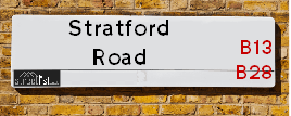
Neighbourhood Policing |
| Police Force: West Midlands &Warwickshire |
| Find a Local Neighbourhood Watch Scheme |
Location Details
| Stratford Road | |
|---|---|

| |
| Latitude | 52.455650 |
| Longitude | -1.868254 |
| OS Easting (X): | 408951 |
| OS Northing (Y): | 284238 |
| OS Grid Reference: | SP090842 |
Known Residential Addresses for Stratford Road
- 168A
- 456B
- 1046
- 1036
- 1024
- 1253
- 1265
- 1278
- 1382
- 1448
- 1450
- 1436
- 1434
- 1526
- 1659
- 18
- 479
- 386A
- 518
- 576
- 560
- 516
- 693
- 691
- 1005
- 1349
- ROSE COTTAGE
- 2673A
- 2677
- 2671
- LILAC COTTAGE
- STRATFORD HOUSE
- AVON HOUSE
- 2414
- THE FIRS
- HAZELWOOD
- NUTHURST LODGE
- OLIVE COTTAGE
- MYERS COTTAGE
- 2177
- 2165
- 2605
- 2591
- 2589
- 2509
- 2447
- 2527
- 2505
- 2511
- 2499
- 2521
- 2232
- 2206
- 2198
- 2182
- 2190
- 2210
- 2292
- 224 FLAT 2
- 681
- 1142 - 1142A
- RIVENDELL COURT, 1071 FLAT 70
- RIVENDELL COURT, 1051 FLAT 17
- RIVENDELL COURT, 1071 FLAT 63
- RIVENDELL COURT, 1071 FLAT 68
- RIVENDELL COURT, 1051 FLAT 43
- RIVENDELL COURT, 1051 FLAT 2
- RIVENDELL COURT, 1051 FLAT 51
- RIVENDELL COURT, 1051 FLAT 9
- RIVENDELL COURT, 1051 FLAT 14
- RIVENDELL COURT, 1071 FLAT 74
- RIVENDELL COURT, 1071 FLAT 69
- RIVENDELL COURT, 1071 FLAT 72
- RIVENDELL COURT, 1051 FLAT 12
- RIVENDELL COURT, 1051 FLAT 3
- RIVENDELL COURT, 1051 FLAT 45
- RIVENDELL COURT, 1051 FLAT 18
- RIVENDELL COURT, 1051 FLAT 47
- RIVENDELL COURT, 1051 FLAT 22
- RIVENDELL COURT, 1051 FLAT 29
- RIVENDELL COURT, 1071 FLAT 55
- RIVENDELL COURT, 1051 FLAT 41
- RIVENDELL COURT, 1051 FLAT 34
- RIVENDELL COURT, 1051 FLAT 30
- RIVENDELL COURT, 1051 FLAT 4
- RIVENDELL COURT, 1051 FLAT 33
- RIVENDELL COURT, 1051 FLAT 25
- RIVENDELL COURT, 1051 FLAT 5
- RIVENDELL COURT, 1051 FLAT 23
- RIVENDELL COURT, 1071 FLAT 62
- RIVENDELL COURT, 1071 FLAT 73
- RIVENDELL COURT, 1051 FLAT 28
- RIVENDELL COURT, 1071 FLAT 75
- RIVENDELL COURT, 1071 FLAT 65
- RIVENDELL COURT, 1051 FLAT 16
- RIVENDELL COURT, 1051 FLAT 40
- RIVENDELL COURT, 1051 FLAT 44
- RIVENDELL COURT, 1051 FLAT 1
- RIVENDELL COURT, 1051 FLAT 32
- RIVENDELL COURT, 1051 FLAT 49
- RIVENDELL COURT, 1051 FLAT 10
- RIVENDELL COURT, 1071 FLAT 64
- RIVENDELL COURT, 1051 FLAT 39
- RIVENDELL COURT, 1051 FLAT 27
- RIVENDELL COURT, 1051 FLAT 8
- RIVENDELL COURT, 1051 FLAT 6
- RIVENDELL COURT, 1071 FLAT 67
- RIVENDELL COURT, 1071 FLAT 71
- RIVENDELL COURT, 1051 FLAT 48
- 1010
- VIGGERS COURT, 1232 FLAT 15
- VIGGERS COURT, 1232 FLAT 22
- 7
- 3
- 8
- 10
- 12
- 15
- 5
- 11
- GRACEWELL COURT, 1520 APARTMENT 9
- GRACEWELL COURT, 1520 APARTMENT 19
- GRACEWELL COURT, 1520 APARTMENT 7
- GRACEWELL COURT, 1520 APARTMENT 3
- GRACEWELL COURT, 1520 APARTMENT 36
- GRACEWELL COURT, 1520 APARTMENT 38
- GRACEWELL COURT, 1520 APARTMENT 15
- GRACEWELL COURT, 1520 APARTMENT 24
- GRACEWELL COURT, 1520 APARTMENT 22
- GRACEWELL COURT, 1520 APARTMENT 1
- GRACEWELL COURT, 1520 APARTMENT 12
- GRACEWELL COURT, 1520 APARTMENT 23
- GRACEWELL COURT, 1520 APARTMENT 10
- GRACEWELL COURT, 1520 APARTMENT 6
- GRACEWELL COURT, 1520 APARTMENT 26
- GRACEWELL COURT, 1520 APARTMENT 37
- GRACEWELL COURT, 1520 APARTMENT 31
- GRACEWELL COURT, 1520 APARTMENT 14
- GRACEWELL COURT, 1520 APARTMENT 33
- GRACEWELL COURT, 1520 APARTMENT 39
- DOVE TREE COURT, 287 APARTMENT 10
- DOVE TREE COURT, 287 APARTMENT 2
- DOVE TREE COURT, 287 APARTMENT 31
- DOVE TREE COURT, 287 APARTMENT 3
- DOVE TREE COURT, 287 APARTMENT 6
- DOVE TREE COURT, 287 APARTMENT 15
- DOVE TREE COURT, 287 APARTMENT 22
- DOVE TREE COURT, 287 APARTMENT 12
- DOVE TREE COURT, 287 APARTMENT 25
- DOVE TREE COURT, 287 APARTMENT 18
- DOVE TREE COURT, 287 APARTMENT 1
- DOVE TREE COURT, 287 APARTMENT 5
- DOVE TREE COURT, 287 APARTMENT 33
- DOVE TREE COURT, 287 APARTMENT 34
- DOVE TREE COURT, 287 APARTMENT 9
- DOVE TREE COURT, 287 APARTMENT 30
- 173A
- 151B
- 147A
- CENTURY HOUSE, 100 APARTMENT 9
- CENTURY HOUSE 100 APARTMENT 22
- CENTURY HOUSE, 100 APARTMENT 17
- CENTURY HOUSE, 100 APARTMENT 7
- CENTURY HOUSE, 100 APARTMENT 11
- CENTURY HOUSE, 100 APARTMENT 6
- CENTURY HOUSE, 100 APARTMENT 8
- CENTURY HOUSE, 100 APARTMENT 4
- CENTURY HOUSE, 100 APARTMENT 23
- CENTURY HOUSE, 100 APARTMENT 15
- CENTURY HOUSE, 100 APARTMENT 18
- CENTURY HOUSE, 100 APARTMENT 12
- CENTURY HOUSE, 100 APARTMENT 3
- CENTURY HOUSE, 100 APARTMENT 14
- CENTURY HOUSE, 100 APARTMENT 25
- ST JAMES COURT, 331 APARTMENT 6
- ST JAMES COURT, 331 APARTMENT 17
- ST JAMES COURT, 331 APARTMENT 10
- ST JAMES COURT, 331 APARTMENT 18
- ST JAMES COURT, 331 APARTMENT 21
- ST JAMES COURT, 331 APARTMENT 2
- ST JAMES COURT, 331 APARTMENT 5
- ST JAMES COURT, 331 APARTMENT 4
- ST JAMES COURT, 331 APARTMENT 12
- ST JAMES COURT, 331 APARTMENT 16
- ST JAMES COURT, 331 APARTMENT 19
- ST JAMES COURT, 331 APARTMENT 20
- ST JAMES COURT, 331 APARTMENT 1
- ST JAMES COURT, 331 APARTMENT 3
- ST JAMES COURT, 331 APARTMENT 9
- ST JAMES COURT, 331 APARTMENT 15
- ST JAMES COURT, 331 APARTMENT 7
- ST JAMES COURT, 331 APARTMENT 8
- ST JAMES COURT, 331 APARTMENT 22
- 9
- 14
- 4
- 61 FLAT 4
- 61 FLAT 3
- 51
- 65 FLAT 1
- 49
- 63 FLAT 3
- 113A
- OSWIO COURT FLAT 493
- OSWIO COURT FLAT 521
- OSWIO COURT FLAT 513
- 460A
- 456A
- HENLEYDALE FLAT 4
- 2
- HENLEYDALE FLAT 6
- HENLEYDALE FLAT 1
- 657 FLAT C
- 645 FLAT F
- 677 FLAT A
- 655 FLAT C
- 675 FLAT E
- 665 FLAT F
- 657 FLAT F
- 677 FLAT F
- 657 FLAT D
- 665 FLAT E
- 647 FLAT D
- 657 FLAT E
- MULBERRY COURT, 785 APARTMENT 6
- MULBERRY COURT, 785 APARTMENT 1
- MULBERRY COURT, 785 APARTMENT 12
- MULBERRY COURT, 785 APARTMENT 8
- 1036 APARTMENT 3
- 1036 APARTMENT 1
- 1036 APARTMENT 5
- 1036 APARTMENT 9
- 1036 APARTMENT 8
- 1036 APARTMENT 4
- 1036 APARTMENT 6
- 1036 APARTMENT 14
- 1036 APARTMENT 7
- 1036 APARTMENT 11
- 1036 APARTMENT 2
- 1036 APARTMENT 15
- 1036 APARTMENT 10
- 1036 APARTMENT 12
- KINGSWOOD COURT, 2405 FLAT 9
- KINGSWOOD COURT, 2405 FLAT 5
- KINGSWOOD COURT, 2405 FLAT 12A
- KINGSWOOD COURT, 2405 FLAT 14
- KINGSWOOD COURT, 2405 FLAT 3
- KINGSWOOD COURT, 2405 FLAT 1
- KINGSWOOD COURT, 2405 FLAT 10
- KINGSWOOD COURT, 2405 FLAT 7
- KINGSWOOD COURT, 2405 FLAT 12
- 2376 FLAT 2
- 2376 FLAT 1
- 2376 FLAT 4
- STARTFORD ROAD BAPTIST CHURCH
- 304
- 282
- 270 - 272
- 178
- 168
- 104
- 245
- 247 - 249
- 183 - 187
- 137 - 139
- 55 - 81
- 344
- REAR OF 350
- 370
- 360A
- 468
- 440 - 444
- 492
- 544
- 572 - 576
- 636
- 720
- 704 - 706
- 776 - 778
- 870
- 838
- 806
- 836
- 846A
- 848A
- 850A
- 852
- 912
- 926
- 940
- 940A
- SPARKHILL PRIMARY CARE CENTRE, 856 PART OF SECOND FLOOR
- 807
- 805
- 791
- 753 - 773
- 701
- 719
- 717
- 721 - 725
- 683 - 687
- 681A
- 643
- 369
- 373
- 443
- 445B
- 565
- 575
- 1186
- 1184
- 1070
- 1080
- 1118
- 1138
- 1146
- 1172
- NAIRN HOUSE, 1174
- 1143
- ASHLEY HOUSE, 1143
- 1081
- 980
- 1002
- 1008A
- 1056
- 955
- 1151
- 1239
- 1205
- 1287
- THE HORSESHOE PH, 1214
- 1320A
- 1358
- 1514B
- 1558
- 1325A
- 1327
- 1351
- 1569A
- 1553
- 1567
- 1561
- 1529
- 1559
- 1651
- 1595
- 266 - 268
- 272
- 278
- 232
- 214
- 216 - 218
- THE SARACENS HEAD HOTEL
- REAR OF 208
- 210
- 205
- 229
- 223
- 227
- 207
- 281
- POLICE STATION
- 187
- 167
- 165
- 159
- 141
- 127
- 137
- 142A
- 130
- CENTURY HOUSE, 100
- CENTURY HOUSE 100 APARTMENT 5
- ST JAMES COURT, 331 APARTMENT 11
- 325
- 377
- 355
- PMIS ESTATE AGENTS AND HIPS LTD, 353
- PARKGATE ASDA
- PARKSIDE 13
- 68
- 66
- 42A UNIT 5
- 42
- 115A
- SOLIHULL CONNECT
- DRIVING TEST CENTRE, 401
- 498-510
- 562
- 1003
- 824 - 828
- 814
- 780
- REGENCY HOTEL
- 1097
- 1353
- TECHNICAL CENTRE
- CONNAUGHT HOUSE SPECIALIST CARE CENTRE
- TAPSTER BROOK HOUSE
- PARADISE LODGE
- 1779
- 2180
- HOCKLEY COURT, 2401 UNIT 17
- HOCKLEY COURT, 2401 UNIT 10
- HOCKLEY COURT, 2401 UNIT 1
- HOCKLEY COURT, 2401 UNIT 3
- HOCKLEY COURT, 2401 UNIT 11
- 2405
- HOCKLEY COURT, 2401 UNIT 7
- 2390
- 2376
- 2402
- 252
- 152
- 1038
- 1260
- 1262
- 1388
- 1400
- 1386
- 1406
- 1420
- 1426
- 1428
- 1422
- 1552A
- 1409
- 1405
- 1389
- 1411
- 1395
- 1417
- 1413
- 1427
- 1429
- 1383
- 1459
- 1451
- 1479
- 1485
- 1461
- 1369
- 1367
- 1575
- 1585
- 1603
- 1605
- 16
- 77
- 400
- 406
- 386
- 424
- 420
- 394
- 442
- 402
- 416
- 440
- 436
- 412
- 390
- 408
- 526
- 530
- 580
- 713
- 725
- 709
- 733
- 747
- 737
- 739
- 1001
- 993
- 977
- 999
- 1054
- 2507
- 2551
- 2517
- 2529
- 2515
- 2535
- 2531
- 2527B
- 2527A
- 2543
- PARTRIDGE COTTAGE, 2303
- 2064
- 2180A
- 2224
- 2421
- 2306
- 2308
- 2356
- 286
- 192A
- 196
- 194A
- 426A
- 570
- 670
- 674
- 676
- 678
- 584
- 598
- 764A
- 766
- 813
- 391 - 393
- 577
- 937
- 895
- 931
- 927
- 929
- 885
- 935
- 861
- 984
- 1006
- 1004
- 990
- 1030
- 943
- 957
- 967
- 1290
- 1316
- 1318
- 1304
- 1352
- 1416
- 1504
- 1371
- 1393
- 1373
- 1397
- 1401
- 1363
- 1365
- 1337
- 1531
- 1547 FLAT
- 1539
- 1609
- 1613
- 208A
- 193
- 189
- 1
- 71
- 89
- 384A
- 378
- 703
- 705
- 749
- 1048
- 2553
- 2495
- 2429
- 2304
- 2300
Roads that have a Junction with Stratford Road
Sunset and Sunrise times
| Sunrise | 08:14 |
|---|---|
| Sunset | 15:58 |
Latest Weather Conditions
| Observed at Weather Station: | Coleshill 22 December 2024 at 09:00 (7.73 miles away) |
|---|---|
| Current Weather: | Sunny day |
| Temperature and Humidity: | 3.2°C (79.5%) |
| Wind Direction and Speed: | W (11 mph) |
Population Statistics
| ONS Area Code | E00047498, E00047480, E00047481, E00047474, E00047483, E00047477, E00047450, E00047463, E00047553, E00047562, E00047570, E00047579, E00047593, E00047594, E00047548, E00047543, E00045818, E00047541, E00047535, E00047581, E00045855, E00045851, E00045843, E00045841, E00045849, E00045856, E00045859, E00045866, E00045864, E00045871, E00045877, E00045882, E00045892, E00045887, E00165815, E00045889, E00045898, E00051647, E00051665, E00051553, E00051586, E00051558, E00051568, E00165816, E00051581, E00051580, E00051574, E00051609, E00051621, E00051636, E00051623, E00051635, E00051631, E00051492, E00051603, E00051604, E00051643, E00051497, E00051487, E00159295, E00051501, E00051466 & E00051504 |
|---|---|
| ONS Area Name | Asian Terraces and Flats, Established Renting Families, Young Families and Students, Pakistani Communities, Achieving Minorities, Multicultural New Arrivals, Private Renting Young Families, Indian Tech Achievers, Inner City Ethnic Mix, Industrious Transitions, Delayed Retirement, Multi-Ethnic Professionals with Families, Multi-Ethnic Suburbia, Hampered Aspiration, Hard-Pressed Ethnic Mix, Older Workers and Retirement, Ageing in Suburbia, White Professionals, Rural White-Collar Workers, Self-Sufficient Retirement, Agricultural Communities & White Suburban Communities |
| Average Age | 28.71, 32.26, 31.40, 32.28, 29.23, 30.71, , 29.03, 28.64, 31.85, 39.23, 37.89, 35.50, 40.21, 38.83, 36.81, 41.28, 40.15, 40.33, 41.80, 39.44, 47.44, 40.71, 42.02, 45.59, 44.70, 43.56, 38.69, 43.21, 46.54 & 38.04 |
| Area Population | 1777.00, 1719.00, 1468.00, 1642.00, 1338.00, 2153.00, , 1622.00, 1645.00, 1836.00, 1800.00, 1712.00, 1971.00, 1655.00, 1794.00, 1812.00, 1514.00, 1691.00, 1212.00, 1652.00, 1471.00, 1248.00, 1733.00, 1535.00, 1700.00, 1362.00, 1524.00, 1604.00, 1861.00 & 1516.00 |
| Male Population | 957.00, 929.00, 769.00, 859.00, 683.00, 1113.00, , 847.00, 858.00, 872.00, 838.00, 951.00, 829.00, 897.00, 886.00, 753.00, 568.00, 826.00, 813.00, 599.00, 845.00, 731.00, 799.00, 693.00, 738.00, 800.00 & 771.00 (50%) |
| Female Population | 820.00, 790.00, 699.00, 783.00, 655.00, 1040.00, , 775.00, 787.00, 907.00, 928.00, 874.00, 1020.00, 826.00, 897.00, 926.00, 761.00, 862.00, 644.00, 878.00, 788.00, 649.00, 888.00, 804.00, 901.00, 669.00, 786.00, 975.00 & 745.00 (50%) |
| Benefit Claimants | 89, 195, 88, 140, 114, 124, , 78, 56, 49, 21, 39, 32, 35, 27, 23, 9, 6, 11, 20, 16, 7, 3 & 5 (3%) |
| LSOA Code: | E01009371, E01009365, E01009368, E01009367, E01009364, E01009396, E01033643, E01033641, E01009391, E01009393, E01009382, E01009046, E01009045, E01009043, E01009031, E01009032, E01009035, E01009036, E01032589, E01009034, E01010223, E01032590, E01010201, E01010206, E01010200, E01010204, E01010203, E01010208, E01010213, E01010183, E01010216, E01010189, E01031244 &E01010187 |
|---|---|
| LSOA Name: | Birmingham 077D, Birmingham 071D, Birmingham 077A, Birmingham 083A, Birmingham 071C, Birmingham 082D, Birmingham 082F, Birmingham 140G, Birmingham 140D, Birmingham 140F, Birmingham 140C, Birmingham 097E, Birmingham 097D, Birmingham 097B, Birmingham 105C, Birmingham 108A, Birmingham 108C, Birmingham 108D, Birmingham 132E, Birmingham 108B, Solihull 030B, Solihull 030D, Solihull 018C, Solihull 018F, Solihull 018B, Solihull 018D, Solihull 022C, Solihull 023A, Solihull 022E, Solihull 029D, Solihull 027D, Solihull 029E, Stratford-on-Avon 001C &Solihull 028E |
| SOA Code: | 7b, 3b, 8c, 3c, 4c, 8a, 5a &2b |
| SOA Name: | |
| MSOA Code: | E02001903, E02001897, E02001909, E02001908, E02006901, E02001923, E02001931, E02001934, E02006807, E02006808, E02002098, E02002102, E02002103, E02002109, E02002107, E02006504 &E02002108 |
| MSOA Name: | Birmingham 077, Birmingham 071, Birmingham 083, Birmingham 082, Birmingham 140, Birmingham 097, Birmingham 105, Birmingham 108, Birmingham 132, Solihull 030, Solihull 018, Solihull 022, Solihull 023, Solihull 029, Solihull 027, Stratford-on-Avon 001 &Solihull 028 |
Nearest Supermarkets
| Sainsburys Alcester Road Local |
|---|
| 158-162 Alcester Road, Birmingham, England, B13 8HS |
| 1214496499 |
| Distance: 1 Miles |
| Directions to Sainsburys Alcester Road Local |
| Asda Small Heath |
|---|
| 859 Coventry Road, Small Heath, B10 0HH |
| 0121 766 7374 |
| Distance: 1.24 Miles |
| Directions to Asda Small Heath |
| Iceland Birmingham St Andrews |
|---|
| Unit 5 St Andrews Shp Prk, 270 Coventry Road, Birmingham, B10 0XA |
| 01217738537 |
| Distance: 1.28 Miles |
| Directions to Iceland Birmingham St Andrews |
| Morrisons Birmingham - Small Heath |
|---|
| 280 Coventry Road, Small Heath, Birmingham B10 0XA |
| 0121 771 2224 |
| Distance: 1.29 Miles |
| Directions to Morrisons Birmingham - Small Heath |
Telephone Information
| Area Code |
|---|
| Area Code: 0121 - Birmingham |
| Area Code: 01675 - Coleshill |
| Area Code: 01564 - Lapworth |
Broadband Information
| Speed | Average Speed | Median Speed | Maximum Speed | Next-generation access (NGA) | Number of Connections |
|---|---|---|---|---|---|
| Less than 2 Mbps | 4.3 | 4.4 | 7.4 | N | 13 |
Local Government
| Local Council Details |
|---|
| Within the area of Birmingham, Solihull &Stratford-on-Avon |
| Visit the Council's Website |
| Visit the Council's Website |
| Council House, Victoria Square, Birmingham, B1 1BB, PO Box 18, Council House, Solihull, West Midlands, B91 3QS, Elizabeth House, Church Street, Stratford upon Avon, Warwickshire &CV37 6HX |
| Send email |
| Telephone Number: 0121 303 1111, 0121 704 6000 &01789 267 575 |
| Local Member of Parliament |
|---|
| Within the Westminster Parliamentary Constituency of Birmingham, Hall Green, Birmingham, Ladywood, Solihull, Meriden &Stratford-on-Avon |
| The Member of Parliament is Tahir Ali, Shabana Mahmood, Neil Shastri-Hurst, Saqib Bhatti &Manuela Perteghella |
| Details for the MP Tahir Ali, Shabana Mahmood, Neil Shastri-Hurst, Saqib Bhatti &Manuela Perteghella on parliament.uk |
| Details for the MP Tahir Ali, Shabana Mahmood, Neil Shastri-Hurst, Saqib Bhatti &Manuela Perteghella on theyworkforyou.com |
| In the 2024 General Election Tahir Ali, Shabana Mahmood, Neil Shastri-Hurst, Saqib Bhatti &Manuela Perteghella won with a majority of 5,656 the result was Lab hold, Con hold &LD gain from Con. The total electorate was 76,936 |
| Wards, Parish Councils and County Councils |
|---|
| Ward: Sparkbrook & Balsall Heath East, Bordesley & Highgate, Sparkhill, Hall Green North, Hall Green South, Shirley West, Shirley East, Shirley South, Blythe, Dorridge and Hockley Heath &Tanworth-in-Arden Ward |
| Parish: Cheswick Green, Hockley Heath & Tanworth-in-Arden Parish Council |
| Ceremonial County: West Midlands |
Nearest Schools
England Primary Schools
St Benedict's Primary School
Address: St Benedict's Primary School, St Benedict's Road, Birmingham, West Midlands, B10 9DP
Distance: 1.23 miles
Contact: 01214646420
Holy Family Catholic Primary School
Address: Holy Family Catholic Primary School, Coventry Road, Small Heath, Birmingham, West Midlands, B10 0HT
Distance: 1.15 miles
Contact: 01216752670
Yorkmead Junior and Infant School
Address: Yorkmead Junior and Infant School, York Road, Hall Green, Birmingham, West Midlands, B28 8BB
Distance: 1.42 miles
Contact: 01214644215
Somerville Primary (NC) School
Address: Somerville Primary (NC) School, Somerville Road, Small Heath, Birmingham, West Midlands, B10 9EN
Distance: 1.20 miles
Contact: 01216750956
Greet Primary School
Address: Greet Primary School, Percy Road, Sparkhill, Birmingham, West Midlands, B11 3ND
Distance: 0.47 miles
Contact:
English Martyrs' Catholic Primary School
Address: English Martyrs' Catholic Primary School, Evelyn Road, Sparkhill, English Martyrs Rc Junior & Infant School, Birmingham, West Midlands, B11 3JW
Distance: 0.37 miles
Contact: 01214643150
St Bernard's Catholic Primary School
Address: St Bernard's Catholic Primary School, Wake Green Road, Moseley, Birmingham, West Midlands, B13 9QE
Distance: 1.25 miles
Contact: 01214643795
Montgomery Primary Academy
Address: Montgomery Primary Academy, White Road, Sparkbrook, Birmingham, West Midlands, B11 1EH
Distance: 0.56 miles
Contact: 01214649115
Anderton Park Primary School
Address: Anderton Park Primary School, Dennis Road, Sparkhill, Birmingham, West Midlands, B12 8BL
Distance: 0.43 miles
Contact: 01214641581
Arden Primary School
Address: Arden Primary School, Baker Street, Sparkhill, Birmingham, West Midlands, B11 4SF
Distance: 0.20 miles
Contact: 01216757702
Regents Park Community Primary School
Address: Regents Park Community Primary School, Arthur Street, Small Heath, Birmingham, West Midlands, B10 0NJ
Distance: 1.15 miles
Contact: 01214646746
Harper Bell Seventh-day Adventist School
Address: Harper Bell Seventh-day Adventist School, 29 Ravenhurst Street, Camp Hill, Birmingham, West Midlands, B12 0EJ
Distance: 1.08 miles
Contact: 01216937742
Conway Primary School
Address: Conway Primary School, Conway Road, Sparkbrook, Birmingham, West Midlands, B11 1NS
Distance: 0.30 miles
Contact: 01216750622
Conway Primary School
Address: Conway Primary School, Conway Road, Sparkbrook, Birmingham, West Midlands, B11 1NS
Distance: 0.30 miles
Contact:
Christ Church CofE Controlled Primary School and Nursery
Address: Christ Church CofE Controlled Primary School and Nursery, Claremont Road, Sparkbrook, Birmingham, West Midlands, B11 1LF
Distance: 0.62 miles
Contact: 01216755121
St John and Monica Catholic Primary School
Address: St John and Monica Catholic Primary School, Chantry Road, Moseley, Birmingham, West Midlands, B13 8DW
Distance: 1.13 miles
Contact: 01214645868
St Martin de Porres Catholic Primary School
Address: St Martin de Porres Catholic Primary School, Oakland Road, Moseley, Birmingham, West Midlands, B13 9DN
Distance: 0.75 miles
Contact: 01214645500
Moseley Church of England Primary School
Address: Moseley Church of England Primary School, Oxford Road, Moseley, Birmingham, West Midlands, B13 9EH
Distance: 1.05 miles
Contact: 01214490441
Nelson Mandela School
Address: Nelson Mandela School, Colville Road, Sparkbrook, Nelson Mandela Community School, Birmingham, West Midlands, B12 8EH
Distance: 0.29 miles
Contact: 01217723055
Ladypool Primary School
Address: Ladypool Primary School, Stratford Road, Sparkbrook, Birmingham, West Midlands, B11 1QT
Distance: 0.42 miles
Contact: 01214647002
King David Primary School
Address: King David Primary School, Alcester Road, Moseley, Birmingham, West Midlands, B13 8EY
Distance: 1.17 miles
Contact: 01214493364
St Anne's Catholic Primary School
Address: St Anne's Catholic Primary School, Lowe Street, Camp Hill, Birmingham, West Midlands, B12 0ER
Distance: 1.09 miles
Contact: 01216755037
Park Hill Primary School
Address: Park Hill Primary School, Alcester Road, Birmingham, West Midlands, B13 8BB
Distance: 0.86 miles
Contact: 01214493004
Ark Tindal Primary Academy
Address: Ark Tindal Primary Academy, Tindal Street, Balsall Heath, Birmingham, West Midlands, B12 9QS
Distance: 0.88 miles
Contact: 01214643049
Chandos Primary School
Address: Chandos Primary School, Vaughton Street South, Highgate, Birmingham, West Midlands, B12 0YN
Distance: 1.33 miles
Contact: 01214643881
Chandos Primary School
Address: Chandos Primary School, Vaughton Street South, Highgate, Birmingham, West Midlands, B12 0YN
Distance: 1.33 miles
Contact:
Percy Shurmer Academy
Address: Percy Shurmer Academy, Longmore Street, Balsall Heath, Birmingham, West Midlands, B12 9ED
Distance: 1.14 miles
Contact: 01214643431
Oasis Academy Woodview
Address: Oasis Academy Woodview, Woodview Drive, Edgbaston, Birmingham, West Midlands, B15 2HU
Distance: 1.79 miles
Contact: 01214404202
Yarnfield Primary School
Address: Yarnfield Primary School, Yarnfield Road, Tyseley, Birmingham, West Midlands, B11 3PJ
Distance: 1.48 miles
Contact: 01216930362
The Olive School, Birmingham
Address: The Olive School, Birmingham, 215 Reddings Lane, Birmingham, West Midlands, B11 3EY
Distance: 1.01 miles
Contact: 01216577100
Al-Furqan Primary School
Address: Al-Furqan Primary School, Reddings Lane, Tyseley, Birmingham, West Midlands, B11 3EY
Distance: 1.01 miles
Contact: 01217772222
Greet Primary School
Address: Greet Primary School, Percy Road, Sparkhill, Birmingham, West Midlands, B11 3ND
Distance: 0.47 miles
Contact: 01214643360
St John's CofE Primary School
Address: St John's CofE Primary School, Stratford Road, Sparkhill, Birmingham, West Midlands, B11 4EA
Distance: 0.45 miles
Contact: 01216751469
Springfield Primary Academy
Address: Springfield Primary Academy, Springfield Road, Moseley, Birmingham, West Midlands, B13 9NY
Distance: 0.89 miles
Contact: 01214643618
Springfield Primary School
Address: Springfield Primary School, Springfield Road, Moseley, Birmingham, West Midlands, B13 9NY
Distance: 0.89 miles
Contact:
Clifton Primary School
Address: Clifton Primary School, Brunswick Road, Balsall Heath, Birmingham, West Midlands, B12 8NX
Distance: 0.40 miles
Contact: 01214642926
England Secondary Schools
Yardleys School
Address: Yardleys School, Reddings Lane, Tyseley, Birmingham, West Midlands, B11 3EY
Distance: 1.01 miles
Contact:
Small Heath School
Address: Small Heath School, Muntz Street, Small Heath, Birmingham, West Midlands, B10 9RX
Distance: 1.32 miles
Contact:
Bordesley Green Girls' School & Sixth Form
Address: Bordesley Green Girls' School & Sixth Form, Bordesley Green Road, Birmingham, B9 4TR
Distance: 1.63 miles
Contact: 01214641881
Small Heath Leadership Academy
Address: Small Heath Leadership Academy, Muntz Street, Small Heath, Birmingham, West Midlands, B10 9RX
Distance: 1.32 miles
Contact: 01214647997
Holy Trinity Catholic School
Address: Holy Trinity Catholic School, Oakley Road, Small Heath, Birmingham, West Midlands, B10 0AX
Distance: 0.83 miles
Contact: 01217720184
Holy Trinity Catholic School
Address: Holy Trinity Catholic School, Oakley Road, Small Heath, Birmingham, West Midlands, B10 0AX
Distance: 0.83 miles
Contact:
Moseley School and Sixth Form
Address: Moseley School and Sixth Form, Wake Green Road, Moseley, Birmingham, West Midlands, B13 9UU
Distance: 1.13 miles
Contact: 01215666444
Ark Boulton Academy
Address: Ark Boulton Academy, Golden Hillock Road, Sparkhill, Birmingham, West Midlands, B11 2QG
Distance: 0.38 miles
Contact: 01217738156
Ark St Alban's Academy
Address: Ark St Alban's Academy, Conybere Street, Birmingham, West Midlands, B12 0YH
Distance: 1.05 miles
Contact: 01214461300
Yardleys School
Address: Yardleys School, Reddings Lane, Tyseley, Birmingham, West Midlands, B11 3EY
Distance: 1.01 miles
Contact: 01214646821
England Higher Schools
Joseph Chamberlain Sixth Form College
Address: Joseph Chamberlain Sixth Form College, Belgrave Road, Highgate, Birmingham, West Midlands, B12 9FF
Distance: 0.87 miles
Contact: 01214462223
Nearest Hospitals
| Zinnia Centre |
|---|
| Address: 100 Showell Green Lane, Birmingham, B11 4HL, |
| NHS Sector |
| Birmingham and Solihull Mental Health NHS Foundation Trust |
| Telephone: 0121 301 5300 |
| Visit Hospital Website |
| Distance: 0.74 (miles) |
| Directions from to Zinnia Centre |
| Grove Avenue |
|---|
| Address: 32 Grove Avenue, Moseley, Birmingham, |
| NHS Sector |
| Birmingham and Solihull Mental Health NHS Foundation Trust |
| Telephone: 0121 678 4004 |
| Visit Hospital Website |
| Distance: 1.9 (miles) |
| Directions from to Grove Avenue |
| Juniper Centre |
|---|
| Address: Moseley Hall Hospital site, Alcester Road, Moseley, Birmingham, |
| NHS Sector |
| Birmingham and Solihull Mental Health NHS Foundation Trust |
| Telephone: 0121 301 5700 |
| Visit Hospital Website |
| Distance: 1.99 (miles) |
| Directions from to Juniper Centre |
Nearest Dentists
Dentists
DENTAL SURGERY
Address: 1 POPLAR ROAD, SPARKHILL, BIRMINGHAM, WEST MIDLANDS, B11 1UH
Distance: 0.16 miles
Contact: :
PRIME DENTAL SURGERY
Address: 543 STRATFORD ROAD, SPARKHILL, BIRMINGHAM, WEST MIDLANDS, B11 4LP
Distance: 0.18 miles
Contact: :
DENTAL SURGERY
Address: 286 LADYPOOL ROAD, BIRMINGHAM, WEST MIDLANDS, B12 8JU
Distance: 0.37 miles
Contact: :
DENTAL SURGERY
Address: 115 LADYPOOL ROAD, BIRMINGHAM, WEST MIDLANDS, B12 8LH
Distance: 0.40 miles
Contact: :
STRATFORD ROAD (DENTAL SURGERY)
Address: 604 STRATFORD ROAD, SPARKHILL, BIRMINGHAM, WEST MIDLANDS, B11 4AP
Distance: 0.44 miles
Contact: :
GRANTHAM ROAD (DENTAL SURGERY)
Address: 34 GRANTHAM ROAD, BIRMINGHAM, WEST MIDLANDS, B11 1LU
Distance: 0.50 miles
Contact: :
Nearest GP Surgeries
Doctors
WEATHER OAK MEDICAL CENTRE
Address: 35 WARWICK ROAD, SPARKHILL, BIRMINGHAM, WEST MIDLANDS, B11 4RA
Distance: 0.09 miles
Contact: tel: 0121 7720352
FERNLEY MEDICAL CENTRE
Address: 560 STRATFORD ROAD, SPARKHILL, BIRMINGHAM, WEST MIDLANDS, B11 4AN
Distance: 0.32 miles
Contact: tel: 0121 4110347
STRATFORD HOUSE SURGERY
Address: 578 STRATFORD ROAD, SPARKHILL, BIRMINGHAM, B11 4AN
Distance: 0.32 miles
Contact: :
STONEY LANE SURGERY (NEWPORT MEDICAL PRACTICE) - COVID LOCAL VACCINATION SERVICE 2
Address: 234 STONEY LANE, BALSALL HEATH, BIRMINGHAM, B12 8AW
Distance: 0.35 miles
Contact: :
DR AHMED B
Address: 234 STONEY LANE, BALSALL HEATH, BIRMINGHAM, WEST MIDLANDS, B12 8AW
Distance: 0.35 miles
Contact: tel: 01214491327
GREET MEDICAL PRACTICE
Address: 50 PERCY ROAD, BIRMINGHAM, WEST MIDLANDS, B11 3ND
Distance: 0.47 miles
Contact: tel: 0121 7666113
Nearest Dispensing Chemists
Pharmacies
OLIVE TREE PHARMACY
Address: 463 STRATFORD ROAD, SPARKHILL, BIRMINGHAM, WEST MIDLANDS, B11 4LD
Distance: 0.05 miles
Contact: tel: 0121 7737177
SHAH PHARMACY
Address: 491 STRATFORD ROAD, SPARKHILL, BIRMINGHAM, WEST MIDLANDS, B11 4LE
Distance: 0.10 miles
Contact: tel: 0121 7720792
EXPRESS PHARMACY SERVICES
Address: FIRST FLOOR, 4 POPLAR ROAD, BIRMINGHAM, WEST MIDLANDS, B11 1UW
Distance: 0.17 miles
Contact: tel: 01217 077996
STAG CHEMIST BIRMINGHAM LIMITED
Address: 553-555 STRATFORD ROAD, SPARKHILL, BIRMINGHAM, B11 4LP
Distance: 0.18 miles
Contact: tel: 01217 720795
BOOTS
Address: 553-555 STRATFORD ROAD, SPARKHILL, BIRMINGHAM, WEST MIDLANDS, B11 4LP
Distance: 0.18 miles
Contact: tel: 0121 7720795
THE PHARMACY PRACTICE
Address: 282 STRATFORD ROAD, SPARKHILL, BIRMINGHAM, WEST MIDLANDS, B11 1AA
Distance: 0.30 miles
Contact: tel: 01217 712978
Nearest Opticians
Opticians
BANKS OPTICIANS (SPARKHILL)
Address: 467 STRATFORD ROAD, SPARKHILL, BIRMINGHAM, WEST MIDLANDS, B11 4LD
Distance: 0.05 miles
Contact: :
EYEMAX OPTICIANS
Address: 485 STRATFORD ROAD, SPARKHILL, BIRMINGHAM, B11 4LE
Distance: 0.10 miles
Contact: :
THE I CLINIC
Address: 537 STRATFORD ROAD, SPARKHILL, BIRMINGHAM, WEST MIDLANDS, B11 4LP
Distance: 0.18 miles
Contact: :
THE EYE STUDIO
Address: 544 STRATFORD ROAD, SPARKHILL, BIRMINGHAM, WEST MIDLANDS, B11 4AL
Distance: 0.27 miles
Contact: :
EYECON OPTICIANS (BALSALL HEATH)
Address: 190B STONEY LANE, BALSALL HEATH, BIRMINGHAM, WEST MIDLANDS, B12 8AN
Distance: 0.31 miles
Contact: :
EYE CENTRE (BIRMINGHAM) LTD
Address: 202 WARWICK ROAD, SPARKHILL, BIRMINGHAM, WEST MIDLANDS, B11 2NB
Distance: 0.31 miles
Contact: :
Transport
Nearest Rail Stations
Small Heath Station is 0.67 miles away.
Address: Small Heath station, Golden Hillock Road, Small Heath, West Midlands, B10 0DP
Small Heath is situated on the Chiltern Main Line|North Warwickshire (Shakespeare Line) Line.
Small Heath Station is staffed on a part time basis.
Bordesley Station is 1.19 miles away.
Address: Bordesley station, Coventry Road, Camp Hill, Birmingham, B9 4HF
Bordesley is situated on the Chiltern Main Line|North Warwickshire (Shakespeare Line) Line.
Bordesley Station is an unstaffed station.