Coursers Road is a street located in the village of Colney Heath and near the village of Colney Heath and near the city of St Albans. The street has a length of approximately 3,094 metres.
The street is publicly maintained which means that the road is adopted and Hertfordshire is responsible for the repair and upkeep of the highway.
The street is located within the Hertsmere District (B) and St. Albans District (B) Council's jurisdiction. They provide various services, like refuse collection, and manage council tax collection. It's situated in the East of England region of the UK.
The road has been assigned the Unique Street Reference Number of 17204506 and 37350033 in the National Street Gazetteer.
The street has the postcodes of AL4 0PF, AL4 0PD, AL4 0PA, AL4 0PB and AL4 0PG.
It is located within the county of Hertfordshire, situated in the East of England region of the UK. It's 17.14 miles North West from central London., 3.49 miles South East from St Albans, 12.23 miles South East from Luton and 24.15 miles East from Aylesbury.
COURSERS ROAD is within the Post Town of ST. ALBANS
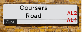
Map of Coursers Road
| Street Crime (updated 14/01/2025) | ||
|---|---|---|
| Location Note | Central Point of Street - Not Actual Location | |
| MSOA Info | For MSOAs E02004938, E02004899 (Statistical Neighbourhood) | |
| Click Hint | Click on a Circle for a detailed breakdown below map. | |
| Crime Levels |
Green = Very Low Yellow = Low Orange = High Red = Very High |
|
| Postcodes | ||
| Icon | Postcodes for Coursers Road | |
| Walking Distances | ||
| Distance Info | Green Circle = 10 Minutes Walk (800 metres) | |
Street Crime Data accessed from data.police.uk on 06/10/2024.
Moving to Coursers Road?
I can help you uncover potential pitfalls and provide key questions to ask about your new property. With decades of experience as a Local Land Charges Manager, I offer confidential insights to make your move informed and stress-free.
This service is free, but you may wish to make an optional donation to support it. Please include the property name and address in your request as well as anything you wish to focus on.
Contact Me
Do you know why this road is called Coursers Road?
What's it like to live here?
Share a Photo of Coursers Road
Ask the community a question.
Do you have any questions, memories to share, have any photos or know any facts? We'd love to know more.
Submit Your Comment

Budget Friendly Hotels near Coursers Road
| Budget Hotel Name | Distance (miles) |
|---|---|
|
1: Name:Holiday Inn Express St. Albans - M25, Jct.22 Address: Colney Field Retail Park Telephone: Visit Hotel Page |
0.94 |
|
2: Name:Travelodge Hatfield Central Address: Hatfield Business Park, Comet Way, Hatfield, AL10 0XR Telephone: 0871 984 6316 Visit Hotel Page |
2.74 |
|
3: Name:Premier Inn South Mimms/Potters Bar Address: Swanland Road Telephone: Visit Hotel Page |
3.12 |
|
4: Name:Premier Inn Hatfield Address: Comet Way, Lemsford Road Telephone: Visit Hotel Page |
3.19 |
|
5: Name:Premier Inn St. Albans/Bricket Wood Address: Smug Oak Lane, Watling Street Telephone: Visit Hotel Page |
3.24 |
Hotel Options
Your support helps keep this site running!
If you enjoy using this website, consider making a donation to help me cover hosting costs.
EPC (Energy Performance Certificate) Information for Coursers Road
UPRN: 10013029918
EPC Current: E
EPC Potential: C
Habitable Rooms: 5
Property Type: House
Tenure: rental (private)
Built Form: Semi-Detached
Age Band: 1900-1929
Mains Gas: No
UPRN: 10013029918
EPC Current: E
EPC Potential: C
Habitable Rooms: 5
Property Type: House
Tenure: rental (private)
Built Form: Semi-Detached
Age Band: 1900-1929
Mains Gas: No
UPRN: 10013029919
EPC Current: E
EPC Potential: A
Habitable Rooms: 4
Property Type: House
Tenure: Owner-occupied
Built Form: Semi-Detached
Age Band: before 1900
Mains Gas: No
UPRN: 10013029919
EPC Current: E
EPC Potential: A
Habitable Rooms: 4
Property Type: House
Tenure: Owner-occupied
Built Form: Semi-Detached
Age Band: before 1900
Mains Gas: No
UPRN: 10013029920
EPC Current: E
EPC Potential: C
Habitable Rooms: 6
Property Type: House
Tenure: Rented (private)
Built Form: Detached
Age Band: 1900-1929
Mains Gas: No
UPRN: 10013029920
EPC Current: E
EPC Potential: C
Habitable Rooms: 6
Property Type: House
Tenure: Rented (private)
Built Form: Detached
Age Band: 1900-1929
Mains Gas: No
UPRN: 10013029921
EPC Current: E
EPC Potential: B
Habitable Rooms: 5
Property Type: House
Tenure: Owner-occupied
Built Form: Semi-Detached
Age Band: 1976-1982
Mains Gas: No
UPRN: 10013029921
EPC Current: E
EPC Potential: B
Habitable Rooms: 5
Property Type: House
Tenure: Owner-occupied
Built Form: Semi-Detached
Age Band: 1976-1982
Mains Gas: No
UPRN: 10013029922
EPC Current: E
EPC Potential: C
Habitable Rooms: 5
Property Type: House
Tenure: rental (private)
Built Form: Semi-Detached
Age Band: 1967-1975
Mains Gas: No
UPRN: 10013029922
EPC Current: E
EPC Potential: C
Habitable Rooms: 5
Property Type: House
Tenure: rental (private)
Built Form: Semi-Detached
Age Band: 1967-1975
Mains Gas: No
UPRN: 200003635822
EPC Current: E
EPC Potential: D
Habitable Rooms: 10
Property Type: House
Tenure: Owner-occupied
Built Form: Detached
Age Band: 2003-2006
Mains Gas: No
UPRN: 200003635822
EPC Current: E
EPC Potential: D
Habitable Rooms: 10
Property Type: House
Tenure: Owner-occupied
Built Form: Detached
Age Band: 2003-2006
Mains Gas: No
UPRN: 200003633407
EPC Current: D
EPC Potential: B
Habitable Rooms: 3
Property Type: House
Tenure: Owner-occupied
Built Form: End-Terrace
Age Band: before 1900
Mains Gas: Yes
UPRN: 200003633407
EPC Current: D
EPC Potential: B
Habitable Rooms: 3
Property Type: House
Tenure: Owner-occupied
Built Form: End-Terrace
Age Band: before 1900
Mains Gas: Yes
UPRN: 10013029923
EPC Current: E
EPC Potential: C
Habitable Rooms: 6
Property Type: House
Tenure: Owner-occupied
Built Form: Detached
Age Band: before 1900
Mains Gas: No
UPRN: 10013029923
EPC Current: E
EPC Potential: C
Habitable Rooms: 6
Property Type: House
Tenure: Owner-occupied
Built Form: Detached
Age Band: before 1900
Mains Gas: No
UPRN: 200003634801
EPC Current: D
EPC Potential: C
Habitable Rooms: 4
Property Type: House
Tenure: rental (private)
Built Form: Mid-Terrace
Age Band: 1900-1929
Mains Gas: Yes
UPRN: 200003634801
EPC Current: D
EPC Potential: C
Habitable Rooms: 4
Property Type: House
Tenure: rental (private)
Built Form: Mid-Terrace
Age Band: 1900-1929
Mains Gas: Yes
UPRN: 200003633398
EPC Current: D
EPC Potential: B
Habitable Rooms: 8
Property Type: House
Tenure: Owner-occupied
Built Form: Detached
Age Band: before 1900
Mains Gas: Yes
UPRN: 200003633398
EPC Current: D
EPC Potential: B
Habitable Rooms: 8
Property Type: House
Tenure: Owner-occupied
Built Form: Detached
Age Band: before 1900
Mains Gas: Yes
UPRN: 200003632205
EPC Current: E
EPC Potential: C
Habitable Rooms: 11
Property Type: House
Tenure: Owner-occupied
Built Form: Detached
Age Band: before 1900
Mains Gas: No
UPRN: 200003632205
EPC Current: E
EPC Potential: C
Habitable Rooms: 11
Property Type: House
Tenure: Owner-occupied
Built Form: Detached
Age Band: before 1900
Mains Gas: No
House Sales
| Year | High | Low | Average | Sales |
|---|---|---|---|---|
| 2014 | £850,000 | £850,000 | £850,000 | 1 |
| 2015 | £1,400,000 | £1,400,000 | £1,400,000 | 1 |
| 2018 | £2,525,000 | £2,525,000 | £2,525,000 | 1 |
| 2021 | £2,325,000 | £2,325,000 | £2,325,000 | 1 |
| 2022 | £365,000 | £365,000 | £365,000 | 1 |
Contains HM Land Registry data © Crown copyright and database right 2025. This data is licensed under the Open Government Licence v3.0.
Nearby Estate Agents
| Name | Address | Website |
|---|---|---|
| Forest Knight | 120 Bunns Ln, London NW7 2AS | Visit Website |
| Ouali Chriqy MNAEA - Personal Estate Agent | Queensland Avenue, London | Visit Website |
| North Estates | 21 Highfield Hall, HIghfield Lane, Tyttenhanger, St. Albans,AL4 0LE | Visit Website |
| Oliver & Akers Estate Agents | 104 High Street High Street London Colney St. Alban AL2 1QL | Visit Website |
| JW&Co | 230 High Street, London Colney, St. Albans, AL2 1HP | Visit Website |
Neighbourhood Policing |
| Police Force: Hertfordshire |
 View Neighbourhood Crime and Policing View Neighbourhood Crime and Policing |
| Find a Local Neighbourhood Watch Scheme |
Location Details
| Coursers Road | |
|---|---|

| |
| Latitude | 51.727403 |
| Longitude | -0.266579 |
| OS Easting (X): | 519706 |
| OS Northing (Y): | 204659 |
| OS Grid Reference: | TL197047 |
Known Residential Addresses for Coursers Road
- THE FIRS
- THE MILL HOUSE
- COLNE SPRING HOUSE
- TYTTENHANGER HOUSE ANNEXE
- GREYNAM
Roads that have a Junction with Coursers Road
| Street | Junction Type |
|---|---|
| Roestock Lane | roundabout |
Sunset and Sunrise times
| Sunrise | 07:34 |
|---|---|
| Sunset | 16:55 |
Latest Weather Conditions
| Observed at Weather Station: | Rothamsted 3 February 2025 at 16:00 (6.79 miles away) |
|---|---|
| Current Weather: | Clear night |
| Temperature and Humidity: | 6.7°C (95.2%) |
| Wind Direction and Speed: | (0 mph) |
Population Statistics
| ONS Area Code | E00120250 & E00119767 |
|---|---|
| ONS Area Name | Self-Sufficient Retirement |
| Average Age | 41.53 & 42.21 |
| Area Population | 1478.00 & 1032.00 |
| Male Population | 736.00 & 505.00 (49%) |
| Female Population | 742.00 & 527.00 (51%) |
| Benefit Claimants | 14 & 8 (1%) |
| LSOA Code: | E01023679 &E01023584 |
|---|---|
| LSOA Name: | St Albans 015C &Hertsmere 004D |
| SOA Code: | 5c |
| SOA Name: | |
| MSOA Code: | E02004938 &E02004899 |
| MSOA Name: | St Albans 015 &Hertsmere 004 |
Nearest Supermarkets
| Sainsburys London Colney |
|---|
| Colney Fields Shopping Park, London Colney, St. Albans, England, AL2 1AB |
| 01707 429220 |
| Distance: 1.18 Miles |
| Directions to Sainsburys London Colney |
| Tesco Colney Express |
|---|
| 196-198 High St, London Colney, St Albans, AL2 1JQ |
| 0345 026 9210 |
| Distance: 1.29 Miles |
| Directions to Tesco Colney Express |
| Tesco Shenley Express |
|---|
| 4, Andrew Close, Shenley, Radlett, WD7 9LP |
| 0345 026 9352 |
| Distance: 2.42 Miles |
| Directions to Tesco Shenley Express |
| Morrisons St Albans |
|---|
| 244 Hatfield Road, St Albans AL1 4SU |
| 01727 834853 |
| Distance: 2.53 Miles |
| Directions to Morrisons St Albans |
Telephone Information
| Dialling Code | Telephone Exchange | Telephone Cabinet | Fibre to the Cabinet or Fibre to the Premises |
|---|---|---|---|
| 01727 | BOWMANSGREEN - LNBGN | P6 | FTTC |
Local Government
| Local Council Details |
|---|
| Within the area of St Albans &Hertsmere |
| Visit the Council's Website |
| Visit the Council's Website |
| Civic Centre, St Peters Street, St Albans, Hertfordshire, AL1 3JE, Civic Offices, Elstree Way, Borehamwood, Hertfordshire &WD6 1WA |
| Send email |
| Telephone Number: 01727 866 100 &020 8207 2277 |
| Local Member of Parliament |
|---|
| Within the Westminster Parliamentary Constituency of St Albans &Hertsmere |
| The Member of Parliament is Daisy Cooper &Oliver Dowden |
| Details for the MP Daisy Cooper &Oliver Dowden on parliament.uk |
| Details for the MP Daisy Cooper &Oliver Dowden on theyworkforyou.com |
| In the 2024 General Election Daisy Cooper &Oliver Dowden won with a majority of 19,834 the result was LD hold &Con hold. The total electorate was 72,739 |
| Wards, Parish Councils and County Councils |
|---|
| Ward: Colney Heath &Shenley Ward |
| Parish: Unparished area |
| Ceremonial County: Hertfordshire |
Nearest Schools
England Primary Schools
Colney Heath Junior Mixed Infant and Nursery School
Address: Colney Heath Junior Mixed Infant and Nursery School, High Street, Colney Heath, St Albans, Hertfordshire, AL4 0NP
Distance: 0.93 miles
Contact: 01727823898
Clore Shalom School
Address: Clore Shalom School, Hugo Gryn Way, Shenley, Hertfordshire, WD7 9BL
Distance: 1.87 miles
Contact: 01923855631
Bowmansgreen Primary School
Address: Bowmansgreen Primary School, Telford Road, London Colney, St Albans, Hertfordshire, AL2 1PH
Distance: 1.52 miles
Contact: 01727767772
Saint Bernadette Catholic Primary School
Address: Saint Bernadette Catholic Primary School, Walsingham Way, London Colney, St Albans, Hertfordshire, AL2 1NL
Distance: 1.56 miles
Contact: 01727822489
Nearest Hospitals
| Kingsley Green |
|---|
| Address: Harper Lane, Shenley, Radlett, WD7 9HQ, |
| Independent Sector |
| Hertfordshire Partnership University NHS Foundation Trust |
| Telephone: 01923 633000 |
| Visit Hospital Website |
| Distance: 3.67 (miles) |
| Directions from to Kingsley Green |
| One Hatfield Hospital |
|---|
| Address: One Hatfield Hospital, 3 Hatfield Avenue, Hatfield, AL10 9UA, |
| NHS Sector |
| One Healthcare |
| Telephone: 01707 443333 |
| Visit Hospital Website |
| Distance: 5.24 (miles) |
| Directions from to One Hatfield Hospital |
| St Albans City Hospital |
|---|
| Address: Waverley Road, St. Albans, AL3 5PN, |
| NHS Sector |
| West Hertfordshire Hospitals NHS Trust |
| Telephone: 01727 866122 |
| Visit Hospital Website |
| Distance: 6.44 (miles) |
| Directions from to St Albans City Hospital |
Nearest Dentists
Dentists
DENTAL SURGERY
Address: 148 HIGH STREET, LONDON COLNEY, ST. ALBANS, HERTFORDSHIRE, AL2 1QF
Distance: 1.25 miles
Contact: :
HILLTOP WAY (DENTAL SURGERY)
Address: 12 HILLTOP WAY, HATFIELD, AL10 8FH
Distance: 2.04 miles
Contact: :
DENTAL SURGERY
Address: 168 DIXONS HILL ROAD, WELHAM GREEN, NORTH MYMMS, HATFIELD, HERTFORDSHIRE, AL9 7DL
Distance: 2.14 miles
Contact: :
GINGER BREAD HOUSE
Address: BLACK LION HILL, SHENLEY, RADLETT, HERTFORDSHIRE, WD7 9DE
Distance: 2.26 miles
Contact: :
HERTFORDSHIRE PARTNERSHIP NHS TR
Address: HARPER LANE, SHENLEY, RADLETT, HERTFORDSHIRE, WD7 9HQ
Distance: 2.41 miles
Contact: :
HERTFORDSHIRE PARTNERSHIP N H S
Address: HARPER LANE, SHENLEY, RADLETT, HERTFORDSHIRE, WD7 9HQ
Distance: 2.41 miles
Contact: :
Nearest GP Surgeries
Doctors
SUMMERFIELD HEALTH CENTRE
Address: CALEDON ROAD, LONDON COLNEY, ST. ALBANS, AL2 1PU
Distance: 1.45 miles
Contact: tel: 01727 823245
VERULAM MEDICAL GROUP
Address: COLNEY MEDICAL CENTRE, 45-47 KINGS ROAD, LONDON COLNEY, ST. ALBANS, AL2 1ES
Distance: 1.54 miles
Contact: tel: 01727 822138
JACOB COURT
Address: 1 JACOB COURT, 61 RUSSET DRIVE, ST. ALBANS, HERTFORDSHIRE, AL4 0AY
Distance: 1.90 miles
Contact: :
NORTHDOWN ROAD SURGERY
Address: 2 NORTHDOWN ROAD, HATFIELD, HERTFORDSHIRE, AL10 8JZ
Distance: 1.97 miles
Contact: tel: 01707 263608
UNI OF HERTS MEDICAL CENTRE
Address: COLLEGE LANE, HATFIELD, HERTFORDSHIRE, AL10 9AB
Distance: 2.05 miles
Contact: tel: 01707 284444
GATEWAYS GP SURGERY
Address: DOCTORS SURGERY, 17 ANDREW CLOSE, SHENLEY, RADLETT, HERTFORDSHIRE, WD7 9LP
Distance: 2.42 miles
Contact: :
Nearest Dispensing Chemists
Pharmacies
WELL
Address: 295 HIGH STREET, LONDON COLNEY, ST. ALBANS, HERTFORDSHIRE, AL2 1EJ
Distance: 1.39 miles
Contact: tel: 01727 823697
JHOOTS PHARMACY
Address: 3 LOYD COURT, RUSSET DRIVE, ST. ALBANS, AL4 0AZ
Distance: 1.92 miles
Contact: tel: 01727 853355
JHOOTS PHARMACY
Address: 16 HIGH VIEW, HATFIELD, AL10 8HZ
Distance: 2.02 miles
Contact: tel: 01707 262748
KEAN PHARMACY
Address: 57-59 DELLSOME LANE, WELHAM GREEN, NORTH MYMMS, HATFIELD, AL9 7DY
Distance: 2.11 miles
Contact: tel: 01707 262644
ST ALBANS PHARMACY
Address: 197 CELL BARNES LANE, ST ALBANS, HERTFORDSHIRE, AL1 5PX
Distance: 2.26 miles
Contact: :
CROWN PHARMACY
Address: 18 ANDREW CLOSE, SHENLEY, RADLETT, HERTFORDSHIRE, WD7 9LP
Distance: 2.42 miles
Contact: tel: 01923 855810
Nearest Opticians
Opticians
M&S OPTICIANS - LONDON COLNEY
Address: COLNEY FIELDS SHOPPING PARK, LONDON COLNEY, ST. ALBANS, AL2 1AB
Distance: 1.01 miles
Contact: :
LONDON COLNEY SPECSAVERS
Address: COLNEY FIELDS SHOPPING PARK, LONDON COLNEY, ST. ALBANS, HERTFORDSHIRE, AL2 1AB
Distance: 1.01 miles
Contact: :
BOOTS OPTICIANS (ST ALBANS)
Address: 4 COLNEY FIELDS SHOPPING PARK, LONDON COLNEY, ST. ALBANS, HERTFORDSHIRE, AL2 1AB
Distance: 1.01 miles
Contact: :
FUTURE VISION OPTICIANS (HATFIELD)
Address: 244 HATFIELD ROAD, ST. ALBANS, HERTFORDSHIRE, AL1 4SU
Distance: 2.53 miles
Contact: :
EYECARE AT MORRISONS
Address: 244 HATFIELD ROAD, ST. ALBANS, AL1 4SU
Distance: 2.53 miles
Contact: :
ENHANCED OPTICIAN SERVICES - ST ALBANS
Address: 209 HATFIELD ROAD, ST. ALBANS, HERTFORDSHIRE, AL1 4SY
Distance: 2.56 miles
Contact: :
Transport
Nearest Rail Stations
Welham Green Station is 2.47 miles away.
Address: Welham Green station, Travellers Green, Welham Green, Hertfordshire, AL9 7HF
Welham Green is situated on the East Coast Main Line and is managed by Govia Thameslink Railway (Great Northern).
Welham Green Station is staffed on a part time basis.
Brookmans Park Station is 2.69 miles away.
Address: Brookmans Park station, Station Road, Brookmans Park, Hertfordshire, AL9 7SS
Brookmans Park is situated on the East Coast Main Line and is managed by Govia Thameslink Railway (Great Northern).
Brookmans Park Station is staffed on a part time basis.