Harpenden Road Childwick Green is a street located near Childwick Green and near the town of Harpenden and in the city of St Albans and near the city of St Albans
About Harpenden Road
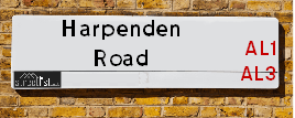
Harpenden Road is a street located near Childwick Green and near the town of Harpenden and in the city of St Albans and near the city of St Albans. The street has a length of approximately 4,573 metres.
The street is located within the St. Albans District (B) Council's jurisdiction. They provide various services, like refuse collection, and manage council tax collection. It's situated in the East of England region of the UK.
The road has been assigned the Unique Street Reference Number of 37307803 in the National Street Gazetteer.
The street has the postcodes of AL3 6JQ, AL3 6JN, AL3 6JH, AL3 6DE, AL3 6DA, AL3 6BZ, AL3 6BY, AL3 6BJ, AL3 5LW, AL3 5LL, AL3 5AH, AL3 5AD, AL3 5AB, AL3 6JG, AL3 6BB and AL3 5HY.
It is located within the county of Hertfordshire, situated in the East of England region of the UK. It's 21.58 miles North West from central London., 1.77 miles North from St Albans, 7.75 miles South East from Luton and 20.41 miles East from Aylesbury.

Do you know why this road is called Harpenden Road?
What's it like to live here?
Ask the community a question.
Do you have any questions, memories to share or know any facts? We'd love to know more.
Map of Harpenden Road
| Postcodes | ||
|---|---|---|
| Icon | Postcodes for Harpenden Road | |
| Walking Distances | ||
| Distance Info | Green Circle = 10 Minutes Walk (800 metres) | |
Street Crime Data accessed from data.police.uk on 06/10/2024.
Budget Friendly Hotels near Harpenden Road
| Budget Hotel Name | Distance (miles) |
|---|---|
|
1: Name:Premier Inn St Albans City Centre Address: 1 Adelaide Street Telephone: Visit Hotel Page |
1.58 |
|
2: Name:Travelodge Hatfield Central Address: Hatfield Business Park, Comet Way, Hatfield, AL10 0XR Telephone: 0871 984 6316 Visit Hotel Page |
4.35 |
|
3: Name:Travelodge Hemel Hempstead Gateway Address: Maylands Ave, Hemel Hempstead, HP2 4SQ Telephone: 0871 984 6360 Visit Hotel Page |
4.50 |
|
4: Name:Premier Inn Hatfield Address: Comet Way, Lemsford Road Telephone: Visit Hotel Page |
4.56 |
|
5: Name:Premier Inn Luton South M1 J9 Address: London Road Telephone: Visit Hotel Page |
4.64 |
Your support helps keep this site running!
If you enjoy using this website, consider buying me a coffee to help cover hosting costs.
Nearby Estate Agents
| Name | Address | Website |
|---|---|---|
| Forest Knight | 120 Bunns Ln, London NW7 2AS | Visit Website |
| Heartwood Homes | 1u Long Spring, St Albans AL3 6EN | Visit Website |
| Beechcroft Developments - Retirement Offer, Maryland Place | Townsend Drive, St. Albans, AL3 5FD | |
| Heartwood Homes St Albans | The Ridgeway, St Albans,AL4 9NU | Visit Website |
| Belvoir | 58 St. Peters Street St. Albans AL1 3HG | Visit Website |
We have found 16 postcodes
Neighbourhood Policing |
| Police Force: Hertfordshire |
 View Neighbourhood Crime and Policing View Neighbourhood Crime and Policing |
| Find a Local Neighbourhood Watch Scheme |
Location Details
| Harpenden Road | |
|---|---|

| |
| Latitude | 51.776985 |
| Longitude | -0.339171 |
| OS Easting (X): | 514567 |
| OS Northing (Y): | 210056 |
| OS Grid Reference: | TL146101 |
Roads that have a Junction with Harpenden Road
| Street | Junction Type |
|---|---|
| Childwick Green | junction |
| Childwick Green | junction |
| Ayres End Lane | junction |
| Stud Lane | junction |
| Beesonend Lane | junction |
| St Albans Road (A1081) | pseudo node |
| Edmund Beaufort Drive | junction |
| Heath Farm Lane | junction |
| Heathlands Drive | junction |
| Batchwood Drive | junction |
| Old Harpenden Road | junction |
| Francis Avenue | junction |
| Green Lane | junction |
| Sandridgebury Lane | junction |
| Petersfield | junction |
| Townsend Drive | junction |
| Avenue Road (B651) | junction |
Sunset and Sunrise times
| Sunrise | 07:29 |
|---|---|
| Sunset | 16:05 |
Latest Weather Conditions
| Observed at Weather Station: | Rothamsted 21 November 2024 at 20:00 (2.24 miles away) |
|---|---|
| Current Weather: | Clear night |
| Temperature and Humidity: | 0.6°C (77.7%) |
| Wind Direction and Speed: | (0 mph) |
Population Statistics
| ONS Area Code | E00120417, E00120423, E00120420, E00120202, E00120498, E00120220, E00120217, E00120474 & E00120342 |
|---|---|
| ONS Area Name | Multi-Ethnic Professionals with Families, Delayed Retirement, Communal Retirement, Private Renting Young Families, Rural White-Collar Workers & Indian Tech Achievers |
| Average Age | 36.47, 37.25, 38.17, 38.78, 37.44, 43.69 & 45.06 |
| Area Population | 2040.00, 1872.00, 2172.00, 2203.00, 1958.00, 1429.00 & 1736.00 |
| Male Population | 1004.00, 917.00, 1002.00, 1102.00, 954.00, 716.00 & 859.00 (49%) |
| Female Population | 1036.00, 955.00, 1170.00, 1101.00, 1004.00, 713.00 & 877.00 (51%) |
| Benefit Claimants | 5, 20, 21, 14, 6 & # (1%) |
| LSOA Code: | E01023716, E01023713, E01023670, E01023728, E01023672, E01023722 &E01023696 |
|---|---|
| LSOA Name: | St Albans 010D, St Albans 007A, St Albans 009B, St Albans 012C, St Albans 009D, St Albans 006A &St Albans 005B |
| SOA Code: | 3a, 3d, 3c, 2b &8a |
| SOA Name: | |
| MSOA Code: | E02004933, E02004930, E02004932, E02004935, E02004929 &E02004928 |
| MSOA Name: | St Albans 010, St Albans 007, St Albans 009, St Albans 012, St Albans 006 &St Albans 005 |
Nearest Supermarkets
| Tesco St Albans Beech Rd Express |
|---|
| 26-30 Beech Rd, St Albans, AL3 5AS |
| 0345 675 7161 |
| Distance: 0.96 Miles |
| Directions to Tesco St Albans Beech Rd Express |
| Tesco St Albans Metro |
|---|
| 33-39 St Peters St, St Albans, AL1 3EB |
| 0345 610 2902 |
| Distance: 1.63 Miles |
| Directions to Tesco St Albans Metro |
| Sainsburys Marshalswick Local |
|---|
| 185 Marshalswick Lane, St. Albans, England, AL1 4UZ |
| 01727 834333 |
| Distance: 1.67 Miles |
| Directions to Sainsburys Marshalswick Local |
| Tesco St Albans Jersey Farm Express |
|---|
| St Bredlades Place, Jersey Farm Estate, St Albans, AL4 9RG |
| 0345 026 9165 |
| Distance: 1.82 Miles |
| Directions to Tesco St Albans Jersey Farm Express |
Telephone Information
| Dialling Code | Telephone Exchange | Telephone Cabinet | Fibre to the Cabinet or Fibre to the Premises |
|---|---|---|---|
| 01727 | ST. ALBANS - LNSTB | P46 | FTTC |
Local Government
| Local Council Details |
|---|
| Within the area of St Albans |
| Visit the Council's Website |
| Civic Centre, St Peters Street, St Albans, Hertfordshire &AL1 3JE |
| Send email |
| Telephone Number: 01727 866 100 |
| Local Member of Parliament |
|---|
| Within the Westminster Parliamentary Constituency of St Albans &Hitchin and Harpenden |
| The Member of Parliament is Daisy Cooper &Victoria Collins |
| Details for the MP Daisy Cooper &Victoria Collins on parliament.uk |
| Details for the MP Daisy Cooper &Victoria Collins on theyworkforyou.com |
| In the 2024 General Election Daisy Cooper &Victoria Collins won with a majority of 19,834 the result was LD hold &LD gain from Con. The total electorate was 72,739 |
| Wards, Parish Councils and County Councils |
|---|
| Ward: Marshalswick South, Batchwood, St Peters, Redbourn &Harpenden South Ward |
| Ceremonial County: Hertfordshire |
Nearest Schools
England Primary Schools
Wheatfields Infants' and Nursery School
Address: Wheatfields Infants' and Nursery School, Downes Road, St. Albans, Hertfordshire, AL4 9NT
Distance: 1.27 miles
Contact:
Wheatfields Junior Mixed School
Address: Wheatfields Junior Mixed School, Downes Road, St Albans, Hertfordshire, AL4 9NT
Distance: 1.27 miles
Contact:
Bernards Heath Junior School
Address: Bernards Heath Junior School, Watson Avenue, St Albans, Hertfordshire, AL3 5HP
Distance: 1.01 miles
Contact: 01727856262
Margaret Wix Primary School
Address: Margaret Wix Primary School, High Oaks, St Albans, Hertfordshire, AL3 6EL
Distance: 0.42 miles
Contact: 01727759232
Bernards Heath Infant and Nursery School
Address: Bernards Heath Infant and Nursery School, 154 Sandridge Road, St Albans, Hertfordshire, AL1 4AP
Distance: 1.20 miles
Contact: 01727852106
Garden Fields Junior Mixed and Infant School
Address: Garden Fields Junior Mixed and Infant School, Townsend Drive, St Albans, Hertfordshire, AL3 5RL
Distance: 0.88 miles
Contact:
Maple Primary School
Address: Maple Primary School, Hall Place Gardens, Maple Primary School, St Albans, Hertfordshire, AL1 3SW
Distance: 1.49 miles
Contact: 01727859053
Alban City School
Address: Alban City School, 7 Hatfield Road, St Albans, Hertfordshire, AL1 3RR
Distance: 1.58 miles
Contact: 01727860304
The Grove Infant and Nursery School
Address: The Grove Infant and Nursery School, Dark Lane, Harpenden, Hertfordshire, AL5 1QD
Distance: 2.15 miles
Contact: 01582761849
The Grove Junior School
Address: The Grove Junior School, Dark Lane, Harpenden, Hertfordshire, AL5 1QB
Distance: 2.17 miles
Contact: 01582760031
Harpenden Academy
Address: Harpenden Academy, 25 Vaughan Road, Harpenden, Hertfordshire, AL5 4EL
Distance: 2.79 miles
Contact: 01582716910
St Dominic Catholic Primary School
Address: St Dominic Catholic Primary School, St Dominic Catholic Primary School, Southdown Road, HARPENDEN, Hertfordshire, AL5 1PF
Distance: 2.41 miles
Contact: 01582760047
St Nicholas CofE VA Primary School
Address: St Nicholas CofE VA Primary School, Church Green, Harpenden, Hertfordshire, AL5 2TP
Distance: 2.84 miles
Contact: 01582623620
St Michael's Church of England Voluntary Aided Primary School, St Albans
Address: St Michael's Church of England Voluntary Aided Primary School, St Albans, St Michael's Street, St Albans, Hertfordshire, AL3 4SJ
Distance: 1.78 miles
Contact: 01727854866
England Secondary Schools
Townsend Church of England School
Address: Townsend Church of England School, High Oaks, St Albans, Hertfordshire, AL3 6DR
Distance: 0.33 miles
Contact: 01727853047
St Albans Girls' School
Address: St Albans Girls' School, Sandridgebury Lane, St Albans, Hertfordshire, AL3 6DB
Distance: 0.56 miles
Contact: 01727853134
Nearest Hospitals
| Name | Address | Postcode | Distance | Map |
|---|
Nearest Dentists
Dentists
| Name | Address | Postcode | Distance | Map |
|---|
Nearest GP Surgeries
Doctors
LODGE SURGERY - COVID LOCAL VACCINATION SERVICE
Address: THE LODGE, NORMANDY ROAD, ST. ALBANS, AL3 5NP
Distance: 1.19 miles
Contact: :
LODGE,HIGHFIELD & REDBOURN
Address: NORMANDY ROAD, ST. ALBANS, HERTFORDSHIRE, AL3 5NP
Distance: 1.19 miles
Contact: tel: 01727 853107
GRANGE STREET SURGERY
Address: 2 GRANGE STREET, ST. ALBANS, HERTFORDSHIRE, AL3 5NF
Distance: 1.37 miles
Contact: tel: 01727 833550
PARKBURY SURGERY
Address: 18 HOPKINS CRESCENT, SANDRIDGE, ST. ALBANS, HERTFORDSHIRE, AL4 9DB
Distance: 1.37 miles
Contact: tel: 01727 847968
PARKBURY AT SANDRIDGE SURGERY - COVID LOCAL VACCINATION SERVICE
Address: 18 HOPKINS CRESCENT, SANDRIDGE, ST. ALBANS, AL4 9DB
Distance: 1.37 miles
Contact: :
PARKBURY HOUSE SURGERY
Address: ST. PETERS STREET, ST ALBANS, HERTFORDSHIRE, AL1 3HD
Distance: 1.42 miles
Contact: tel: 01727 851589
Nearest Dispensing Chemists
Pharmacies
| Name | Address | Postcode | Telephone | Map | Distance in Km |
|---|
Nearest Opticians
Opticians
Transport
Nearest Rail Stations
St Albans City Station is 1.90 miles away.
Address: St Albans station, Station Way, St. Albans, Hertfordshire, AL1 5HE
St Albans City is situated on the East Midland Main Line and is managed by Govia Thameslink Railway (Thameslink).
St Albans City Station is staffed on a full time basis.
St Albans Abbey Station is 2.23 miles away.
Address: St Albans Abbey station, Holywell Hill, St Albans, Hertfordshire, AL1 2DN
St Albans Abbey is situated on the Abbey Line and is managed by Grand Central North West.
St Albans Abbey Station is an unstaffed station.