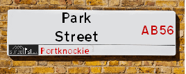
Park Street is a street located in Portknockie. It uses the postcode AB56 4LT. The street has a length of approximately 243 metres.
The street is located within the West Moray &North East Moray Council's jurisdiction. They provide various services, like refuse collection, and manage council tax collection. It's situated in the nation of Scotland.
It is located within the county of Banffshire, which is a part of the nation of Scotland. It's 442.76 miles North from central London., 48.05 miles North West from Aberdeen, 52.93 miles East from Inverness and 86.14 miles North from Dundee.
PARK STREET is within the Post Town of BUCKIE
Map of Park Street
| Postcodes | ||
|---|---|---|
| Icon | Postcodes for Park Street | |
| Walking Distances | ||
| Distance Info | Green Circle = 10 Minutes Walk (800 metres) | |
Street Crime Data accessed from data.police.uk on 06/10/2024.
Moving to Park Street?
I can help you uncover potential pitfalls and provide key questions to ask about your new property. With decades of experience as a Local Land Charges Manager, I offer confidential insights to make your move informed and stress-free.
This service is free, but you may wish to make an optional donation to support it. Please include the property name and address in your request as well as anything you wish to focus on.
Contact Me
Do you know why this road is called Park Street?
What's it like to live here?
Share a Photo of Park Street
Ask the community a question.
Do you have any questions, memories to share, have any photos or know any facts? We'd love to know more.
Submit Your Comment

Budget Friendly Hotels near Park Street
| Budget Hotel Name | Distance (miles) |
|---|---|
|
1: Name:Premier Inn Elgin Address: 15 Linkwood Way Telephone: Visit Hotel Page |
16.29 |
Hotel Options
Your support helps keep this site running!
If you enjoy using this website, consider making a donation to help me cover hosting costs.
Nearby Estate Agents
| Name | Address | Website |
|---|---|---|
| Stewart & Watson | 42-44 East Church Street, Buckie,AB56 1AB | Visit Website |
| Grant Smith Law Practice Ltd | 16 East Church Street, Buckie,AB56 1AE | Visit Website |
| Springfield - North Scotland, Inchgower | Seafield Circle, off Barhill Road, Buckie, AB56 5AD | Visit Website |
| Peterkins Solicitors | 186 Mid St, Keith,AB55 5BQ | Visit Website |
We have found 1 postcode
Neighbourhood Policing |
| Police Force: Scotland |
| Find a Local Neighbourhood Watch Scheme |
Location Details
| Park Street | |
|---|---|

| |
| Latitude | 57.702992 |
| Longitude | -2.858880 |
| OS Easting (X): | 348818 |
| OS Northing (Y): | 868427 |
| OS Grid Reference: | NJ488684 |
Roads that have a Junction with Park Street
| Street | Junction Type |
|---|---|
| Patrol Road | junction |
| Commercial Road | junction |
| Falconer Terrace | junction |
| Bridge Street (A942) | junction |
Sunset and Sunrise times
| Sunrise | 08:04 |
|---|---|
| Sunset | 16:46 |
Latest Weather Conditions
| Observed at Weather Station: | Lossiemouth 4 February 2025 at 05:00 (17.11 miles away) |
|---|---|
| Current Weather: | Clear night |
| Temperature and Humidity: | 11.0°C (71.2%) |
| Wind Direction and Speed: | S (11 mph) |
Population Statistics
| ONS Area Code | S00121589 |
|---|---|
| ONS Area Name | Ageing Rural Flat Tenants |
| LSOA Code: | S01011068 |
|---|---|
| LSOA Name: | Cullen, Portknockie, Findochty &Drybridge and Berryhillock - 04 |
| SOA Code: | 5e |
| SOA Name: | |
| MSOA Code: | S02002077 |
| MSOA Name: | Cullen, Portknockie, Findochty &Drybridge and Berryhillock |
Nearest Supermarkets
| Tesco Buckie Superstore |
|---|
| Highstreet, Buckie, AB56 4AB |
| 0345 026 9628 |
| Distance: 4.47 Miles |
| Directions to Tesco Buckie Superstore |
| Tesco Keith Moss St Superstore |
|---|
| Moss St, Keith, AB55 5HB |
| 0345 671 9357 |
| Distance: 11.59 Miles |
| Directions to Tesco Keith Moss St Superstore |
| Tesco Banff Metro |
|---|
| Carmelite St, Banff, AB45 1AF |
| 0345 677 9028 |
| Distance: 12.8 Miles |
| Directions to Tesco Banff Metro |
| Asda Elgin |
|---|
| Edgar Road, Elgin, IV30 6YQ |
| 01343 564000 |
| Distance: 17.21 Miles |
| Directions to Asda Elgin |
Telephone Information
| Area Code |
|---|
Broadband Information
| Speed | Average Speed | Median Speed | Maximum Speed | Next-generation access (NGA) | Number of Connections |
|---|---|---|---|---|---|
| Less than 2 Mbps | 2.7 | 2.6 | 5.1 | N | 16 |
Local Government
| Local Council Details |
|---|
| Within the area of West Moray &North East Moray |
| Visit the Council's Website |
| Council Office, High Street, Elgin, Moray &IV30 1BX |
| Telephone Number: 01343 543 451 |
| Local Member of Parliament |
|---|
| Within the Westminster Parliamentary Constituency of Moray |
| The Member of Parliament is |
| Details for the MP on parliament.uk |
| Details for the MP on theyworkforyou.com |
| In the 2024 General Election won with a majority of 0 the result was . The total electorate was 0 |
| Wards, Parish Councils and County Councils |
|---|
| Ward: Keith and Cullen Ward |
| Ceremonial County: Banffshire |
Nearest Schools
Scotland Primary Schools
Cullen Primary School
Address: Cullen Primary School, Old Church Road, Cullen, MORAY, AB56 4UZ
Distance: 1.77 miles
Contact: 01542 840279
Portknockie Primary School
Address: Portknockie Primary School, King Edward Terrace, Portknockie, MORAY, AB56 4NX
Distance: 0.16 miles
Contact: 01542 840244
Findochty Primary School
Address: Findochty Primary School, Burnside Street, Findochty, MORAY, AB56 4QW
Distance: 1.86 miles
Contact: 01542 832287
Nearest Hospitals
| Name | Address | Postcode | Distance | Map |
|---|---|---|---|---|
| Turner Memorial Hospital | Turner Street, Keith | AB55 5DJ | 18.78 Km | View Directions |
Nearest Dentists
Dentists
| Name | Address | Postcode | Distance | Map |
|---|---|---|---|---|
| 8 TO 8 DENTAL | 32 West Church Street, Buckie | AB561HL | 7.24 Km | View Directions |
| BUCKIE DENTAL PRACTICE | 93 West Church Street, Buckie | AB561BS | 7.46 Km | View Directions |
| 8TO8 DENTAL | 1 Westerton Rd North, Keith | AB555FL | 18.60 Km | View Directions |
Nearest GP Surgeries
Doctors
ARDACH HEALTH CENTRE
Address: HIGHFIELD ROAD, BUCKIE, BANFFSHIRE, AB56 1JE
Distance: 4.52 miles
Contact: tel: 03450 997200
SEAFIELD & CULLEN MEDICAL GROUP
Address: BARHILL ROAD, BUCKIE, AB56 1FP
Distance: 5.18 miles
Contact: tel: 01542 835577
AN CAORANN MEDICAL PRACTICE
Address: PORTSOY SURGERY, 16 SEAFIELD TERRACE, PORTSOY, BANFF, BANFFSHIRE, AB45 2GB
Distance: 6.20 miles
Contact: tel: 03453 379966
FOCHABERS MEDICAL PRACTICE
Address: 12 HIGH STREET, FOCHABERS, IV32 7EP
Distance: 10.66 miles
Contact: tel: 01343 820247
KEITH MEDICAL GROUP
Address: TURNER STREET, KEITH, BANFFSHIRE, AB55 5DJ
Distance: 11.68 miles
Contact: tel: 03453 379944
MACDUFF MEDICAL PRACTICE
Address: MACDUFF HEALTH CLINIC, FIFE STREET, BANFF, BANFFSHIRE, AB45 1JD
Distance: 12.51 miles
Contact: tel: 03453 379933
Nearest Dispensing Chemists
Pharmacies
| Name | Address | Postcode | Telephone | Map | Distance in Km |
|---|---|---|---|---|---|
| Floriage Ltd | 3 Union Street, Portnockie | AB56 4LF | 01542 840268 | View Directions | |
| Cullen Pharmacy | 28-30 Seafield Street, Cullen, Moray, | AB56 4RS | 01542 840220 | View Directions | |
| Norvik Pharmacies Ltd | 1 High Street, Buckie | AB56 1AL | 01542 831116 | View Directions |
Nearest Opticians
Opticians
BOOTS OPTICIANS (ELGIN)
Address: 169 HIGH STREET, ELGIN, IV30 1DW
Distance: 17.36 miles
Contact: :
COSTCO WHOLESALE UK LTD - MANDELA WAY
Address: COSTCO, ENDEAVOUR DRIVE, ARNHALL BUSINESS PARK, WESTHILL, ABERDEENSHIRE, AB32 6UF
Distance: 43.98 miles
Contact: :
VISION EXPRESS (ABERDEEN)
Address: UNIT 32, BON ACCORD CENTRE, GEORGE STREET, ABERDEEN, ABERDEENSHIRE, AB25 1HZ
Distance: 47.56 miles
Contact: :
BOOTS OPTICIANS (ABERDEEN - BON ACCORD CENTRE)
Address: BON ACCORD CENTRE, GEORGE STREET, ABERDEEN, ABERDEENSHIRE, AB25 1HZ
Distance: 47.56 miles
Contact: :
OPTIMAX LASER EYE CLINIC
Address: 2 GOLDEN SQUARE, ABERDEEN, ABERDEENSHIRE, AB10 1RD
Distance: 47.65 miles
Contact: :
ABERDEEN DOMICILIARY SPECSAVERS LIMITED
Address: 56-58 UNION STREET, ABERDEEN, ABERDEENSHIRE, AB10 1BB
Distance: 47.73 miles
Contact: :
Transport
Nearest Rail Stations
Keith Station is 11.08 miles away.
Address: Keith station, Station Road, Keith, Moray, AB55 3DR
Keith is situated on the Aberdeen to Inverness line and is managed by ScotRail.
Keith Station is staffed on a part time basis.
Elgin Station is 17.22 miles away.
Address: Elgin station, Station Road, Elgin, Moray, IV30 1QP
Elgin is situated on the Aberdeen to Inverness line and is managed by ScotRail.
Elgin Station is staffed on a part time basis.